Cyprus Discovery

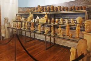
Discover Cyprus Heritage by Categories

Begin your exploration of the island's iconic landmarks and vibrant culture.

Fascinating Topics

Dive into the stories that captivate and inspire.

Adaptation of Imported Artistic Techniques

Adaptation of Imported Artistic Techniques

Adaptation of Imported Artistic Techniques in ancient Cyprus involved incorporating styles from regions such as Greece, Egypt, and the Near East, then modifying them to align with local beliefs and values. Rather than exact replication, Cypriot artists infused these elements with distinctive island characteristics, resulting in art that felt authentically Cypriot - unique and rich in significance. This process of selective adaptation transformed external influences into innovative expressions, illustrating how an island on the periphery of empires developed a vibrant creative identity. metmuseum-org A Creative Synthesis at a Mediterranean Crossroads Cypriot art emerged from the island's position as a nexus of cultural exchange, where imported techniques underwent transformation to reflect indigenous perspectives. External styles arrived through trade, migration, and conquest, but artists selectively reshaped them to emphasize themes central to Cypriot life, such as harmony with nature, divine protection, and communal resilience. Pottery, sculptures, and architectural elements bear witness to this blending, where foreign forms gained new meanings tied to the island's spiritual and social fabric. The outcome was a visual language that balanced innovation with tradition, capturing the essence of a society navigating diverse influences while preserving its core identity. ancientcyprus-com The Beginnings of Cultural Adaptation The practice of adapting imported techniques traces back to the Bronze Age around 2500 BC, when Cyprus's copper resources attracted merchants from surrounding…

Read more
Ledra Palace Hotel Nicosia, Cyprus

Ledra Palace Hotel Nicosia, Cyprus

The Ledra Palace Hotel stands in central Nicosia, caught between past glory and present division. Once the capital's most glamorous hotel, it now sits in the UN buffer zone that splits Cyprus in two. The Ledra Palace Hotel occupies a unique position in Cyprus's modern history. Built as a luxury establishment in the late 1940s, it served as the island's social center for Greek, Turkish, British, and Armenian elites. Today the building remains frozen in the Green Line buffer zone, its facade scarred by bullets and mortar craters from the 1974 conflict. The hotel has transformed from a place of celebration to a symbol of division, yet it continues to serve as neutral ground where both communities meet. dom-com-cy Historical Background Three businessmen conceived the Ledra Palace in 1947 when tourism on Cyprus was just beginning. George Skyrianides, already owner of the luxurious Forest Park Hotel in Platres, partnered with Nicosia's Vice Mayor George Poulias and Egyptian businessman Dimitrios Zerbinis. Together they formed Cyprus Hotels Limited with the goal of creating the island's finest accommodation. tuckdbpostcards-org The hotel was designed by German Jewish architect Benjamin Günsberg, who also created the Curium Palace in Limassol. Construction took two years and costs far exceeded the original budget, reaching approximately £240,000 Cyprus pounds. The hotel opened on October 8, 1949, with British Governor…

Read more
Cyprus Birthplace Mediterranean Copper Trade

Cyprus Birthplace Mediterranean Copper Trade

Long before Cyprus became known for beaches or crossroads of empires, it was known for something far more fundamental. Copper. Drawn from its mountains and carried across open water, this metal placed the island at the center of the ancient Mediterranean world. Cyprus did not merely export a resource. It supplied the material that powered the Bronze Age and, in doing so, helped shape the earliest long-distance trade networks ever formed at sea. wikipedia-com This is not a story of passive geography or accidental wealth. It is the story of how an island learned to move its resources outward, turning stone into influence and distance into connection. An Island Defined by What Lay Beneath Copper was the first metal to change how societies lived. It allowed stronger tools, more effective weapons, and eventually the creation of bronze, the alloy that defined an entire era. Control of copper meant control of technology, agriculture, and military power. Cyprus stood apart because of scale. Its copper deposits, concentrated in the Troodos Mountains, were among the richest and most accessible in the ancient world. Mining was not scattered or marginal. It was continuous, extensive, and organized. The island’s association with copper became so strong that the Latin word cuprum ultimately derived from Cyprus. While the name of the island itself likely predates the metal…

Read more

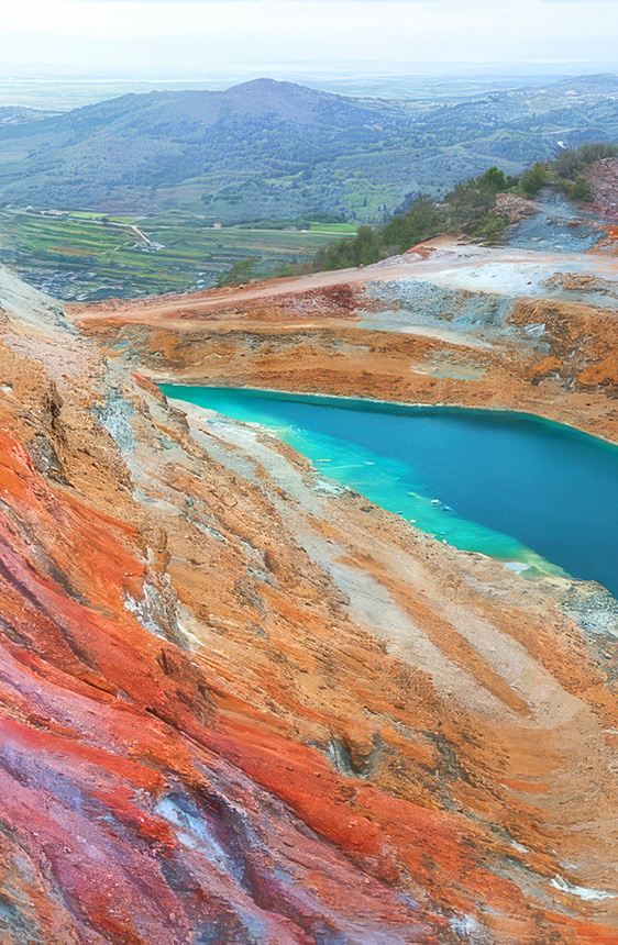
Cyprus: A Tapestry of Life

Uncover the island's spiritual depth, natural beauty, and diverse ecosystems.

Curated Insights

Journey through Cyprus's most intriguing stories and themes.
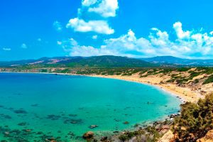
The Chalcolithic Priestesses of Enkomi

The Chalcolithic Priestesses of Enkomi

In the Chalcolithic period of Cyprus, around 3900 to 2500 BC, women likely held key roles as priestesses or ritual leaders in communities like those near what would later become Enkomi. These figures guided ceremonies focused on fertility, birth, and the emerging magic of metallurgy, acting as bridges between daily life and unseen forces. Their story uncovers a time when religion was woven into survival, leaving us with intriguing artifacts that hint at powerful female authority in ancient Cypriot society. estateofcyprus-com Unveiling an Ancient Spiritual World Step back to a Cyprus without cities, kings, or written words - a landscape of scattered villages where life hung on the whims of nature. This was the Chalcolithic era, a bridge between the Stone Age and Bronze Age, when people first experimented with copper tools and settled into larger groups. Communities clustered around fertile valleys and rivers, like those in the Paphos region or near the eastern coast where Enkomi would later rise. Religion wasn't separate from daily grind; it was a toolkit for dealing with births, harvests, and deaths. Women, tied closely to life's cycles through childbearing and caregiving, emerged as natural leaders in these rituals. Though we don't have names or titles, artifacts suggest priestesses - knowledgeable women who orchestrated ceremonies to keep balance in an unpredictable world. ancientcyprus-com Roots in…

Read more
Paphos Ancient Heart of Goddess Worship

Paphos Ancient Heart of Goddess Worship

Paphos, the ancient city on Cyprus's southwest coast, stood as the unrivaled heart of goddess worship in the Mediterranean, where Aphrodite's cult drew pilgrims from afar to honor her as the embodiment of love, beauty, and fertility. This wasn't just a local shrine; it became a global beacon, blending myth, ritual, and power in a place believed to be her earthly birthplace. Exploring its story reveals how a coastal spot turned into a sacred powerhouse that still captivates imaginations today. A Sacred Hub Born from the Sea www.sovereign.com Picture Paphos as more than ruins – it's where ancient worlds collided in devotion to a goddess who symbolized life's spark. Tucked on Cyprus's edge, with waves lapping at rocky shores and fertile fields stretching inland, the city grew around a sanctuary that felt like the goddess's own domain. Here, worship wasn't confined to temples; it spilled into the landscape, making every visit a brush with the divine. For centuries, from humble beginnings as a Mycenaean settlement to a bustling Roman hub, Paphos claimed supremacy in Aphrodite's cult, attracting everyone from sailors seeking safe voyages to rulers craving legitimacy. No other site could match its pull – it was the origin point, where myth met reality in a way that felt timeless and intimate. From Mythic Origins to Mediterranean Fame Paphos's rise…

Read more
Roman Road Network Ancient Cyprus Routes

Roman Road Network Ancient Cyprus Routes

Cyprus already had roads before the Romans arrived. The earliest routes date back to the Bronze Age, and by the end of the Hellenistic period, a road network circled the entire island. These pre-Roman roads connected cities with their surrounding territories and linked major settlements along the coast. However, they were often simple tracks suitable for pedestrians and pack animals rather than the engineered highways Romans built elsewhere in their empire. pixabay-com When Cyprus became a Roman province in 22 BC under Emperor Augustus, the new administration inherited this existing network. The Romans added secondary roads and improved certain routes, but they did not rebuild the entire system to match the standards used in Italy or other provinces. This practical approach reflected Cyprus's geography and peaceful status. The island was stable enough not to require a large military presence, so the roads served primarily civilian purposes rather than rapid military deployment. Augustus and later Emperor Titus are credited in inscriptions as the creators of the formal Roman road system on Cyprus. The roads they established formed part of the imperial network, meaning they received official recognition and maintenance funding from Rome itself. How the Road System Worked The main roads formed a coastal highway that encircled the island, connecting all major cities. From this primary route, secondary roads branched inland…

Read more
Category: Individual Objects and Landmarks Individual Objects and Landmarks
Venetian Walls of Nicosia, Cyprus

Venetian Walls of Nicosia, Cyprus

The Venetian Walls of Nicosia form a circular defense system around the capital city of Cyprus. Built between 1567 and 1570 by the Republic of Venice, these Renaissance fortifications remain largely intact and represent one of the best-preserved examples of 16th-century military architecture in the Eastern Mediterranean. voicemap-me The walls create an almost perfect circle around the old city with a circumference of approximately 5 kilometers. This circular shape was innovative for its time and reflected the latest military engineering principles from Renaissance Italy. The design eliminated the weaknesses of medieval fortifications and created a more efficient defensive perimeter that…

Read more
Larnaca Fort Cyprus

Larnaca Fort Cyprus

Larnaca Fort is a coastal defensive structure that started as a Byzantine fortification and took its current form during Ottoman rule in the 17th century. The fort sits directly on the waterfront at the western edge of one of Cyprus's most popular seaside promenades. Despite its modest size compared to larger Cypriot castles like Kyrenia or Kolossi, the fort played an essential role in protecting Larnaca harbour and the southern coast from pirates and invaders. Today, it houses the Larnaca Medieval Museum and hosts cultural events in its courtyard. shutterstock-com Historical Background Archaeological evidence suggests the Byzantines built a small…

Read more
Buffavento Castle Cyprs

Buffavento Castle Cyprs

Buffavento Castle stands at 960 meters above sea level in the Kyrenia mountain range of Cyprus. This medieval fortress is the highest and least preserved of three Byzantine strongholds built along the mountains. The name comes from Italian and means "Defier of the Winds," a fitting description for a castle constantly exposed to mountain winds at this elevation. cycprusfaqs-com The castle sits between St. Hilarion Castle to the west and Kantara Castle to the east, forming a defensive line across the Kyrenia Mountains. All three castles are visible from each other, allowing them to pass signals and warnings. Buffavento guarded…

Read more
Famagusta Martinengo Bastion

Famagusta Martinengo Bastion

In the northwest corner of Famagusta's historic walled city stands one of the Mediterranean's most impressive examples of Renaissance military architecture. The Martinengo Bastion, also known as Tophane, represents a turning point in defensive technology and remains a testament to 16th-century engineering brilliance. visitncy.com When the Republic of Venice took control of Cyprus in 1489, military engineers quickly recognized a serious problem. The existing fortifications throughout the island were outdated and vulnerable to modern artillery. Medieval walls, built tall and thin to defend against siege towers and scaling ladders, could not withstand the devastating impact of cannon fire. Famagusta presented…

Read more
Category: Mythology and Sacred Landscapes Mythology and Sacred Landscapes
Astarte Eastern Goddess Influence Cyprus Religion

Astarte Eastern Goddess Influence Cyprus Religion

Origins and Divine Character Astarte was one of the most prominent goddesses of the ancient Near East, worshipped across regions such as Phoenicia, Syria, and Mesopotamia long before her influence reached the Mediterranean islands. She embodied a complex divine character, associated with fertility, sexuality, political power, and war. Unlike deities confined to a single sphere, Astarte represented a broad spectrum of life forces, from generative vitality to martial strength. Her worship reflected societies in which reproduction, protection, and sovereignty were inseparable concerns. Over time, her cult traveled westward through trade networks and cultural exchange, eventually reaching Cyprus, where it played…

Read more
Adonis Death Rebirth Cyprus Mythology

Adonis Death Rebirth Cyprus Mythology

Mythological Origins and Cypriot Connections Adonis is one of the most symbolically rich figures in Mediterranean mythology, closely linked to Cyprus through narratives that connect the island to themes of beauty, mortality, and regeneration. According to tradition, Adonis was born under extraordinary circumstances connected to the tragic story of Myrrha, daughter of King Kinyras of Cyprus. After Myrrha was transformed into a tree as a result of divine punishment, Adonis emerged from its trunk, entering the world already marked by themes of transformation and renewal. His birth in this context rooted his identity in the land and mythic heritage of…

Read more
Copper Mountains Gift of the Gods

Copper Mountains Gift of the Gods

The copper-rich mountains of Cyprus, particularly the Troodos range, were seen by ancient inhabitants as divine gifts from the gods, providing not just vital metal for tools and trade but also spiritual protection and prosperity. These peaks, laced with reddish ore veins, blended natural bounty with sacred myths, making mining a reverent act and turning the island into a Bronze Age powerhouse. Exploring their story reveals how earth, faith, and human ingenuity intertwined to shape Cyprus's enduring legacy. visitsolea-com A Sacred Backbone of the Island Step into the heart of Cyprus, and you'll find the Troodos Mountains rising like ancient…

Read more
Mount Stavrovouni Cyprus Sacred Mountain

Mount Stavrovouni Cyprus Sacred Mountain

Rising 689 meters above the Mesaoria plain, Mount Stavrovouni has been a sacred site for over 2,000 years. The name derives from two Greek words: stavros (cross) and vouno (mountain), literally meaning "Mountain of the Cross." The monastery follows the strict ascetic rule of Saint Basil and maintains traditions similar to those of Mount Athos in Greece. Adobe-Stock-com The site is recognized as the earliest documented monastery in Cyprus. The oldest written reference appears in Byzantine records from the 4th century and confirms its establishment as a major religious center. A Russian monk named Abbot Daniel visited in 1106 and…

Read more

Learn More About Cyprus Traditions

Experience the warmth of community, the rhythm of music, and the spirit of family life.

Cyprus Unveiled

Discover the island's secrets and learn what lies beyond the familiar.

Cyprus Railway Museum Evrychou History Facts

Cyprus Railway Museum Evrychou History Facts

The museum occupies the original Evrychou railway station, a sandstone building constructed in 1906 in the foothills of the Troodos Mountains. The station operated as the western terminus of the Cyprus Government Railway from June 14, 1915, until December 31, 1931, when the final five miles of the railway were abandoned due to financial losses. atlasobscura-com After the railway closed completely in 1951, the building served various purposes, first as a health center and later as a forest workers' dormitory. EOKA fighters damaged and burned the building during their campaign against British rule, as the railway represented colonial infrastructure. The Department of Antiquities restored the station between 2003 and 2012, with new tracks laid in 2010 to 2012 in a Y-shape formation covering about 100 meters. The museum officially opened in September 2016, becoming Cyprus's only railway museum. British expats and local railway enthusiasts contributed significantly to the museum's development, and their contributions are acknowledged in the entrance hall. Historical Background The Cyprus Government Railway operated from October 21, 1905, to December 31, 1951, covering 76 miles across the island. British High Commissioner Sir Garnet Wolseley proposed building a railway when Britain took control of Cyprus in 1878, but uncertainty about how long Britain would govern the island delayed the project for decades. Frederick Shelford submitted a feasibility study on…

Read more
Cyprus Folk Dances and Festivals

Cyprus Folk Dances and Festivals

Cyprus folk dances represent living traditions that connect modern Cypriots to Byzantine heritage through choreographed movements, traditional costumes, and communal participation. These dances appear at weddings, religious festivals, harvest celebrations, and family gatherings, serving social functions beyond entertainment by reinforcing community bonds, facilitating courtship under supervision, and displaying cultural identity. incyprus-com The basic repertoire includes syrtos and kartzilaumas, performed as paired confrontational dances or circle formations, alongside specialty performances like tatsia where dancers balance wine-filled glasses on sieves, and drepani, the sickle dance demonstrating agricultural skills. incyprus-com Men and women traditionally danced separately, with social conventions restricting female dancing primarily to weddings while men performed at coffee shops, threshing floors, and festivals. The movements emphasize improvisation within communal constraints, with dancers competing to display skill while adhering to strict local standards that discourage excess or showiness that would violate collective norms. The Kartzilaumas Confrontational Tradition Kartzilaumas, the fundamental Cypriot dance from approximately 1910 through the 1970s, consists of six parts performed by confronted pairs of dancers, either two men or two women. The name derives from the Turkish word karşılama meaning greeting, reflecting the face-to-face positioning where dancers mirror and respond to each other's movements. The suite progresses through first, second, third, fourth, fifth or balos stages, with each part featuring slight variations in steps, tempo, and intensity. Between the…

Read more
Ancient Soli, Cyprus – Hellenistic Coastal City

Ancient Soli, Cyprus – Hellenistic Coastal City

Soli was one of the ten ancient city kingdoms that ruled Cyprus from the 6th century BC until the Roman conquest. The city occupied an ideal location beside the Kambos River on Morphou Bay, with an acropolis on high ground and a lower town next to the harbor. visitncy-com Rich copper deposits lay just south of the city, good water flowed from nearby sources, and fertile soil stretched across the plains. These advantages made Soli prosperous for over a thousand years until Arab raiders destroyed it in the 7th century AD. Historical Background Several legends explain how Soli got its name. One Greek story claims the mythical Athenian hero Acamas founded the city after the Trojan War, accompanied by Phalerus. Another version tells of King Philocyprus, who ruled the nearby town of Aipeia around 580 BC. The famous Athenian lawmaker and philosopher Solon visited Cyprus during his travels and met the king. adakibrisim-com According to ancient sources, Solon noticed that Aipeia sat in a strong position on rough, elevated ground but suffered from poor access and cramped conditions. He persuaded Philocyprus to abandon the old site and move his capital down to the coastal plain, where there was more space, better water, and easier access to the harbor. Solon stayed to help plan and organize the new city. In gratitude,…

Read more

At the Heart of Cyprus

Immerse yourself in vibrant festivals, folklore, and village life.

Category: Ideas for Photoshoots and Locations Ideas for Photoshoots and Locations
Cyprus Cliffside Horizons Power of the Drop

Cyprus Cliffside Horizons Power of the Drop

Cyprus is often imagined as a land of calm beaches and gentle shorelines, but some of its most striking coastal landscapes rise sharply instead of stretching outward. In several parts of the island, the land ends abruptly in high limestone cliffs that fall straight into the Mediterranean, creating views that feel expansive, exposed, and quietly dramatic. These vertical coastlines offer a very different way of experiencing Cyprus, one shaped by height, light, and the sudden meeting of land and sea. facebook-com Where Cyprus Breaks the Horizontal Line Most Mediterranean coastlines encourage the eye to travel sideways. Cyprus’s cliffs do the…

Read more
Cape Greco Viewpoints, Cyprus

Cape Greco Viewpoints, Cyprus

Cape Greco, also known as Cavo Greco, features several distinct viewpoints scattered along its southeastern coastline between Ayia Napa and Protaras. The main viewing platform sits at the highest point of the 385-hectare national forest park, providing 360-degree panoramas of the Mediterranean Sea and surrounding coastline. googleusercontent-com Additional viewpoints appear along the clifftops at various locations, each offering unique perspectives of limestone formations, sea caves, and the famous Blue Lagoon below. These elevated positions range from easily accessible roadside pullouts to platforms requiring short walks along nature trails. The viewpoints attract photographers, nature enthusiasts, and visitors who want to experience…

Read more
Madari Viewpoint Cyprus Panoramic Views

Madari Viewpoint Cyprus Panoramic Views

Madari Summit stands at 1,613 metres, securing the spot as the second-highest peak among the mountains in Cyprus. The Madari viewpoint sits atop Mount Adelfoi in the eastern Troodos range, offering unrestricted access to its summit, unlike Mount Olympus, where military installations block the highest point. livejournal-com The fire lookout station at the peak provides 360-degree views that stretch from the Turkish-occupied Pentadaktylos mountains in the north across the Mesaoria plain to the southern coast. Visitors can climb the open tower structure to gain even higher vantage points. The location draws photographers, nature enthusiasts, and hikers who want to experience…

Read more
Category: Cyprus and the Sea Cyprus and the Sea
Piracy and Naval Conflict in Cyprus

Piracy and Naval Conflict in Cyprus

For centuries, Cyprus lived with a constant awareness of the sea. Its position at the crossroads of Europe, the Middle East, and North Africa brought trade, wealth, and cultural exchange, but it also exposed the island to piracy and naval warfare. Ships on the horizon were never neutral. They could mean commerce and connection, or sudden violence and loss. Over time, this uncertainty shaped how Cyprus was built, governed, and defended. Piracy and naval conflict were not interruptions to Cypriot history. They were defining forces. An Island That Could Not Be Ignored Cyprus sits directly along major east–west Mediterranean sea…

Read more
Community-Based Fishing Villages of Cyprus

Community-Based Fishing Villages of Cyprus

Along the Cypriot coast, fishing was never simply a job carried out at sea and forgotten once boats returned to shore. It was a shared way of life that shaped villages, relationships, and daily rhythm. In small coastal communities, fishing organised how people worked, ate, celebrated, and supported one another. Boats and nets mattered, but cooperation mattered more. Understanding Cyprus’s fishing villages means looking beyond catches and techniques to the social systems that grew around them and quietly endured. Adobe-Stock-com Villages Built Around Shared Work Community-based fishing villages developed where fishing was not an individual pursuit but a collective responsibility.…

Read more
Modern Naval Heritage in Cyprus

Modern Naval Heritage in Cyprus

Cyprus has never treated the sea as a boundary. For centuries, its coastline functioned as a working edge where trade, defense, administration, and daily life met. In the modern period, this relationship was shaped most clearly by two naval powers: the Ottoman Empire and the British Empire. Their presence did not simply leave behind forts and harbors. It reshaped how the island was governed, how its ports functioned, and how Cypriots understood their place within the wider Mediterranean world. globalgrasshopper-com This article explores how Ottoman and British naval priorities transformed Cyprus from a regional outpost into a strategic maritime asset,…

Read more
Modern Naval Heritage & Maritime Identity

Modern Naval Heritage & Maritime Identity

Cyprus has never treated the sea as a boundary. For centuries, its coastline functioned as a working edge where trade, defense, administration, and daily life met. In the modern period, this relationship was shaped most clearly by two naval powers: the Ottoman Empire and the British Empire. Their presence did not simply leave behind forts and harbors. It reshaped how the island was governed, how its ports functioned, and how Cypriots understood their place within the wider Mediterranean world. Globalgrasshopper-com This article explores how Ottoman and British naval priorities transformed Cyprus from a regional outpost into a strategic maritime asset,…

Read more

Beyond the Obvious

Learn stories and themes that define Cyprus.

Cape Greco Nature Trails Cyprus Coastal Walks

Cape Greco Nature Trails Cyprus Coastal Walks

Cape Greco National Forest Park sits at the southeastern tip of Cyprus, between Ayia Napa and Protaras. This protected area covers 385 hectares of dramatic coastline where limestone cliffs drop into turquoise Mediterranean waters. loveayianapa.com The park became a National Forest Park in 1993 and forms part of the Natura 2000 network, recognized for its ecological importance across Europe. Cape Greco offers a network of interconnected nature trails that guide visitors through diverse coastal landscapes, past ancient ruins, and along some of the island's most spectacular viewpoints. Historical Background The area has been inhabited since ancient times, with evidence of Neolithic settlements and later Greek and Roman influences. The landscape formed millions of years ago through tectonic activity and erosion from sea and wind. The ruins of a temple dedicated to Aphrodite can be found along one of the trails, connecting hikers to the island's mythological past. The natural rock formations themselves tell the story of geological forces that shaped this coastline over countless millennia. wikipedia-org The area was designated as a National Forest Park in 1993, providing formal protection for its unique ecosystems and cultural heritage. Conservation efforts focus on preserving the delicate balance between public access and environmental protection. The park's establishment reflected growing awareness of the need to safeguard Cyprus's natural treasures for future generations. The Nature…

Read more
Piracy and Naval Conflict in Cyprus

Piracy and Naval Conflict in Cyprus

For centuries, Cyprus lived with a constant awareness of the sea. Its position at the crossroads of Europe, the Middle East, and North Africa brought trade, wealth, and cultural exchange, but it also exposed the island to piracy and naval warfare. Ships on the horizon were never neutral. They could mean commerce and connection, or sudden violence and loss. Over time, this uncertainty shaped how Cyprus was built, governed, and defended. Piracy and naval conflict were not interruptions to Cypriot history. They were defining forces. An Island That Could Not Be Ignored Cyprus sits directly along major east–west Mediterranean sea routes. Any ship moving between the Aegean, the Levant, and Egypt passed close to its shores. This made the island strategically valuable to empires and dangerously attractive to pirates. Its long coastline offered sheltered bays and natural harbours that were ideal for trade, but equally useful as hiding places for raiders. Cyprus was never isolated from maritime traffic. It was embedded within it, and that visibility made avoidance impossible. Piracy as a Constant, Not an Exception Piracy in the eastern Mediterranean did not belong to a single era. From the Bronze Age onward, coastal communities in Cyprus faced the risk of seaborne raids. Archaeological sites such as Maa-Palaeokastro show early attempts to respond, featuring Cyclopean-style walls designed to protect against…

Read more
Mamonia Mélange Cyprus

Mamonia Mélange Cyprus

You can arrive at Mamonia without planning to. You stop to watch the sunset near Petra tou Romiou. You follow a narrow road inland from Paphos. You walk a riverbed after winter rain and pick up a stone that feels heavier and smoother than it should. The land looks familiar yet slightly unsettled. A hillside glows deep red. A green rock appears among pale gravel. A white cliff rises abruptly above darker slopes. VasilyPapkovskiy It takes a moment to realise the reason. You have not left Cyprus. You have stepped onto land that existed before the island itself. The Mamonia Mélange, a geological area occupying a large portion of West Cyprus: from Akamas Peninsula to Petra Tou Romiou and all the way up to Troodos foothills, belongs to the material tied to the African tectonic plate. Long before Troodos rose and long before Cyprus took shape, this land lay along the margin of the African continent facing the Neo-Tethys Ocean. When that ocean began to close, the seabed fractured violently. Mantle rock, submarine lava and coral reef were compressed together and later lifted above the sea, scrapping themselves ontop of slowly rising Troodos range. Much later the rest of Cyprus formed around it. Therefore, Mamonia Mélange represents an accretionary complex, a term geologists use to describe similar unique occurrences. The…

Read more

Echoes on Display

Perspectives shaped by place and form.

Category: Transportation and Travel Transportation and Travel
Cyprus Driving – Cities vs Mountains vs Village Roads

Cyprus Driving – Cities vs Mountains vs Village Roads

Cyprus offers drivers dramatically different experiences depending on where they travel. City streets demand alertness for roundabouts and parking challenges, mountain roads require careful handling on steep grades, and village lanes test patience with narrow passages. Understanding these differences helps drivers navigate the island safely and confidently. In-Cyprus-com Major cities like Nicosia, Limassol, and Paphos feature modern infrastructure with well-maintained roads, but they also present unique obstacles. Roundabouts appear frequently, especially at highway exits and major intersections. Traffic already on the roundabout has the right of way, so drivers must yield before entering. Local drivers move quickly through these circles,…

Read more
Summer vs Winter Travel in Cyprus

Summer vs Winter Travel in Cyprus

Cyprus offers two distinctly different travel experiences depending on when visitors visit. The Mediterranean island transforms from a sun-soaked beach paradise in summer to a mild, green sanctuary in winter. Both seasons have their unique advantages, and choosing between them depends on what visitors want from their trip. Shutterstock-com Summer brings hot weather and crowded beaches, while winter offers cooler temperatures and fewer tourists. Understanding these differences helps visitor plan a trip that matches their expectations and budget. Weather Patterns Throughout the Year Summer in Cyprus runs from June to August, with temperatures regularly reaching 30 to 34 degrees Celsius…

Read more
Popular Tourist Travel Paths

Popular Tourist Travel Paths

Cyprus offers distinct travel paths that showcase different aspects of the island within compact distances. The most popular routes connect coastal cities, ancient archaeological sites, mountain villages, and natural landmarks. shutterstock-com Each path reveals unique character, from beach-focused coastal routes to cultural exploration in the mountains. The island spans just 240 kilometers east to west and 96 kilometers north to south, making multiple routes accessible during a single visit. Well-maintained roads, clear signage in both Greek and English, and short drive times allow travelers to experience varied landscapes within hours. These established paths have developed over years of tourism, balancing…

Read more
Salamis to Paphos Historic Routes

Salamis to Paphos Historic Routes

The story of Cyprus roads spans over 3,000 years, from Bronze Age trade routes to Roman highways and modern infrastructure. This network transformed the island from scattered settlements into a connected civilization, linking major cities and remote villages while facilitating trade across the Mediterranean. In-Cyprus-com The earliest roads in Cyprus date back to the Bronze Age, when the island served as a crucial trading hub between the Aegean, Egypt, and the Levant. Cyprus became the principal intermediary station for Mycenaean Greece in accessing Middle Eastern markets, largely due to its copper resources in the Troodos Mountains. By the end of…

Read more