The agora at Amathus stands as one of the most important marketplace ruins in Cyprus. This ancient public square served as the commercial and political heart of a city that thrived for over two thousand years. Located in the lower town of what was once a major Mediterranean trading hub, the agora reveals how Romans organized their public spaces and conducted daily business in this eastern corner of their empire.
Historical Background
Amathus was founded around 1100 BC and grew into one of the ancient royal cities of Cyprus. The settlement sat on coastal cliffs about 11 kilometers east of modern Limassol, positioned where a natural harbor allowed ships to dock safely. This strategic location helped Amathus become a wealthy trading center. The city exported grain and sheep to Greek merchants and profited from rich copper mines in the surrounding hills.
The city maintained strong connections with Phoenician culture and resisted joining several rebellions against Persian rule. When Onesilos of Salamis led a Greek revolt against Persia in 500-494 BC, Amathus refused to participate. After the revolt failed, the Amathusians captured and executed Onesilos. According to the historian Herodotus, they cut off his head and hung it above their city gates, where bees later built a honeycomb inside the skull.
Under Roman control, Amathus became the capital of one of four administrative districts on Cyprus. The city was so significant that Romans used the term Amathusia as a synonym for Cypriot. This importance came partly from its religious status. The city housed the second most important sanctuary of Aphrodite in Cyprus, after Paphos. The temple facilities attracted worshippers from across the Mediterranean world.
The Roman Market Square Layout
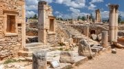
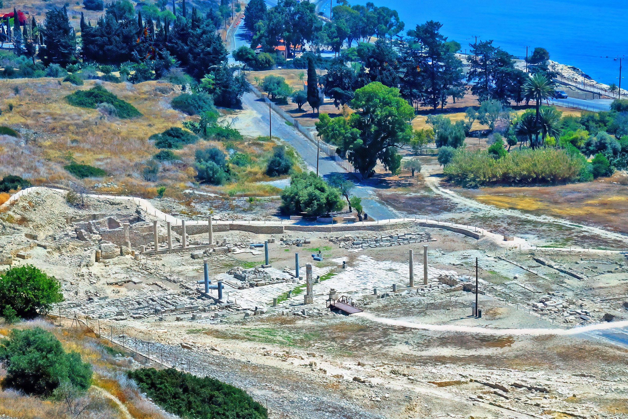
During the Roman period, builders organized the agora around a large central courtyard paved with limestone slabs. This open square provided space for merchants to set up stalls, citizens to gather for announcements, and politicians to address crowds. The design followed typical Roman town planning, with the main street running along one side of the square.
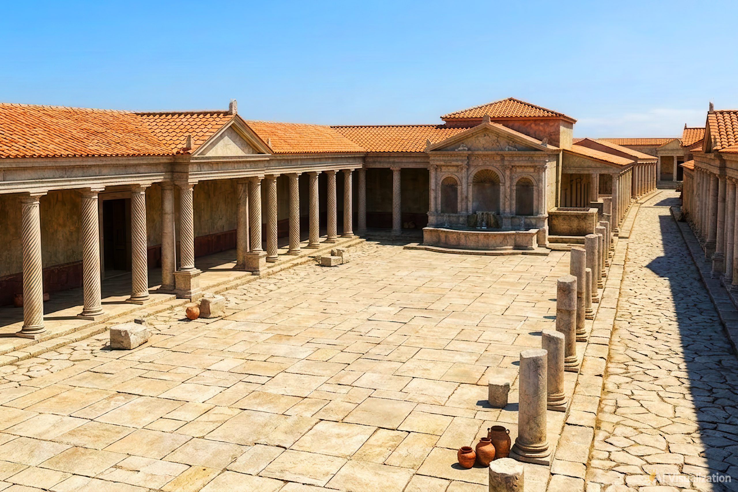
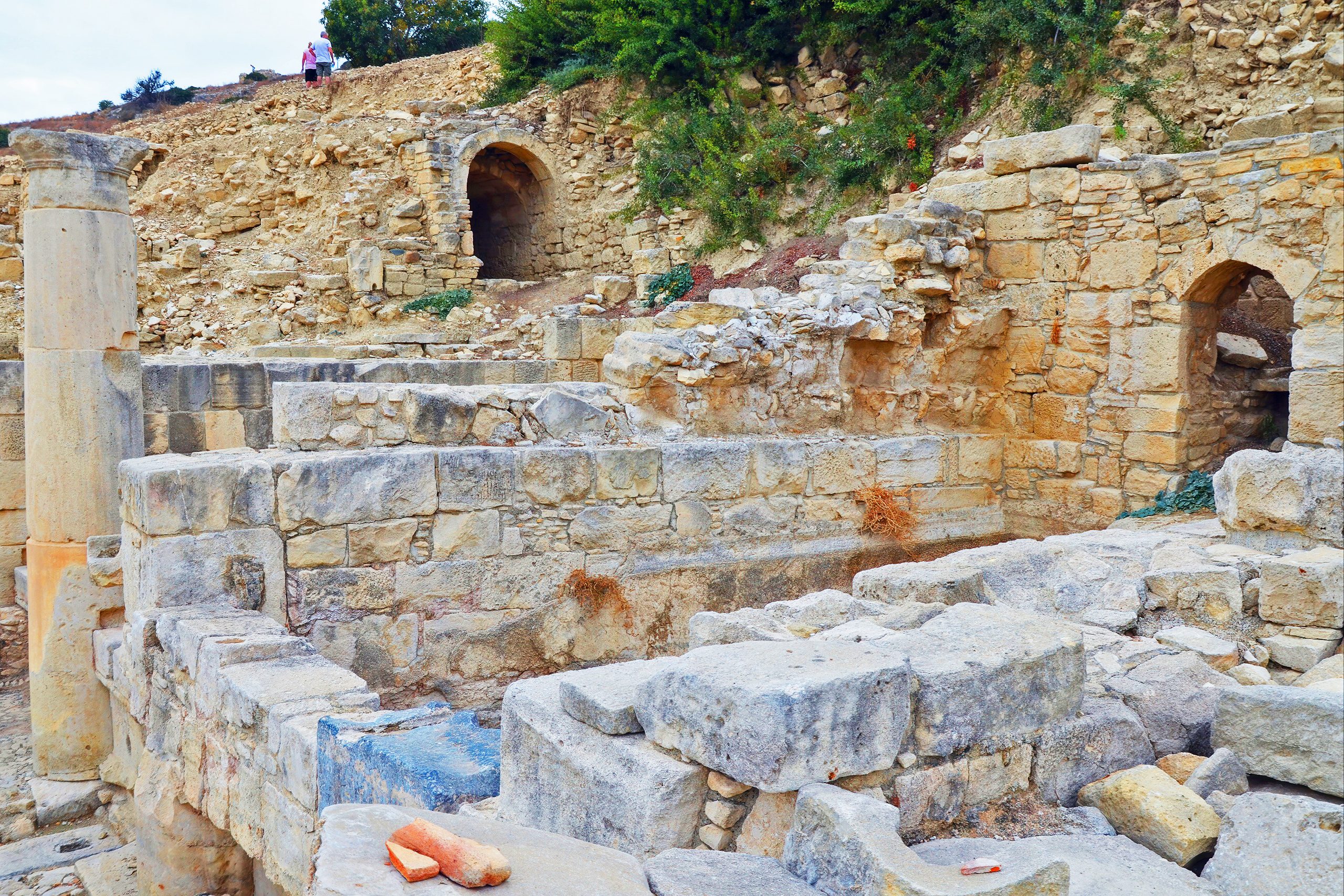
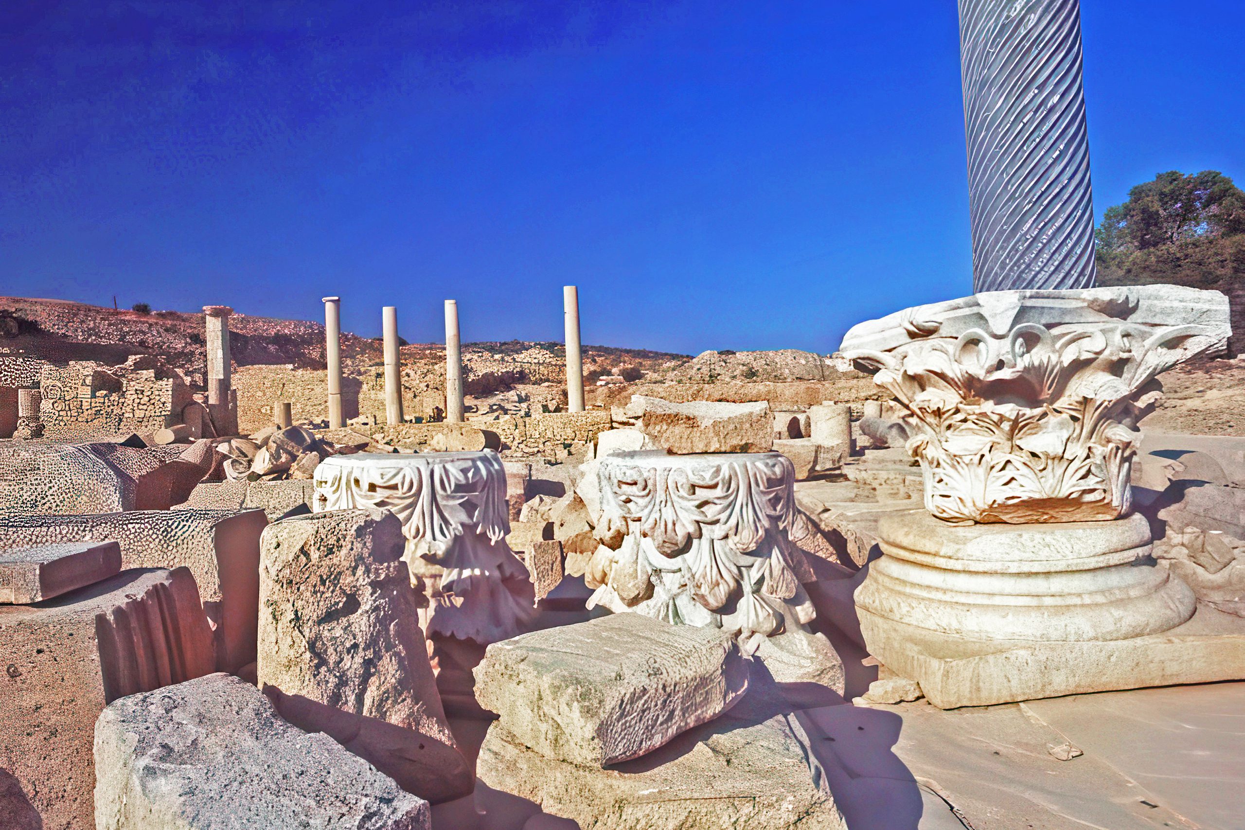
Three covered walkways called porticos enclosed the other three sides of the courtyard. These roofed colonnades protected people from sun and rain while they conducted business or socialized. The west portico featured thirteen Doric columns that opened onto the central court. Marble columns decorated with spiral carvings added visual appeal to the marketplace. The craftsmanship of these spirals shows skilled stonework, with each groove carved symmetrically into the marble.
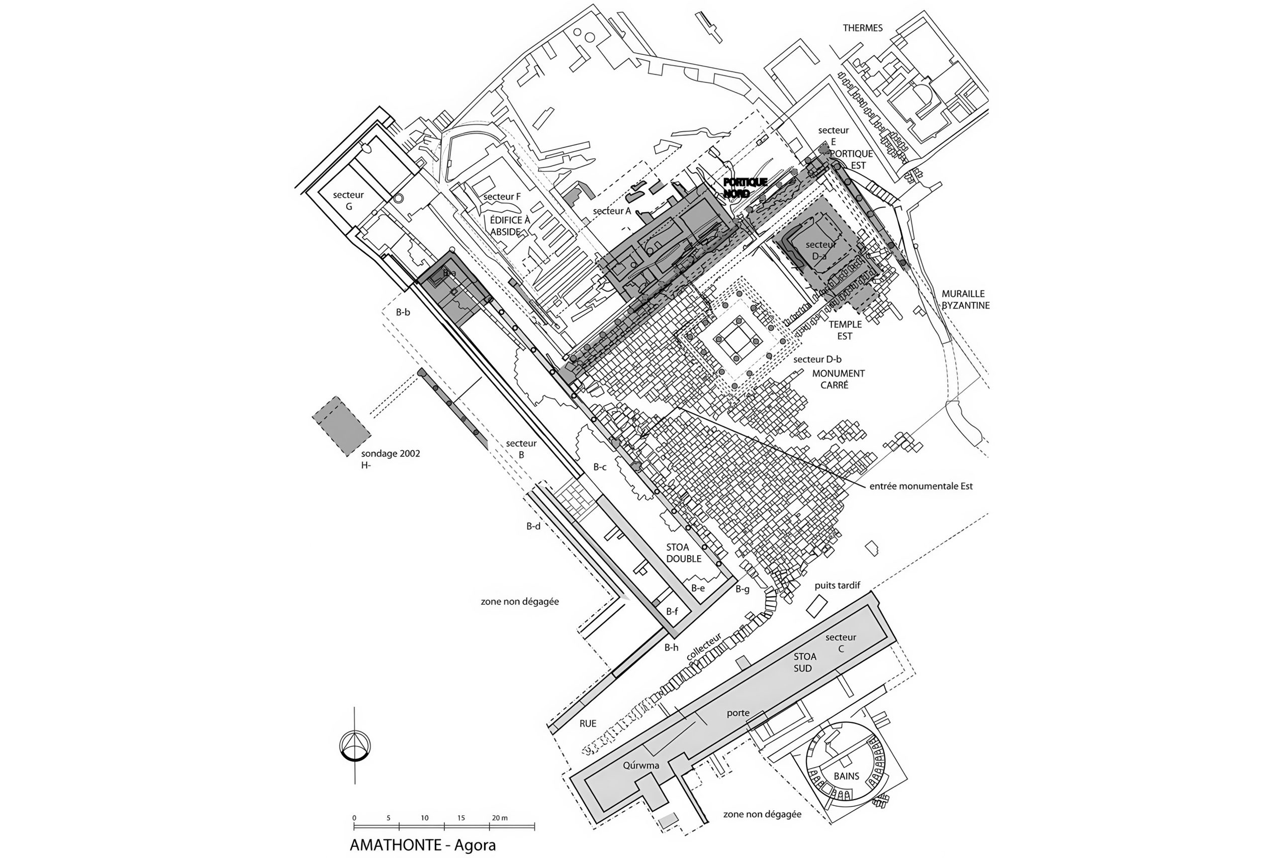
The west portico ended at its northern edge with a fountain, known as a nymphaeum in Roman architecture. This ornamental fountain provided fresh water for visitors and added a pleasant sound to the busy marketplace. Behind the fountain, workers later constructed a cistern to store additional water. These water features were essential in the Mediterranean climate, where summer temperatures could be extreme.
Public Buildings Around the Square
The north portico, though now badly damaged, once fronted important administrative and religious structures. These buildings handled the governmental functions necessary for running a major city. Tax collection, legal proceedings, and official records all required dedicated spaces. Religious ceremonies connected to civic life may have also taken place in these structures, as Roman cities typically combined sacred and secular authority in their public buildings.
Archaeological excavations have revealed foundations of houses and shops excavated along the slopes near the agora. These structures show how commercial and residential areas intermingled in ancient cities. Merchants often lived above or behind their shops, keeping their businesses close at hand. The proximity of homes to the marketplace made daily shopping convenient for residents.
Drainage channels ran through the area to handle rainwater and prevent flooding. The Romans were experts at managing water in their cities. Reservoirs stored water during dry periods, while carefully engineered channels carried excess water away during storms. These systems show the practical engineering knowledge that Romans applied even in distant provinces like Cyprus.
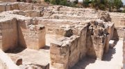
The Public Baths Next Door
Just south of the agora, a public bathhouse served the community. This bath complex, called a balaneion in Greek, consisted of a circular main chamber with several attached rooms. Emperor Hadrian commissioned improvements to these baths in the 2nd century AD as part of broader civic upgrades across the empire. The structure demonstrates typical Roman bathing practices adapted to a Mediterranean setting.
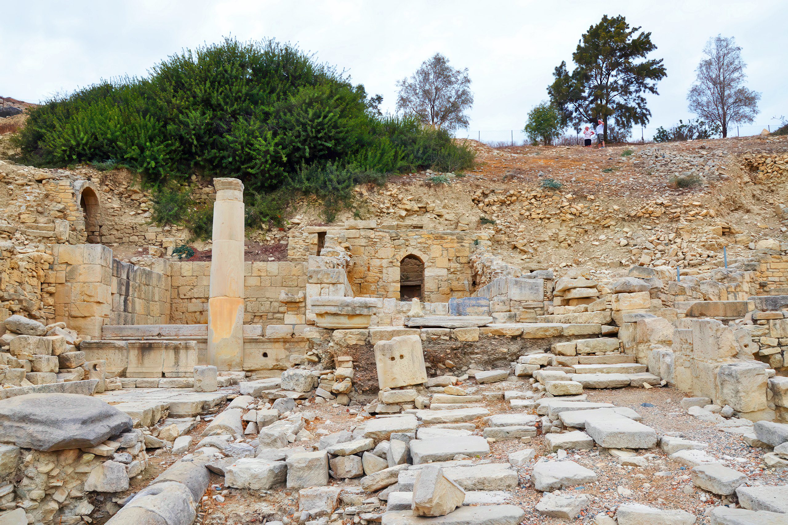
The bath complex included portions from the earlier Hellenistic period, along with parts of the west portico of the agora. These older sections represent the earliest evidence of organized human activity in this part of the city. The Romans later expanded and improved these facilities, showing continuity between Greek and Roman urban planning in Cyprus.
Modern Archaeological Work
In the 1870s, Luigi Palma di Cesnola excavated the necropolis of Amathus. He sent many objects to the Metropolitan Museum of Art in New York, while others went to the British Museum in London. These early excavations were less careful than modern archaeological methods, but they brought Amathus to scholarly attention and preserved artifacts that might otherwise have been lost.
Joint Cypriot-French excavations began in 1980 and continue today. These modern digs have systematically uncovered the acropolis, the Temple of Aphrodite, the agora, city walls, the basilica, and the ancient port. Archaeologists preserve finds at both the Cyprus Museum in Nicosia and the Limassol District Archaeological Museum, making them accessible to researchers and the public.
One spectacular discovery was a massive limestone vessel on the acropolis, dating from the 6th century BC. This enormous vase stands 1.85 meters tall and weighs 14 tons. Carved from a single piece of stone, it features four curved handles decorated with bull motifs. A similar vessel was taken to the Louvre in Paris in 1867. Today, a modern replica stands at the site while the original remains in France.
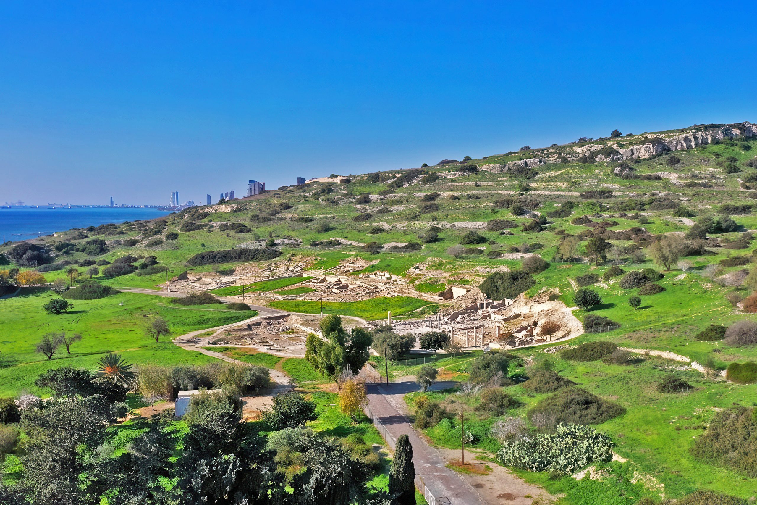
Visiting the Ruins Today
The archaeological site is open to visitors year-round. A small entrance fee grants access to the lower town, where the agora and baths are located. The acropolis on the hill above can be visited for free. Information stands and marked trails help visitors understand what they are seeing. The site covers a large area, so visitors should plan to spend at least two hours exploring.
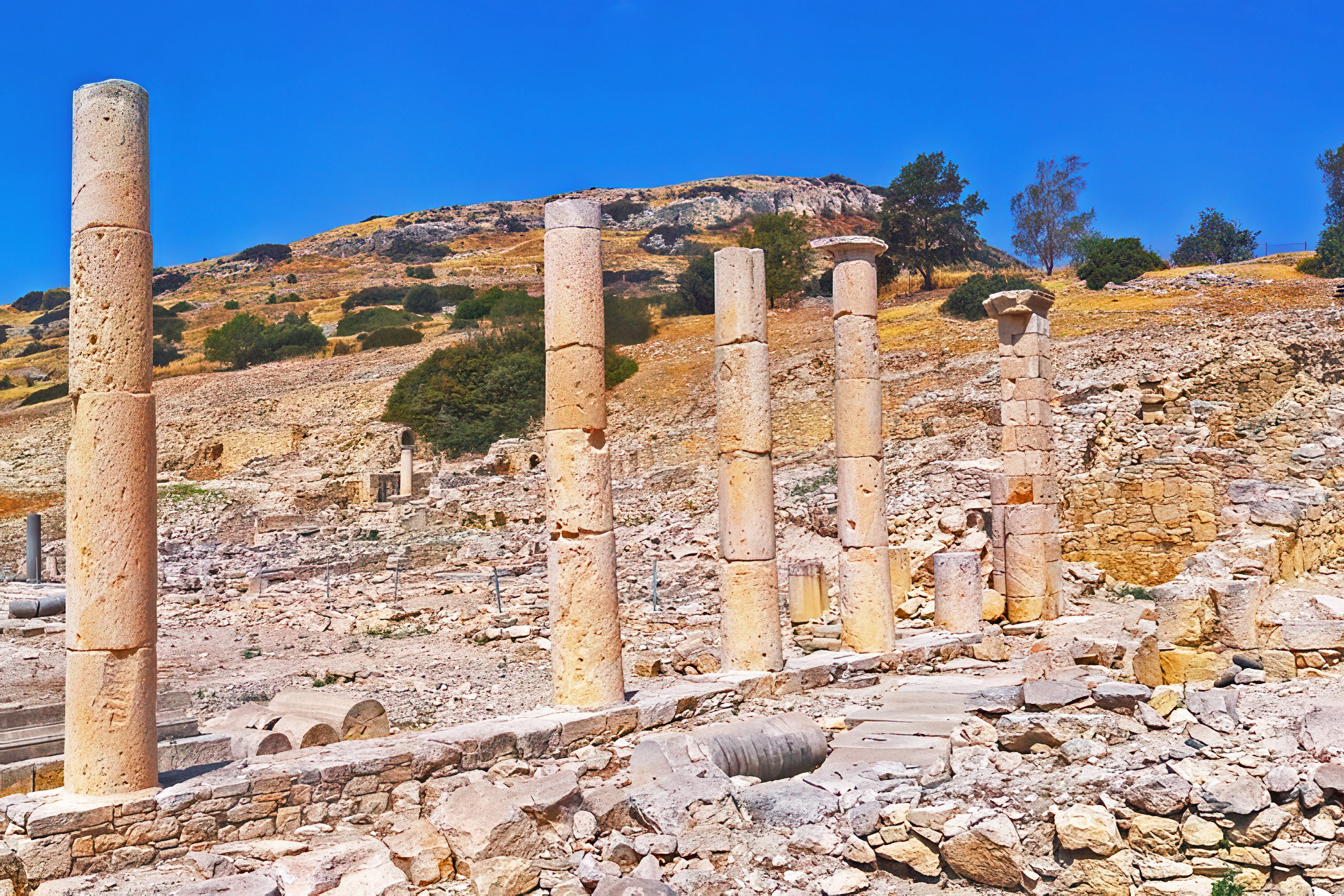
The limestone-paved square of the agora remains clearly visible, along with bases where marble columns once stood. The spiral decorations on some surviving columns show the artistic skill of ancient craftsmen. Visitors can trace the outline of the porticos and identify where the fountain once stood. The bath complex to the south reveals its circular layout and the different rooms where Romans once bathed.
From the acropolis, panoramic views extend across the Mediterranean Sea and the surrounding countryside. This elevated position shows why ancient builders chose this spot for their city. The natural harbor below made trade possible, while the hilltop provided defensive advantages. Standing among the ruins, it takes only modest imagination to picture the bustling marketplace that once occupied this space.
The Legacy of the Amathus Marketplace
The agora at Amathus represents more than just an ancient marketplace. It shows how Romans adapted their urban planning to local conditions while maintaining their characteristic organization and engineering standards. The stone-paved square with its surrounding porticos created a functional space for commerce and politics. The nearby baths provided essential social facilities. Together, these structures formed the public core of a successful Mediterranean city.
What makes the Amathus agora particularly valuable is how it preserves both Hellenistic and Roman construction phases. The earliest parts of the bath and west portico date to the Hellenistic period, while later Roman improvements show how cities evolved over centuries. This layered history helps archaeologists understand the transition from Greek to Roman control in Cyprus.
Today, the ruins continue to reveal information about ancient life. Each excavation season brings new discoveries. The agora stands as a testament to the importance of public spaces in ancient cities, where commercial transactions, political decisions, and social connections all took place in the same central square. For modern visitors, walking through this archaeological site offers a direct connection to the daily activities of people who lived and worked here more than two thousand years ago.