Explore Cyprus with Our Interactive Map

Explore our top stories and discover ideas worth your time.

Lefkara Lace (Lefkaritika)

Lefkara Lace (Lefkaritika)

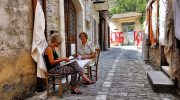
Lefkara Lace (Lefkaritika) is a world-renowned handmade lace tradition from Cyprus, distinguished by its geometric precision, white-on-white stitching, and centuries-old transmission through female artisans. Originating in the village of Lefkara, this craft blends intricate patterns that symbolize nature and life, creating delicate textiles prized for their elegance and cultural depth. Recognized by UNESCO as intangible cultural heritage in 2009, it represents Cyprus's enduring artisanal legacy, where women's hands have woven history into fabric for generations. A Timeless Craft of Elegance and Skill Lefkara lace, known locally as Lefkaritika, embodies the island's rich textile heritage, a form of needlework where fine linen threads are drawn and stitched into intricate designs that appear almost ethereal against a white background. Produced exclusively in the villages of Pano and Kato Lefkara in the Larnaca District, this lace features geometric motifs inspired by nature, such as rivers, daisies, and almond blossoms, arranged in symmetrical patterns that require exceptional precision and patience. The craft's white-on-white aesthetic, using unbleached cotton or linen, creates subtle shadows and textures that play with light, giving pieces a luminous quality. This tradition not only produces beautiful items like tablecloths, doilies, and clothing but also serves as a cultural symbol of Cypriot ingenuity, where women's artistry has sustained communities through economic and social changes. The process begins with "dafna," a counted thread…

Read more
Kourion Mosaics Apollo To Basilicas Guide

Kourion Mosaics Apollo To Basilicas Guide

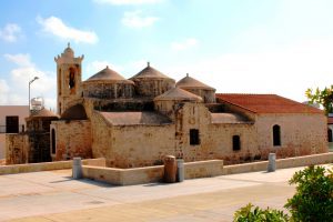
Kourion’s mosaics record Cyprus’s shift from a classical city organised around temples and civic life to an early Christian centre rebuilt under episcopal authority after mid-fourth-century earthquakes. In villas and basilicas, floors and inscriptions became a visual language that guided movement, reinforced belief, and redefined what power looked like in public space. This article explains how disaster opened the ground for change, how the Episcopal Complex reshaped the city’s core, and how mosaic imagery at sites like the House of Eustolios shows a community rebuilding identity as well as architecture. Apollo Hylates and Old Order For centuries, Kourion thrived as a Greco-Roman city, complete with temples, baths, theatres, and elite villas. Public life revolved around civic institutions and traditional religious cults, most notably the Sanctuary of Apollo Hylates. Christianity was present early, introduced to Cyprus in the first century, but in Kourion it remained largely private and unobtrusive. Everything changed in the mid-fourth century. A catastrophic earthquake, most notably the one in 365 CE, devastated the city. Entire neighbourhoods collapsed, public monuments were abandoned, and the old religious landscape effectively ended. The destruction was not symbolic. It was physical, sudden, and comprehensive. When rebuilding began, it followed a new logic. Instead of restoring pagan sanctuaries, Kourion was reorganised around Christian authority. The centre of gravity shifted from temples to basilicas,…

Read more
Cyprus Fertile River Valleys

Cyprus Fertile River Valleys

Cyprus contains approximately 35 streams and rivers, though most qualify as temporary watercourses that flow only during winter rains. These rivers create fertile valleys that have supported agricultural communities for over 9,000 years. The island receives an estimated 600 million cubic meters of usable runoff from annual rainfall, a limited resource distributed unevenly across the landscape. Major rivers, including the Pedieos, Kouris, Xeros, Vasilikos, and Diarizos originate in the Troodos Mountains, flow through productive valleys, and terminate either at the Mediterranean coast or in modern reservoir systems. The Pedieos River Valley and Central Plains Agriculture The Pedieos River extends 100 kilometers from its source near Machairas Monastery in the Troodos range, making it the longest river in Cyprus. The river flows northeast through the Mesaoria Plain, passes through Nicosia, and then continues east to Famagusta Bay near the ancient city of Salamis. Archaeological evidence confirms continuous agricultural settlement along the Pedieos valley from the Bronze Age through modern times. The ancient town of Tamasos developed on the left bank of the Pedieos, its ruins extending across a hill overlooking the rich valley below. The river derives its name from ancient Greek words meaning to see the east, as its course coincides with the path of the dawn goddess. The Mesaoria Plain, traversed by the Pedieos and several tributary floodplains, once…

Read more