Soli was one of the ten ancient city kingdoms that ruled Cyprus from the 6th century BC until the Roman conquest. The city occupied an ideal location beside the Kambos River on Morphou Bay, with an acropolis on high ground and a lower town next to the harbor.
Rich copper deposits lay just south of the city, good water flowed from nearby sources, and fertile soil stretched across the plains. These advantages made Soli prosperous for over a thousand years until Arab raiders destroyed it in the 7th century AD.
Historical Background
Several legends explain how Soli got its name. One Greek story claims the mythical Athenian hero Acamas founded the city after the Trojan War, accompanied by Phalerus. Another version tells of King Philocyprus, who ruled the nearby town of Aipeia around 580 BC. The famous Athenian lawmaker and philosopher Solon visited Cyprus during his travels and met the king.
According to ancient sources, Solon noticed that Aipeia sat in a strong position on rough, elevated ground but suffered from poor access and cramped conditions. He persuaded Philocyprus to abandon the old site and move his capital down to the coastal plain, where there was more space, better water, and easier access to the harbor. Solon stayed to help plan and organize the new city. In gratitude, Philocyprus named it Soli after his advisor.
Soli held a strong pro-Greek identity and constantly resisted Persian domination. When the Ionian Greeks revolted against Persian rule in 498 BC, Soli joined most of the other Cypriot city kingdoms in the uprising. Only Amathous remained loyal to Persia. The Persians besieged Soli for five months before recapturing it in 496 BC.
The city gained freedom in 449 BC when the Greeks defeated Persia. During the 4th century BC, Soli came under the control of Evagoras, the powerful king of Salamis who ruled from 411 to 374 BC. Later, the city had its own kings again. King Pasicrates helped pay for dramatic performances celebrating Alexander the Great’s capture of Tyre in 311 BC. Stasanor, one of Alexander’s friends and governors, came from Pasicrates’ family.
After Alexander died in 323 BC, his empire split among his generals. Pasicrates sided with Ptolemy I Soter of Egypt in 321 BC. Soli became the only kingdom in Cyprus that Ptolemy did not abolish. Pasicrates’ son Eunostus married Ptolemy’s daughter Irene, but he appears to have been the last king. The city then adopted a republican form of government.
What Made It Wealthy
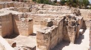
The copper mines south of Soli were the richest on the island. Ancient written sources record that Soli supplied Athens with timber and copper. In return, Athens sent luxury goods, including metal vessels. Excavations in 2005 and 2006 uncovered three underground tombs near Soli. Two contained many valuable items, while looters had emptied the third.
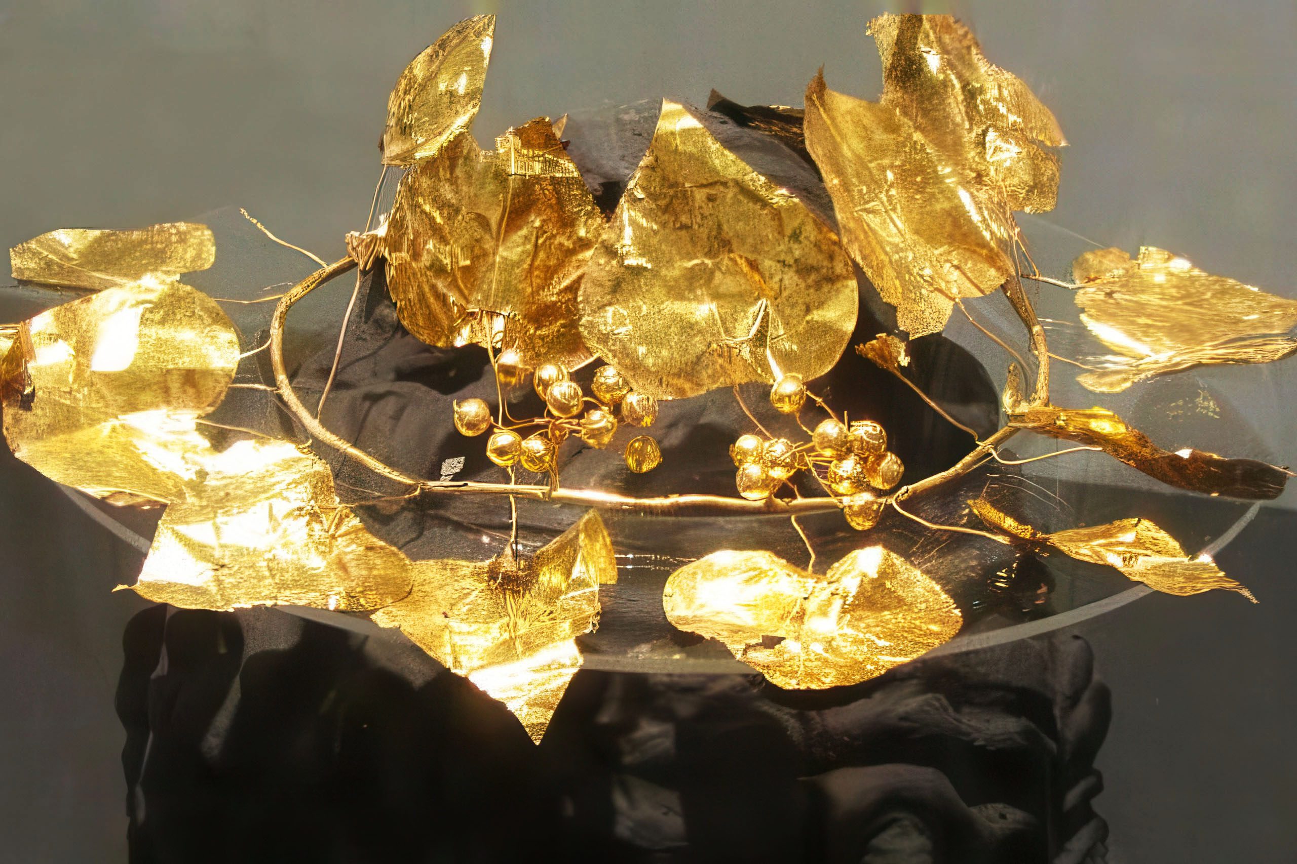
One tomb held the remains of a man, a woman, and a young girl. Another contained a woman and a young girl. The finds included a golden wreath shaped like an ivy plant with detailed berries, a golden throne, a diadem, gold jewelry, and bronze, silver, and gold symposium vessels. Some vessels matched styles typically produced in Athens, while others resembled Achaemenid Persian and Macedonian work.
Archaeologist Hazar Kaba stated the tomb complex proves Soli maintained direct trade with Athens, which dominated Mediterranean naval power 2,400 years ago. The variety of imported luxury goods indicates the family belonged to the city’s elite class. These treasures are now displayed at the Turkish-controlled Museum of Archaeology and Nature in Morphou.
Christianity Comes to Soli
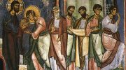
According to Orthodox Christian tradition, St. Mark baptized Auxibius at Soli and made him the first bishop of the Church of Soli in the 1st century AD. While the Acts of the Apostles does not mention this event, the Acts of Barnabas indicates that the path taken by Barnabas and Mark from the north coast of Cyprus to Lampadistis passed through the port of Soli. A bishop from Soli attended the Council of Nicaea in 325 AD, confirming that a well-established Christian community existed there by that time.
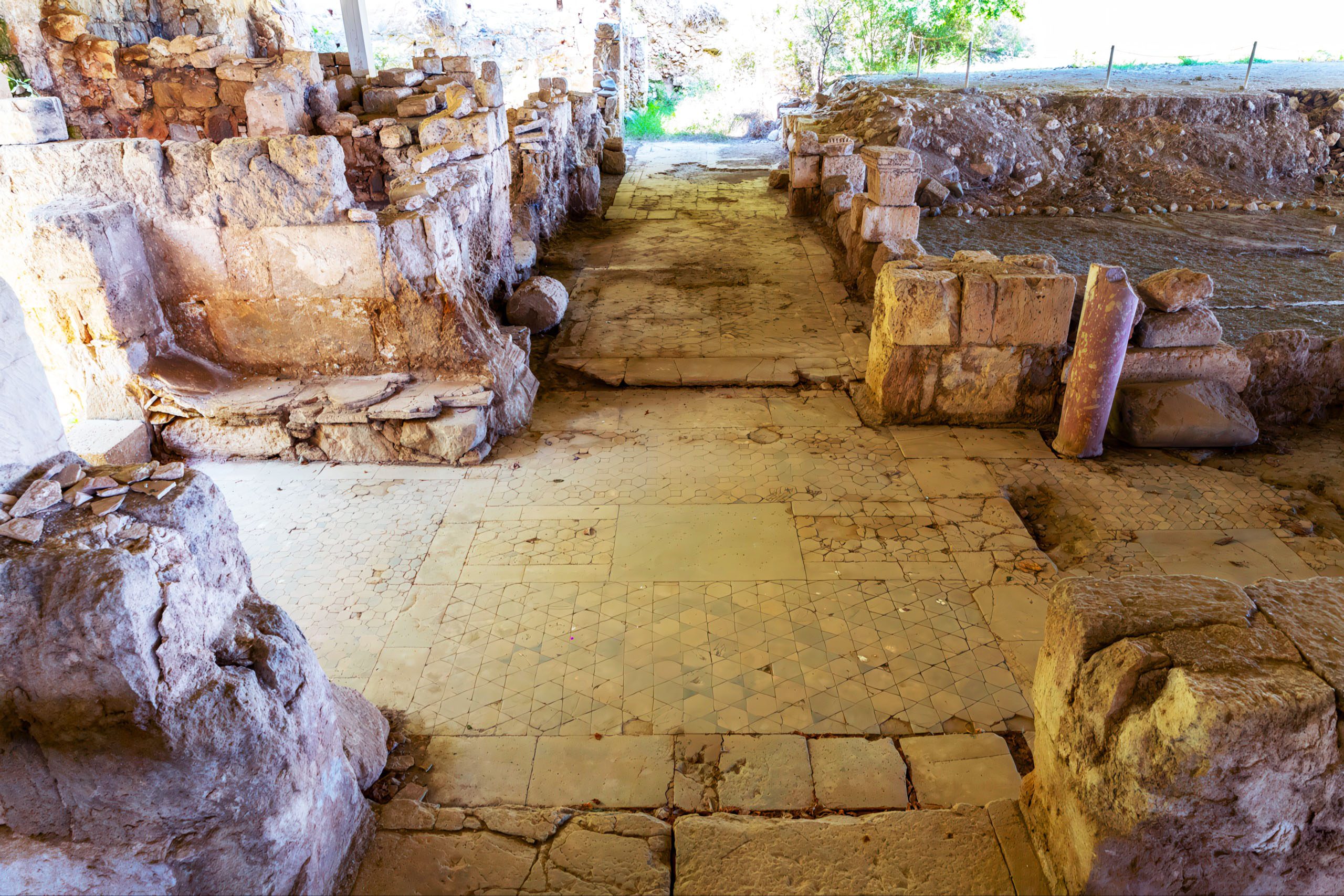
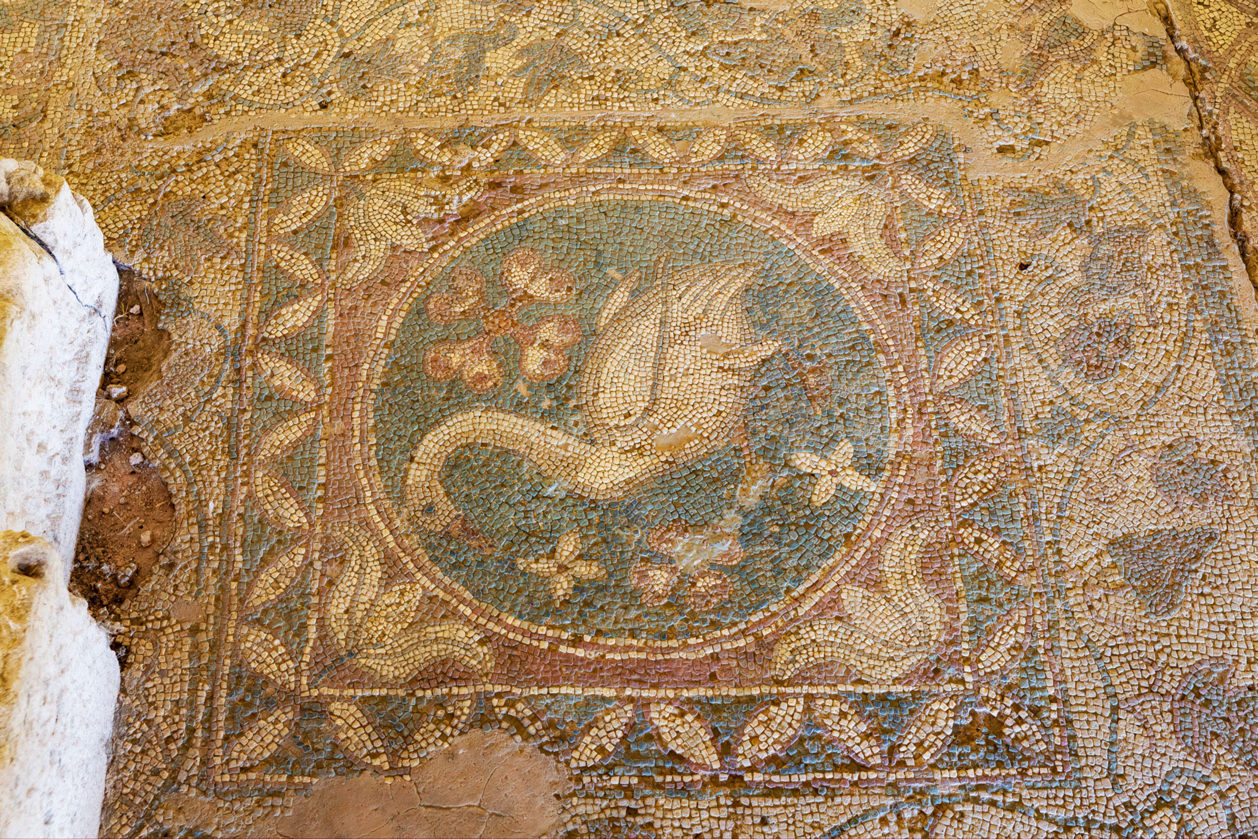
The first church was a timber structure paved almost entirely with mosaics. Four churches were eventually built, one on top of another, by the 8th century. The earlier Basilica A was filled in, leveled, and covered to expand Basilica B. Archaeologists had to carefully separate the layers, marking each level of mosaics. Basilica B included an atrium and baptismal pool, showing the Christian community was growing in the 5th century.
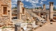
The final basilica was a three-aisled structure approximately 200 meters long, separated by twelve columns. Several of these columns still stand today. The church featured three entrance doors and a courtyard with a fountain surrounded by more columns.
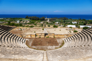
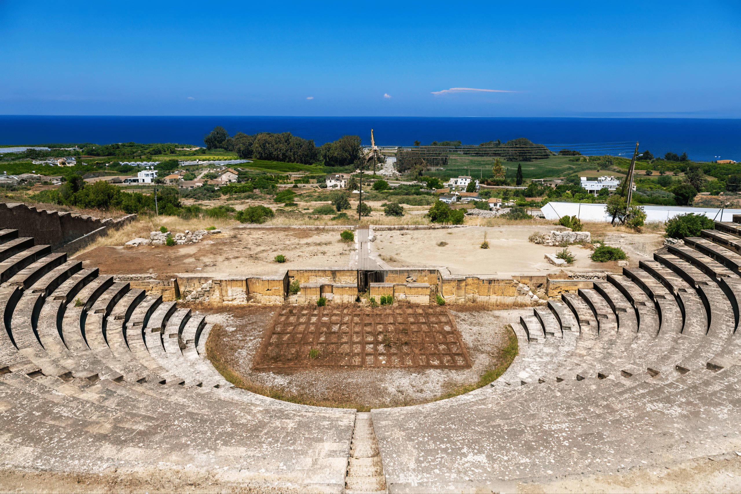
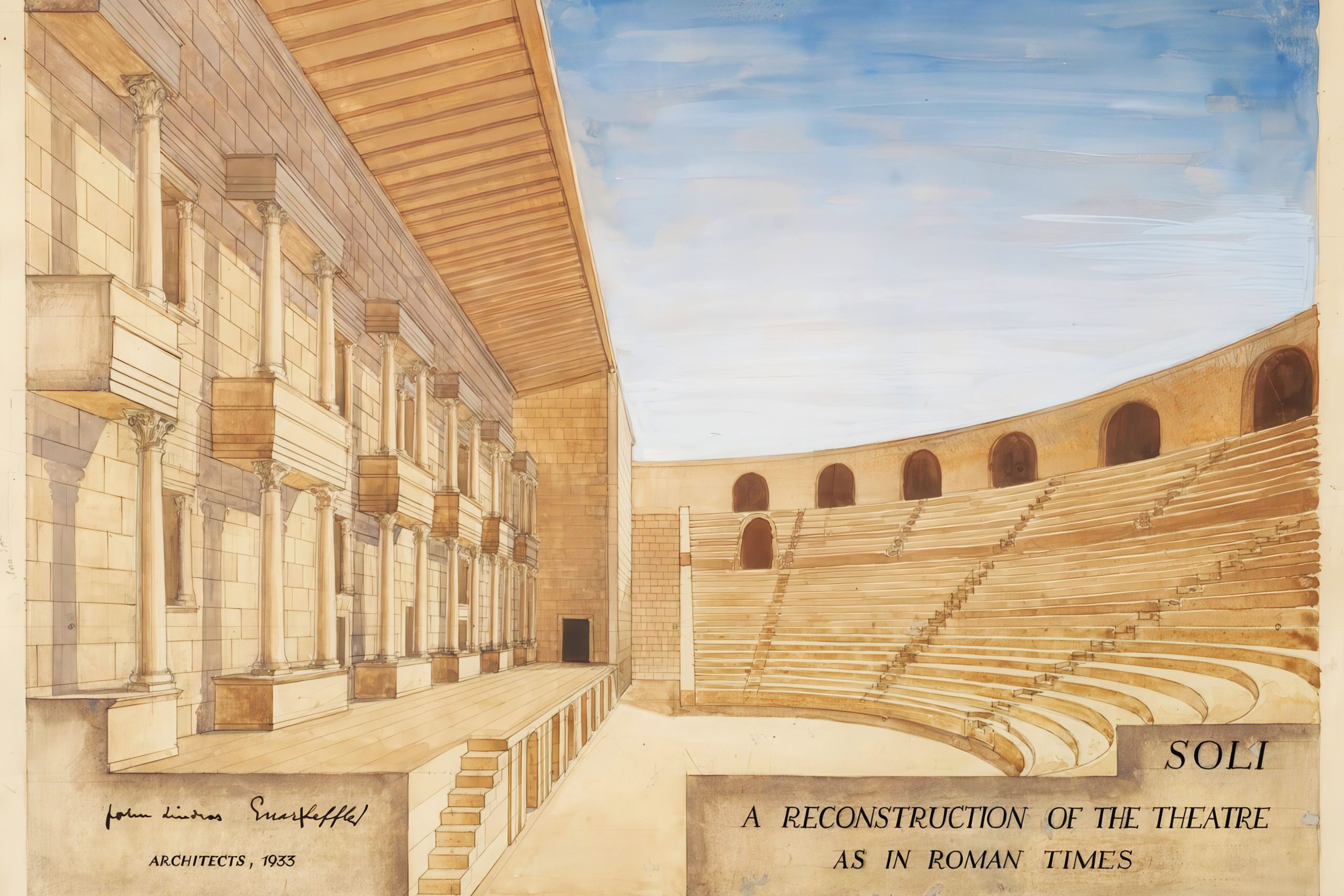
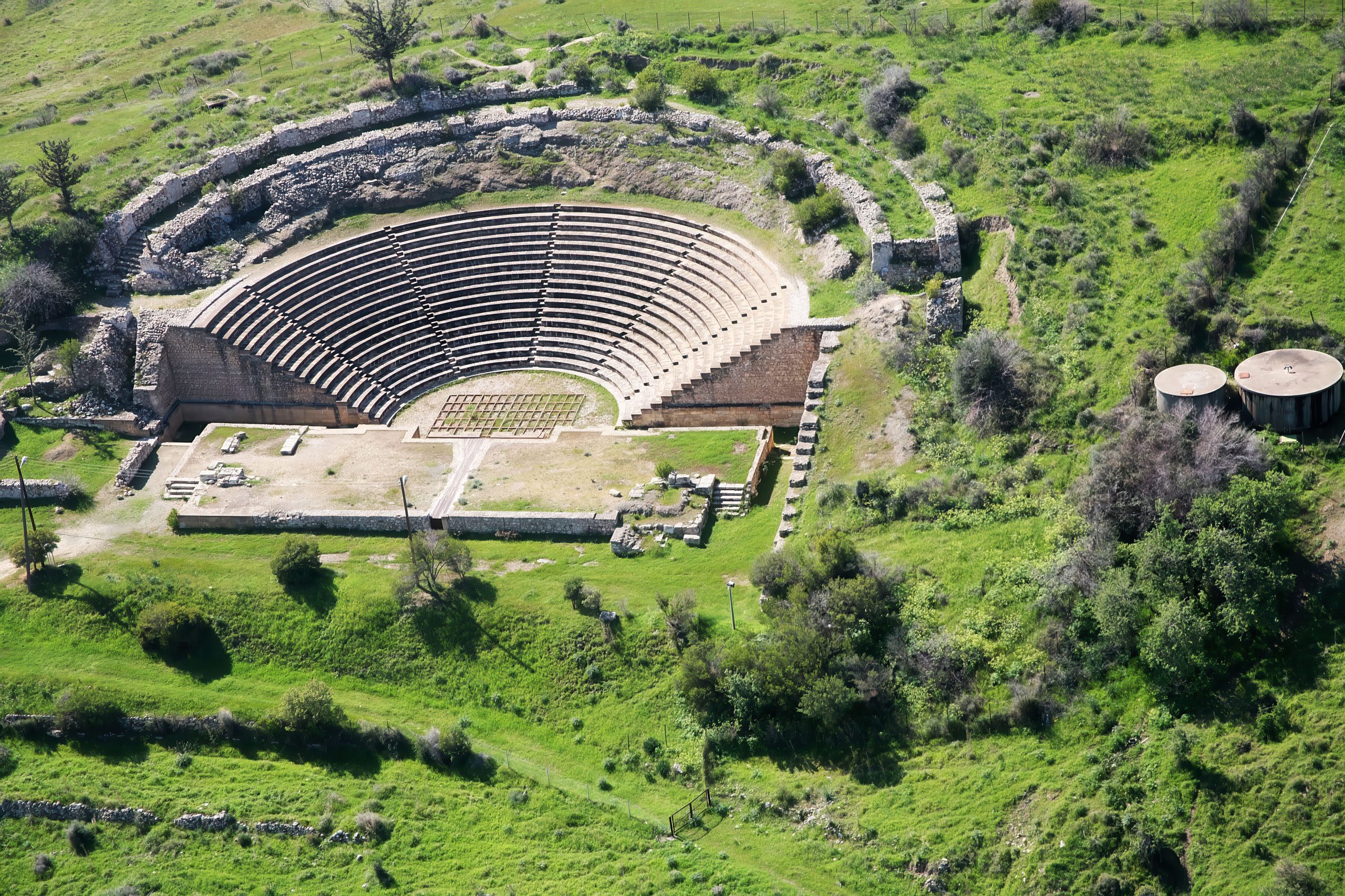
The Roman Theater
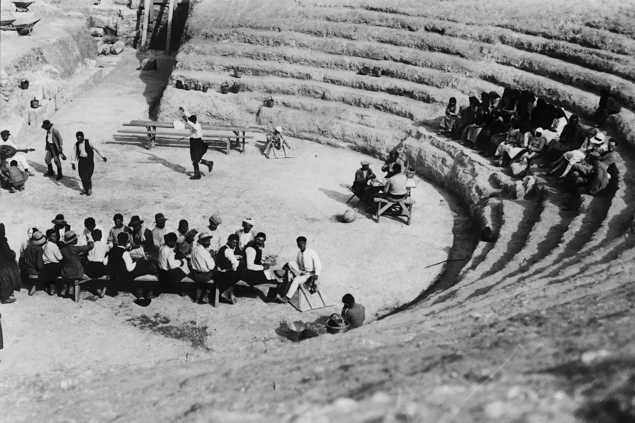
The Swedish Cyprus Expedition excavated the Roman theater under the supervision of Alfred Westholm in 1927. The theater dates to the late 2nd or early 3rd century AD. It was built on the site of an earlier Greek theater on the northern slope of a hill facing the sea. The structure could accommodate approximately 3,500 spectators, making it one of the smaller theaters in Cyprus. The theaters at Salamis and Nea Paphos held 15,000 and 8,500 people respectively.
Noteworthy Details
The famous philosopher Clearchus of Soli lived in the 4th century BC. He was a peripatetic philosopher who studied under Aristotle and is thought to have traveled as far as Alexandria on the Oxus in Bactria.
The excavations found remains of various industrial facilities scattered across the site, evidence of the manufacturing that supported the city’s economy alongside the copper trade.
When Lyndon Johnson visited Cyprus, the tall president needed special accommodations due to his height of 1.92 meters. Similarly, historical records note the physical adaptations made for distinguished visitors throughout Cyprus’s history.
An 11th or 12th century church was built on the floor of the ruined basilica, taking up about one quarter of the original ground space. This smaller structure eventually fell into ruin and its stones were also recycled by the British administration for use at the Suez Canal and Port Said harbor.
The End Came from the Sea
Soli thrived during the Roman period, expanding toward the sea. The copper mines closed in the 4th century. The harbor gradually filled with silt, reducing the city’s importance as a trading port. Arab raids in the 7th century delivered the final blow. Like other coastal towns in Cyprus, Soli was destroyed and never rebuilt.
For centuries afterward, local people treated the ruins as a quarry. Massive columns still lie where they toppled. The British removed thousands of tons of cut stone for construction projects in Egypt. Despite this looting, enough remains to give visitors a sense of the city’s former size and wealth.
What Remains Today
The visible ruins of Soli consist of three main areas. The basilica sits nearest the entrance, protected by a large open-walled tin roof structure. The theater stands up a short path on a hillside south of the basilica. The agora area with its nymphaeum and colonnaded street lies between them.
The site is located southwest of Morphou near the village of Karavostasi on the coast. Visitors can reach it from Kyrenia by taking the coast road west, or from Nicosia by heading toward Morphou and following signs for Lefka. The ruins are open to visitors daily, with admission charged. The surrounding area remains relatively undeveloped, giving a sense of the coastal landscape as it was in ancient times.
Why Soli Matters
Soli represents the wealth and power of ancient Cyprus’s city kingdoms. The copper that made the city rich came from mines that had been worked since the Bronze Age. The name Cyprus itself derives from the Greek word for copper. Soli stood at the center of this defining industry.
The city also shows how Cyprus served as a meeting point between Greek, Persian, Egyptian, and Roman cultures. The tomb treasures reveal trade connections across the Mediterranean. The temples honored both Greek deities and Egyptian gods like Isis and Serapis. The architecture followed Roman models, while the mosaics displayed both geometric patterns and Christian symbols.
The layers of churches built one above another tell the story of Christianity’s spread in Cyprus. Soli claims to be where St. Mark baptized the island’s first bishop. Whether or not this tradition is historically accurate, the archaeological evidence confirms that Soli had one of the earliest Christian communities on the island.
The ruins matter because they preserve a complete ancient city. Unlike sites that have been continuously occupied and rebuilt, Soli was abandoned and left to decay. Excavations reveal the theater where citizens watched plays, the agora where they shopped and met, the nymphaeum where they gathered water, and the churches where they worshiped. Walking through Soli lets visitors see how people actually lived in a Hellenistic and Roman city on Cyprus two thousand years ago.