Explore Cyprus with Our Interactive Map

Explore our top stories and discover ideas worth your time.

Panthea Nature Trail

Panthea Nature Trail

The Panthea Nature Trail is one of the most serene and visually spectacular hiking routes nestled within the high-elevation forests of Cyprus. Situated in the Nicosia District, the trail begins on the mountain pass between the world-famous Kykkos Monastery and the secluded village of Tsakkistra. Unlike the coastal walking paths of Cyprus, the Panthea trail immerses hikers in dense stands of pine trees, leading them along sharp ridges that offer sweeping views of the surrounding valleys. The trail serves as a physical link between isolated mountain communities, providing a peaceful escape for those looking to experience the authentic, untamed interior of the island. Panthea Nature Trail Overview Location: Road between Kykkos and Tsakkistra, Nicosia District, Western Cyprus. Distance: 10.1 kilometers (6.3 miles) for the full linear trail; there is also a popular 7.2-kilometer (4.5 miles) out-and-back variation. Route Type: Linear (can be walked one-way or out-and-back). Difficulty: Category 2 (Moderate/Difficult) due to sudden gradient changes and narrow sections. Elevation Gain: Approximately 413 meters (1,355 feet). Duration: 3 to 3.5 hours for a one-way walk, or 4+ hours for an out-and-back. Best Time to Visit: Winter and Spring (December to April) for peak visibility, cool weather, and blooming orchards. Terrain: Narrow dirt footpaths along high mountain ridgelines, transitioning to weathered gravel forest roads. The Geography and Setting of the Panthea Region…

Read more
Maronite Villages of Cyprus

Maronite Villages of Cyprus

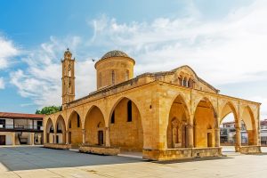
The Maronite community of Cyprus represents one of the island's smallest yet most distinctive religious groups, descended from Arab Christians who fled persecution in modern-day Syria and Lebanon starting in the 8th century. Today approximately 7,500 to 10,000 Maronites live on Cyprus, though their numbers have declined dramatically from an estimated 80,000 in the 13th century when they inhabited 60 villages across the island. Four traditional Maronite villages remain: Kormakitis, Asomatos, Agia Marina, and Karpasha, all located in the Turkish-controlled part of Cyprus. These communities maintain unique cultural practices, including speaking Sanna, a critically endangered Arabic dialect that preserves traces of Aramaic and represents one of the world's rarest languages. Four Waves of Migration from the Levant The Maronite presence in Cyprus developed through four distinct waves of emigration from the Levant between the 7th and 13th centuries. The first wave began around the 8th century when Islamic conquests radiated outward from the Arab Peninsula, prompting many Christians to abandon Syria and Lebanon for safer territories. These early migrants brought with them an Arabic dialect heavily influenced by Aramaic, the language spoken in the region before Arab invasion. In 938, the destruction of St Maron's Monastery in Lebanon triggered a second wave of refugees seeking sanctuary on Cyprus. Saint Maron, a 4th century hermit who became the spiritual father of…

Read more
Environmental Awareness and Eco Trails

Environmental Awareness and Eco Trails

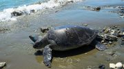
Cyprus has transformed itself into a model for environmental education and sustainable tourism across the Mediterranean region. The island maintains a network of 52 designated nature trails covering 319.6 kilometers through national forests, complemented by 47 additional trails outside protected areas, for a total of 99 marked routes accessible to visitors. These paths connect to specialized environmental education centers, green certification programs, and conservation initiatives that demonstrate how tourism and environmental protection can support each other. The Department of Forests developed the initial network of nature trails to offer direct contact with Cypriot nature while serving environmental education, general information, and physical exercise. These trails span three major regions: the Akamas Peninsula, Troodos Mountains, and Cape Greco National Forest Park. Each area presents distinct landscapes, from coastal cliffs to pine covered peaks reaching 1,951 meters elevation at Mount Olympus. Routes vary from easy one kilometer walks to challenging 17 kilometer treks, with the European E4 Long Distance Path extending more than 500 kilometers across the island. The trails fall into three difficulty categories: Category 1 features gentle gradients suitable for most visitors, Category 2 includes some uphill sections, and Category 3 presents steep or difficult terrain for experienced hikers only. At Cape Greco National Forest Park, the Agioi Anargyroi trail network showcases dramatic coastal features. The 2.3 kilometer circular trail…

Read more