Explore Cyprus with Our Interactive Map

Explore our top stories and discover ideas worth your time.

Vavla Village

Vavla Village

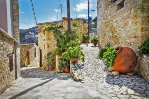
Vavla is a small mountain village situated in the Larnaca district of Cyprus, approximately 38 kilometers west of Larnaca city and 450 meters above sea level. The village lies in the foothills of the Troodos mountains, positioned between the major cities of Larnaca, Limassol, and Nicosia, each within 25 to 40 minutes by car. With fewer than 100 permanent residents, Vavla has been officially declared a Preserved Village by the Cyprus authorities due to its traditional white stone architecture built from local Lefkara limestone. The village stands on the geological boundary between Lefkara limestone formations and the volcanic earth of Troodos, creating a unique microclimate that supports rich vegetation, including three rare species and 18 endemic plant varieties. Historical Origins The exact founding date of Vavla remains unknown, though archaeological evidence confirms human settlement in the area since ancient times. The village appears on a French map from 1367 as "Vala" or "Vaules" and on another from 1423 as "Vaula." Two competing theories explain the village name. One suggests it derives from a feudal lord named De Vavyla who controlled the area including Vavla, Kato Drys, and Lefkara during the Lusignan period in the 14th century. The alternative theory claims the name comes from a plant that grew along the Nile River banks in Egypt, which village residents brought to…

Read more
Sheftalia Cypriot Street Food

Sheftalia Cypriot Street Food

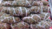
Sheftalia is a traditional Cypriot sausage made from ground meat wrapped in caul fat, a thin membrane that surrounds animal organs. The mixture uses pork, lamb, or a combination of both, along with finely chopped onions, fresh parsley, and basic seasonings. The meat is formed into oval shapes and encased in the lacy caul fat before grilling over charcoal. Unlike standard sausages that use casings, sheftalia relies on this natural membrane that melts during cooking. This creates a crispy exterior while the fat bastes the meat from the outside, keeping it tender and moist inside. The name comes from the Turkish word "şeftali," which means peach, likely referring to the texture or appearance of the finished product. Historical Context Sheftalia appeared in Cyprus during the 19th century, when meat was expensive and cooks found ways to maximize every part of the animal. The caul fat, which might otherwise go unused, became the perfect wrapper to preserve moisture and enhance flavor. Two theories explain the name's origin: The first connects it to "şeftali kebabı," meaning peach kebab in Turkish, possibly describing the texture. The second attributes it to a Turkish Cypriot street vendor called Şef Ali, or Chef Ali, who supposedly created "Şef Ali kebabı," which eventually became known as sheftali or sheftalia. The dish reflects Ottoman influence on Cypriot cooking…

Read more

Akrotiri Peninsula

Akrotiri Peninsula

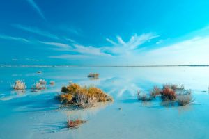
\nThe Akrotiri Peninsula in the Limassol District marks the southernmost tip of Cyprus and also the southernmost part of Europe. This 123 square kilometer area contains the largest complex of natural wetlands on the island, centered around Akrotiri Salt Lake.\n\n\n\n \n\n\n\nThe peninsula hosts over 300 recorded bird species, more than 800 indigenous plant species representing roughly 40 percent of all plants found on Cyprus, and critical habitats ranging from coastal sand dunes to Mediterranean juniper forests. Most of the peninsula lies within the British Sovereign Base Area of Akrotiri, territory retained by the United Kingdom when Cyprus gained independence in 1960.\n\n\n\n\n\nFrom Ancient Island to Protected Reserve\n\n\n\nThe Akrotiri Peninsula was once a small island that merged with the rest of Cyprus through processes spanning thousands of years, creating what geologists call a double tombolo. The Kouris River carried sediment to create a land bridge on the western side at least 56,000 years ago, while the Garilis River later formed a second connection on the eastern side. This gradual process trapped seawater between the two land bridges, forming Akrotiri Salt Lake.\n\n\n\nThe south cliffs of the peninsula, known as Aetokremmos, host the earliest known archaeological site in Cyprus and are believed to be the first part of the island inhabited by people during the pre-Neolithic period.\n\n\n\nThe site contains 12,000-year-old fossilized bones of pygmy…

Read more