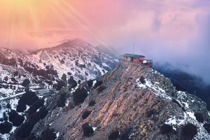
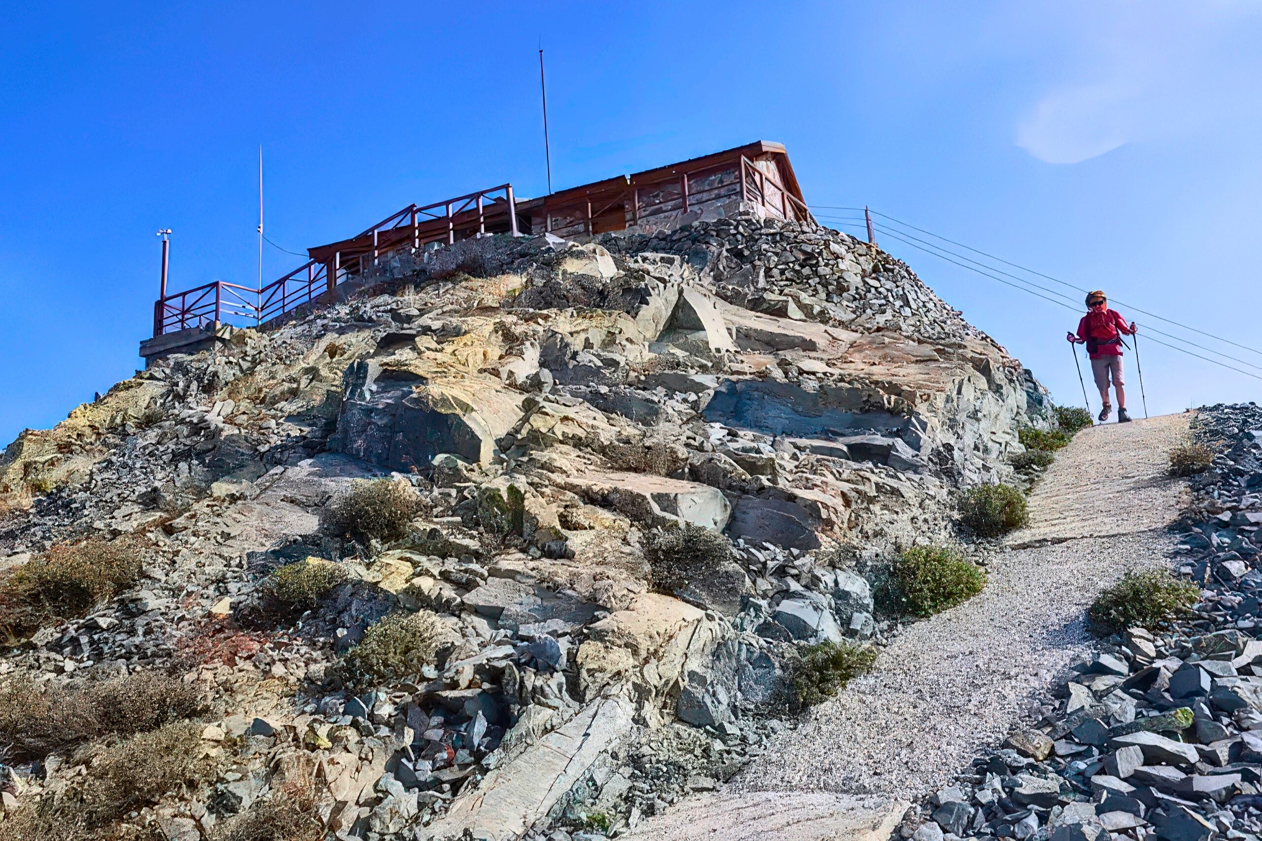
Madari Summit stands at 1,613 metres, securing the spot as the second-highest peak among the mountains in Cyprus. The Madari viewpoint sits atop Mount Adelfoi in the eastern Troodos range, offering unrestricted access to its summit, unlike Mount Olympus, where military installations block the highest point.
The fire lookout station at the peak provides 360-degree views that stretch from the Turkish-occupied Pentadaktylos mountains in the north across the Mesaoria plain to the southern coast. Visitors can climb the open tower structure to gain even higher vantage points.
The location draws photographers, nature enthusiasts, and hikers who want to experience Cyprus from its most panoramic natural viewpoint without the restrictions that limit access elsewhere in the mountains.
Historical Development
The Troodos Mountains formed approximately 90 million years ago as part of the Neotethys seafloor. The range rose slowly from the sea as a result of the collision between the African and European tectonic plates, a process that eventually formed the island of Cyprus.
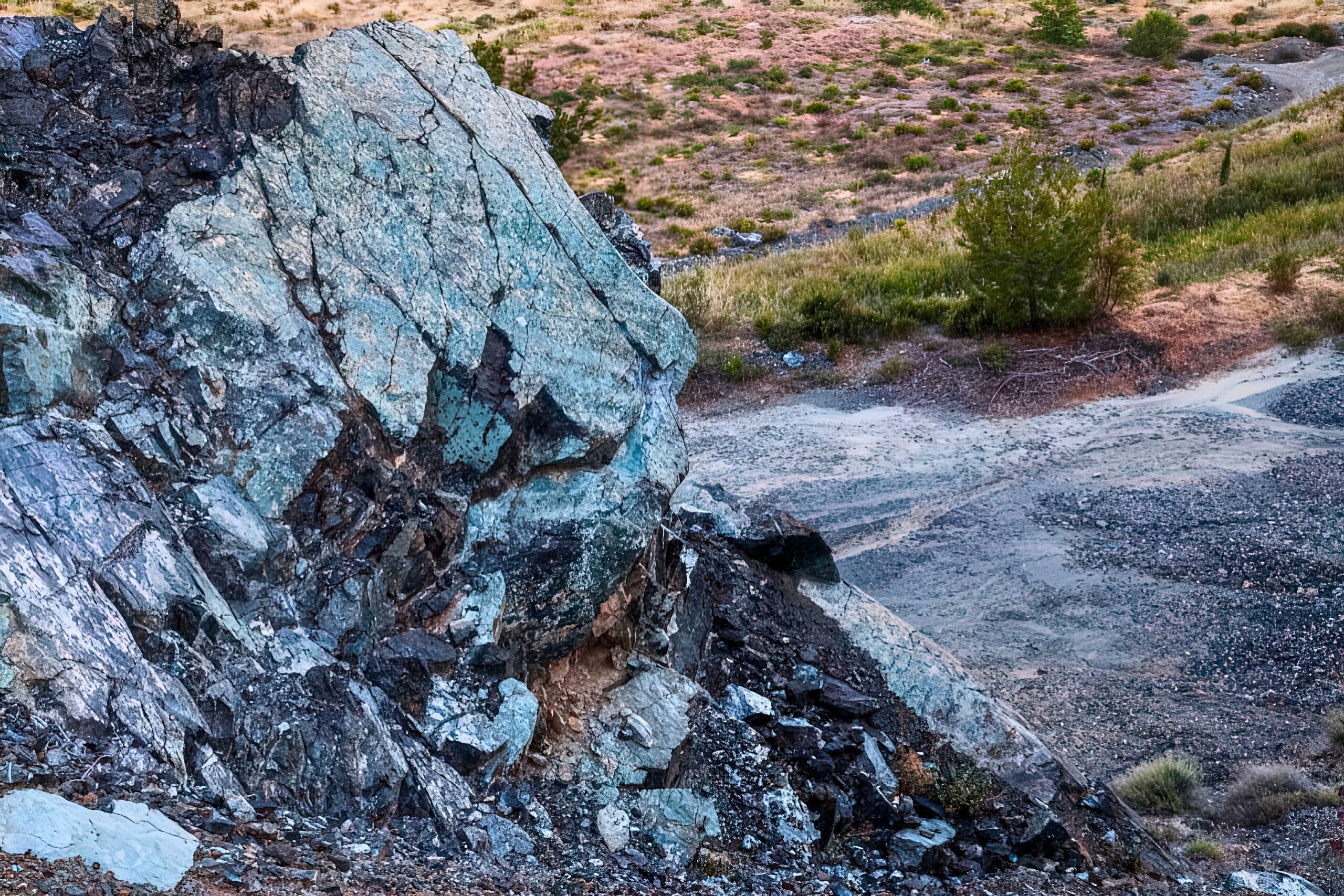
The Madari area showcases the famous Troodos Ophiolite, one of the world’s most complete and accessible examples of oceanic crust that has been lifted above sea level. Ophiolite formations include layers of oceanic crust and upper mantle rocks normally found deep beneath the ocean floor.
As this process slowed and nearly ceased, the rock formations remained largely intact, while subsequent erosion exposed the former magma chamber beneath the mountains, revealing intact rocks and petrified pillow lava formed millions of years ago.
These pillow lavas, named for their characteristic bubble-like shapes created when lava cooled rapidly underwater, are clearly visible along the Madari ridge. The area’s unique geology has made it a site of international scientific interest, with geological surveys conducted here contributing to the theory of seafloor spreading in the 1960s.
The Summit and Viewing Platform
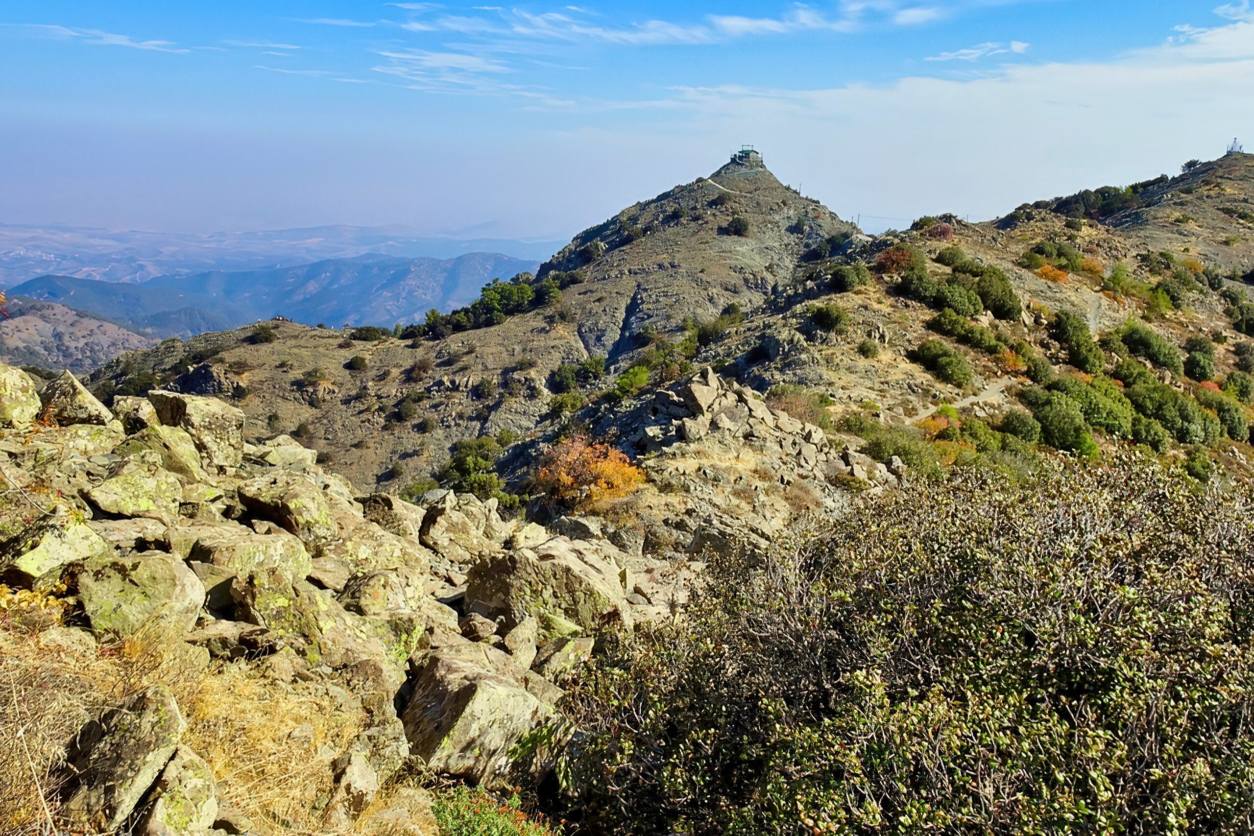
The fire lookout tower stands as the defining structure at the Madari viewpoint. The tower features an open-air platform that visitors can climb to reach the highest accessible point. From this elevated position, the panorama encompasses nearly the entire island.
To the north, the view extends across the Mesaoria plain, a 65-kilometer-wide valley that served as Cyprus’s breadbasket before the 1974 Turkish invasion. The Pentadaktylos mountains, named for their five-fingered peak resemblance, rise along the northern horizon in the occupied territories.
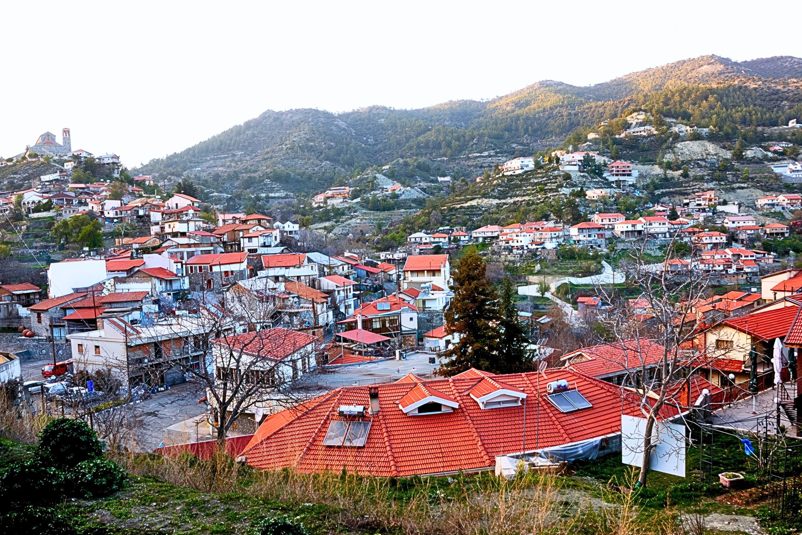
Looking south, the view includes Kyperounta village at 1,140 meters elevation, positioned roughly 2.5 kilometers from the viewpoint. The village serves as the head town of the Pitsilia region. Mount Olympus, Cyprus’s highest peak at 1,952 meters, appears to the west, its radar installations visible against the skyline. The eastern view reveals the agricultural valleys and terraced hillsides that characterize the Troodos foothills.
The Mesaoria has a width of about 65 km and a length of about 35 kilometers and the two largest rivers of Cyprus Pediaios and Gialias run through it. The valley composed of calcareous sandstone, fossiliferous marl, and gravel deposits was underwater 120,000 years ago before silting from the Troodos and Pentadaktylos mountains created today’s valley. This geological history becomes visually apparent from the Madari viewpoint, where the valley’s flatness contrasts sharply with the surrounding mountain ranges.
Notable Features and Wildlife
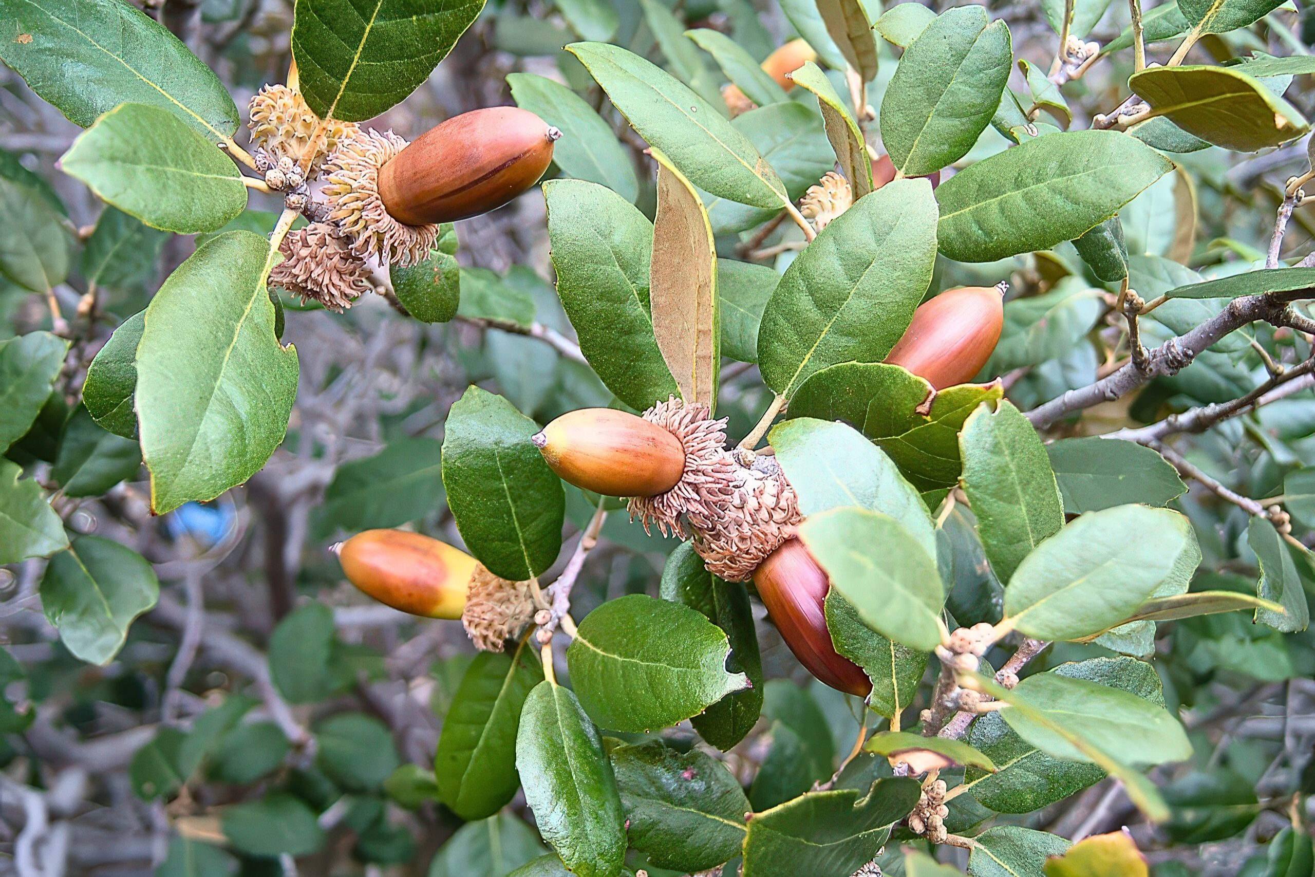
The Madari area supports diverse plant communities adapted to different elevation zones. Golden oak (Quercus alnifolia), an endemic species found only in Cyprus, grows throughout the mid-elevation forests. Wild rose bushes, mastic, junipers, and several pine species populate different zones based on elevation and moisture availability. Strawberry trees, rock rose, and sage add to the botanical diversity. A small stand of Cyprus cedar (Cedrus libani subsp. brevifolia), another endemic species restricted to the highest Troodos peaks, appears along certain trail sections.
The endemic shrubby knapweed (Ptilostemon chamaepeuce var. cyprius) grows in rocky areas, while purple rock cress (Arabis purpurea) colonizes cliff faces and exposed rock surfaces. The Pterocephalus multiflorus subspecies, locally called manouthkia, blooms across the hillsides during spring months. These endemic plants evolved in isolation on Cyprus and cannot be found anywhere else on Earth.
Bird populations include species typical of Mediterranean mountain environments. The common raven nests in cliff areas, while Bonelli’s eagle and other raptors hunt across the open slopes. The Cyprus wheatear, an endemic subspecies, appears frequently along the ridgeline. During migration periods in spring and autumn, the mountain serves as a waypoint for numerous species traveling between Europe and Africa.
The Circular Trail Network
The Madari Circular Trail creates a 13-kilometer loop that ranks among Cyprus’s premier hiking routes. This 4 kilometer section has some amazing views left and right with Kyperounta and Chandria villages to the south and several rows of mountains to the north which belong to the greater mountain line of Troodos.
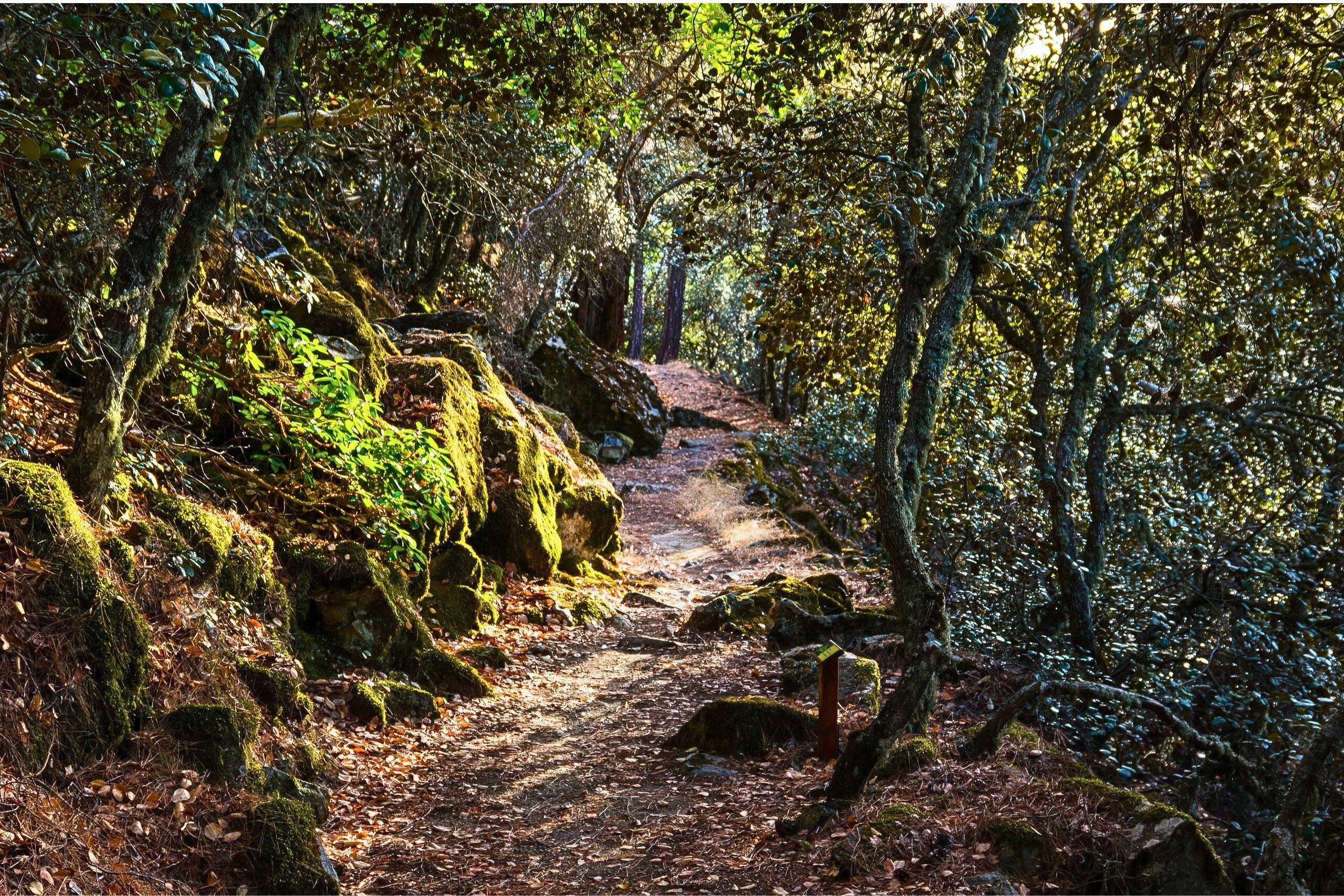
The trail divides into four connected sections, each marked with large information boards at the beginning and end points.
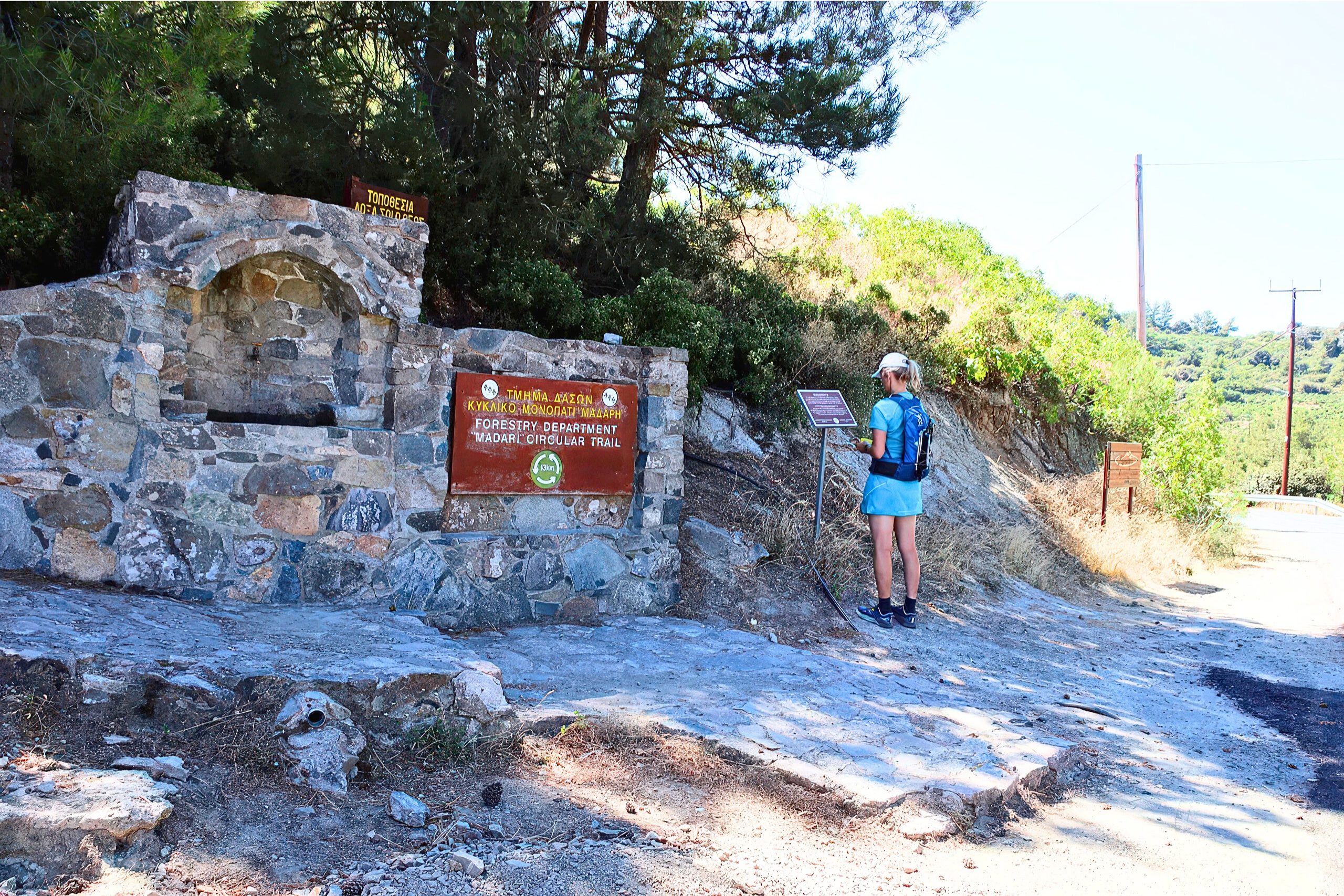
The most popular starting point sits at Doxa si o Theos (Glory to God), located at 1,335 meters elevation on the F944 road north of Kyperounta. A drinking water fountain provides fresh mountain water at this location. A small parking area accommodates vehicles, though space fills quickly during peak visiting times. The Mountain Adventure Park sits just before the trailhead for those interested in additional activities.
Visiting Madari Viewpoint
The viewpoint remains accessible year-round, though seasonal conditions vary dramatically. Summer temperatures at 1,613 meters stay comfortable even when coastal areas swelter, though afternoon heat can still reach 28°C. Winter brings snow from December through March, making roads treacherous and requiring proper winter equipment. Spring from March through May provides optimal conditions with moderate temperatures, blooming wildflowers, and clear air after winter rains wash away summer dust.
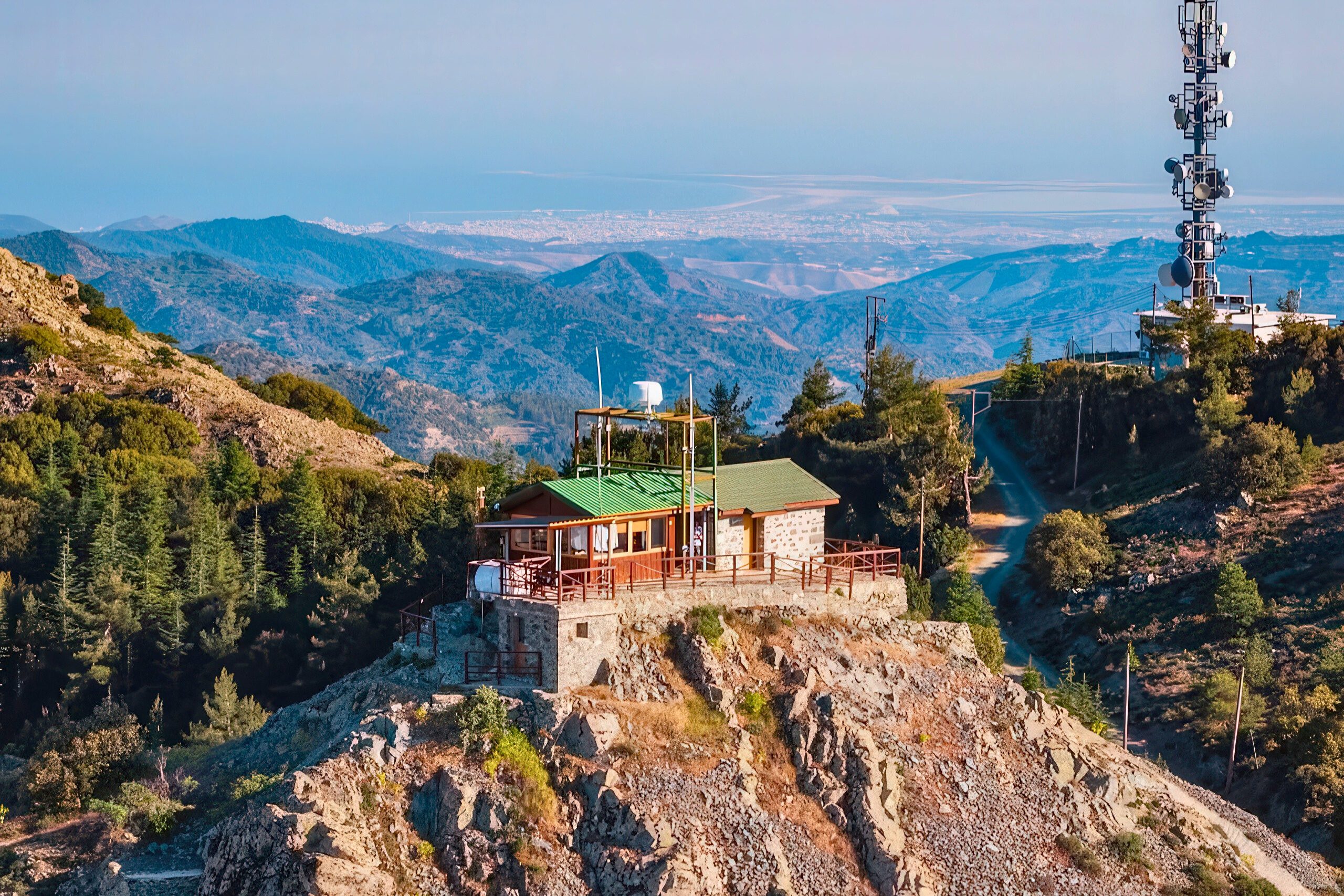
Access by car from Limassol requires roughly one hour via the B8 road to Troodos and then the F944 toward Kyperounta. From Nicosia, the journey takes approximately 90 minutes through mountain villages. The road quality varies, with paved sections giving way to rougher surfaces near the trailhead. The final 800 meters to the fire lookout station require navigating a narrow dirt road unsuitable for low-clearance vehicles.
The complete circular trail requires 4 to 5 hours for average hikers, though this varies based on fitness level and how many photo stops occur. Those interested only in the viewpoint can drive directly to the fire lookout station, though the dirt road presents challenges.
Why This Viewpoint Stands Out
Madari offers something increasingly rare in modern Mediterranean tourism. This is an accessible mountain summit where geology, ecology, and panoramic views combine without the crowds found at more publicized locations. The fire lookout station symbolizes the practical marriage of conservation and public access, serving both as a working fire prevention facility and a public viewing platform.

The viewpoint connects visitors to Cyprus’s formation story. Standing on ophiolite rocks that once lay beneath an ancient ocean, looking across an island that emerged through tectonic collision, creates tangible understanding of geological time and processes. The pillow lavas visible along the ridge formed when molten rock erupted underwater 90 million years ago. These same processes continue today as the African and European plates maintain their slow collision.
For Cypriots, Madari represents their island’s wild character beyond the beach resort stereotypes. The view encompasses both occupied northern territories and the republic’s southern lands, offering a geographical perspective on the island’s division. The endemic plants growing here, the mouflons roaming nearby forests, and the traditional mountain villages visible below all contribute to a sense of place that defines Cypriot identity beyond tourism brochures.