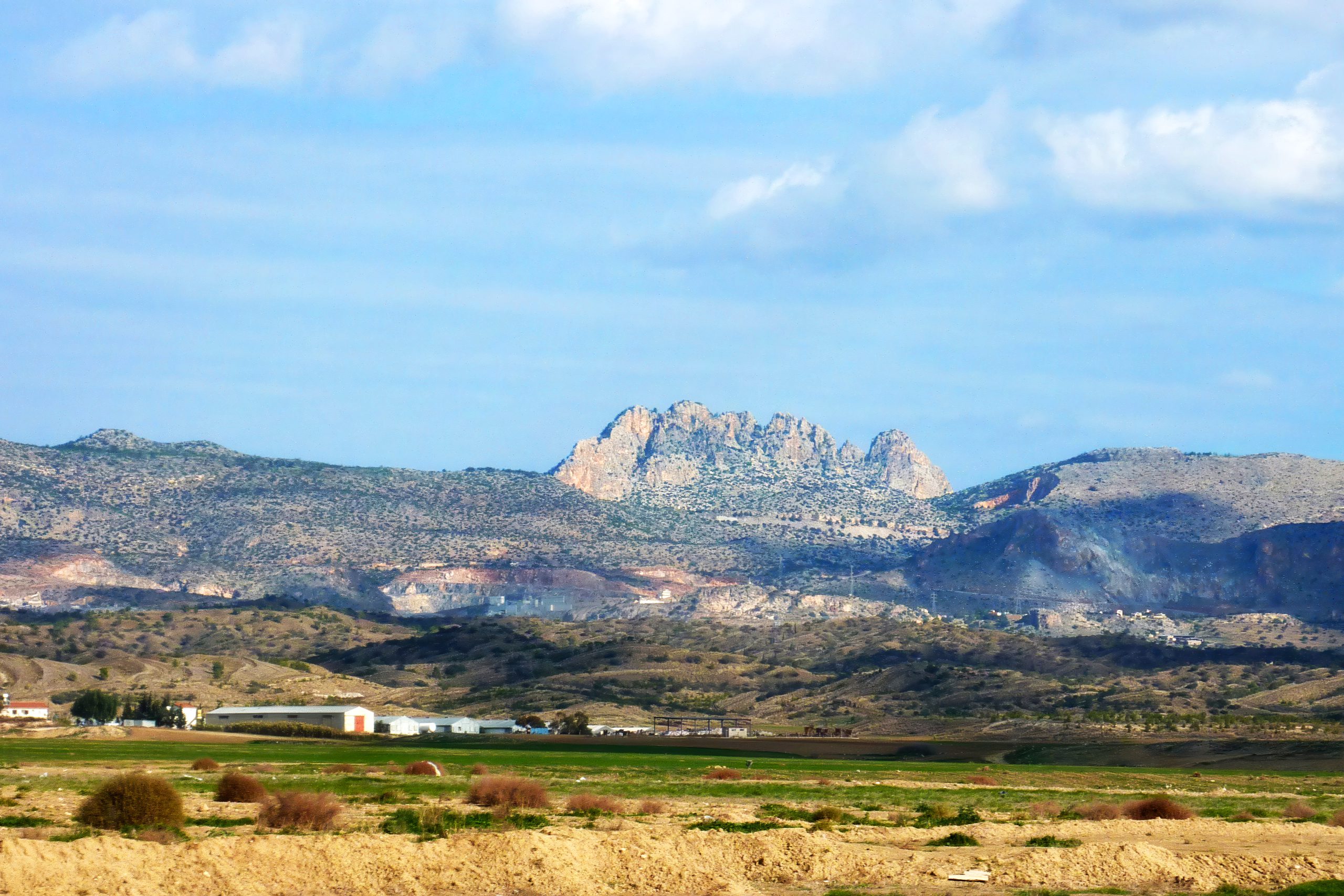
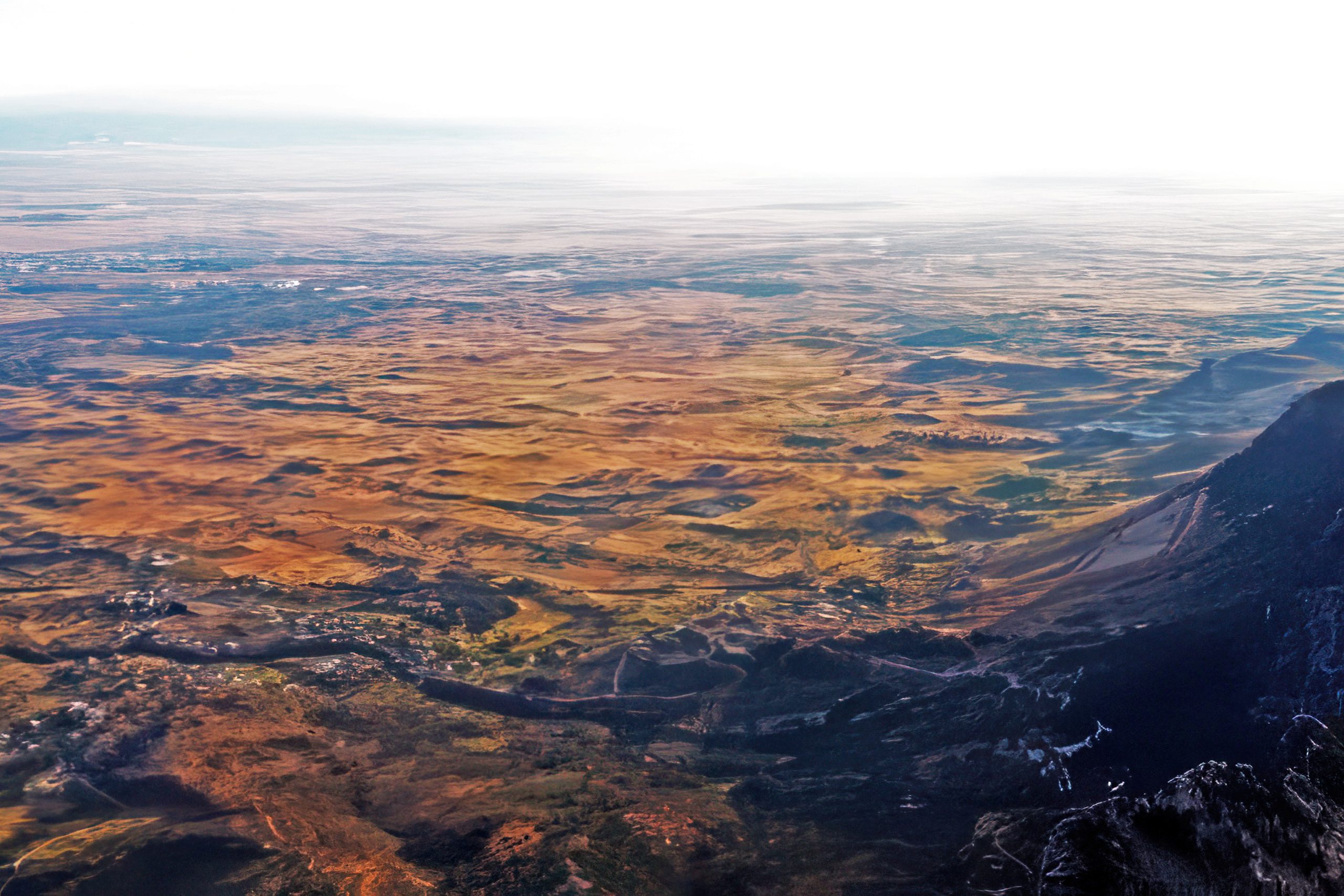
The Mesaoria Plain stretches 96 kilometres across central Cyprus between two mountain ranges. Mesaoria, meaning “between the mountains” in Greek, is a broad central plain that extends from Morphou Bay in the west to Famagusta Bay in the east. The Troodos Mountains rise to the south, while the Kyrenia Range forms a wall to the north. The plain covers approximately 1,000 square kilometres with elevations ranging from 100 metres on average up to 325 metres at its highest points.
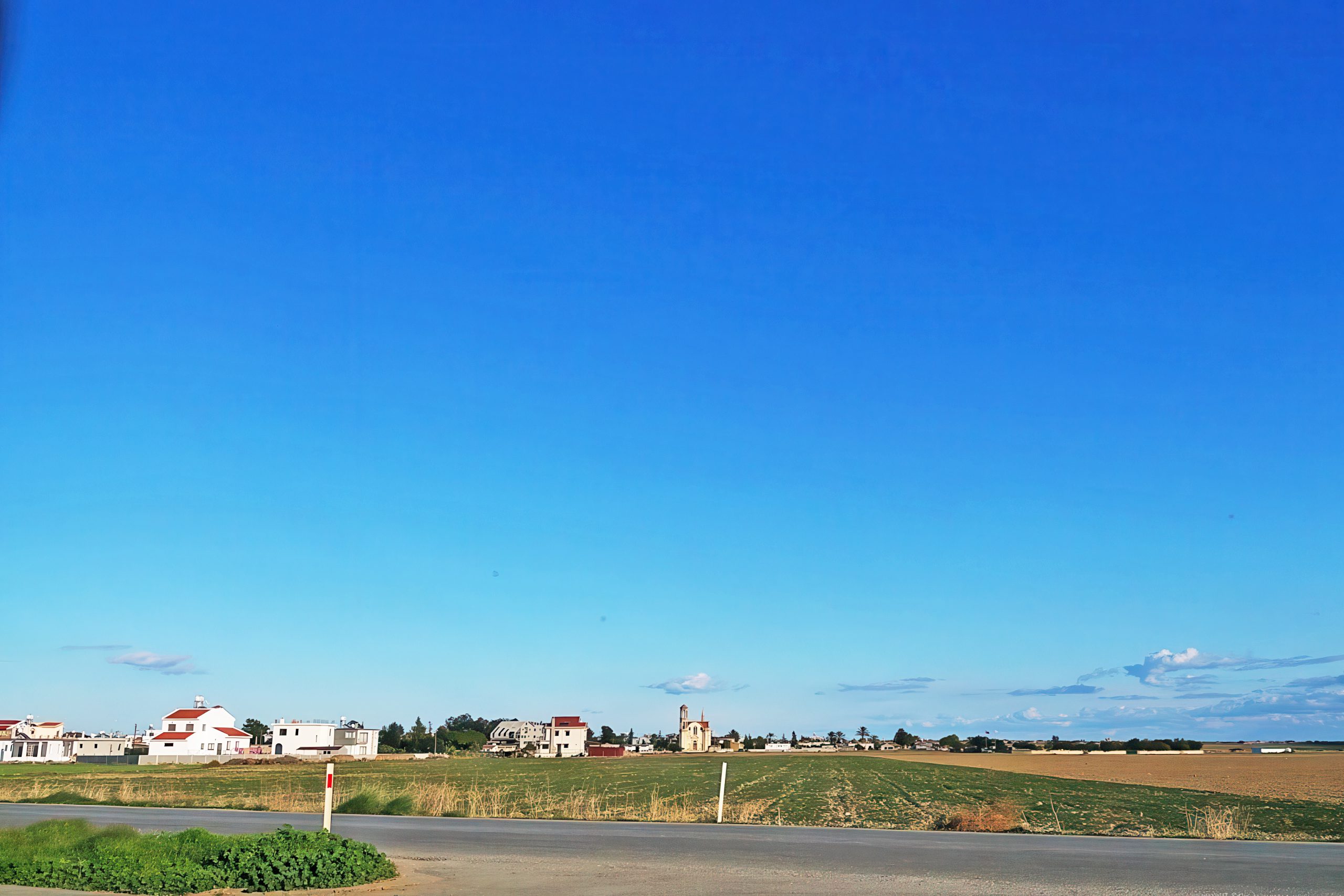
Nicosia, the capital of Cyprus, sits roughly in the centre of the plain along the Pedieos River. This positioning reflects centuries of strategic thinking, as the location provided access to both coasts. The plain contains dozens of villages and several major towns, making it the most densely populated region on the island despite its harsh summer climate and winter-dependent water supply.
Historical Background
Twenty million years ago, Cyprus existed as two separate islands corresponding to what would become the Kyrenia and Troodos mountain ranges. Approximately one million years ago, tectonic forces pushed up the land between these islands, creating the Mesaoria Plain and joining them into the single landmass known today as Cyprus. The Mediterranean Sea covered and exposed the plain multiple times as sea levels changed, but it has remained in its current form since the end of the Pleistocene period around 11,700 years ago.
The plain consists largely of alluvial deposits, light sediment brought down from the mountains through successive rainstorms and floods over millennia. Human activity contributed significantly to spreading this material through a traditional irrigation practice called colmatage, which has been used since ancient times. This process gradually raised the land surface and naturally reclaimed areas that were once shallow marine inlets, particularly in the lower sections near Famagusta Bay.
Geologically, the Mesaoria forms part of the Circum Troodos Sedimentary Succession, distinct from the ophiolite rocks of the Troodos Mountains and the limestone formations of the Kyrenia Range. The fertile vertisols found here contrast sharply with the gravelly lithosols dominating the mountain areas, creating ideal conditions for cereal cultivation when adequate water is available.
What Makes the Plain Distinctive
The Mesaoria presents a flat, largely treeless landscape where the eye can follow unbroken sight lines for kilometres. The few trees that exist were planted deliberately as windbreaks to protect crops and settlements from the strong winds that sweep across the open terrain. This bare quality gives the plain a harsh beauty, particularly in summer when temperatures regularly reach 40 degrees Celsius and the land turns golden brown from heat and drought.
Seasonal streams descend from the Troodos Mountains, fed by winter rainfall and spring snowmelt. The Pedieos River, Cyprus’s longest at approximately 100 kilometres, rises near Machairas Monastery and flows eastward past Nicosia toward Famagusta Bay. The Yialias River also drains the plain eastward, while the Serakhis flows northwest to Morphou Bay. None of these waterways flow year-round. They swell during wet months and become dry channels in summer, losing most of their water in marshes and sandy soil before reaching the sea.
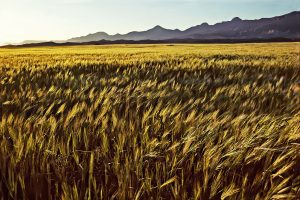
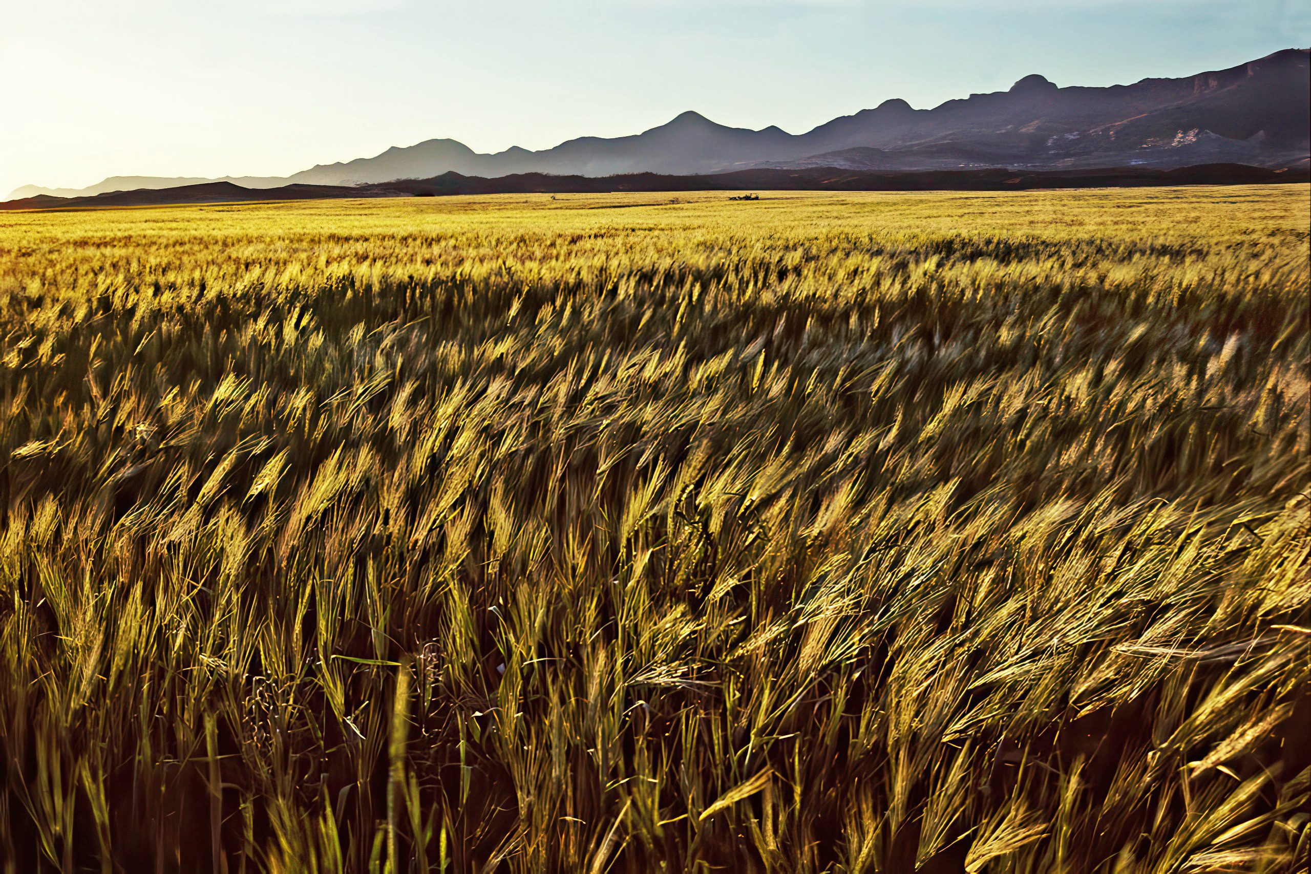
Winter and spring transform the Mesaoria into a green carpet of young wheat and barley interspersed with wildflowers, flowering shrubs, and patches of woodland. Eucalyptus, acacia, cypress, and lowland pine appear in scattered groves where water allows their survival. This seasonal colour shift makes the plain almost unrecognizable compared to its parched summer appearance, demonstrating the landscape’s complete dependence on winter rainfall and irrigation for productivity.
Interesting Facts About the Region
In classical times, dense forests covered the entire centre of Cyprus. Most were cut down in the middle of the first century BC to provide timber for the Ptolemaic navy, which controlled Egypt and portions of the Eastern Mediterranean. Additional harvesting occurred to fuel the copper smelting operations that defined Cyprus’s economy for millennia. As late as the 16th century, significant stands of trees still existed on the plain, but these gradually disappeared through continued exploitation and grazing pressure.
A narrow-gauge railway once ran the full length of the plain, connecting Famagusta to Nicosia and continuing to Karavostasi on Morphou Bay. Construction began in 1904, with Nicosia connected by October 21, 1905. The total route covered 113 kilometres using 2-foot-6-inch gauge track. This railway served agricultural transport and passenger movement until it ceased operations, leaving only archaeological traces and local memories.
The plain produces Cyprus’s principal cereal crops, but productivity fluctuates dramatically based on winter rainfall. Dry years can devastate harvests, while wet winters ensure abundant yields. This unpredictability shaped settlement patterns and economic strategies throughout history, forcing communities to develop storage systems, trade networks, and irrigation infrastructure to buffer against climate variability.
Documentary evidence from 1196 shows that the eastern Mesaoria had developed a dense network of villages by the 12th century AD under Crusader rule. This settlement pattern reflected the plain’s agricultural importance and its position along trade routes connecting the coast to inland resources, particularly copper deposits in the Troodos foothills.
The 1974 division of Cyprus cut through the Mesaoria, with the Green Line separating north from south across the plain. This political boundary complicated water management, agricultural planning, and economic development while dividing communities that had occupied the plain for generations.
Ancient Kingdoms and Archaeological Heritage
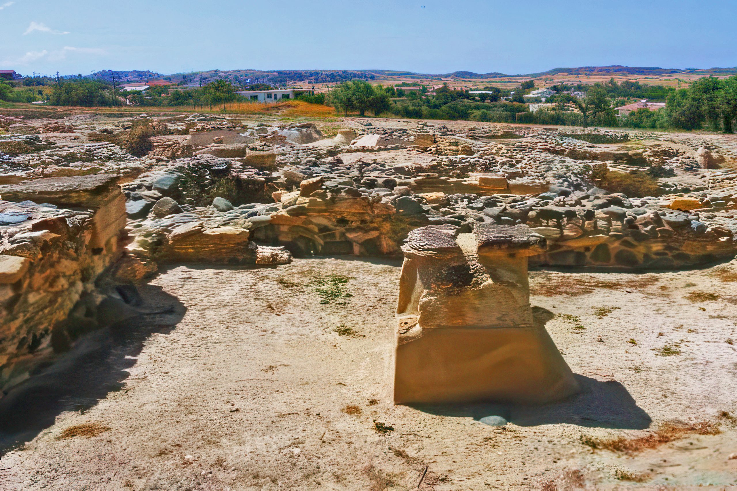
The Mesaoria supported several of Cyprus’s ten ancient city-kingdoms, unusual examples of inland political centres on an island where most settlements clustered along coasts. Tamassos, located near modern Politiko about 21 kilometres southwest of Nicosia, thrived between the 8th and 4th centuries BC through control of rich copper deposits in the nearby Troodos foothills. Homer apparently mentioned Tamassos in The Odyssey as Temese, where Athena tells Telemachus about trading gleaming iron for copper.
Archaeological excavations at Tamassos revealed royal tombs with walls carved to imitate wood, possibly reflecting Anatolian influences. Limestone lions, sphinxes, and a magnificent bronze head of Apollo were discovered at the site, though many burial treasures were lost to ancient and modern looters. The kingdom eventually fell to Phoenician Kition around the middle of the 4th century BC, ending its independence but continuing its economic importance through copper production.
Idalion, another inland city-kingdom, occupied land south of modern Dali village in the central plain. The settlement developed near the Yialias River, where reliable water supplies supported both agriculture and copper-related industries. Evidence suggests continuous occupation from approximately 2000 BC, with the urban centre possibly evolving from even earlier Bronze Age settlements at nearby Agios Sozomenos.
The kingdom of Ledra, predecessor to modern Nicosia, also developed in the Mesaoria. These inland centres defied the typical coastal pattern because they controlled copper resources and the agricultural production that fed mining communities and sustained trade. Their strategic positions allowed access to both the northern and southern coasts while maintaining defensive advantages from their inland locations.
Neolithic cultivation evidence appears throughout the Mesaoria, demonstrating that humans recognized the plain’s agricultural potential thousands of years before recorded history. Settlement density increased during the Bronze Age as copper exploitation intensified, creating demand for food production to support mining operations and metallurgical centres.
Why the Plain Matters to Modern Cyprus
The Mesaoria remains Cyprus’s breadbasket despite water scarcity challenges and climate pressures. Modern irrigation systems using dam-stored water extend the growing season beyond natural rainfall patterns, allowing cultivation of vegetables, fruits, and fodder crops alongside traditional cereals. Over 100 dams and reservoirs across Cyprus capture winter rainfall, with much of this water directed to agricultural use on the plain.
Small family farms dominate land ownership patterns, with average holdings around 4.5 hectares, often fragmented into multiple parcels scattered across different villages. This fragmentation reflects inheritance customs and historical land distribution practices. Approximately 42,500 smallholders work these farms, maintaining family agricultural traditions while adapting to modern market demands and environmental constraints.
The plain’s productivity directly affects food security for the entire island. Wheat and barley grown here reduce dependence on imports, while livestock raised on plain pastures and fodder contribute to dairy and meat production. The economic value extends beyond direct agricultural output to include processing industries, transport services, and rural employment that keeps mountain villages viable.
Tourism largely bypasses the Mesaoria, with visitors typically driving through to reach coastal resorts, mountain villages, or specific archaeological sites. This oversight means the plain retains an authentic character less affected by tourist development pressures. Villages preserve traditional architecture, local cafes serve residents rather than visitors, and agricultural rhythms continue largely unchanged despite modernization elsewhere on the island.