Explore Cyprus with Our Interactive Map

Explore our top stories and discover ideas worth your time.

Anerades Nature Trail

Anerades Nature Trail

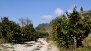
The Anerades Nature Trail serves as a significant ecological asset within the Paphos district of Cyprus. This path winds through the valley of Milliou which is a region famous for its abundant water sources and citrus orchards. Visitors walk through a landscape that stays green even during the hot summer months. The trail provides a direct link to the rural traditions and folklore of the island. Local myths suggest that fairies once lived in the nearby caves and springs of the area. This cultural element adds a unique layer to the physical journey through the river valley. Modern travelers use this route to observe the diverse plant life of the Mediterranean interior. It offers a cool retreat from the coastal heat and a chance to study local geology. The environment supports a wide variety of birds and small mammals that thrive in the dense vegetation. Trail Overview Location: Milliou Village, Paphos District, Cyprus Distance: 1.2 miles (2 km) Route Type: Circular Loop Difficulty: Easy Elevation Gain: 40 meters Duration: 45 – 60 minutes Best Time to Visit: March – May and September – November Terrain: Dirt tracks and riverbed paths Geographical Context of the Milliou Valley Milliou sits at a low altitude within the hilly terrain of the western Paphos region. This village is one of the smallest on the…

Read more
Cape Greco Sea Cliffs And Caves

Cape Greco Sea Cliffs And Caves

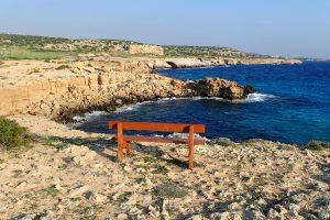
Cape Greco rises from the Mediterranean Sea at Cyprus's southeastern tip, where limestone cliffs drop sharply into turquoise waters, and erosion has carved spectacular sea caves that extend up to 80 metres into solid rock. Cape Greco, also known as Capo Greco or Kavo Greko, forms a rocky peninsula jutting into the Mediterranean between the resort towns of Ayia Napa and Protaras. The headland marks the easternmost point of both the Republic of Cyprus and the European Union, excluding outlying territories. The area covers 385 hectares protected as National Forest Park under the Cyprus Forestry Department since 1993, with additional recognition as part of the Natura 2000 network for its European ecological significance. Historical Background The limestone cliffs at Cape Greco formed from sediments deposited when shallow seas covered the region millions of years ago. Marine organisms including mollusks, corals, and microscopic creatures contributed calcium carbonate that accumulated on the seabed and eventually compressed into rock layers. Tectonic activity lifted these sediments above sea level, creating the elevated plateau that characterizes the cape today. Wave erosion shaped the detailed features that make Cape Greco distinctive. Constant pounding by Mediterranean storms exploits weaknesses in the limestone, gradually hollowing out caves, cutting through narrow points to form arches, and creating vertical channels where waves compress and release with explosive force. This process…

Read more
Archangel Michael Frescoes Pedoulas

Archangel Michael Frescoes Pedoulas

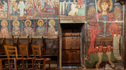
The Church of Archangel Michael in Pedoulas contains one of Cyprus's most complete late-medieval fresco cycles. Painted in 1474 and signed by the artist Minas, the interior preserves an extraordinary collection of wall paintings that provide insight into the artistic traditions, social realities, and cultural identity of mountain communities during the late Byzantine period. Within a modest timber-roofed church, the frescoes combine religious imagery with details drawn from contemporary life. Elements such as Western-style armour appearing in key scenes reveal the political and cultural influences that shaped Cyprus during the fifteenth century. This article explores how the church was adapted to the Troodos climate, how its fresco program was designed to be viewed and understood, and why its artwork remains an important record of local identity, patronage, and historical continuity. A Church Built for Mountain Conditions Pedoulas lies in the Marathasa Valley at an elevation of approximately 1,100 meters. The region experiences cold winters, heavy snowfall, and long periods of isolation from the coastal areas. The church's architecture reflects these environmental conditions. Its steep timber roof protects the stone structure from rain, snow, and moisture, while the compact interior helps preserve warmth and structural stability. Rather than emphasizing size or grandeur, the building was designed to serve the practical needs of a mountain community. The contrast between the plain exterior…

Read more