Karpasia Peninsula Sub-Humid Climate is marked by a slightly wetter profile in Cyprus’s northern region, supporting lush scrub, wetlands, and seasonal agriculture. This climate, with higher rainfall than the island’s interior, creates diverse habitats from coastal dunes to inland plains, fostering unique biodiversity and human activities. It shapes a landscape where moisture gradients influence everything from plant life to settlement patterns, highlighting the peninsula’s role as a transitional zone in the eastern Mediterranean.

- A Wetter Northern Haven on the Island
- Formation Through Geology and Time
- Features of Wetter Conditions and Ecosystems
- Notable Aspects That Highlight Its Uniqueness
- Deeper Environmental and Cultural Impacts That Matter
- Karpasia Peninsula Sub-Humid Climate in Cyprus Today
- Opportunities for Exploration
- A Climate of Transitional Richness
A Wetter Northern Haven on the Island
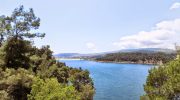
The Karpasia Peninsula, also known as the “panhandle” of Cyprus, extends 80 kilometers into the Mediterranean from the island’s northeast, encompassing a sub-humid climate that distinguishes it from the drier central Mesaoria Plains. Annual rainfall averages 450-550 millimeters, about 20-30% higher than inland areas, concentrated in winter months from November to March, with mild temperatures ranging from 15-20°C. Summers are warm, with highs of 30-35°C moderated by sea breezes, and lower evaporation rates due to coastal proximity. This slight increase in moisture supports lush maquis scrub dominated by evergreen shrubs like lentisk (Pistacia lentiscus) and wild olive (Olea europaea), wetlands that form ephemeral lagoons, and seasonal agriculture focused on rain-fed crops like wheat and barley. The climate’s balance creates isolated niches, where freshwater sources and salt marshes coexist, making Karpasia a biodiversity hotspot with over 600 plant species and a key area for migratory wildlife on an otherwise arid island.
Formation Through Geology and Time
Karpasia’s sub-humid climate resulted from geological processes beginning in the Miocene epoch around 10 million years ago, when tectonic uplift formed the Kyrenia Range’s eastern extension, creating a peninsula that traps moisture from northerly Mediterranean winds. Geological studies by the Cyprus Geological Survey since the 1950s indicate how this ridge acts as a barrier, enhancing orographic precipitation where air rises and cools, leading to higher rainfall compared to the leeward southern plains. Paleoclimatic data from sediment cores in nearby lagoons show transitions from wetter Pleistocene conditions to the current sub-humid state around 5,000 years ago, aligning with human settlement patterns.

Historical records from ancient times, like Ptolemy’s Geography (2nd century AD), describe Karpasia as “well-watered” with forests, supporting early agriculture. Neolithic inhabitants around 7000 BC at sites like Apostolos Andreas exploited winter rains for gathering, as evidenced by shell middens. Bronze Age (2500 BC) settlements at Nitovikla used wetlands for fishing, with pottery from digs showing trade. Byzantine era (4th-15th centuries AD) monasteries like Apostolos Andreas (10th century) noted rains as “blessings,” influencing irrigation for olives. Lusignan rule (1192-1489) expanded farming with windmills, as chronicled by Leontios Makhairas in the 15th century.
Venetian (1489-1571) and Ottoman (1571-1878) periods adapted qanats for underground water channels, as Ali Bey described in 1806 for wheat fields. British colonial rule (1878-1960) mapped it for agriculture, with 1920s reports promoting salt-tolerant crops. Post-1960, data from the Meteorological Service shows 10% rain increase since 1950 in Karpasia, linking to shifting patterns, while the 1974 Turkish invasion affected management but preserved its wetter profile.
Features of Wetter Conditions and Ecosystems
Higher rainfall in Karpasia supports lush scrub, with maquis covering 70% of the peninsula, featuring plants like myrtle (Myrtus communis) with aromatic oils for pest resistance. Wetlands like the Golden Sands lagoon receive 100mm more rain than inland, creating brackish habitats for reeds (Phragmites australis) and tamarisk (Tamarix smyrnensis). Seasonal agriculture benefits from winter moisture, with spring wheat harvests and summer dry farming for figs, yielding 10,000 tons annually per the Department of Agriculture.
Temperature moderation from sea exposure keeps winters at 12°C, preventing frost for citrus, while summers’ breezes (15km/h average) reduce heat stress. This fosters biodiversity: 530 plant species, 16% endemic like the Karpasia tulip (Tulipa agenensis) blooming in rains. Wildlife includes monk seals (Monachus monachus) in caves, with 10 individuals monitored by MEDPAN since 1990, and loggerhead turtles nesting on beaches.
Notable Aspects That Highlight Its Uniqueness
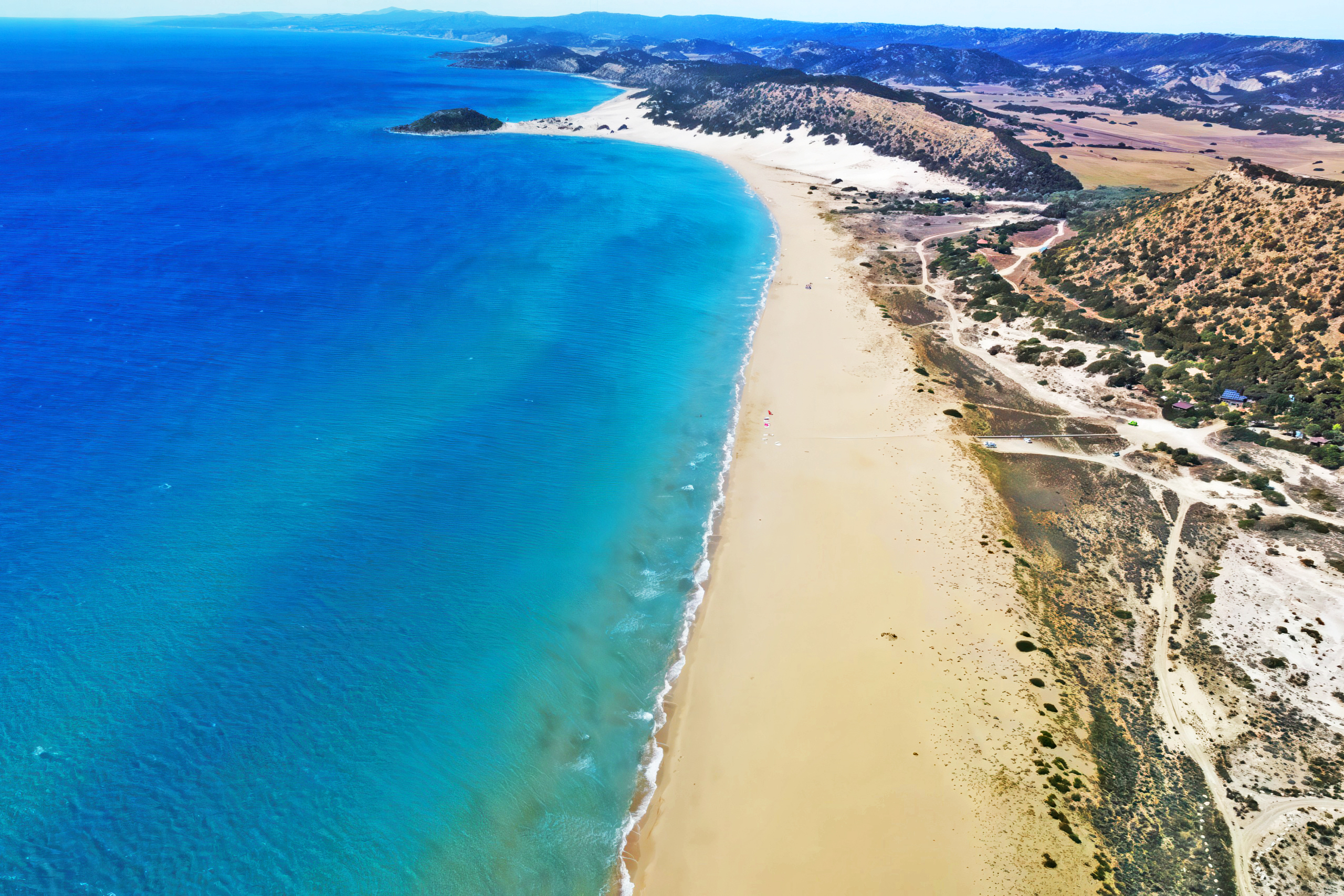
One captivating feature is the “golden beaches” – dunes with sea daffodils (Pancratium maritimum) blooming post-rain, a sight in autumn that draws botanists from the Nature Conservation Unit. Karpasia holds Cyprus’s wetland record with 20 lagoons hosting flamingos (Phoenicopterus roseus) in winter migrations. Endemic flora like the Karpasia donkey orchid (Ophrys kotschyi) thrives in moist pockets, studied by the Herbarium of the Forestry Department. And legends claim Karpasia rains blessed by Saint Andrew, tying climate to myths in ancient texts like Ptolemy’s Geography (2nd century AD).

Wildlife adaptations include the Cyprus meadow viper (Vipera lebetina) hibernating in winter, studied by Herpetological Society since 1980 with 500 individuals estimated. Rains create temporary ponds for amphibians like the green toad (Bufo viridis), with 5 species unique to the area.
Deeper Environmental and Cultural Impacts That Matter
The sub-humid climate’s wetness has molded Karpasia into a biodiversity refuge, hosting rare species like the Cyprus wheatear bird (Oenanthe cypriaca), with migratory routes studied by BirdLife Cyprus since 1979, estimating 100 pairs. Seasonal rains recharge aquifers, supporting 20% of agriculture, but climate change threatens with erratic patterns, per IPCC models for Cyprus showing 15% less rain by 2050, potentially drying wetlands by 25%.
Ecologically, it creates habitats for 30 reptile species like the hardun lizard (Stellagama stellio), adapted to scrub with camouflage. Culturally, it influenced myths like sea gods favoring the peninsula’s coasts, and festivals like Kataklysmos with water games celebrating rains. Socially, it dictated lifestyles – winter sowing for wheat, summer fishing in bays – and architecture, with reed-roofed homes for ventilation. This climate’s balance has sustained ecosystems, with 200 bird species migrating through, but overgrazing risks 20% vegetation loss by 2100, per national reports.
Human impacts include ancient salt pans at Apostolos Andreas, where rains filled evaporation pools, as studied in geoarchaeology by Frank Koucky. Cultural adaptations like Ottoman terracing for agriculture used rains for crop diversity, with 18th-century records showing rice in wetlands.
Karpasia Peninsula Sub-Humid Climate in Cyprus Today
Karpasia’s sub-humid climate continues to define Cyprus’s northeast, with wetter conditions supporting tourism – over 200,000 visitors annually for beaches like Golden Sands – while wetlands sustain fishing. Climate change alters patterns, with summers 2°C hotter since 1960 per Meteorological Service data, leading to 10% less rain and stressing scrub. Biodiversity faces threats, with conservation by the Forestry Department protecting seals through marine parks since 2010. Seasonal agriculture adapts with drip irrigation, increasing yields by 25%. This climate shapes identity, with festivals like “Karpasia Nature Day” celebrating wetlands, blending ancient rites with contemporary eco-awareness.
Opportunities for Exploration
The Karpasia National Park offers hiking trails to view scrub and wetlands, open year-round with free entry. Boat tours from Rizokarpaso to coastal lagoons cost €20 for biodiversity spotting. Guided wildlife tours by the Cyprus Tourism Organization cost €15-20 to see migratory birds. Spring orchid walks in April pair with village stays for climate insights. Many sites have online cams for remote viewing.

A Climate of Transitional Richness
Karpasia Peninsula Sub-Humid Climate, slightly wetter in the northern region, has supported lush scrub, wetlands, and seasonal agriculture, defining Cyprus’s northeast diversity. This pattern’s balance has fostered unique habitats and human ingenuity, from ancient myths to modern challenges. Knowing it deepens appreciation for Cyprus as a resilient sub-humid haven. Engagement with its zones or species evokes wonder at nature’s gradients. In a changing climate, it reminds of the need to safeguard this delicate balance.