Explore Cyprus with Our Interactive Map

Explore our top stories and discover ideas worth your time.

Colonial Roads and Infrastructure

Colonial Roads and Infrastructure

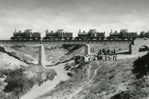
British-built roads, bridges, and public works that transformed mobility, trade, and communication across the island. Colonial Road and Infrastructure Networks in Cyprus mark a pivotal era of transformation under British rule from 1878 to 1960, where engineered roads, bridges, and public works revolutionized the island's connectivity, boosting trade, communication, and economic integration. These projects, spearheaded by the colonial administration, shifted Cyprus from Ottoman-era isolation to a modernized network, linking remote villages to urban centers like Nicosia, Limassol, and Famagusta. Key features included macadamized roads, stone bridges (including the Trimiklini Double Bridge) over seasonal rivers, and irrigation dams that supported agriculture, reflecting imperial strategies to exploit resources while imposing control. As symbols of progress and domination, they facilitated troop movements and commerce but also sparked local resistance, highlighting tensions between development and exploitation. Today, many endure as vital arteries, preserved for heritage while adapting to contemporary needs, underscoring Cyprus's journey from colony to independent nation amid ongoing debates on legacy and sustainability. A Transformative Colonial Network Colonial road and infrastructure networks reshaped Cyprus's landscape, creating a web of paved routes, sturdy bridges, and essential public works that connected its rugged terrain, from the Troodos Mountains to coastal plains. Spanning thousands of kilometers by independence, the system included major arteries like the Nicosia-Limassol road and rural links to villages, built to withstand…

Read more

Madari Circular Trail Hiking

Madari Circular Trail Hiking

The Madari Circular Trail starts just outside the village of Kyperounta in the eastern Troodos Mountains and follows a well signed 13 kilometer route with approximately 650 meters of elevation gain through some of the most beautiful scenery the island has to offer. The trail is considered difficult based on the routes available in Cyprus, and the peak of the mountain reaches 1,600 meters. This superb circular trail winds around Madari mountain peak in the Pitsilia area of the Troodos mountain range. The circular hike takes around 4 to 5 hours to complete. The route combines ridge walking with spectacular panoramic views, dense forest passages through the Adelfoi Forest, and unique geological formations. The trail ranks among the most beautiful hiking routes in Cyprus for its combination of vertical exposure, varied vegetation, and 360-degree vistas that span from the Mesaoria Plain to the Mediterranean coast. The creation of Cyprus's mountain trails The Cyprus Forestry Department developed the Madari trail system as part of a broader initiative to create accessible nature trails throughout the Troodos Mountains. The Adelfoi Forest forms a natural boundary near Agia Marina Xyliatou in the Nicosia district and spans across more than 120 square kilometers. The trail network around Madari includes several interconnected routes that allow hikers to customize their experience. The starting point is called Doxa…

Read more
Marine Conservation Programs

Marine Conservation Programs

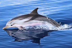
Cyprus sits at the crossroads of the eastern Mediterranean Sea where diverse marine species converge. The island's coastal waters support endangered sea turtles, rare monk seals, extensive seagrass meadows, and dozens of shark and ray species. Marine conservation programs work to protect these ecosystems through scientific research, policy reform, and community engagement. These initiatives span both the government-controlled south and the Turkish-occupied north, with multiple organizations collaborating to safeguard Cyprus's marine biodiversity. A History of Marine Protection Efforts Sea turtle conservation in Cyprus began in 1971 when the government enacted legal protection for turtles and their eggs under the Fisheries Law. A comprehensive survey in 1976 and 1977 identified critical nesting beaches, particularly for green turtles in the Lara area on the west coast. The Cyprus Wildlife Society joined the effort in 1989, and by 1992, the Marine Turtle Conservation Project launched in the Turkish-occupied part of Cyprus through collaboration between the Society for the Protection of Turtles and the University of Exeter. Marine Protected Areas emerged later as conservation priorities evolved. Since 2009, five coastal MPAs have been established in the Turkish-occupied part of Cyprus, covering approximately 134 kilometers of coastline and 17,596 hectares of marine environment. A 30-year trawling ban in the north created a de facto large marine protected area, allowing ,habitats to recover compared to regions…

Read more