Explore Cyprus with Our Interactive Map

Explore our top stories and discover ideas worth your time.

Papoutsa Peak Cyprus Eco Trails

Papoutsa Peak Cyprus Eco Trails

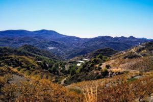
Papoutsa Peak stands at 1,554 metres in the eastern Troodos Mountains, surrounded by one of Cyprus's most important forest reserves. The forests are part of the Adelfoi Forest system, a vast protected area recognized within the Troodos Geopark for its ecological significance. The peak sits between Mount Olympus to the west and Madari to the north, creating a corridor of protected wilderness that covers over 120 square kilometres. Unlike more accessible Troodos peaks with developed facilities, Papoutsa maintains a wilder character with fewer visitors and more pristine ecosystems. The mountain lies within the Papoutsa and Adelfoi Forests mentioned by the Troodos Geopark as among the island's most noteworthy woodland areas. These forests protect crucial habitat for species found nowhere else on Earth. The combination of elevation, geology, and minimal human disturbance creates conditions where rare plants and animals can survive pressures that threaten them in more accessible locations. Historical Background The Troodos Mountains, including Papoutsa, emerged approximately 92 million years ago as oceanic crust from the ancient Tethys Ocean. Tectonic forces pushed this underwater rock upward through obduction, eventually creating the island's central mountain mass. Papoutsa consists of the same serpentinized harzburgite and peridotite rocks found throughout Troodos, representing mantle material from thousands of metres beneath the ancient seabed. These ultramafic rocks create unique soil chemistry with high concentrations of…

Read more
Nea Paphos Harbor

Nea Paphos Harbor

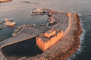
Nea Paphos emerged as one of the most strategically important harbor cities in the ancient Mediterranean. Founded in the late 4th century BC on the southwest coast of Cyprus, this planned city replaced the older settlement of Palaipaphos and quickly became the island's capital. The harbor served dual purposes as both a major naval base and a thriving commercial port, connecting Egypt with the broader Mediterranean world. Today, the archaeological remains spread across 100 hectares near modern Kato Paphos, offering a window into ancient maritime power. Historical Background King Nikokles, the last monarch of Palaipaphos, founded Nea Paphos around 320 BC. After Alexander the Great's death, Cyprus fell under Ptolemaic Egyptian control in 294 BC, where it remained for over 250 years. The site offered exceptional advantages. The city occupied a peninsula between two hills, with a natural bay providing shelter from storms. Strabo reported that the harbor offered protection from winds in all directions. Nearby forests supplied abundant cedar wood for shipbuilding, while the location sat on the critical maritime route between Rhodes and Alexandria. Urban planners designed Nea Paphos according to the Hippodamian grid system, heavily influenced by Alexandria. Regular streets intersected at right angles, creating rectangular blocks called insulae. Defensive walls separated the urban area from the mainland, while public buildings faced the large harbor. The city…

Read more

Mamonia Mélange Cyprus

Mamonia Mélange Cyprus

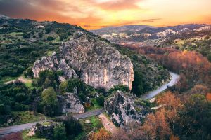
You can arrive at Mamonia without planning to. You stop to watch the sunset near Petra tou Romiou. You follow a narrow road inland from Paphos. You walk a riverbed after winter rain and pick up a stone that feels heavier and smoother than it should. The land looks familiar yet slightly unsettled. A hillside glows deep red. A green rock appears among pale gravel. A white cliff rises abruptly above darker slopes. It takes a moment to realise the reason. You have not left Cyprus. You have stepped onto land that existed before the island itself. The Mamonia Mélange, a geological area occupying a large portion of West Cyprus: from Akamas Peninsula to Petra Tou Romiou and all the way up to Troodos foothills, belongs to the material tied to the African tectonic plate. Long before Troodos rose and long before Cyprus took shape, this land lay along the margin of the African continent facing the Neo-Tethys Ocean. When that ocean began to close, the seabed fractured violently. Mantle rock, submarine lava and coral reef were compressed together and later lifted above the sea, scrapping themselves ontop of slowly rising Troodos range. Much later the rest of Cyprus formed around it. Therefore, Mamonia Mélange represents an accretionary complex, a term geologists use to describe similar unique occurrences. The origin…

Read more