Explore Cyprus with Our Interactive Map

Explore our top stories and discover ideas worth your time.

Marion and Tamassos

Marion and Tamassos

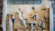
Funerary reliefs in ancient Cyprus were public status tools, not private grief markers, and Marion and Tamassos developed two distinct ways of making rank visible in stone. Marion favoured framed relief panels and inscriptions that anchored individuals within families, while Tamassos emphasised tomb architecture, guardians, and scale to project continuity and authority. This article compares how imagery, materials, and writing systems shaped remembrance in both kingdoms, and what those choices still reveal about power and belief on the island. Two Kingdoms, Two Worlds Although Marion and Tamassos existed on the same island, their landscapes shaped very different societies. Marion, located on the northwestern coast near modern Polis Chrysochous, was outward-facing. Its wealth depended on maritime trade and access to copper exported through nearby harbours. This openness brought strong Aegean influence, visible in imported pottery and artistic styles. Tamassos, by contrast, was inland. Situated close to the copper-rich foothills of the Troodos Mountains, it drew power from controlling resources rather than sea routes. Its rulers operated within Near Eastern political networks, and that reality shaped how authority and status were presented in death. These different foundations mattered. They influenced not just economics, but how memory itself was constructed in stone. Cemeteries Built to Be Seen The cemeteries of Marion were expansive and varied. Tombs stretched across eastern and western necropoleis, with…

Read more

Landscape Driven Villages of Cyprus

Landscape Driven Villages of Cyprus

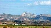
Cyprus villages evolved through intimate relationship between human settlement and natural terrain, creating communities shaped by mountains, valleys, water sources, and agricultural land. The island's dramatic geography, dominated by the Troodos Mountains rising to 1,952 meters and the northern Kyrenia Range reaching 1,024 meters, determined where people built homes and how they organized village life. Between these ranges lies the Mesaoria Plain, Cyprus's agricultural heartland where lowland villages spread across fertile flatlands. Mountain villages cling to steep slopes, terraced into hillsides at multiple elevations with buildings accessible from streets at different heights. This landscape adaptation created sustainable settlement patterns that persisted for millennia, balancing human needs with environmental constraints while maintaining agricultural productivity. The terracing, water management, and compact building forms demonstrate sophisticated understanding of terrain that allowed dense population while preserving productive farmland surrounding villages. Geography Determines Settlement Patterns Cyprus's two mountain ranges and central plain created distinct regional settlement types. Troodos foothill villages occupy elevations between 400 and 1,200 meters where mineral-rich volcanic soils support vineyards, fruit orchards, and olive groves. These villages developed around copper mining from the Bronze Age through the 20th century, combining agriculture with metallurgical industries that connected Cyprus to Mediterranean trade networks. Villages like Politiko-Troullia in the Troodos foothills prospered from copper resources less than one kilometer away while maintaining agricultural terraces on…

Read more
Kyrenia Shipwreck Museum

Kyrenia Shipwreck Museum

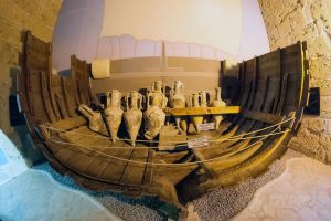
The Kyrenia Shipwreck Museum houses the oldest recovered Greek merchant ship in the world, located within Kyrenia Castle in the Turkish-occupied part of Cyprus. The vessel sank approximately one nautical mile off the coast around 300 BC during the era of Alexander the Great's successors. A local diving instructor named Andreas Cariolou discovered the wreck in November 1965 while collecting sponges at 33 meters depth during a storm. He lost the exact position and required over 200 dives before relocating it in 1967. The ship measures 15 meters in length and was constructed from Aleppo pine around 389 BC, sailing for about 80 years before its final voyage. The wreck represents a unique window into ancient Mediterranean trade, daily shipboard life, and maritime technology from over two millennia ago. The rescue that took two years Michael Katzev from the University of Pennsylvania Museum of Archaeology directed a scientific excavation from 1967 to 1969 after Cariolou notified authorities. Over 50 underwater archaeologists, students, and technicians employed stereophotography and advanced techniques to record the position of each object before bringing it to the surface. The team carefully photographed, labeled, dismantled, and lifted the wooden hull to avoid damage. A protective layer of sand had built up around the ship soon after it reached the seabed, blocking oxygen and marine life from attacking…

Read more