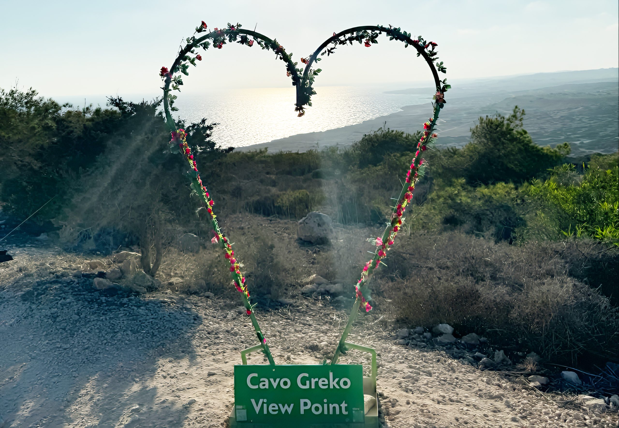
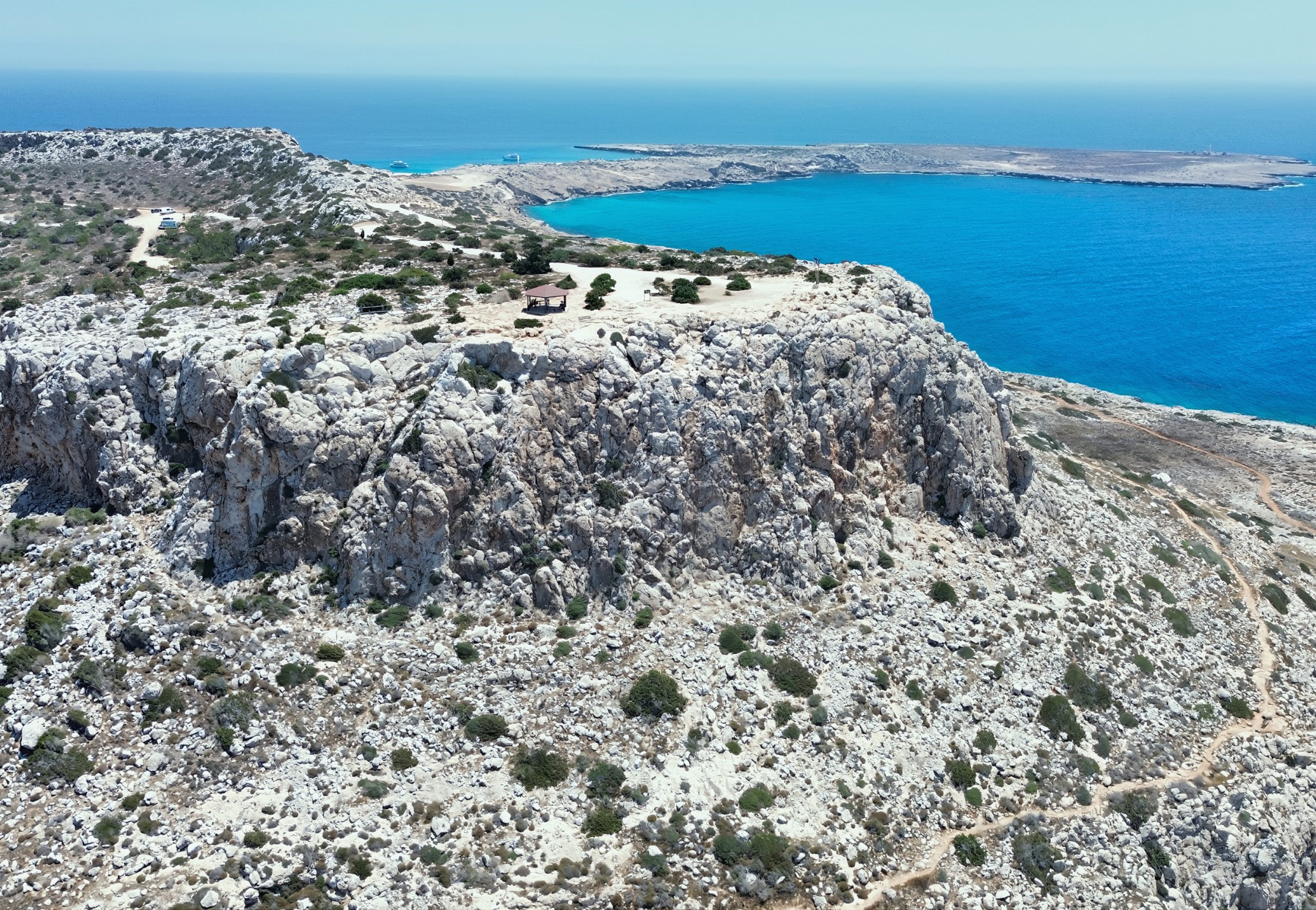
Cape Greco, also known as Cavo Greco, features several distinct viewpoints scattered along its southeastern coastline between Ayia Napa and Protaras. The main viewing platform sits at the highest point of the 385-hectare national forest park, providing 360-degree panoramas of the Mediterranean Sea and surrounding coastline.
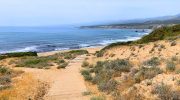
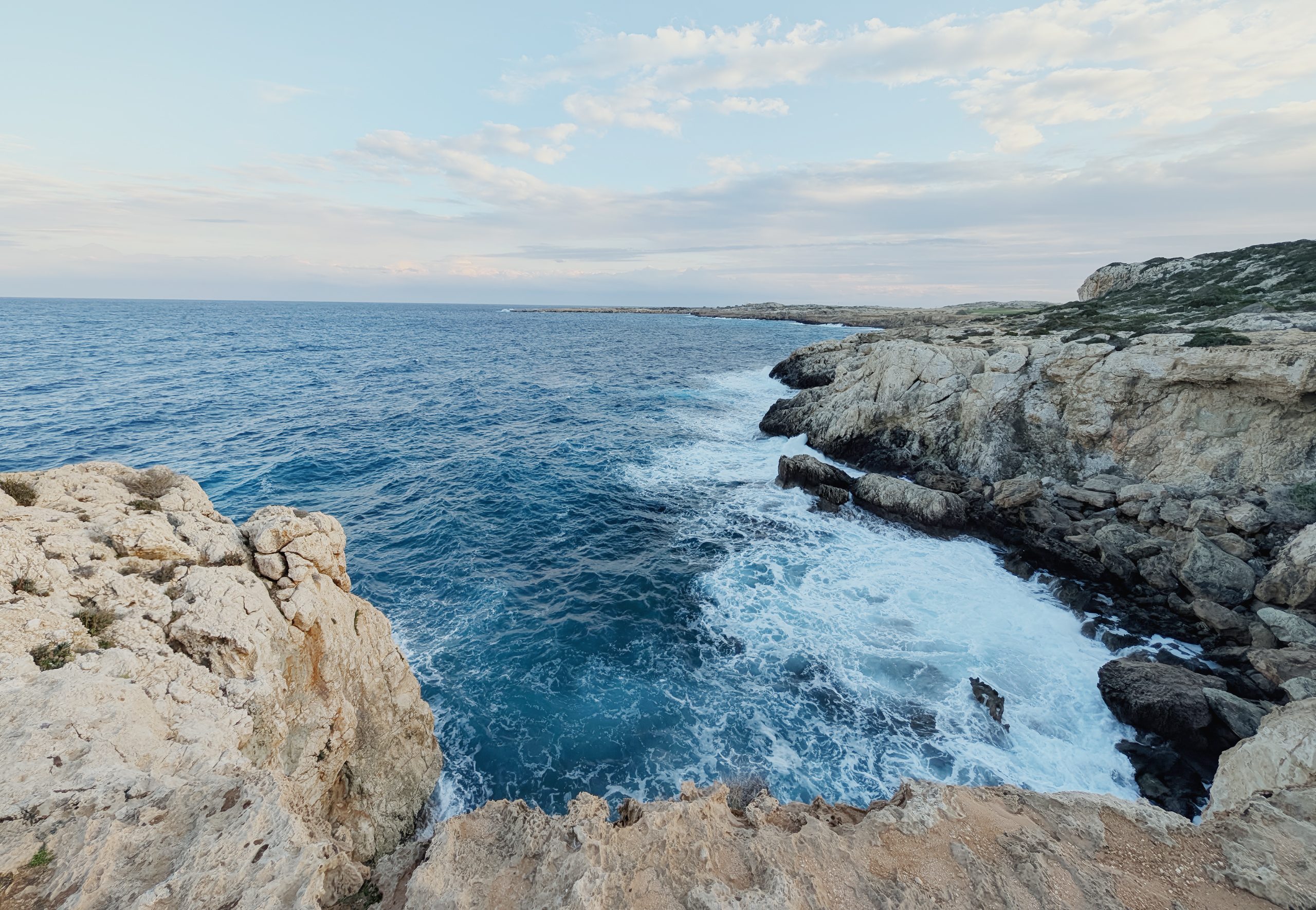
Additional viewpoints appear along the clifftops at various locations, each offering unique perspectives of limestone formations, sea caves, and the famous Blue Lagoon below. These elevated positions range from easily accessible roadside pullouts to platforms requiring short walks along nature trails.
The viewpoints attract photographers, nature enthusiasts, and visitors who want to experience Cyprus’s dramatic coastal geology without the crowds found at the resort beaches just minutes away.
Geological Origins and Historical Development
Cape Greco’s geological history dates back millions of years. The limestone cliffs and formations seen today were created through a combination of tectonic activity and the erosive forces of the sea and wind. The limestone rock belongs to the Nicosia Formation, deposited during the Pliocene period approximately 5 to 3 million years ago, when this area was part of a shallow tropical sea. As the African and European tectonic plates collided, the seafloor gradually rose to form the island of Cyprus.
Wave action and weathering have carved the coastline into its current dramatic form. Thirty foot high limestone cliffs have caves which have been hewn by Mother Nature. The continuous pounding of Mediterranean waves against the rock created networks of sea caves, natural arches, and platforms visible from the viewpoints today. Some caves extend as deep as 240 feet into the cliffs and are accessible only by sea.
The cape was known as Cape Pedalion in antiquity. According to Strabo, the trapezoidal hill lying above it was sacred to Aphrodite. Archaeological evidence suggests the area has been inhabited since Neolithic times, with one of Cyprus’s oldest settlements discovered here in 1992. At the headland of Cape Greco is a lighthouse, and walkers can also find the ruined foundations of an ancient temple devoted to Aphrodite. The British constructed the lighthouse in 1892, making it the second lighthouse built in Cyprus after the one at Paphos Castle.
The area received designation as a National Forest Park in 1993 to preserve its unique ecosystems. Between 1910 and 1920, dense juniper forests covering the cape were rapidly cut down and burned to power steam flour mills in the Paralimni region. The slow-growing juniper has never fully recovered, though varieties of pine and 14 endemic plant species now populate the landscape.
What the Viewpoints Reveal
The main Cape Greco viewpoint at the summit provides the most comprehensive panorama. Looking north, visitors see Famagusta Bay stretching toward the Turkish-occupied Pentadaktylos mountains in the distance. On a clear day, it’s said you can see all the way to Israel from this elevated position, though atmospheric conditions rarely allow visibility that far. The viewpoint includes benches and a gazebo providing shade during summer months.
The western view encompasses Ayia Napa and Konnos Bay, while the eastern perspective reveals Protaras and the rugged coastline extending toward Paralimni. Below the viewpoint, the turquoise waters of the Blue Lagoon display their characteristic color, created by sunlight reflecting off the white limestone seabed through exceptionally clear water. Cape Greko has warm sea temperatures ranging from 16oC to 28oC and visibility reaching up to 40 metres.
The Arch of Korakas, the most impressive natural bridge of Cyprus, located in the northeast, rugged coast of Cape Greko, appears from certain viewpoints. This natural limestone bridge, also known as the Bridge of Lovers or Kamara tou Koraka, spans 50 feet in height and measures 23 feet wide. According to local legend, couples who cross the bridge together will enjoy eternal love. The formation shows gradual erosion, with plant roots contributing to its deterioration over recent decades.
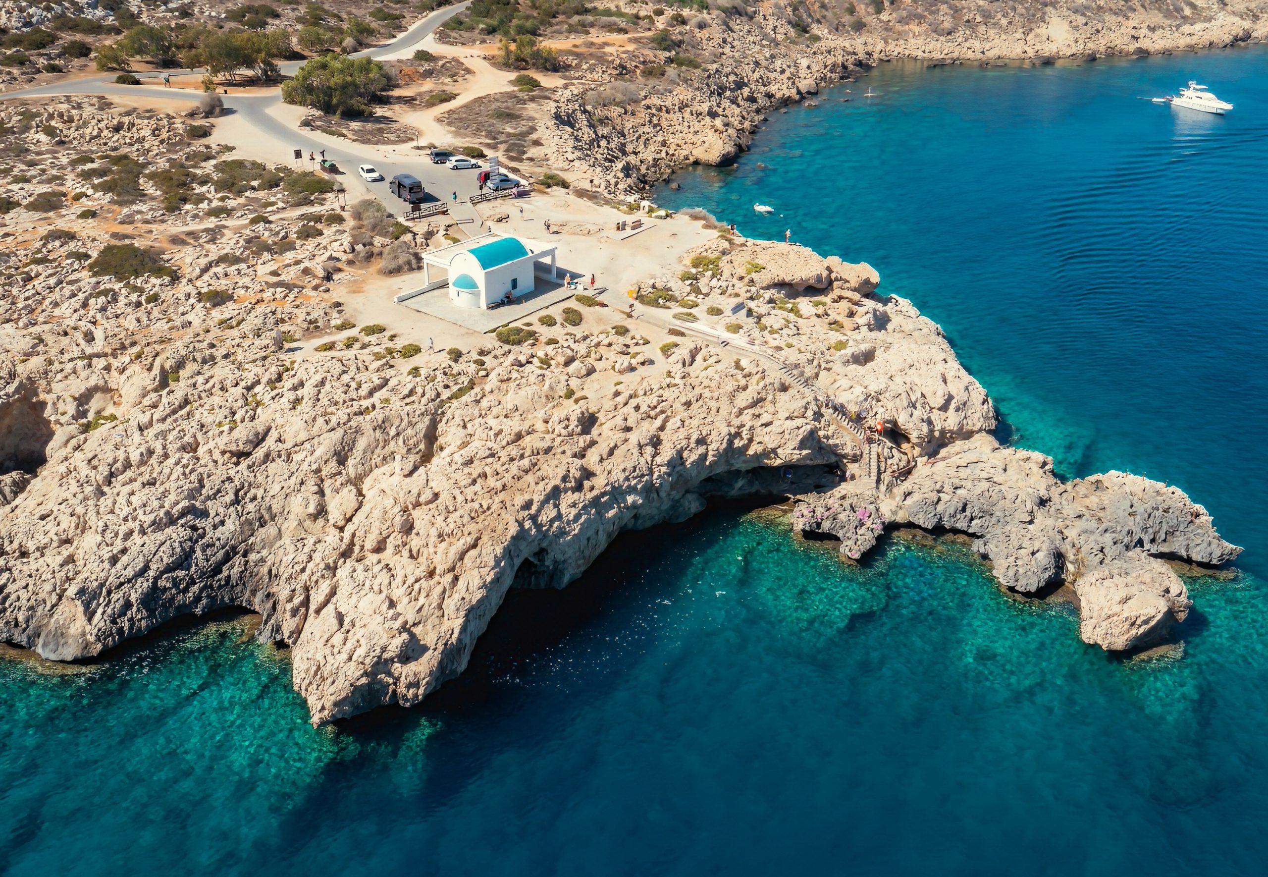
The Ayioi Anargyroi Chapel appears from several viewpoints, its whitewashed structure perched on a cliff edge. The chapel, dedicated to Saints Cosmas and Damian, features steps leading down to the sea where holy water flows. Below the chapel lies a cave mentioned in local legends, believed to have sheltered the saints during their time in the region.
Interesting Details About the Area
Cape Greco marks the easternmost point of both the Republic of Cyprus and, effectively, the European Union when excluding the outermost regions. This geographic distinction makes sunrise viewing particularly special, as the sun rises here earlier than anywhere else in the EU during summer months.
According to local legend, it is also the home of the ‘Ayia Napa sea monster’. Described as a mix between a giant serpent and a crocodile, it’s been dubbed the “Cypriot Loch Ness Monster”. Scientists explain these sightings as encounters with Mediterranean monk seals (Monachus monachus), a critically endangered species occasionally spotted in Cyprus waters, though the legend persists among locals and adds mystique to the location.
The area encompassing the cape has been designated an Important Bird Area by BirdLife International because it is a key migration site for large numbers of raptors and other birds. The cape forms a migration bottleneck for red-footed falcons, pallid harriers, honey buzzards, and common kestrels. Over 80 species have been recorded here, with breeding populations of Cyprus wheatears, Cyprus warblers, and black francolins. The elevated viewpoints provide excellent positions for birdwatching during spring and autumn migration periods.
Marine Life and Underwater Visibility
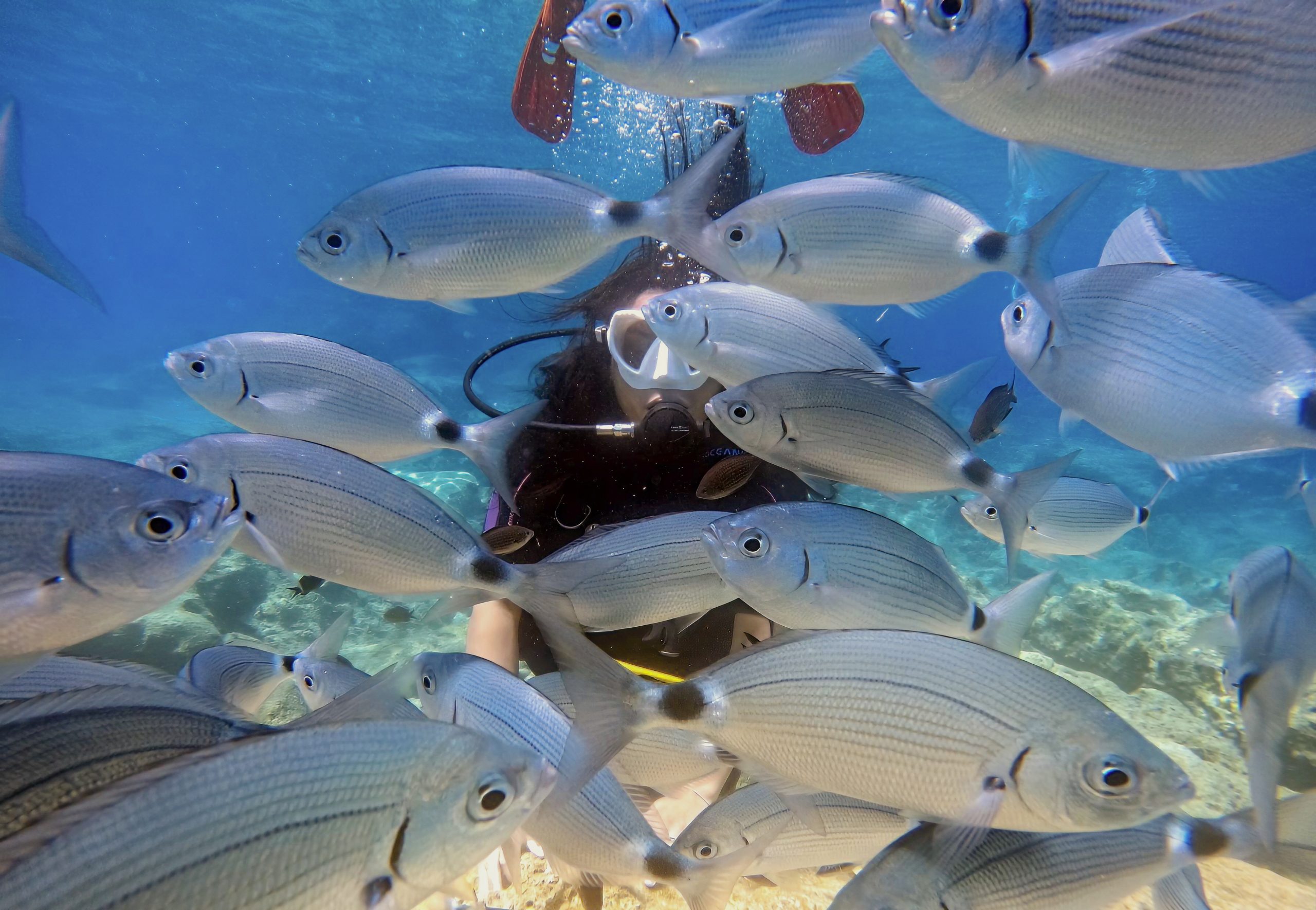
The waters visible from the viewpoints support diverse Mediterranean marine ecosystems. As soon as you enter the water, you’ll find yourself relatively deep areas (↕6-18 feet/2-6 meters), with rugged rocky reliefs. The seabed features huge blocks, plateaus, and scree creating varied underwater landscapes before transitioning to sandy bottoms at 12 to 24 feet depth.
Common species include saddled seabream, ornate wrasse, damselfish, and common sea bream. Divers can observe numerous species of Mediterranean fish, including colorful parrotfish, octopus, moray eels and seasonally appearing schools of barracuda.. The underwater seagrass meadows of Posidonia oceanica, sometimes called the “lungs of the Mediterranean,” provide critical ecosystems for countless species. These endemic marine plants form extensive underwater meadows visible from boat tours passing near the viewpoints.
Sea turtles regularly appear in the waters around Cape Greco. Many visitors report seeing loggerhead and green sea turtles swimming in the Blue Lagoon and surrounding areas. While sightings are not guaranteed, the clear water visible from the viewpoints often allows observers to spot turtles from above when conditions permit.
Cape Greco’s Role in Modern Cyprus
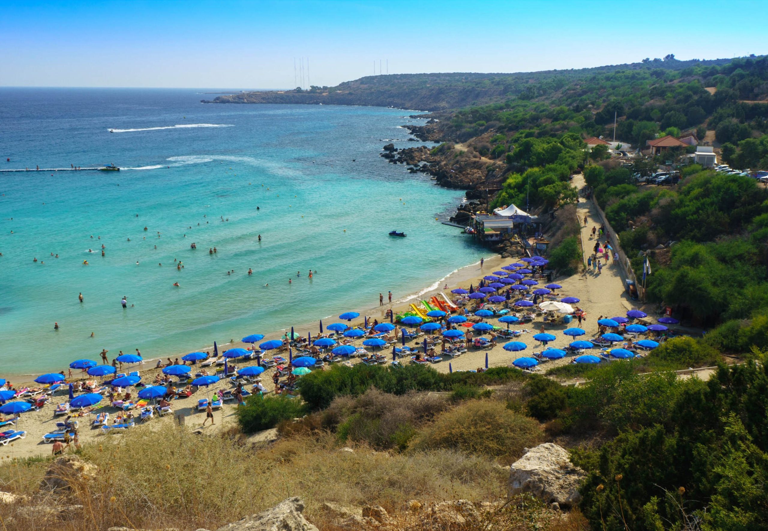
Cape Greco National Forest Park attracts thousands of visitors annually while remaining relatively uncrowded compared to nearby resort beaches. The viewpoints serve as accessible natural attractions for tourists staying in Ayia Napa and Protaras, providing contrast to beach-focused vacations. Many visitors specifically seek the viewpoints for photography, particularly during sunrise and sunset when lighting conditions create dramatic effects on the cliffs and sea.
Conservation efforts continue under the Department of Forests management. BirdLife Cyprus conducts regular anti-trapping patrols during migration seasons to combat illegal bird poaching. Reforestation initiatives have planted over 400 native saplings and shrubs in degraded areas. The Cape Greco Visitor Centre provides educational exhibits about the area’s ecology, endemic flora, and migratory bird populations.
The viewpoints have become popular locations for wedding photography and special occasions. The combination of dramatic cliffs, turquoise water, and Mediterranean light creates visually striking backdrops. Professional photographers regularly bring clients here, particularly during golden hour periods when angled sunlight illuminates the limestone formations.
Exploring the Viewpoint Area
Access to Cape Greco viewpoints is free and available 24 hours daily throughout the year. The main viewpoint sits approximately 5 to 10 minutes from Ayia Napa by car. From Ayia Napa, visitors head east toward Protaras, then take the first turn toward the Grecian Park Hotel and Cape Greco. Clear signage marks the route through the national park.
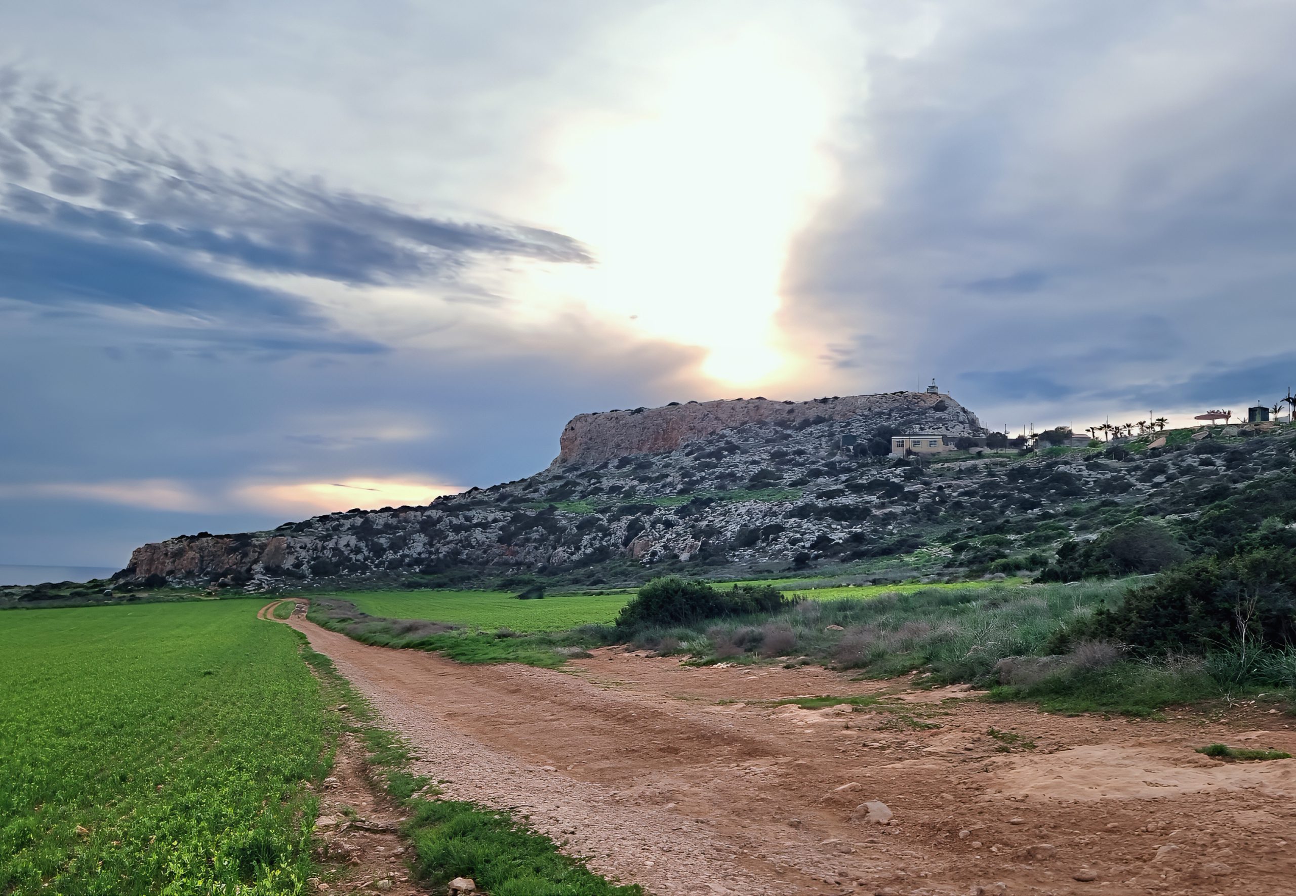
Multiple parking areas serve different viewpoints. The main parking lot near the summit accommodates cars, motorcycles, quad bikes, and tour buses. Additional parking appears near the Blue Lagoon viewpoint and sea caves area. Parking remains free, though spaces fill quickly during peak hours from 10 AM to 2 PM during summer months.
Public bus routes 101 and 102 run through Cape Greco National Forest Park from both Ayia Napa and Protaras, with fares of €2 per person each way. Buses stop near the park entrance and visitor center, requiring short walks to reach specific viewpoints. Service operates regularly during tourist season but reduces frequency during winter months.
The nature trails connecting viewpoints range from easy to moderate difficulty. The Aphrodite Nature Trail stretches 2 kilometers along the northeast coast and forms part of the European Long Distance Trail E4, which runs from Cyprus to Gibraltar. The trail passes multiple viewpoints while traversing Mediterranean maquis shrubland. Another trail leads to the Cyclops Cave with a picnic site nearby. Well-maintained cycling paths extend throughout the park, offering alternative access to viewpoints.
Optimal visiting times vary by purpose. Sunrise occurs between 5:30 AM in summer and 6:45 AM in winter, with the earliest EU sunrise due to the easternmost location. Photographers should arrive 45 minutes before sunrise to capture pre-dawn color changes. Sunset viewing is equally spectacular, particularly from the western-facing viewpoints overlooking Ayia Napa. Midday visits provide the clearest long-distance visibility, though heat can be intense during summer. Early morning and late afternoon offer comfortable temperatures and better lighting for photography.
Why These Viewpoints Matter
The Cape Greco viewpoints offer something increasingly rare in Mediterranean tourism. These are natural platforms where geological processes remain visible, where endemic species continue to thrive, and where visitors can observe coastal ecosystems without extensive commercialization. The viewpoints demonstrate how conservation and tourism access can coexist when properly managed.
Standing at these elevated positions connects visitors to the forces that shaped Cyprus. The limestone beneath their feet formed from ancient marine organisms. The caves below were carved by millennia of wave action. The endemic plants growing from rock crevices evolved in isolation over thousands of years. This tangible connection to deep time and natural processes provides perspective often missing from typical beach vacations.
Cape Greco’s viewpoints reward those who make the short journey from resort areas with experiences distinct from pool lounging and beach clubs. The wind, the sound of waves against cliffs hundreds of feet below, the sight of migratory birds passing overhead, these elements combine to create memories rooted in natural phenomena rather than constructed entertainment. These viewpoints prove that some of Cyprus’s most compelling attractions require no admission fees, no crowds, and no development beyond basic access and protection.