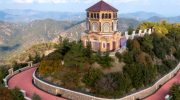
You can arrive at Mamonia without planning to. You stop to watch the sunset near Petra tou Romiou. You follow a narrow road inland from Paphos. You walk a riverbed after winter rain and pick up a stone that feels heavier and smoother than it should. The land looks familiar yet slightly unsettled. A hillside glows deep red. A green rock appears among pale gravel. A white cliff rises abruptly above darker slopes.
It takes a moment to realise the reason. You have not left Cyprus. You have stepped onto land that existed before the island itself. The Mamonia Mélange, a geological area occupying a large portion of West Cyprus: from Akamas Peninsula to Petra Tou Romiou and all the way up to Troodos foothills, belongs to the material tied to the African tectonic plate.
Long before Troodos rose and long before Cyprus took shape, this land lay along the margin of the African continent facing the Neo-Tethys Ocean. When that ocean began to close, the seabed fractured violently. Mantle rock, submarine lava and coral reef were compressed together and later lifted above the sea, scrapping themselves ontop of slowly rising Troodos range. Much later the rest of Cyprus formed around it. Therefore, Mamonia Mélange represents an accretionary complex, a term geologists use to describe similar unique occurrences.
The origin sounds almost mythic. Aphrodite was said to emerge from disturbed sea water along this same coast, and here too the island’s earliest stone comes from a turbulent and resettles ancient ocean. A small inland village named Mamonia in Diarizos valley happened to stand among these stones and its name remained attached to the entire landscape in global geology.
1. Colours of the collision. Stones with different history
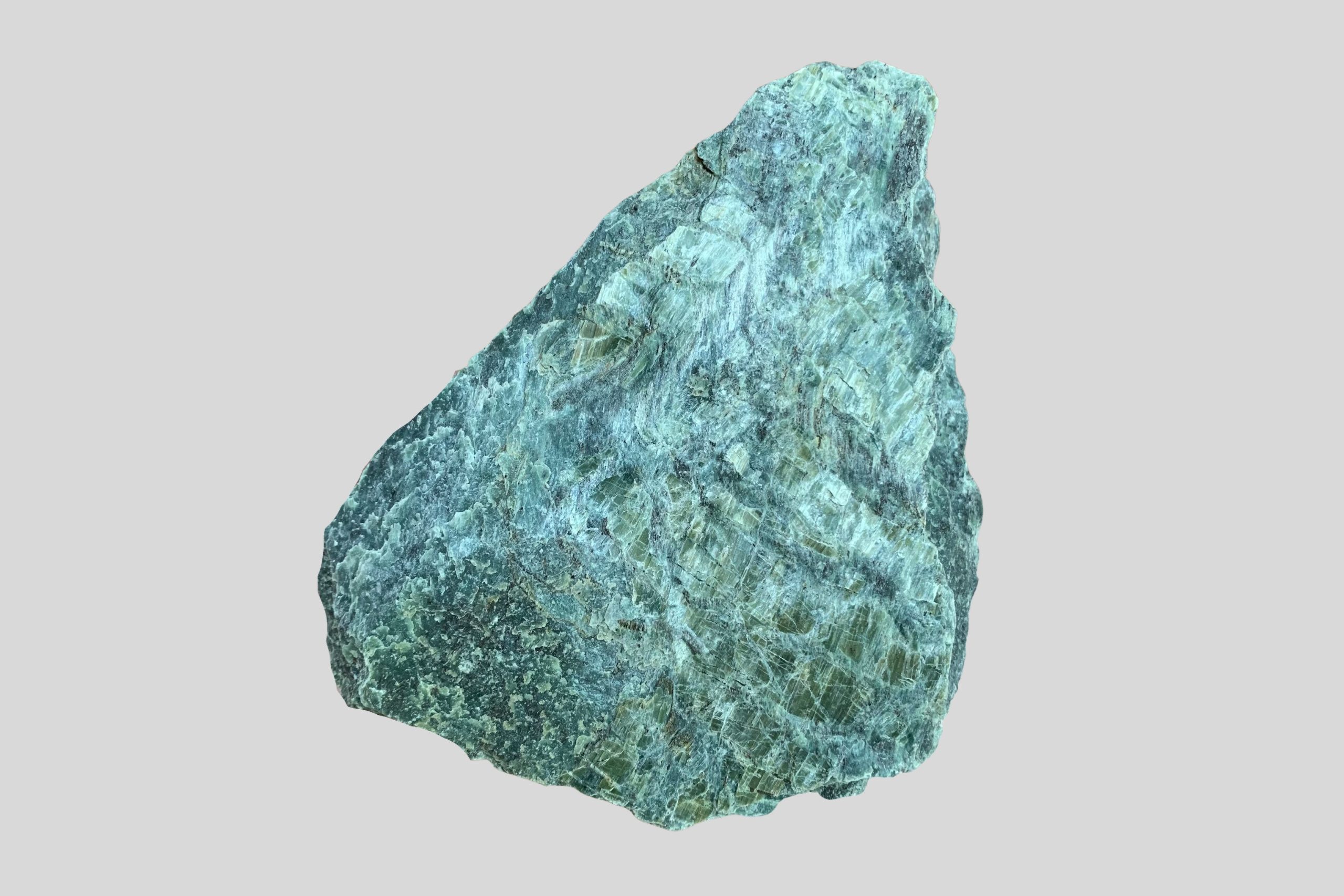
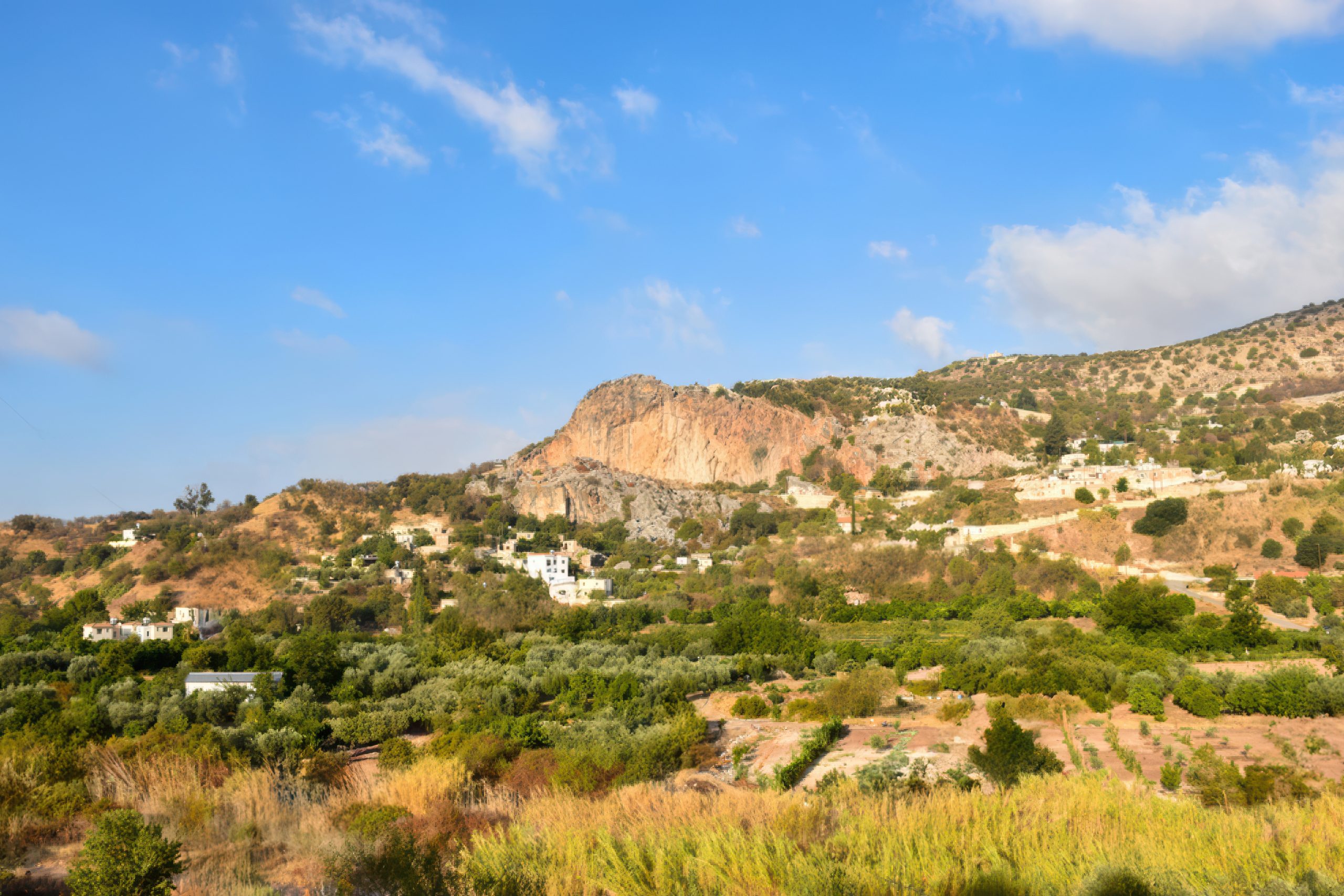
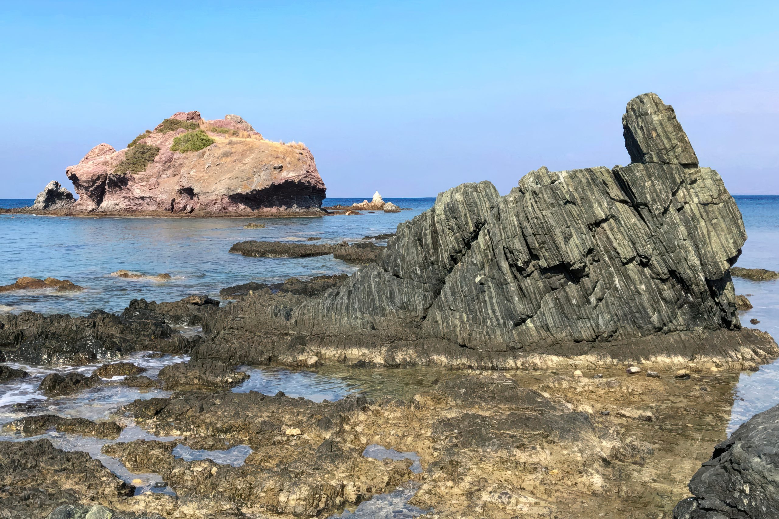
Unlike the main Troodos range, Mamonia explains itself through colour and textures rather than elevation. Red volcanic slopes, pale limestone blocks and dark basalts share the same hillside. Between them appear green serpentinite rocks polished by water.
In Mamonia the minerals antigorite and lizardite dominate, giving turquoise and green tones. This differs from the Troodos serpentinite which mostly contains chrysotile and picrolite formed in ocean ridge conditions. To a geologist the difference immediately tells two separate stories of formation.
The green and bluish stones of Mamonia were never treated as ordinary. Rounded serpentinite pebbles often appeared in riverbeds after winter storms. Villagers collected them quietly and carried them home. Some were placed beside entrances, others near children’s beds or inside storage rooms. The belief was simple: the stone protected the household.
Older residents spoke of the stones keeping snakes away and calming restless nights. In farming communities this mattered. Snakes were common in warm seasons and a house near fields always remained alert to them. A smooth green stone near the doorway was considered a safeguard. The practice had no formal ritual and no written explanation. It survived through habit and memory.
Ethnographers in Cyprus recorded similar customs in several rural areas during the late nineteenth and early twentieth century. People rarely described the stones as magical. Instead, they said the stone “held strength” from the mountain. The idea fits naturally with a landscape where unusual rocks constantly emerged from rivers after storms.
Long before geology identified serpentinite, the stones already carried meaning. Some lava rocks are rich in iron and still hold faint magnetism. A compass may hesitate before pointing north. The effect is subtle yet memorable and hints at the unusual conditions under which the rock formed.
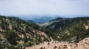
Researchers still visit Mamonia because it exposes part of a 200-million-year-old continental margin rarely visible at the surface. Structures usually buried deep underground can be examined directly.
2. Rivers that tell the story of the Earth
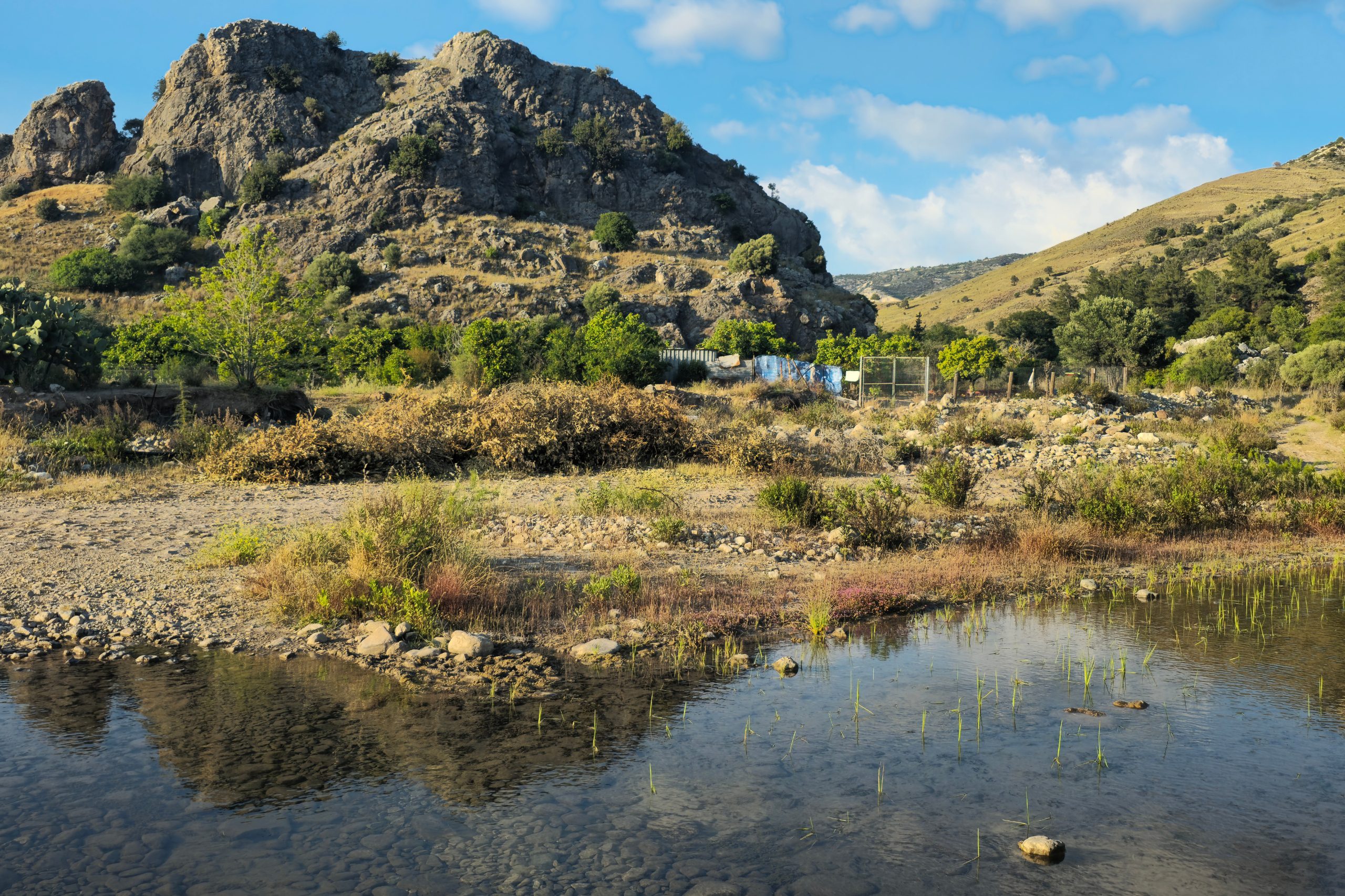
The clearest guide to Mamonia is water. Western Cyprus holds some of the deepest gorges on the island because rivers followed fractures in the broken rock and cut downward for thousands of years.
Diarizos. Where Mamonia truly begins
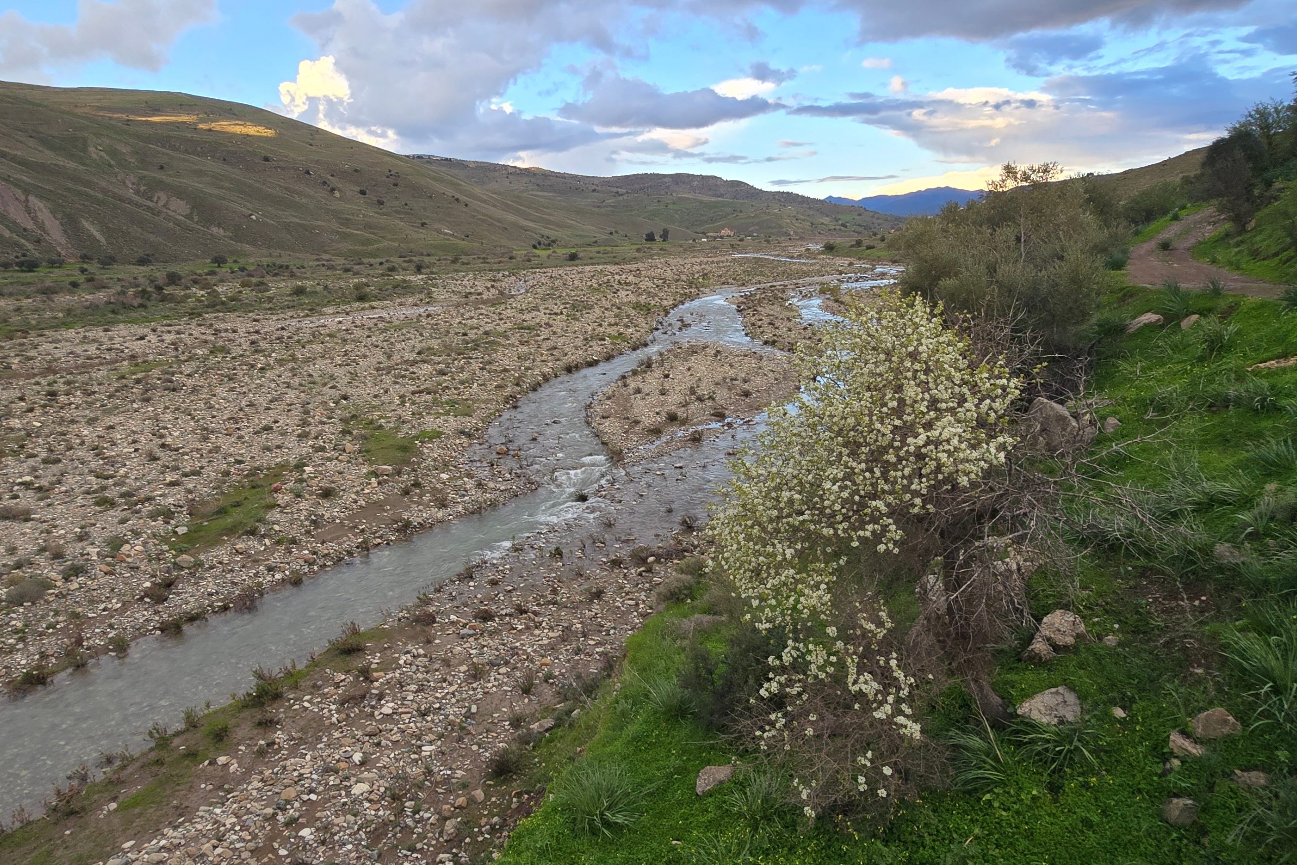
The Diarizos river valley stretches inland for almost thirty kilometres through hills, orchards and terraces. At its mouth near Kouklia stands the sanctuary of Aphrodite, placed strategically a mere mile away from where the river meets sea. It is no surprise that Ancient writers connected it with Aphrodite and in older times the water from the river was deemed sacred to the goddess.

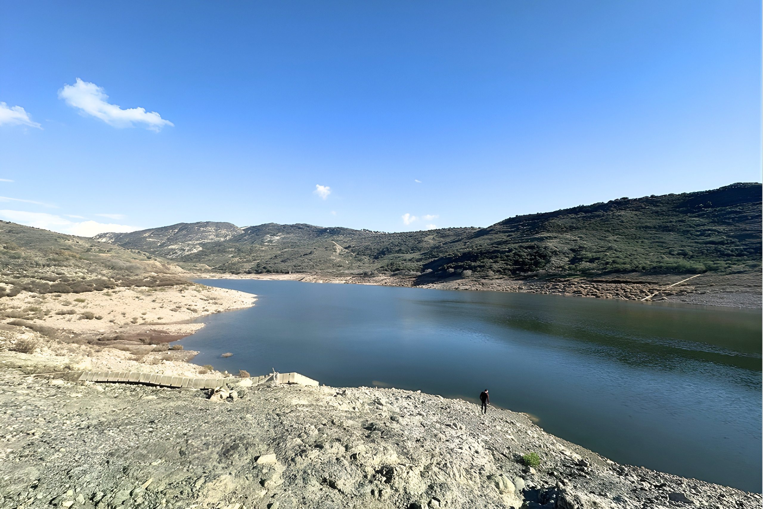
Today the river is held back upstream in the Paphos Forest by the Arminou Reservoir, with much of its water redirected by pipeline to the larger Kouris Dam. For most of the year the channel lies quiet, coming properly to life only in its certain short stretches and during the rainy season.
Along the river valley the ground shifts constantly in colour and texture. Smooth serpentinite boulders lie beside red volcanic rock, while dark black basalt, almost obsidian-like in places, breaks through the banks. Exposures like these first drew geologists’ attention to the strange mixture of rocks, and it was near the village of Mamonia , where many of these outcrops can be seen together, that the formation was studied and eventually took its name.
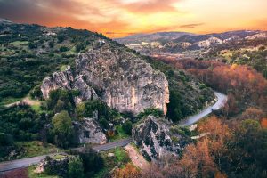
Between the villages of Prastio and Kidasi, above the valley and at its narrowest point rises the gigantic Rock of Chasamboulion, a series of massive slabs of petrified coral limestone.
Local stories once warned travellers about thieves hiding near the rock, waiting for merchants crossing the gorge. Caravans avoided passing after dusk and shepherds would whistle loudly while walking beneath the cliff to announce their presence. The place gained a reputation not only for danger but also for protection, and some left small offerings of food before leading flocks through the valley.
Xeros. The deepest valley of Cyprus
The Xeros appears quiet for most of the year (hence its name meaning “dry” in Greek), a wide bed of colourful stones. But winter storms transform it into the strongest torrent in Cyprus. Numerous streams flow into it from all directions and during heavy rain the valley fills with sound and moving water. In spring temporary waterfalls appear along the walls before fading again in summer heat. Ancient and medieval watermills still stand along its course, placed where seasonal flow could be harnessed.
Between Vretsia and Agios Ioannis the elevation difference between the riverbed and surrounding hilltops can reach nearly 700 metres. Steep cliffs descend sharply, creating one of the deepest gorge systems on the island.
The section of the valley within the Mamonia Mélange extends from the coast near Paphos Airport to the Venetian bridge of Roudias at the edge of the Paphos forest, where it meets the boundary of the Troodos ophiolitic complex.
The wide stony bed winds through a sequence of rocks that changes repeatedly along its course, almost like a cross-section laid open.
Near the lower reaches pale limestone and chalk appear first. Moving upstream the ground turns green with serpentinite and darker with volcanic rock, then lightens again into limestone, followed by brittle chert layers. Higher still the serpentinite and volcanics return, and toward the upper stretches pillow lavas begin to emerge as the terrain approaches the ophiolitic zone.
The banks amplify the effect. Around Agia Marina on the right side and near Agios Ioannis on the left, immense chalk cliffs rise nearly vertical for hundreds of metres above the riverbed. Even without flowing water, the Xeros feels active, its empty channel exposing the island’s geological layers as if the earth had been cut open.
The valley narrows at three natural gates. One lies between Salamiou and Galataria near the car crossing, another between Agia Marina and Kelokedara and the third near the modern Asprokremmos dam. These passages once guided travellers and determined safe routes through the region.
Xeros is also home to the humongous reef limestone formations: Galataria Monolith and the Xeros Monolith. They stand as tall survivors after surrounding material eroded away. After heavy rain villagers still walk the valley to see what the river revealed, as if reading a new chapter each year.
Ezousa. The ancient route through the hills and vineyards
Rising deep within the Paphos forest and fed by numerous smaller mountain streams, the Ezousa enters its main valley just below the Kannaviou Reservoir.
The Ezousa valley feels different. It is gentler yet just as important. For centuries it served as a natural route connecting inland villages with the coast. Paths followed the river because it offered water, shade and gradual passage through difficult terrain. Traders, farmers and shepherds all moved along its banks.
The river also became central to viticulture. Vineyards developed along the slopes where soils derived from Mamonia rocks provided drainage and mineral richness. Many wine-growing villages stand along or near its course, and the valley continues to support grape production today.
Springs emerge frequently along the Ezousa because fractured rock releases stored water. This steady supply made agriculture possible even in dry years and allowed settlements to persist where surrounding hills remained barren.
The Ezousa crosses several geological environments in a short distance. Near its valley towers the Great Rock of Episkopi, the biggest extant monolith of Cyprus visible even from the Paphos-Limassol highway.
While the Xeros reveals the power of erosion, the Ezousa shows the quiet partnership between geology and daily life. One carved the land dramatically. The other allowed people to travel, cultivate and remain.
Together these three rivers shaped how western Cyprus was explored, settled and farmed, turning an ancient collision zone into a living landscape.
Mavrokolymbos. The Black Lake
Much further west, between Paphos and Peyia, in a separate basin, lies Mavrokolymbos, forming the Black Lake reservoir. Bluish serpentinite cliffs surround water noticeably darker than other dams. The colour and depth gave rise to local stories of a bottomless pool and many avoided the place after nightfall. The explanation is geological yet still striking. Fractured rock here traps groundwater emerging from springs beneath the hills.
The stream feeding Mavrokolymbos travels first through layered limestone before entering a distinct part of the Mamonia sub-region rich in serpentinite and dark basalt. Near the dam and toward Coral Bay these rocks reach the surface and can even be recognised from the main coastal road.
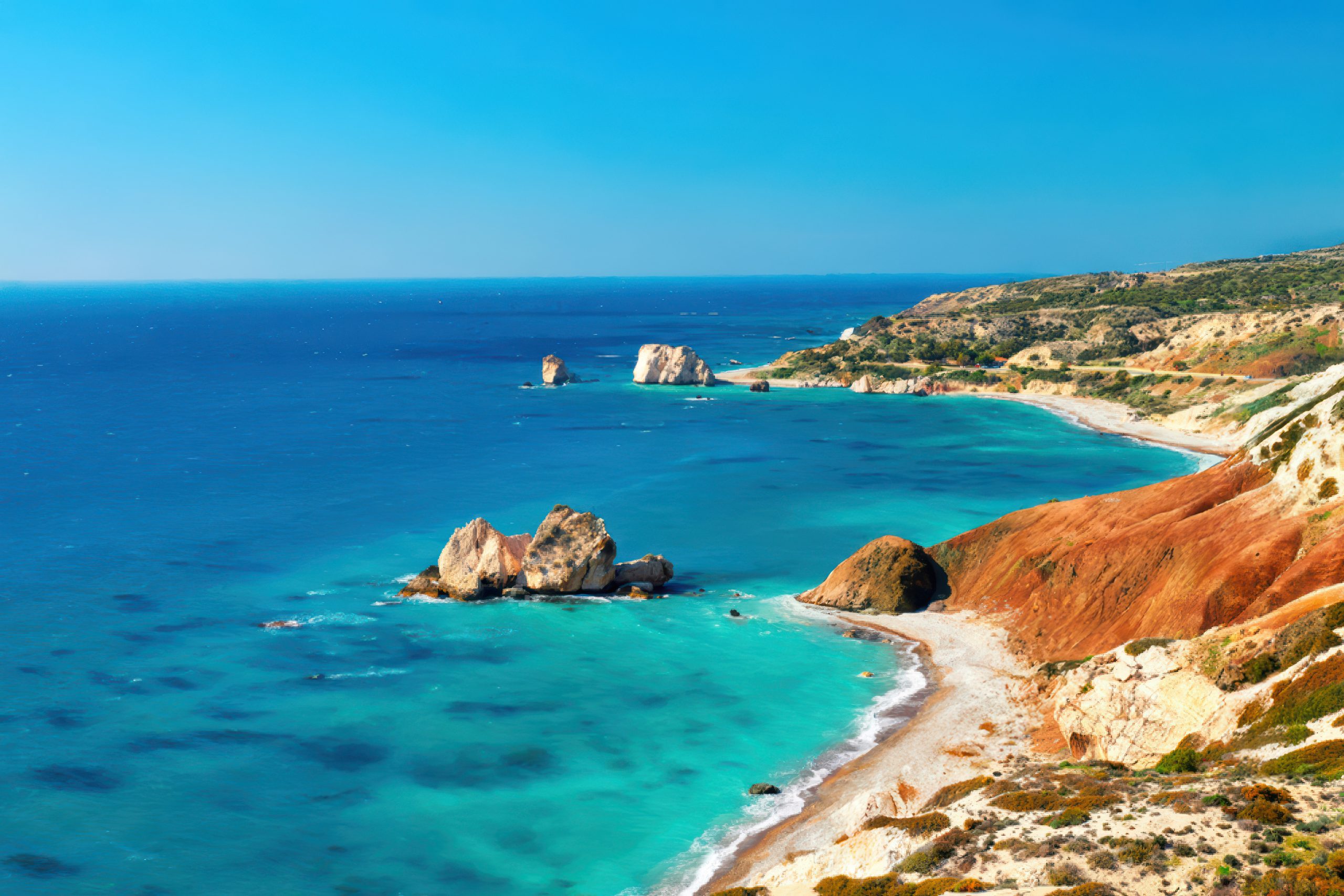
4. Akamas. Where two worlds meet
Akamas Peninsula, the western end of the island is not only scenic. It is geological theatre.
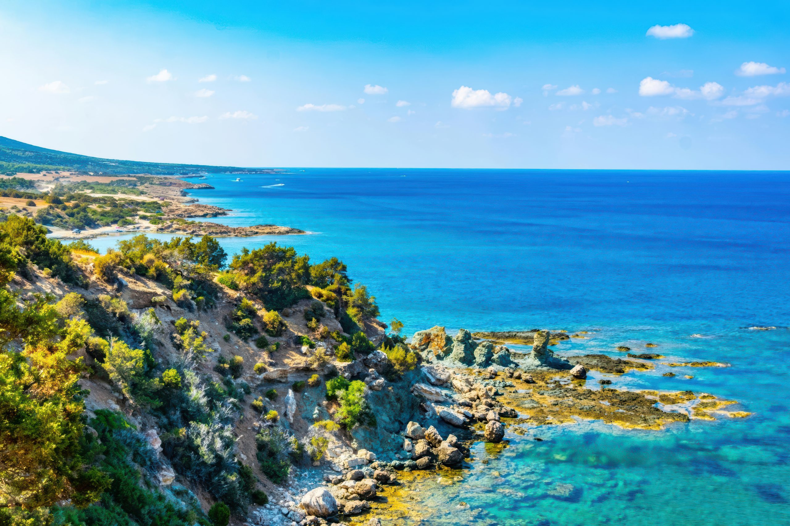
In Akamas several formations meet within walking distance. Ophiolitic rocks from the Troodos sequence reach the surface beside the Mamonia Mélange and younger sedimentary layers. Along trails you can see pillow lavas, diabase dykes and dark volcanic rock directly beside pale limestone and green serpentinite.
At Aphrodite Beach (near the Baths of Aphrodite) mantle-derived and lava rocks, such as serpentinites and basaltic outcrops reach the shoreline. Not far away limestone ridges rise in-between Moutis tis Sotiras and the Smigies viewpoints. The Adonis Trail crosses frozen submarine lava flows while nearby valleys formed by small streams cut through fractured Mamonia terrain.
The most striking examples lie along the western shore, where deep slot canyons have formed. Avakas and Snake Canyons cut sharply through layers of limestone and chalk on their way toward the sea, creating scenery more reminiscent of the American Wild West than the Mediterranean coast.
The result feels unusual even to a casual walker. The ground changes colour and texture repeatedly within minutes. The landscape seems assembled rather than formed in one piece. It is not surprising that mythology settled here. A coast where different stones, springs and cliffs gather so closely naturally became associated as the living and beloved place of Aphrodite herself. The setting already felt like a meeting point of forces larger than the island itself.
5. Living on the remnants of the African Plate
Despite its rugged appearance Mamonia sustains life well. Fresh water is abundant in winter months. Soil gathers in pockets forming terraces and grazing land. Almond orchards and vineyards spread across the hills.
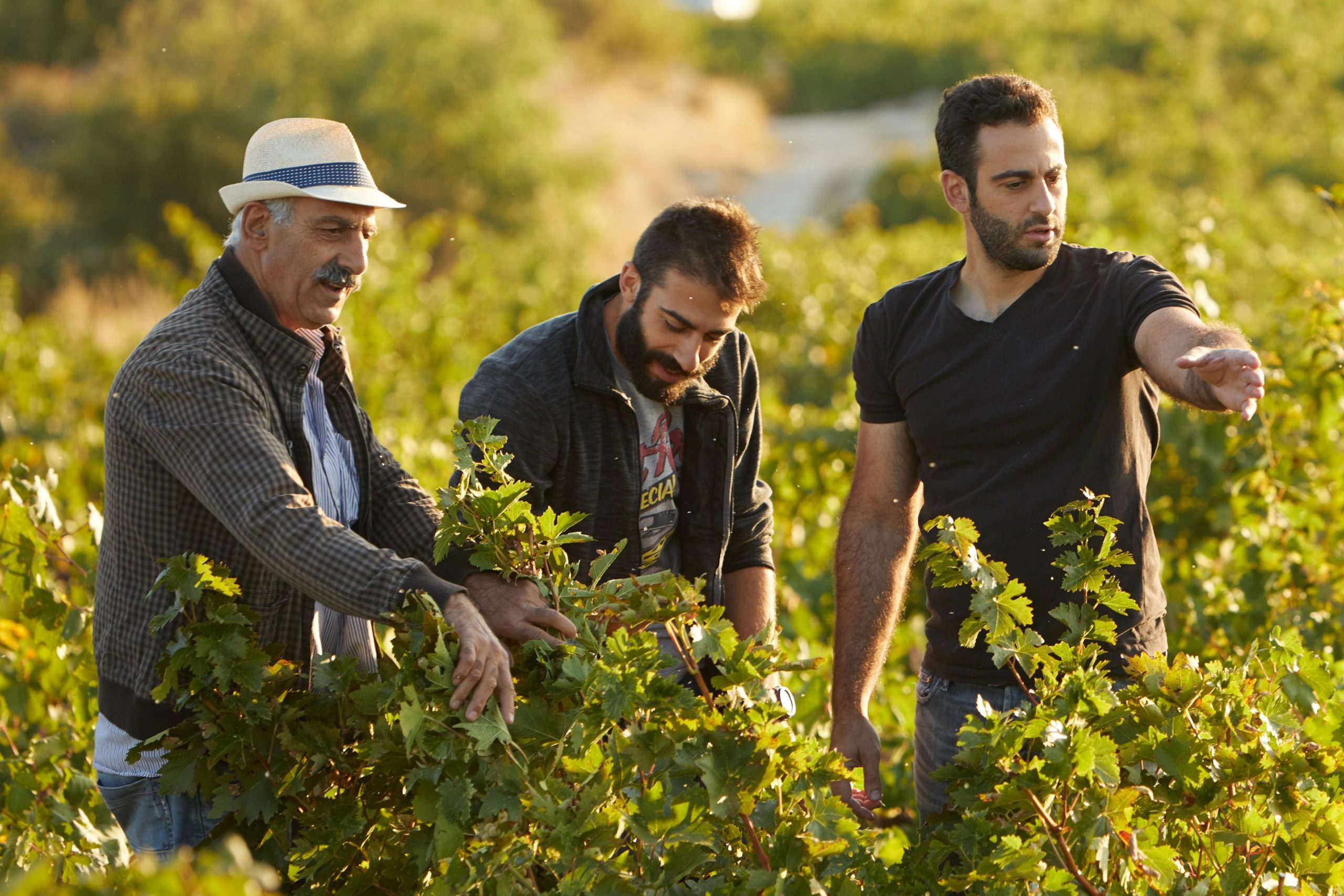
The region houses three wine zones of Cyprus including Vouni Panagias-Ambelitis, one of the largest and most fertile areas on the island. Mineral rich soils and good drainage produce concentrated grapes and influence the character of western Cypriot wines.
Modern dams now capture the same waters that supported earlier communities. The fractured ground stores moisture and releases it slowly through the year.
6. Learning from the stones
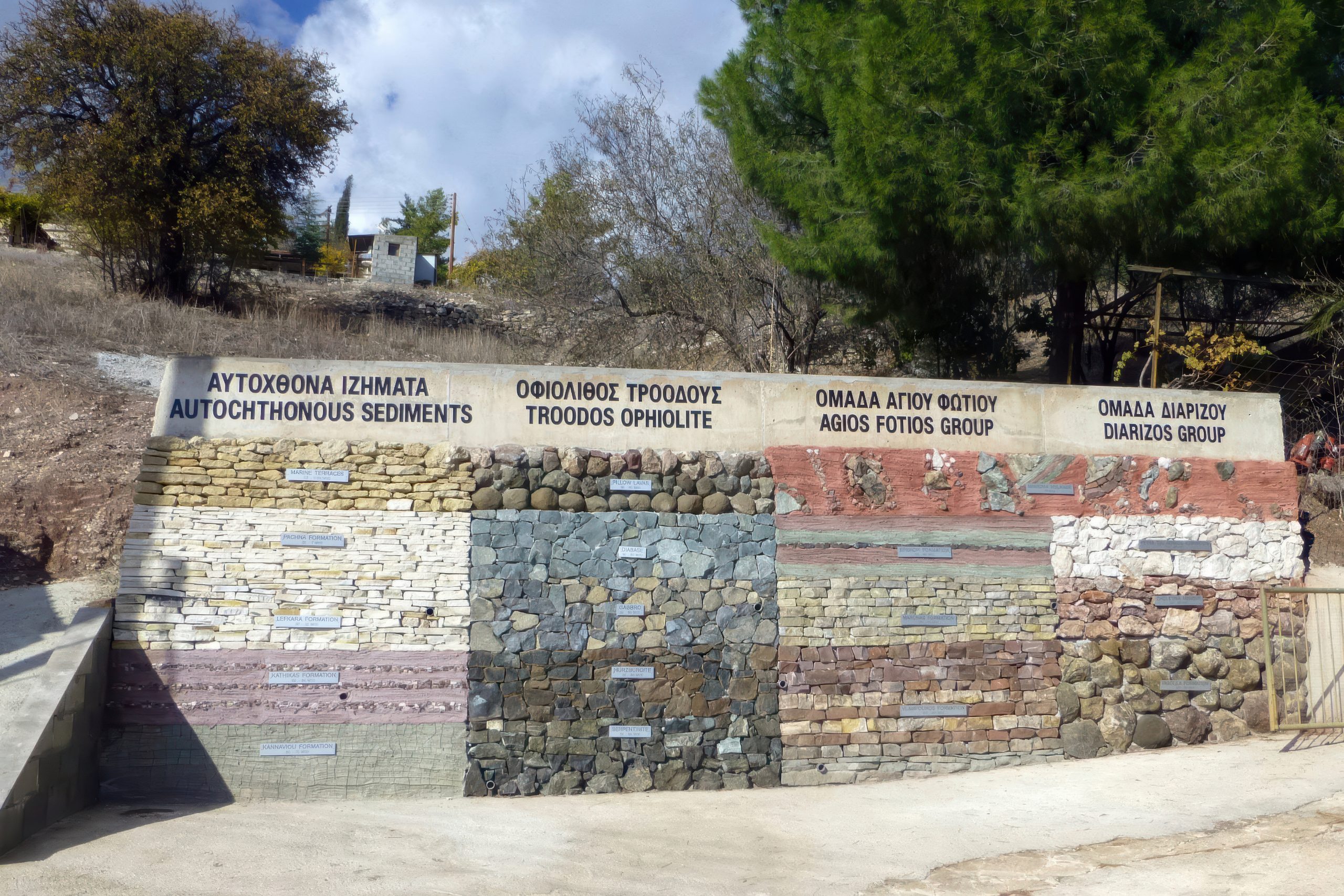
In the village of Trachypedoula geology appears in the open air rather than behind museum glass. Along the central street an outdoor installation presents rock types from across Cyprus arranged as a visible cross section, including samples from the Mamonia complex. Walking past the display is like moving downward through the island itself, from young surface sediments into much older material. For visitors it quietly explains what the surrounding hills contain and why the ground changes so abruptly within short distances.
The same stones shaped culture as well as science. Roman craftsmen who created the mosaics of Paphos worked with naturally coloured rock collected from nearby valleys. Reds, greens, blacks and pale creams were not painted but cut from volcanic rock, serpentinite and limestone. Because the colour belongs to the mineral, the images still appear fresh after nearly two thousand years. The mosaics endured not only because of artistic skill but because the island’s geology provided a palette that time could not easily fade.
7. The Rocks of Mamonia
Mamonia preserves material from several environments:
- mantle-derived serpentinite containing antigorite and lizardite
- red submarine volcanic lava
- black oceanic basalt
- metamorphic rocks altered by pressure
- chalk and limestone cliffs with marine fossils
- massive coral reef limestone monoliths
- deep sea chert formed from microscopic organisms
Together they record the closing of an ancient ocean and the processes that preceded it by tens of millions of years.
8. Where to see it?
Monoliths
- Petra tou Romiou
- Rock of Chasamboulion
- the Great Rock of Episkopi
- Galataria Crag
- Xeros Monolith
- Drousia-Ineia cliffs
River valleys
- Diarizos
- Ezousa
- Xeros
- Mavrokolymbos
Akamas landscapes
- Aphrodite Beach
- the ridge from Moutis tis Sotiras to Smigies
- the magnesium mine cave
- lava flows along the Adonis Trail
- Avakas Canyon
- Snake Canyon
Caves
- Sea Caves of Coral Bay
- Ammati Cave near Kallepia
- Akoursos Cave
9. The Ground that remembers
By the time you leave Mamonia, the island no longer feels quite the same.
You begin to notice stones in unexpected places. A green pebble in a dry riverbed. A red slope catching the last light of evening. A pale cliff standing where it should not logically be. What first looked like ordinary countryside slowly reveals itself as something far older than the villages, the churches or even the coastline.
Here the story of Cyprus does not begin with temples or ancient city-states. It begins with Aphdorite herself, the violent primordial pre-historic movement deep beneath an ancient sea, when continents pressed together and the ocean floor broke and rose. The hills, rivers and fields of western Cyprus rest upon that moment.
People sensed it long before science explained it. They carried stones home, placed them by their doors and trusted them. They gave names to rocks and attached stories to valleys. Myths settled where the land itself felt unusual.
Mamonia is therefore more than a geological formation. It is the island’s first chapter, still visible in daylight. Beneath vineyards and quiet roads lies a fragment of a vanished world that survived the subduction of Northern Africa with the closing of an ocean and waited for an island to form above it.Walk or drive here and you are not only exploring Cyprus. You are standing where Cyprus began.