The nymphaeum at Kourion stands as one of the largest fountain complexes in the Roman Mediterranean world. This impressive water structure measured 45 meters long and 15 meters wide at its peak, dominating the northern edge of the city’s public forum. Built through four major construction phases between the early first century and the mid-seventh century AD, the nymphaeum served not just as a water source but as a grand architectural statement about Roman power and civilization in Cyprus.
Kourion occupied a strategic hilltop position on the southern coast of Cyprus, about 19 kilometers west of modern Limassol. Founded around the 13th century BC by Argive colonists according to tradition, the city controlled fertile valleys and natural harbors. This location brought prosperity through trade in grain, sheep, copper, and agricultural products across the Mediterranean.
Before the Romans built aqueducts, Kourion depended largely on stored rainwater collected in numerous bottle-shaped cisterns carved into bedrock. The city and the nearby Sanctuary of Apollo Hylates both lacked natural springs. Residents had to transport water in jars by animal portage from distant sources. As the city grew wealthier and more populous, this system became inadequate. The construction of at least one major aqueduct, possibly followed by a second larger one, solved this problem by bringing water from springs further inland.
Historical Background
In its earliest phase during the early first century AD, the nymphaeum consisted of a relatively simple rectangular room. Three apsed fountains stood along the northern wall. Water flowed from these semicircular fountain niches into a rectangular basin that ran the length of the same wall. This initial design was functional rather than monumental, providing a reliable water source for the growing forum area.
The location was carefully chosen. The nymphaeum sat at the northern edge of what would become the Roman forum, accessible through the northern portico. This position made it central to public life while keeping the water infrastructure organized in one area. The structure connected to the city’s water supply system, which included a large underground reservoir beneath the forum’s eastern colonnade. This reservoir measured 9.6 meters long, 8.3 meters wide, and 3.5 meters deep, holding approximately 280 cubic meters of water.
The Trajanic Transformation
A devastating earthquake struck Cyprus in 77 AD, damaging many structures across the island. Emperor Trajan, who ruled from 98 to 117 AD, ordered major restoration work at Kourion. This period marked the nymphaeum’s transformation from a simple fountain room into a grand architectural complex that ranked among the Mediterranean’s most impressive water monuments.
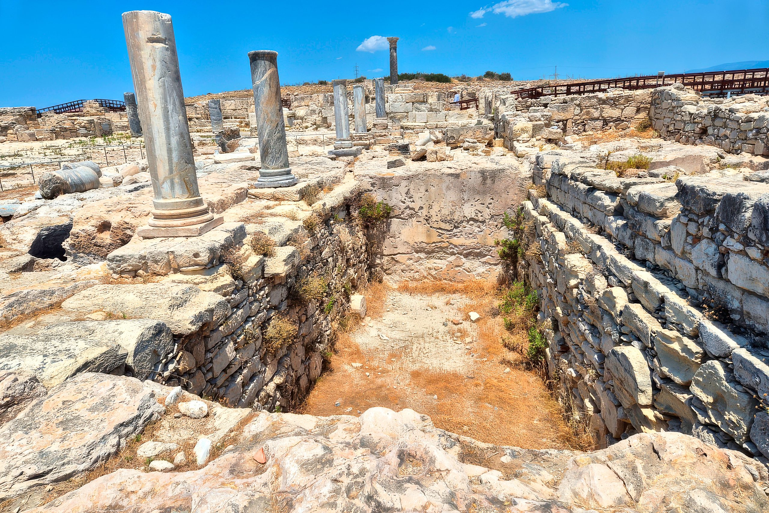
The builders replaced the three small apsed fountains with a large rectangular basin. They divided the interior space with a courtyard arrangement and added a room to the south that contained an apsidal fountain and rectangular basins. This new configuration reached the structure’s maximum dimensions of 45 meters in length and 15 meters in width. The scale demonstrated Roman engineering ambition and the city’s prosperity during the second and third centuries.
The renovation required completely overhauling the water supply system. Engineers added six water basins at various points and built a large reservoir directly behind the nymphaeum. Water flowed through carefully engineered channels and pipes to supply the expanded fountain complex. The system had to maintain adequate pressure to fill the large basins and create the desired visual effects of flowing water.
An inscription found on a doorway lintel mentions rebuilding by a venerable priest. Scholars believe this refers to the Trajanic renovations, possibly indicating the emperor himself as the benefactor. Trajan invested heavily in Cyprus, particularly in rebuilding the Sanctuary of Apollo Hylates and other civic structures damaged by earthquakes. The improvements at Kourion formed part of a broader imperial policy to demonstrate Roman authority and integrate local traditions with Roman culture.
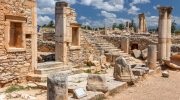
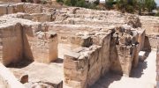
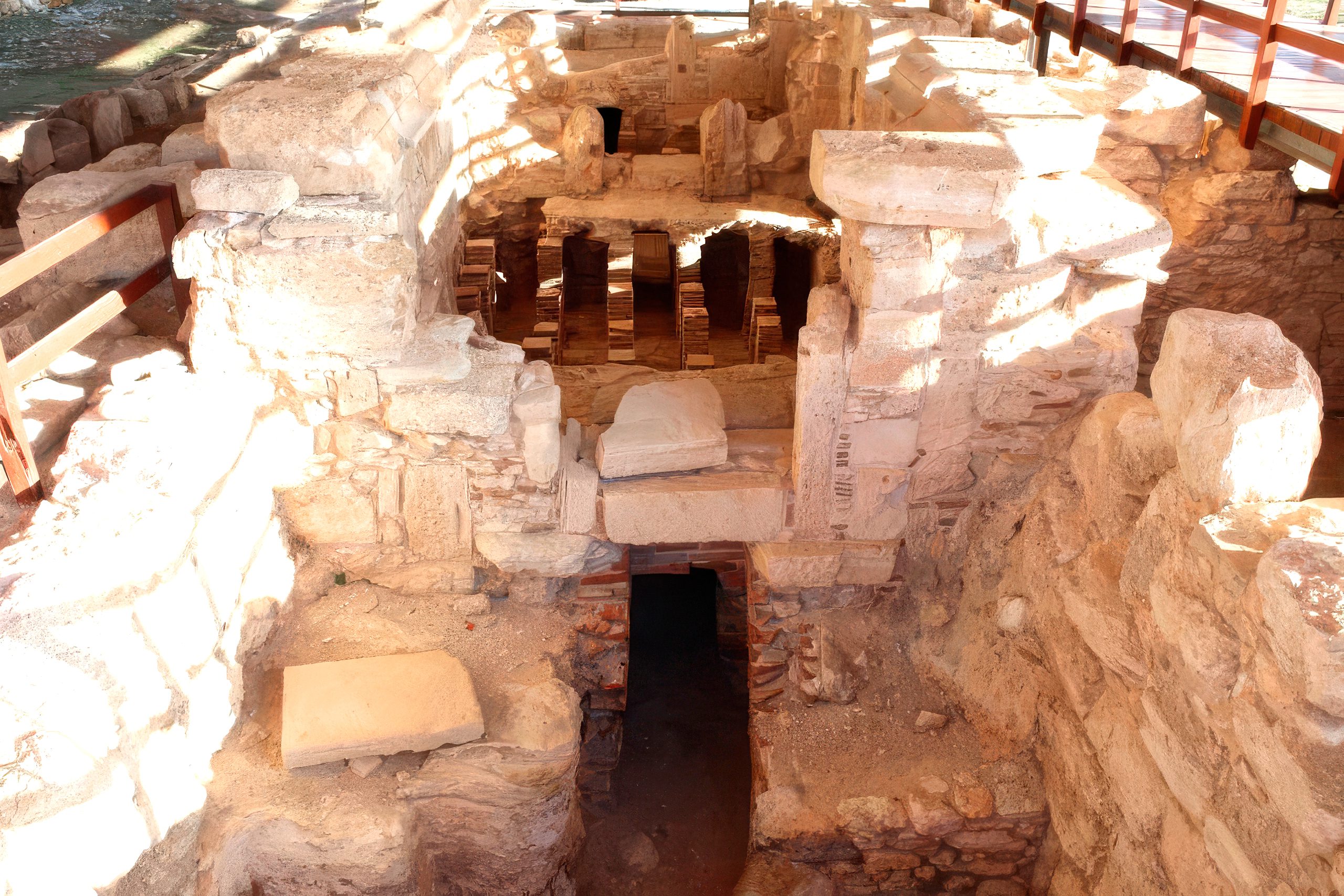
What the Ruins Reveal Today
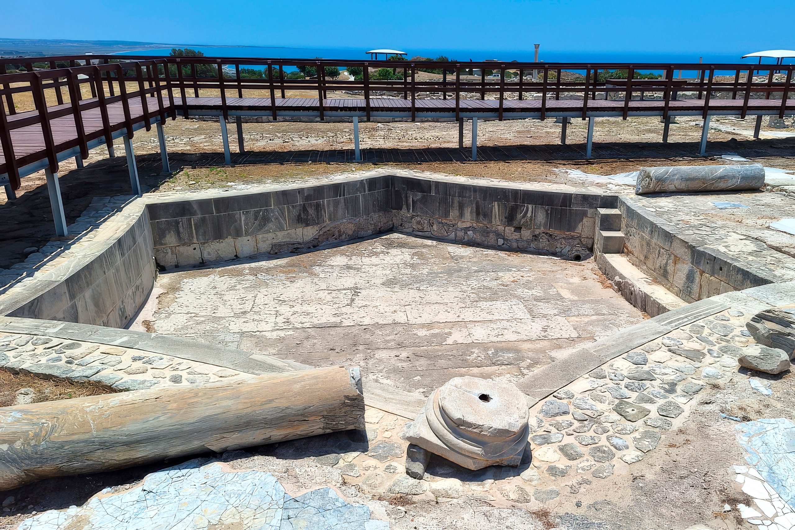
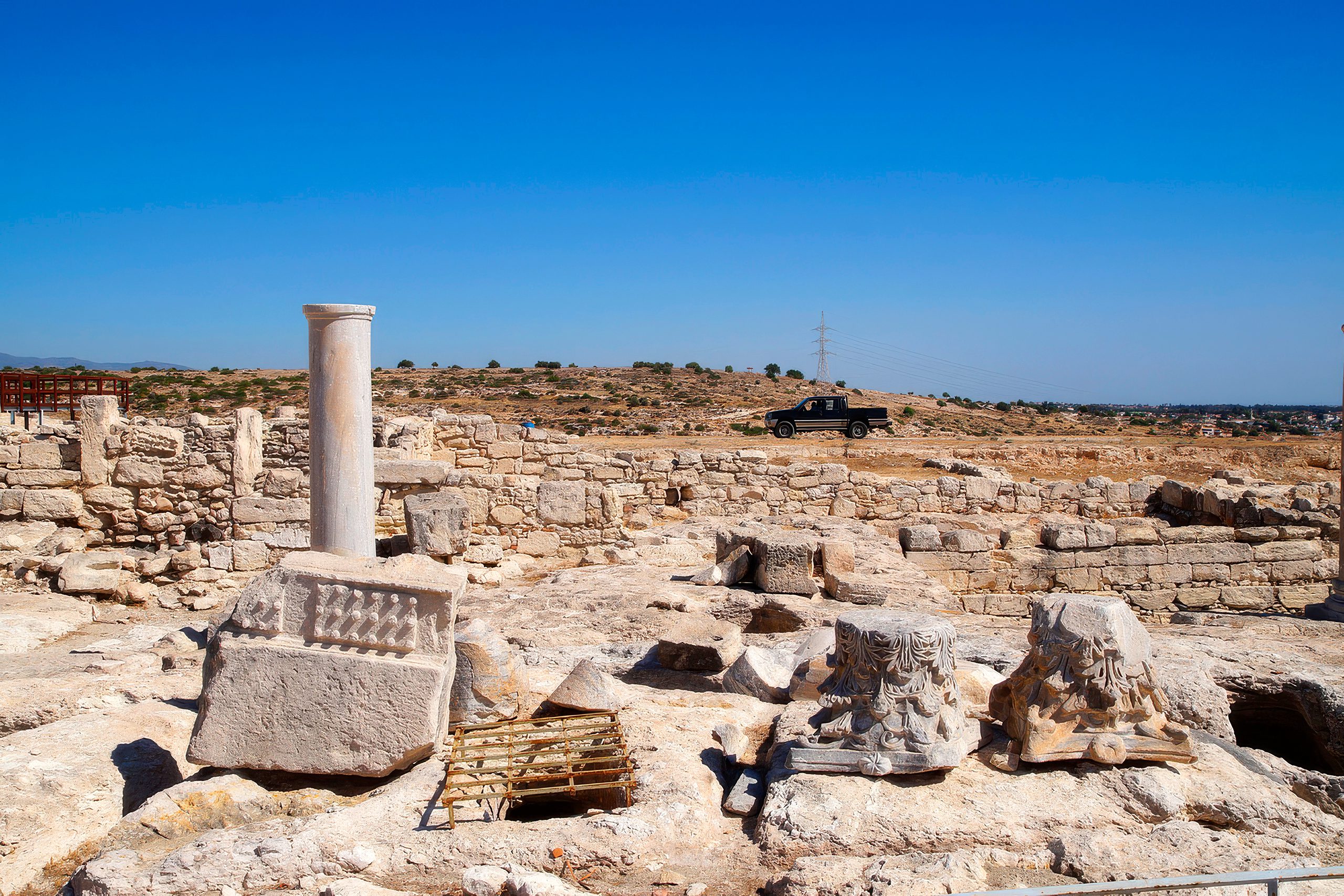
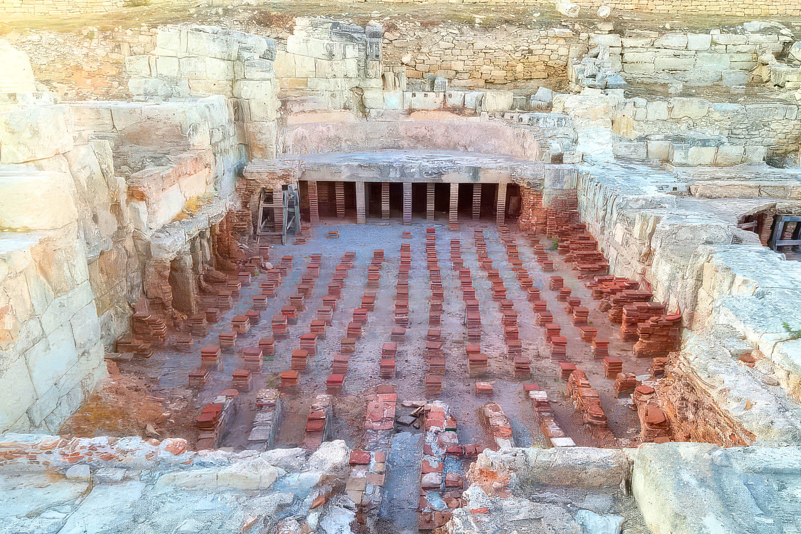
Modern visitors to Kourion can walk over the substantial remains of the nymphaeum and bath complex on raised wooden walkways. The foundations clearly show the layout of different rooms and the progression of construction phases. The bases of the pyramidal building dating from 375-350 BC are visible east of the hexagonal pool. These represent the earliest architectural remains found at Kourion, predating even the Hellenistic structures.
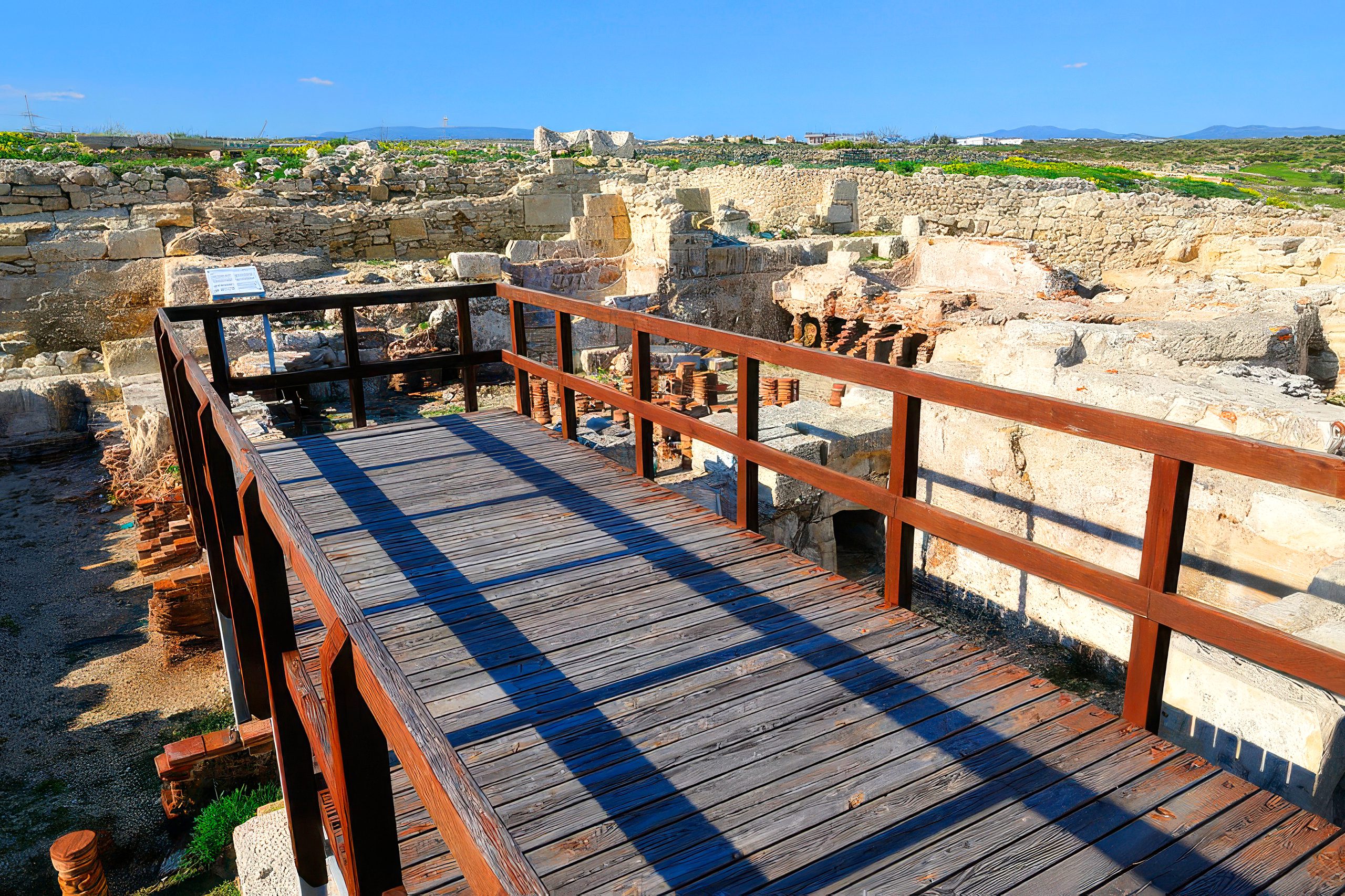
The hexagonal frigidarium remains one of the most distinctive features. Its unusual shape and substantial size demonstrate the ambition of Roman engineering. Nearby, traces of the hot room foundations show where the hypocaust heating system once operated. Visitors can identify the channels that carried hot air beneath the floors and the positions where supporting pillars held up the raised floor surfaces.
The nymphaeum’s rectangular footprint is clearly visible, measuring the full 45 meters of its Trajanic expansion. Though the ornamental facades and water features are gone, the scale of the structure impresses visitors. The location at the forum’s northern edge, accessible through the colonnade, shows how Romans organized their public spaces with water architecture as a focal point.
Archaeological work continues to reveal details about the water supply system. Researchers have traced pipe networks, identified reservoir locations, and documented the engineering methods used to bring water to the elevated site. Each excavation season adds to the understanding of how Romans managed water resources in challenging Mediterranean environments.
The Nymphaeum in Roman Urban Planning
The Kourion nymphaeum represents a standard element of Roman city design adapted to local conditions. Throughout the empire, nymphaea served as public fountains dedicated to water nymphs from classical mythology. These structures provided drinking water, created impressive visual displays, and demonstrated civic wealth and Roman engineering prowess.
What made the Kourion example exceptional was its size and evolution. During the second and third centuries AD, it ranked among the largest nymphaea in the entire Roman Mediterranean. The 45-meter length exceeded most comparable structures in other cities. The integration with bath complexes on both sides created a water architecture zone that few other cities could match.
The four construction phases show how Romans adapted structures over time rather than abandoning and rebuilding entirely. Each phase responded to specific needs: earthquake damage, population growth, religious change, or shifting civic priorities. The final transformation into a temporary church demonstrates Roman pragmatism in reusing valuable buildings when circumstances changed.
The location next to the forum followed classical urban planning principles. Water, commerce, politics, and social life all concentrated in the same area. Citizens conducting business in the forum could refresh themselves at the nymphaeum. After bathing, they might discuss affairs in the forum’s colonnaded porticos. This integration of functions created efficient, livable cities that served populations for centuries.
Engineering Legacy of the Kourion Fountain
The nymphaeum at Kourion demonstrates Roman water engineering at its most ambitious. From simple beginnings as a fountain room with three apses, it grew into a monumental complex spanning 45 meters and serving multiple functions. The Trajanic renovations created one of the Mediterranean’s largest nymphaea, integrating it with extensive bath facilities that provided essential services to the community.
The structure’s four construction phases reflect six centuries of continuous use and adaptation. Engineers solved the challenge of supplying abundant water to an arid hilltop location through aqueducts, reservoirs, and pipe networks. Builders incorporated heating systems, drainage channels, and storage facilities into a coordinated infrastructure that served thousands of residents.
When earthquakes damaged the complex, Romans rebuilt it. When Christianity replaced traditional religion, they converted the nymphaeum into a church rather than destroying it. This flexibility allowed the structure to remain useful for over 600 years, from the first century AD to the mid-seventh century. Few ancient buildings matched this longevity of active service.
Today, the ruins stand as evidence of Roman commitment to public amenities and urban infrastructure. The massive scale, careful engineering, and long useful life of the Kourion nymphaeum show that Romans built not just for their own generation but for centuries to come. Modern visitors walking through the archaeological site can still appreciate the ambition and skill that created one of ancient Cyprus’s most important water monuments.