Explore Cyprus with Our Interactive Map

Explore our top stories and discover ideas worth your time.

Community Solidarity in Cyprus

Community Solidarity in Cyprus

Community solidarity in Cyprus is a long-running social system that spread risk through trust, shared labour, and reciprocity, especially during foreign rule, hardship, and displacement. In villages, it acted as a practical safety net through kinship ties, communal work, and rituals that redistributed time, food, and care when families were vulnerable. This article explains how those habits formed, how they still operate in modern cities through associations and digital networks, and why mutual support remains one of Cyprus's most durable survival strategies. Surviving Without Reliable Institutions For much of its history, Cyprus existed under external rule, shifting borders, and limited self-determination. In this environment, survival depended less on state protection and more on community reliability. Villages became self-sustaining units where food production, housing, care for the vulnerable, and conflict resolution were managed collectively. This mindset was established early. Archaeological evidence from sites such as Khirokitia shows that Cyprus's earliest settled communities were already organised around shared labour and communal responsibility. Homes were built collectively, resources were managed locally, and daily life depended on cooperation rather than individual independence. These early patterns laid the foundation for a culture where solidarity was not optional but essential. The Village as a Social Safety Net Traditional Cypriot villages functioned as living social systems rather than simple residential clusters. Kinship extended beyond immediate family to…

Read more
Byzantine Cyprus: Eastern Mediterranean Defense

Byzantine Cyprus: Eastern Mediterranean Defense

Cyprus was never a distant outpost of the Byzantine Empire. From late antiquity through the Middle Ages, it functioned as a frontline maritime shield, protecting the sea lanes that connected Anatolia, the Levant, and the Aegean. Byzantine naval defense on Cyprus was not limited to fleets and battles. It was a layered system combining geography, coastal fortifications, mountain surveillance, communication networks, and naval presence. Together, these elements allowed the empire to detect threats early, control movement at sea, and preserve stability in one of the Mediterranean’s most contested regions. An Island Positioned to Watch the Sea Cyprus sits at a natural crossroads of the Eastern Mediterranean. From its shores, routes radiate toward southern Anatolia, Syria and Palestine, Egypt, and the Aegean. This position made the island unavoidable for any power seeking maritime dominance in the region. For the Byzantine Empire, Cyprus acted as a forward sentinel. Control of the island meant early visibility over naval traffic moving between the Islamic-controlled Levant and the Byzantine heartlands of Asia Minor. Losing Cyprus would have meant losing advance warning, leaving the southern coast of Anatolia and the Aegean islands exposed to sudden raids. This strategic reality shaped every aspect of Byzantine policy on the island. From Roman Province to Maritime Bastion In the early Roman and late antique periods, Cyprus was relatively peaceful.…

Read more
National Forest Park of Machairas

National Forest Park of Machairas

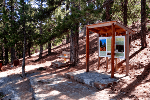
The National Forest Park of Machairas protects one of Cyprus's most important natural areas through 6,057 hectares of Mediterranean forest. It supports over 600 plant species and serves as the source of the island's two largest rivers. The park was officially declared a National Forest Park on December 22, 2004, through decree 61.368. The designation initially covered the Machairas forest at 43.93 square kilometers and the smaller Lythrodontas forest at 1.31 square kilometers. On June 1, 2005, decree 62.114 added the adjacent area called Vounia tou Anemou, which covers 1.126 square kilometers. The total protected area now spans 60.6 square kilometers across parts of Nicosia and Larnaca districts. The forest takes its name from the historic Machairas Monastery, which occupies a commanding position at the head of a wooded valley on one of the highest slopes of Kionia Peak. The monastery's name derives from the Greek word for sword or knife. By 1921, Machairas Forest covered 15.26 square miles and was recognized as one of the five main state forests in Cyprus, though it was smaller than the largest, Paphos Forest. The park received designation as a Natura 2000 site and Important Bird Area due to its ecological significance. Part of the forest has been declared a Special Protection Area to safeguard its biodiversity. The Department of Forests manages the…

Read more