The National Forest Park of Machairas protects one of Cyprus’s most important natural areas through 6,057 hectares of Mediterranean forest. It supports over 600 plant species and serves as the source of the island’s two largest rivers.
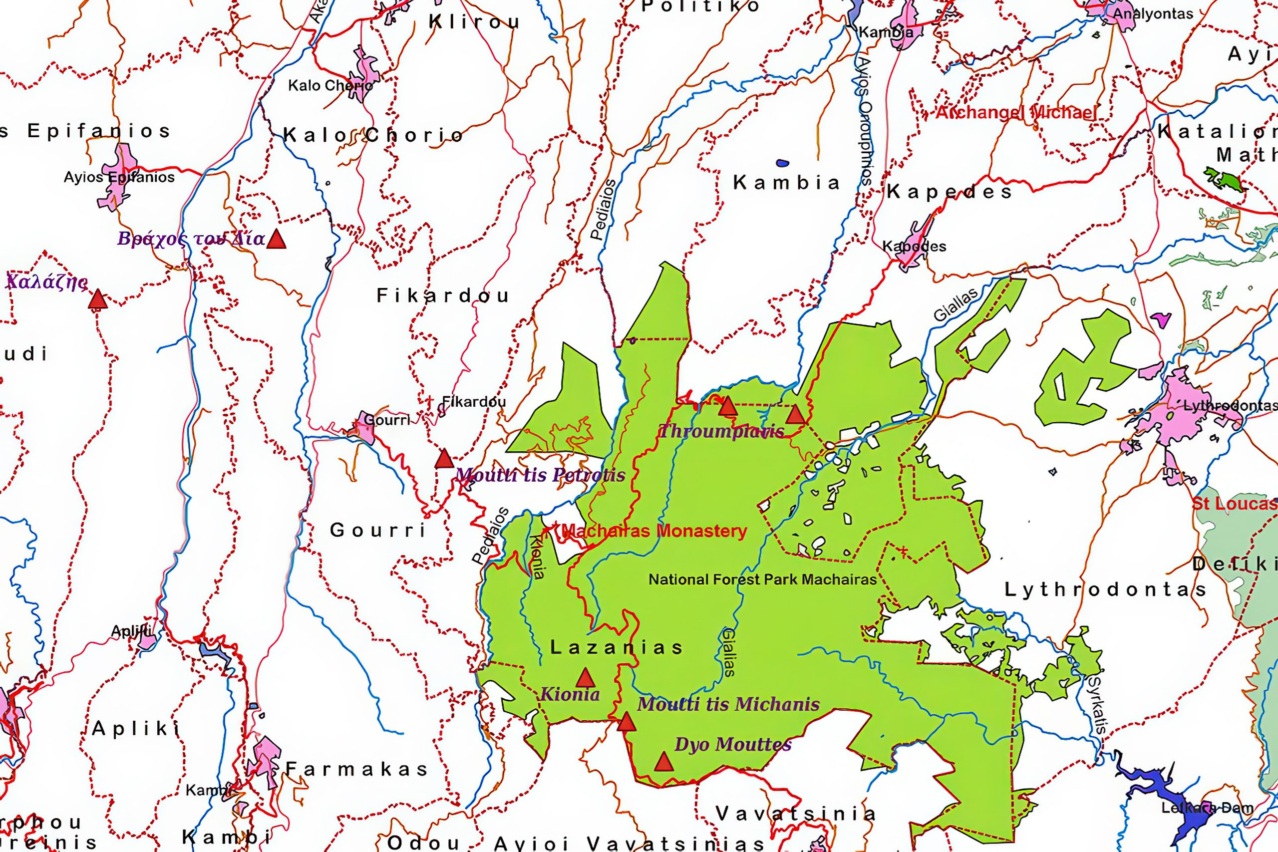
The park was officially declared a National Forest Park on December 22, 2004, through decree 61.368. The designation initially covered the Machairas forest at 43.93 square kilometers and the smaller Lythrodontas forest at 1.31 square kilometers. On June 1, 2005, decree 62.114 added the adjacent area called Vounia tou Anemou, which covers 1.126 square kilometers. The total protected area now spans 60.6 square kilometers across parts of Nicosia and Larnaca districts.
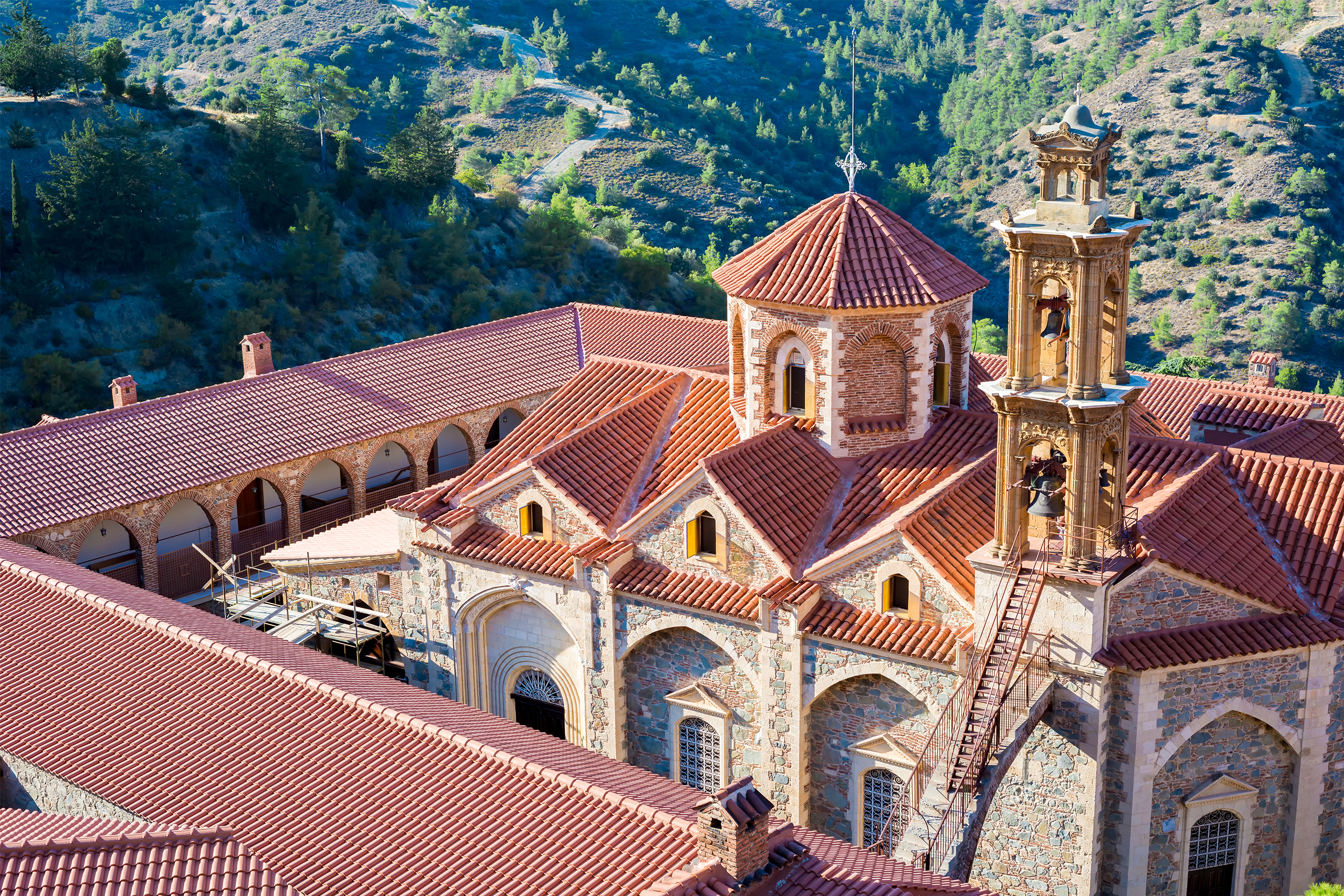
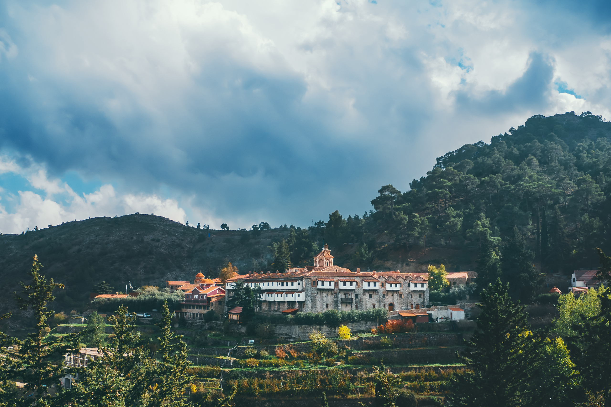
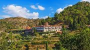
The forest takes its name from the historic Machairas Monastery, which occupies a commanding position at the head of a wooded valley on one of the highest slopes of Kionia Peak. The monastery’s name derives from the Greek word for sword or knife. By 1921, Machairas Forest covered 15.26 square miles and was recognized as one of the five main state forests in Cyprus, though it was smaller than the largest, Paphos Forest.
The park received designation as a Natura 2000 site and Important Bird Area due to its ecological significance. Part of the forest has been declared a Special Protection Area to safeguard its biodiversity. The Department of Forests manages the entire area from a station in Lythrodontas, staffed by forest employees who handle fire protection, trail maintenance, recreational area development, and wildlife conservation.
Historical Context
The Machairas region holds deep historical significance, stretching back centuries. The area takes its name from the Machairas Monastery, founded in 1148 by two monks who reportedly discovered a miraculous icon of the Virgin Mary in a nearby cave.
The monastery became an important spiritual center and landowner in medieval Cyprus. Throughout the Byzantine, Lusignan, and Ottoman periods, the surrounding forest provided timber, game, and grazing land for local communities.
By the early 20th century, British colonial authorities recognized the need to protect what remained of Cyprus’s natural forests. The establishment of formal forest reserves began during this period, though protection measures remained limited. Following independence in 1960, the Republic of Cyprus expanded conservation efforts.
The Forest Department assumed management responsibility and implemented systematic protection measures. Fire control became a priority concern, with Kionia Peak serving as a fire observation station during high-risk summer months.
The forest suffered significant damage from wildfires over the decades, particularly during the dry summer months. In recent years, the designation of portions of Machairas as Special Protection Areas under European Union directives provided additional safeguards for vulnerable species and habitats.
Geography and Climate Patterns
The forest’s elevation ranges from 300 meters near Lythrodontas to 1,423 meters at Kionia Peak, creating diverse climatic zones. Mountain ridges, steep valleys, and rocky slopes define the landscape. These geographic variations support different vegetation types and wildlife habitats.
The Kionia–Machairas peak line receives higher rainfall, with annual precipitation reaching approximately 700 millimeters. Lower elevations receive between 446 and 707 millimeters annually. This rainfall pattern supports dense pine forests at higher elevations and Mediterranean vegetation at lower altitudes.
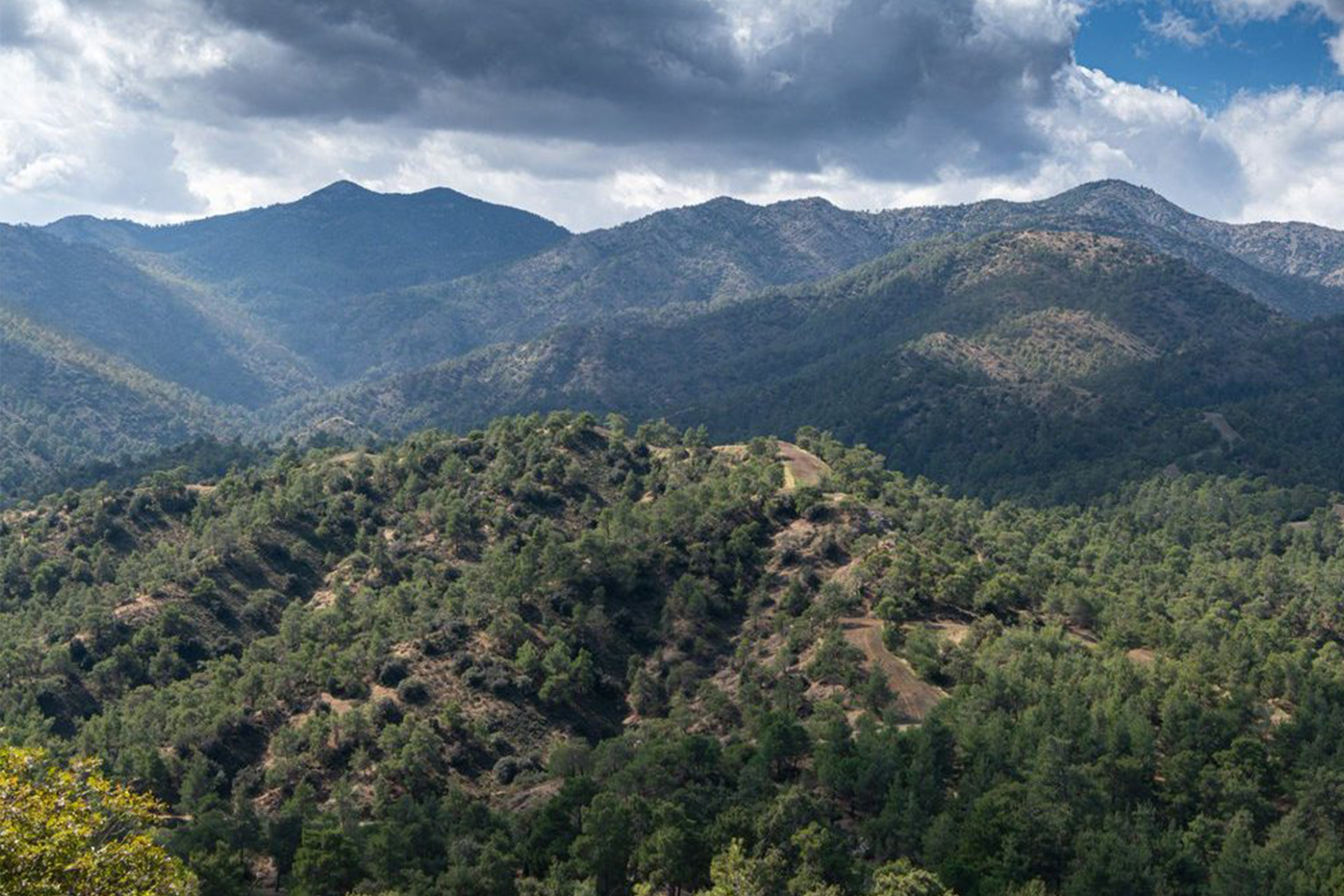
Summer temperatures in higher areas remain moderate, rarely exceeding 32 to 33 degrees Celsius. Winter temperatures can drop to minus 5 degrees Celsius, and snowfall occasionally covers higher peaks. Even during summer, occasional rainfall helps maintain vegetation.
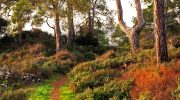
Lower elevations transition into scrubland dominated by aromatic herbs, cistus shrubs, and scattered carob trees. Stream valleys support riparian vegetation such as plane trees, willows, and moisture-loving plants.
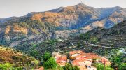
The forest extends eastward to Lythrodontas and Kyprovasa, northward toward Vavatsinia, westward to Fikardou, Lazania, and Gourri, and southward toward Kapedes and Filani. The park lies approximately 45 kilometers southwest of Nicosia and 60 kilometers west of Larnaca, making it easily accessible while retaining its mountainous character.
Rivers and Water Sources
Four major rivers originate within the park boundaries. The Pediaios and Yialias rivers, the two largest waterways in Cyprus, begin in the Machairas mountains. The Pentaschinos and Maroni rivers also originate within the forest.
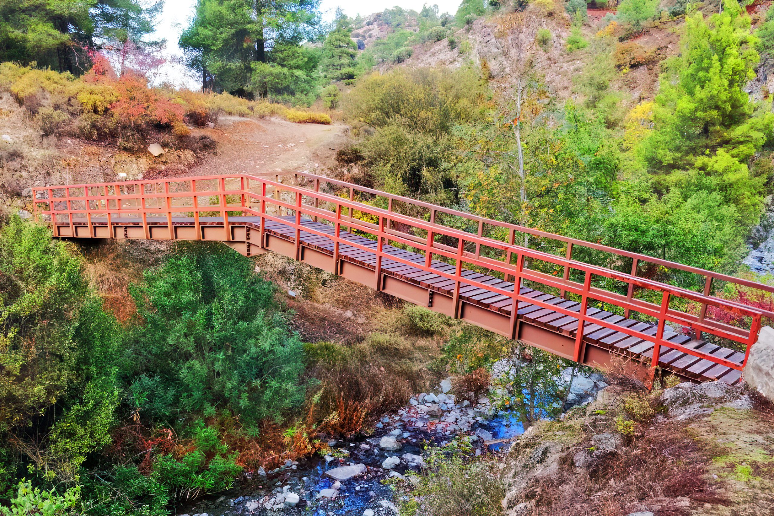
Numerous streams flow from mountain slopes, feeding these rivers and their tributaries. These water systems provide essential resources for communities across central Cyprus. The watershed function of the forest helps regulate water flow, prevent erosion, and maintain soil stability.
Kionia Peak also functions as a fire observation station during summer months. Rangers monitor the forest from this elevated point, allowing rapid response to potential fires.
Plant Life and Forest Composition
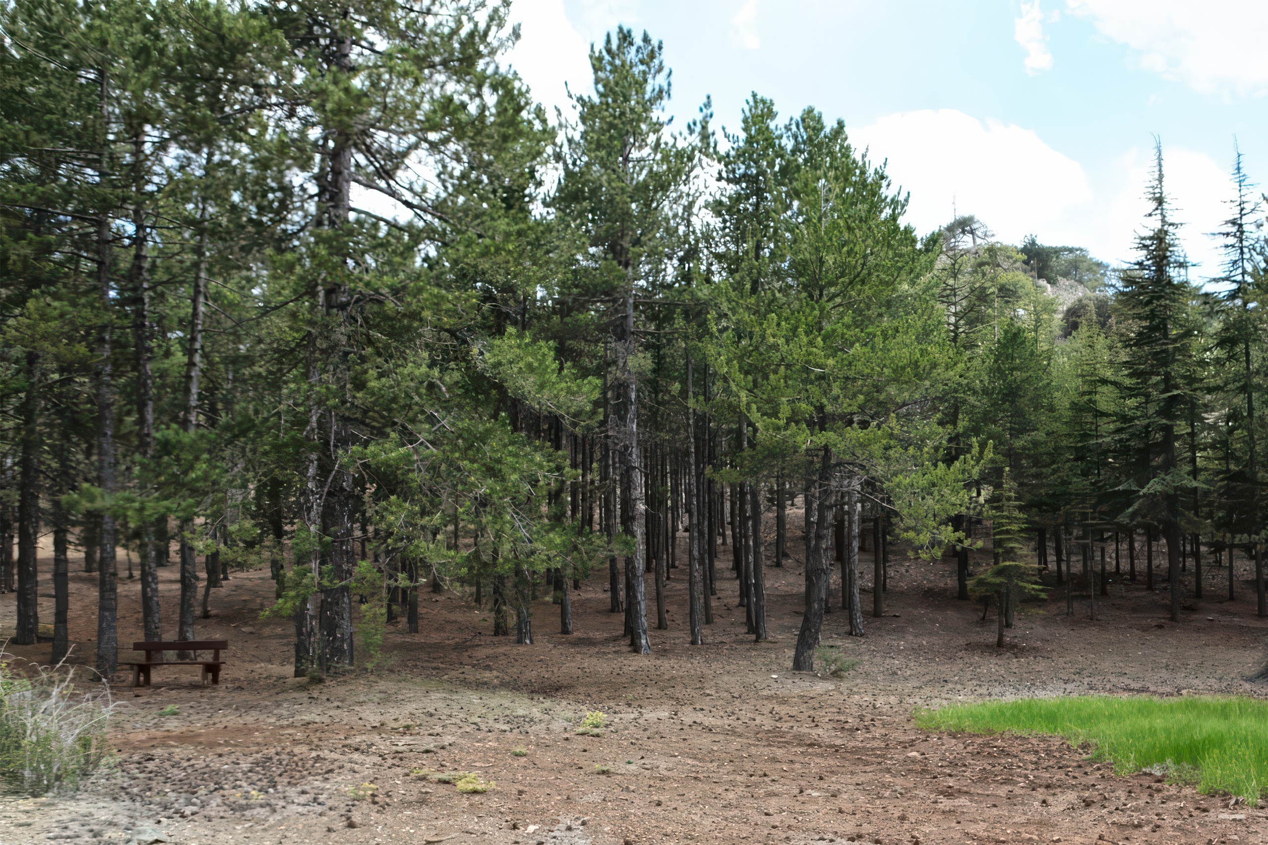
More than 600 plant species grow within the park, including 27 endemic to Cyprus. The dominant tree is the Calabrian pine, known scientifically as Pinus brutia. These pines form dense stands across much of the forest, either alone or mixed with other species.
The endemic golden oak, Quercus alnifolia, appears throughout the forest, particularly at mid-elevations. Known locally as latzia, this small tree forms thick colonies on rocky slopes. Its leaves display a golden underside created by dense hair coverings, which reduce water loss in dry conditions.
Lower elevations include Mediterranean vegetation such as olive trees, hawthorn, terebinth, and cistus shrubs. Some areas regenerate naturally, while others consist of plantations established after fires damaged sections of the forest.
Rocky outcrops create microhabitats for specialized plant species. These include Pterocephalus multiflorus, Ptilostemon chamaepeuce, and Arabis purpurea, which grow on nutrient-poor soils and exposed slopes.
Protected endemic species include Crocus hartmannianus and Crocus cyprius. Crocus hartmannianus grows at 600 to 900 meters and blooms in January with pale lilac flowers marked by deep violet lines.
Surprising Facts About Mountain Wildlife
The forest harbors several endemic bird species found only in Cyprus. Endemic species include the Cyprus Warbler, Cyprus Wheatear, Coal Tit, Scops Owl, and Jay. The Cyprus Warbler lives year-round in dense scrubland and forest edges, where its distinctive call echoes through the vegetation.
The Cyprus Wheatear prefers rocky areas and cliff faces, establishing territories among boulders and outcrops. Both species have evolved distinct characteristics that separate them from their mainland relatives.
The forest supports a healthy population of Bonelli’s Eagle, Cyprus’s only breeding eagle species. The current Bonelli’s eagle population in Cyprus is estimated at 31-39 breeding pairs, with 70 percent of nests built on large Calabrian pine trees at an average altitude of 625 meters.
These magnificent raptors build massive stick nests in the tallest pines, returning to the same sites year after year.
Protected endemic plant species include Crocus hartmannianus and Crocus cyprius.
Crocus hartmannianus is found in just four mountain localities, where it grows at 600-900 meter altitude on stony hillsides in scrub or under sparse coniferous woodland. This rare crocus blooms in January, producing pale lilac or white flowers with distinctive deep violet markings.
Recreational Facilities and Activities
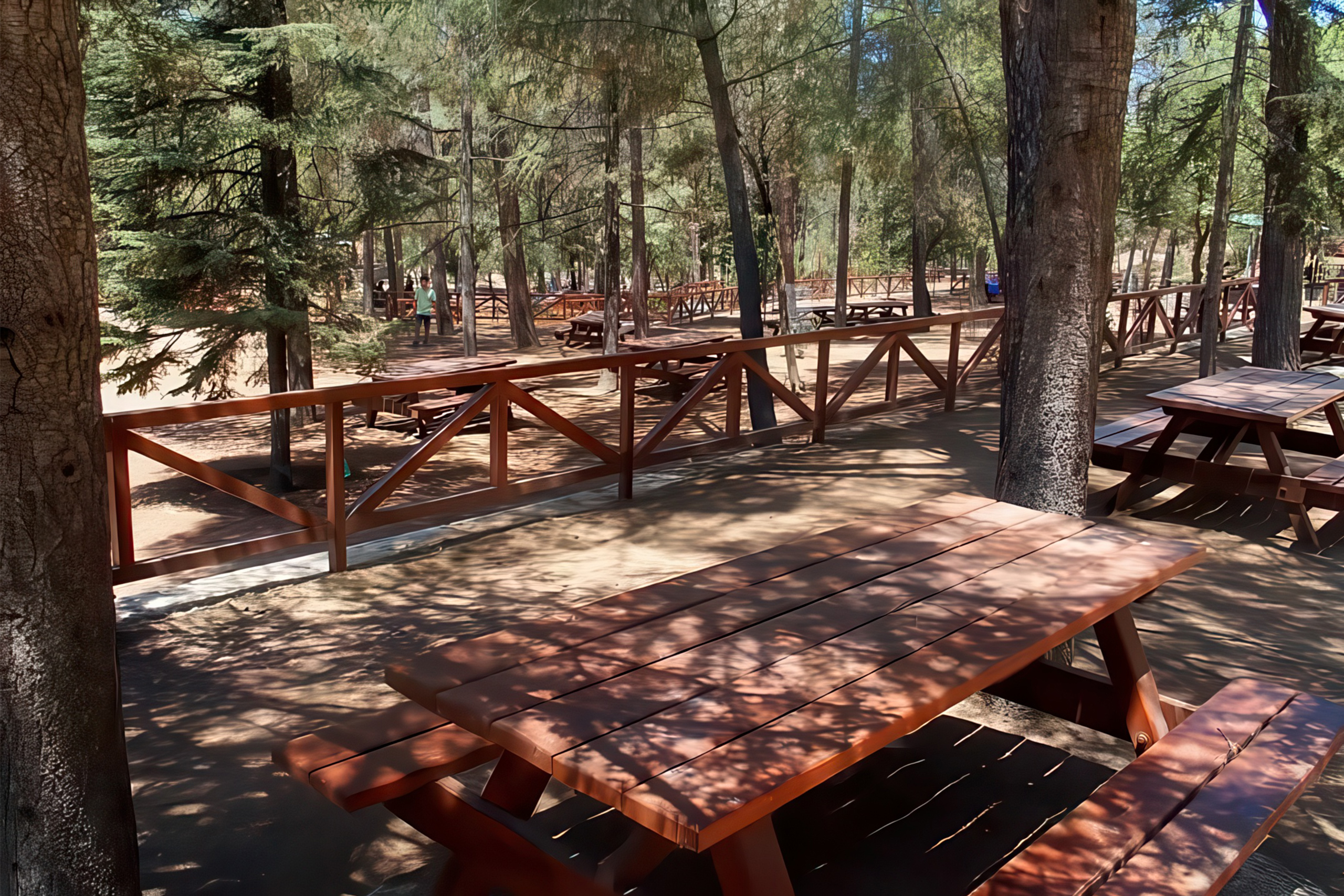
The park maintains three picnic areas equipped with tables, drinking water, parking spaces, toilets, and children’s playgrounds. These sites have a combined capacity of approximately 2,200 people. The Mantra Kampiou picnic site is among the most popular facilities.
The Kionia recreational area, near the fire observation station at 1,423 meters elevation, attracts cyclists for its beautiful mountain biking routes and panoramic views from the radar area.
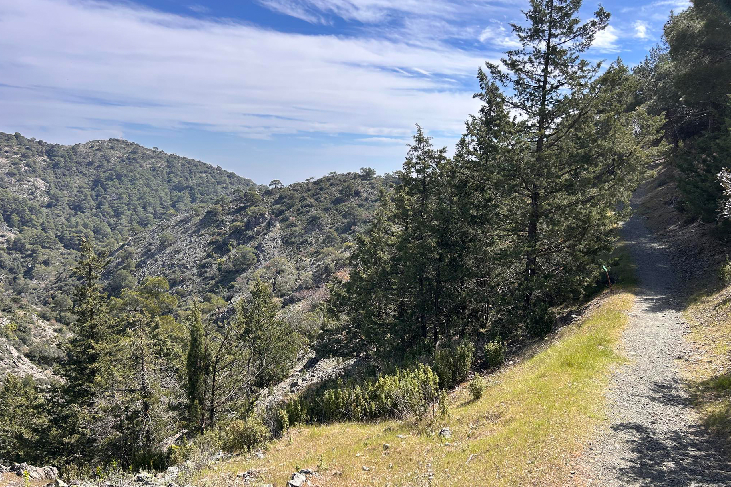
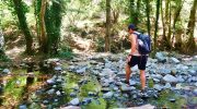
Five nature trails operate within the park, covering a total distance of 19 kilometers. One trail was specifically designed for wheelchair accessibility. All trails feature informative signs marking points of special interest. The trails range from easy walks to more challenging hikes, accommodating different fitness levels. Forest roads also serve mountain bikers who use the park for sport.
Wine Route Number 7 crosses through the Machairas area, connecting the forest to the island’s viticulture heritage. The combination of natural beauty, recreational facilities, and cultural attractions draws both local and foreign tourists throughout the year.
Visiting the Park
The National Forest Park of Machairas is open year-round and offers free access to visitors. The proximity to Nicosia makes it an ideal day-trip destination. Visitors should bring adequate water and snacks, as facilities within the park are limited. Comfortable walking shoes are essential for trail exploration. Early morning or late afternoon visits offer cooler temperatures and fewer crowds.
The park provides a peaceful escape from urban life while maintaining accessibility. The combination of natural beauty, recreational opportunities, historical sites, and wildlife observation makes Machairas one of Cyprus’s most valuable protected areas. The forest demonstrates how conservation efforts preserve ecological functions while allowing public enjoyment and education about Mediterranean ecosystems.