Explore Cyprus with Our Interactive Map

Explore our top stories and discover ideas worth your time.

Stavros tis Psokas Forest

Stavros tis Psokas Forest

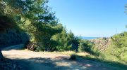
Stavros tis Psokas Forest sits at 900 meters elevation in the Paphos Forest, located roughly halfway between the coastal towns of Paphos and Polis Chrysochous. This remote forest station covers part of the 603 square kilometers that make up the largest and most extensive forest complex in Cyprus. The area takes its name from the Stavros tis Psokas river, a tributary of the Chrysochou River that flows through this mountainous region. The forest station serves as the operational headquarters for the Paphos branch of the Department of Forests and has become a popular destination for nature enthusiasts who want to experience Cyprus beyond its beaches. Historical Background The Paphos Forest extends from near sea level up to the peak of Tripylos at 1,352 meters. The climate is typically Mediterranean with prolonged dry and hot summers and short, rainy, but mild winters. Winter temperatures average 10°C at the lowest elevations and 5°C at the highest altitude, while summer brings 35°C in the lowlands and 22°C at the peaks. Annual rainfall ranges from 450mm in lower areas to 900mm at the mountain tops. The forest has provided resources for human populations for thousands of years. Historical records show Cyprus was once an important shipbuilding center and timber exporter, which led to extensive forest exploitation. By the 19th century, Cyprus had the largest…

Read more
Cyprus Citrus Groves

Cyprus Citrus Groves

Citrus trees have never been a background crop in Cyprus. They reshaped coastal plains, sustained export economies, scented villages with orange blossom, and anchored everyday cooking. Oranges, lemons, grapefruits, and local hybrids thrive where mild winters meet long sunlight hours, making citrus one of the island's most recognisable and enduring farming traditions. Even as Cyprus modernises, citrus remains a quiet constant, rooted in land, memory, and daily life. Why Citrus Took Hold in Cyprus Citrus farming in Cyprus is defined by geography. The island’s coastal plains provide exactly what citrus trees require: frost-free winters, fertile soils, and long growing seasons. Unlike vineyards that climb into the mountains, citrus orchards stay close to the sea, shaping lowland landscapes around Morphou, Limassol, and Paphos. These groves were never ornamental. They provided reliable harvests, export income, and household staples, becoming as common in village courtyards as in commercial plantations. Over time, citrus trees blurred the boundary between agriculture and domestic life, integrating farming directly into everyday routines. The Coastal Landscapes That Grow Citrus Citrus orchards are closely tied to Cyprus’s coastal geography. The most productive groves sit on fertile alluvial soils where irrigation can be carefully managed. Historically, regions such as Morphou developed reputations as citrus heartlands due to access to natural springs and groundwater flowing from the Troodos foothills. Limassol’s coastal zones…

Read more
Machairas Monastery

Machairas Monastery

Machairas Monastery, officially known as the Monastery of Panagia Machaira, is a historic monastery located about 40 kilometers from Nicosia in the mountainous interior of Cyprus. Built near Mount Kionia at an elevation of approximately 870 meters, the monastery is surrounded by dense pine forests and overlooks the Pediaios River, the island’s longest waterway. Its fortress-like position on a steep hillside makes it one of the most recognizable monastic sites in Cyprus. Machairas Monastery is considered one of the island’s three most historically significant monasteries alongside Kykkos Monastery and Agios Neophytos Monastery. The monastery historically held stavropegic status, which granted it administrative independence from the Archbishopric of Cyprus. The Discovery of a Sacred Icon According to local tradition, the monastery’s famous icon was associated with the Byzantine period and linked to the Church of Blachernae in Constantinople. During the eighth-century period of iconoclasm, when many religious images were removed or destroyed across the Byzantine Empire, the icon was reportedly transported to Cyprus and hidden in a cave for preservation. Around 1145, two hermits named Ignatios and Neophytos are said to have discovered the cave concealed behind thick vegetation. Tradition states that they used a knife to clear access to the site. The Greek word for knife, machairi, later influenced both the icon’s name, Machairiotissa, and the monastery’s name. Machairas Monastery…

Read more