The Troodos Mountains cover roughly one-third of Cyprus, stretching across most of the western portion. Mount Olympus rises to 1,952 meters, making it the island’s highest peak. These mountains formed through the collision of African and European tectonic plates, pushing ancient seabed rock formations skyward over millions of years.
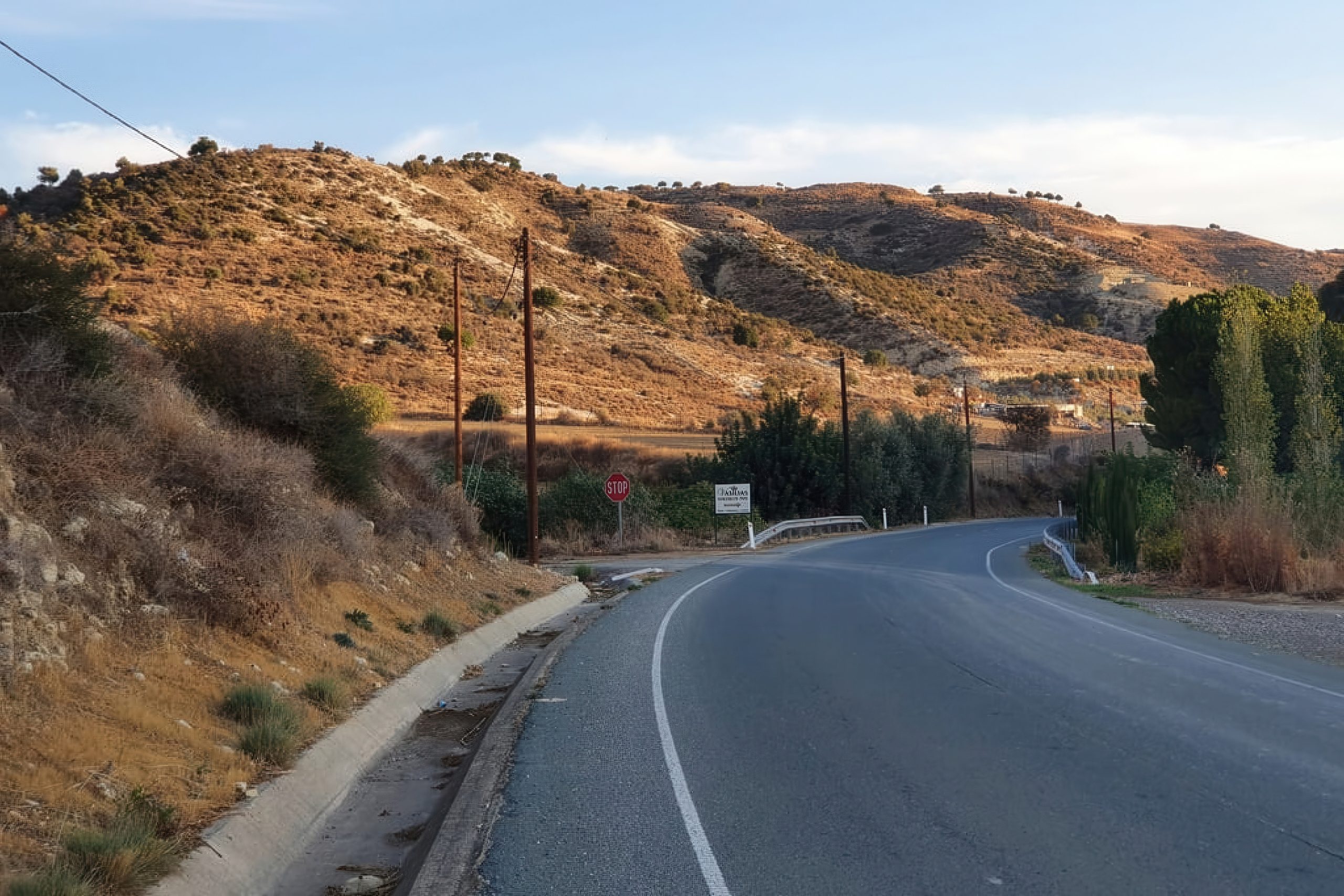
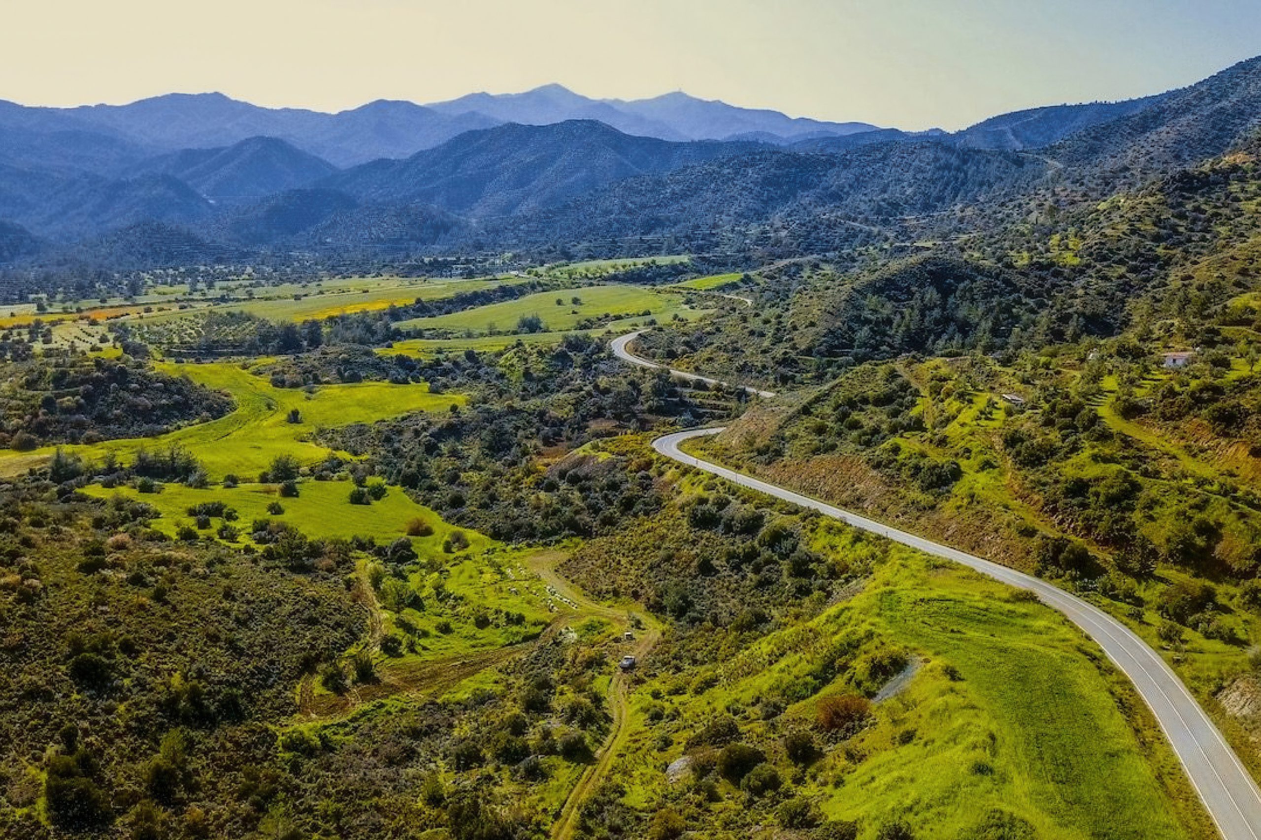
The landscape varies dramatically within short distances. Coastal areas sit at sea level while mountain villages perch at elevations exceeding 1,000 meters. Steep valleys cut through the terrain, with rivers carving gorges that modern roads must somehow cross.

In 2011, heavy rainfall triggered 128 separate landslide incidents in Paphos, causing significant damage to roads and buildings. These geological realities force engineers to constantly assess slope stability when planning new infrastructure. The island’s geology includes unstable clay-rich soils and fractured rock formations that shift during rainfall, creating ongoing maintenance demands.
Building Motorways Through Mountains
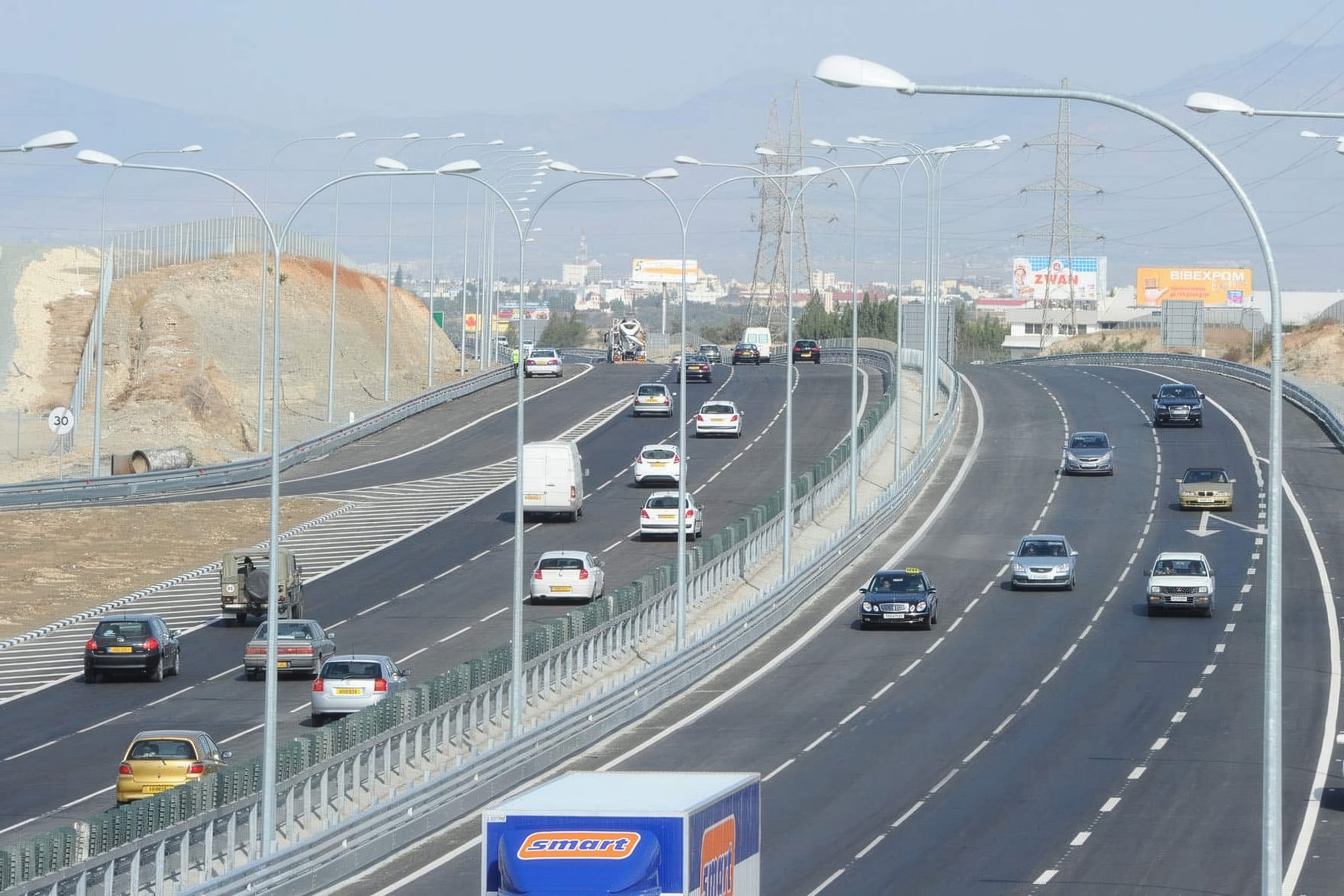
Cyprus developed its motorway network relatively recently compared to European neighbors. The A1, completed in October 1985, became the island’s first motorway. Despite this late start, Cyprus now leads all European Union members with 36.8 kilometers of motorway per 100,000 inhabitants.
The network totals approximately 7,206 kilometers of paved roads and 4,387 kilometers of unpaved routes. No toll roads exist anywhere on the island. The Public Works Department manages motorways and major roads, while municipalities handle urban streets and district authorities oversee rural routes.
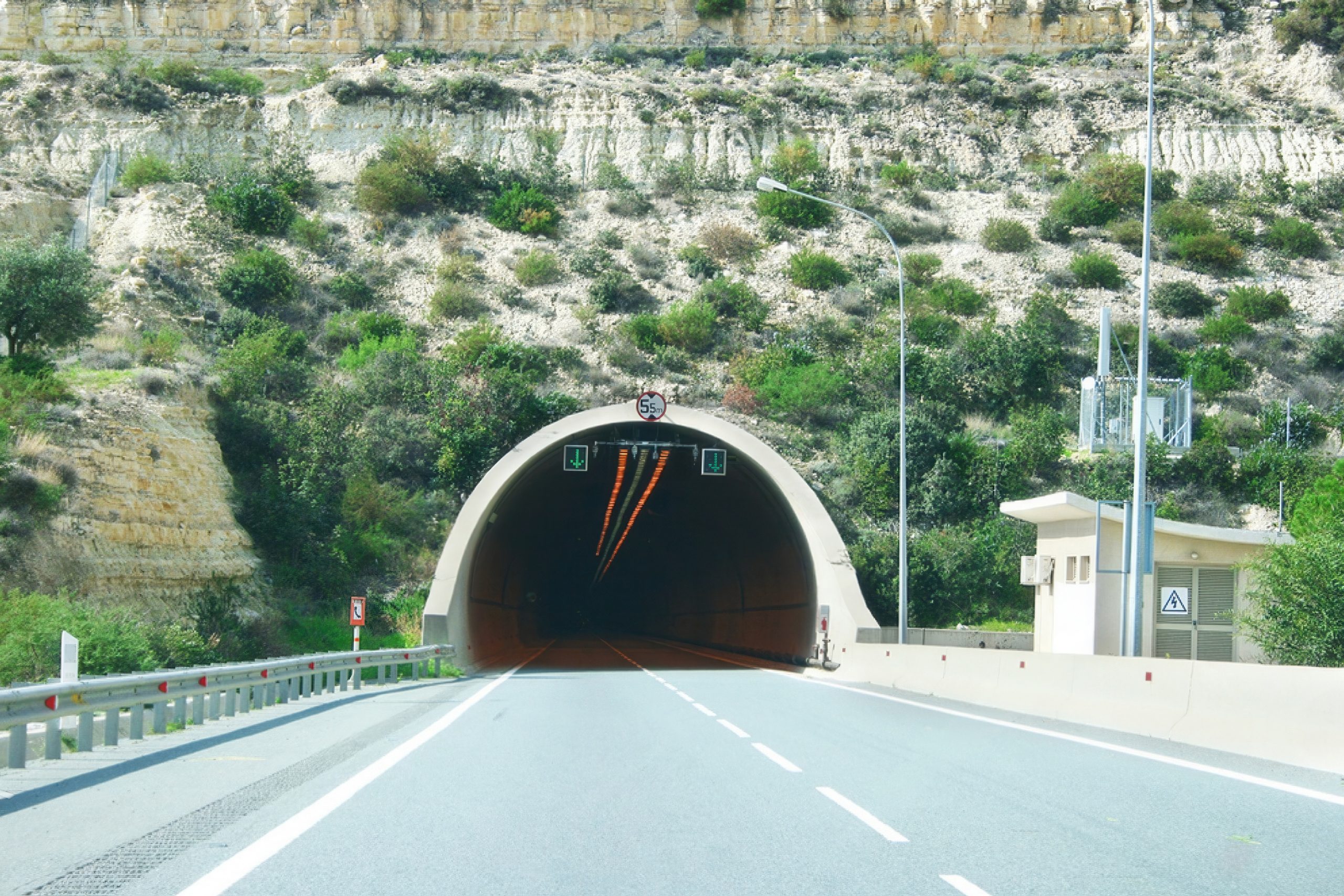
The A6 motorway connects Limassol with Paphos across 66 kilometers of challenging terrain. This route required engineering solutions unprecedented in Cyprus. The motorway features two parallel 950-meter tunnels, one for each direction, cutting through the Western Sovereign Base Area. These remain the only public road tunnels on the entire island.
The A6 also includes a massive viaduct near Petra Tou Romiou. This bridge stands 110 meters tall and stretches 550 meters in length. For comparison, that height equals a 36-story building. The structure allows traffic to cross deep valleys without the dangerous descents and climbs that characterized older roads.
The Paphos to Polis Challenge
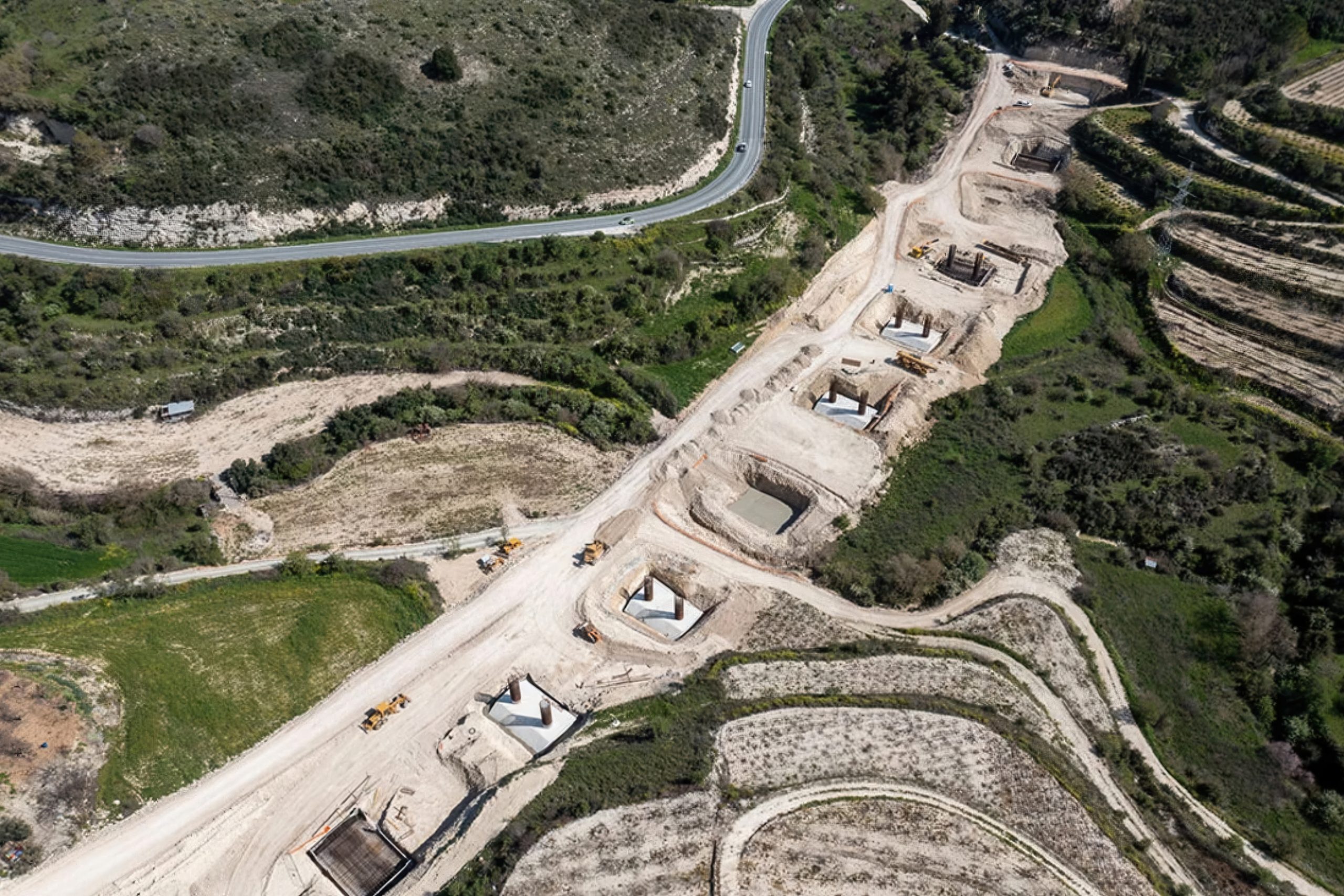
The Paphos-Polis motorway represents one of Cyprus’s most ambitious current infrastructure projects. The existing B7 road between these cities covers 90 winding kilometers through mountain terrain. Drivers face narrow passages, sharp curves, and roads that deteriorate rapidly under weather stress.
Construction began in July 2022 on the first 15.5-kilometer section from Paphos to Stroumpi. The full 31-kilometer motorway will include multiple engineering features designed to conquer the landscape. Two main tunnels near Kallepia and Stroumpi will total 3.5 kilometers in combined length, allowing traffic to bypass the most hazardous mountain sections.
Seven viaducts with a combined length exceeding 2 kilometers will span valleys too deep for conventional roadway construction. The longest viaduct will cross near Tsada, where steep terrain makes any ground-level route impractical. Bridge construction presents particular challenges in valleys where pillars must reach stable bedrock far below the surface.
The project will generate approximately 8 million cubic meters of spoil material from excavations. Engineers identified 47 potential disposal sites within 5 kilometers of the route, though they aim to use only a few large sites to minimize environmental impact. Finding disposal areas near the southern sections, particularly south of the Tsada tunnel, remains a priority.
Connecting Nicosia to Troodos
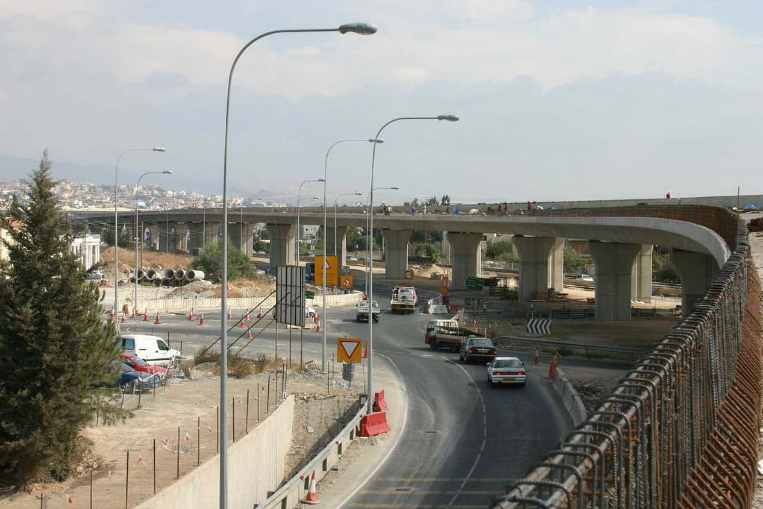
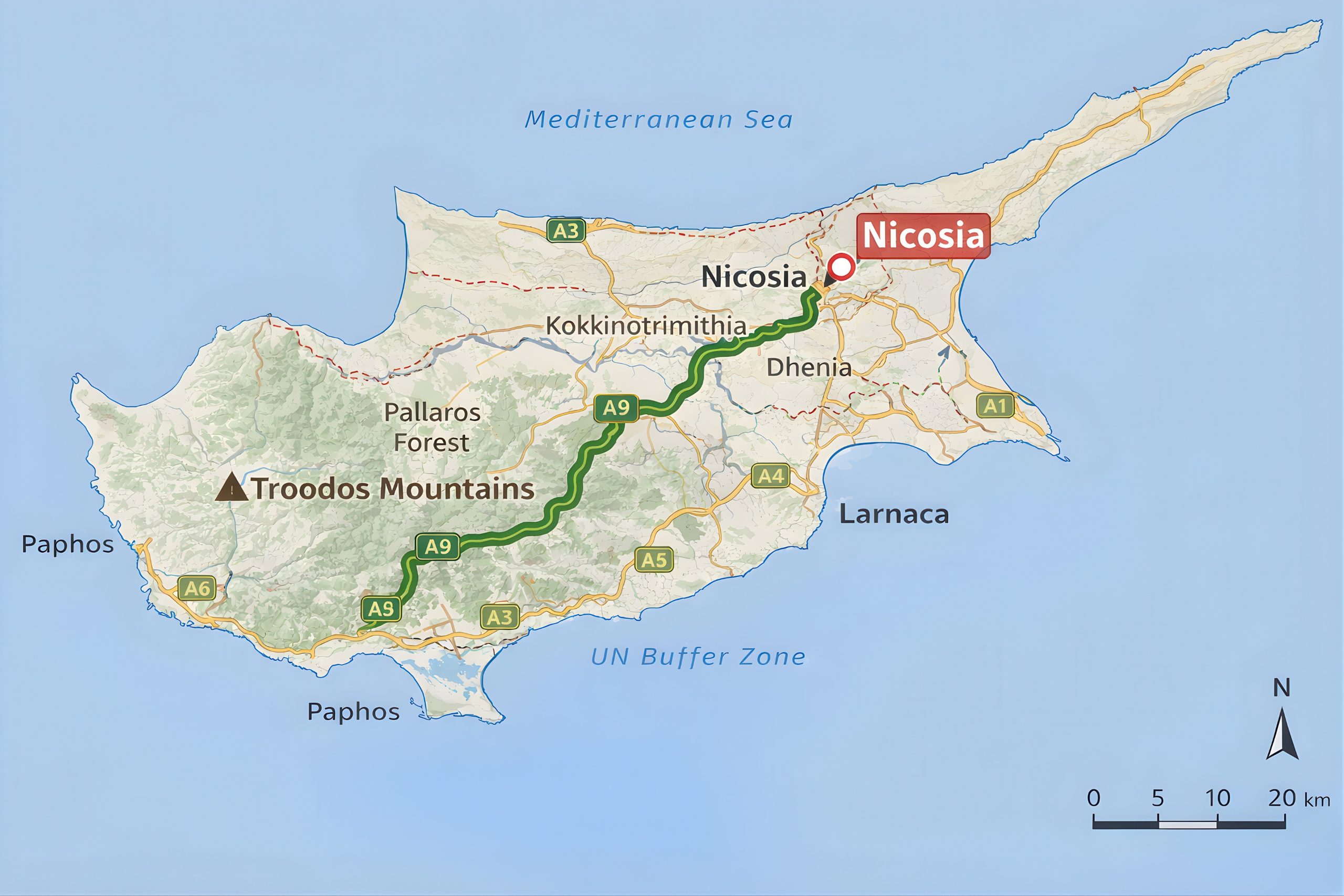
The A9 motorway project aims to link Cyprus’s capital with the Troodos mountain region. Currently, only the section from Kokkinotrimithia to Akaki stands completed, reaching the small village of Dhenia. Further sections remain under study as engineers develop solutions for increasingly difficult terrain.
This motorway will serve residents of mountain communities who currently rely on winding roads with limited safety features. The project appears in the National Strategic Plan for Mountain Communities, recognizing its importance for rural development. Better road access could slow urbanization by making mountain life more practical.
Valley crossings present the biggest engineering challenges. One planned section includes a valley bridge approximately 700 meters long spanning the Elia River near Vizakia. The bridge will require substantial foundation work to support its length while maintaining structural integrity across the gap.
The route will feature a rough interchange in the Kutraf area, plus two overpasses and two underpasses to connect areas on both sides of the motorway. At the intersection directing traffic toward Kalopanagioti and Kikko, engineers plan a terminal roundabout to manage multiple traffic flows.
Rural Road Quality Varies Widely
Motorways and major urban routes maintain excellent standards with regular resurfacing and clear signage. Rural and mountain roads present a different picture. Paved roads sometimes end abruptly, continuing as dirt tracks without warning. Drivers may find themselves on paths that appear to cross private property, though these often return to proper road status after a short distance.
Roadwork signage and safety measures have improved but still lag behind European standards. Workers only recently began consistently wearing reflective jackets. The signing and operation of roadwork sites sometimes direct traffic into potentially dangerous situations. Drivers should slow or stop when approaching roadwork areas until they confirm a safe path through.
The Infrastructure Investment Pays Off
Improved road infrastructure directly supports Cyprus’s tourism economy. The Paphos-Polis motorway will cut travel time between these cities by approximately 30 minutes, making previously remote areas accessible to day-trippers. Better roads increase property values in mountain villages and support local businesses.
Cyprus roads carry high traffic volumes relative to the island’s population. With 485 road motor vehicles per 1,000 inhabitants, the car dependency creates congestion during peak hours in major cities. New motorways help distribute traffic more efficiently, reducing bottlenecks on older routes.
Road construction also creates employment, though finding workers with appropriate skills remains challenging. The industry experienced a 5.4 percent decline in enterprises in 2020 compared to 2019, partly due to COVID-19 impacts. However, the volume index of production in civil engineering increased 5.1 percent between 2015 and 2020.
Northern Cyprus pursues separate infrastructure development with European Union support. The EU launched an aid program for the Turkish Cypriot community, including projects to expand and improve transport infrastructure. These efforts aim to alleviate deficiencies in energy, transport, water supply, and telecommunications.
Cyprus continues to demonstrate that small island nations can develop world-class infrastructure despite challenging terrain. From ancient Venetian bridges to modern viaducts, the island’s roads tell a story of human ingenuity overcoming geographical obstacles.