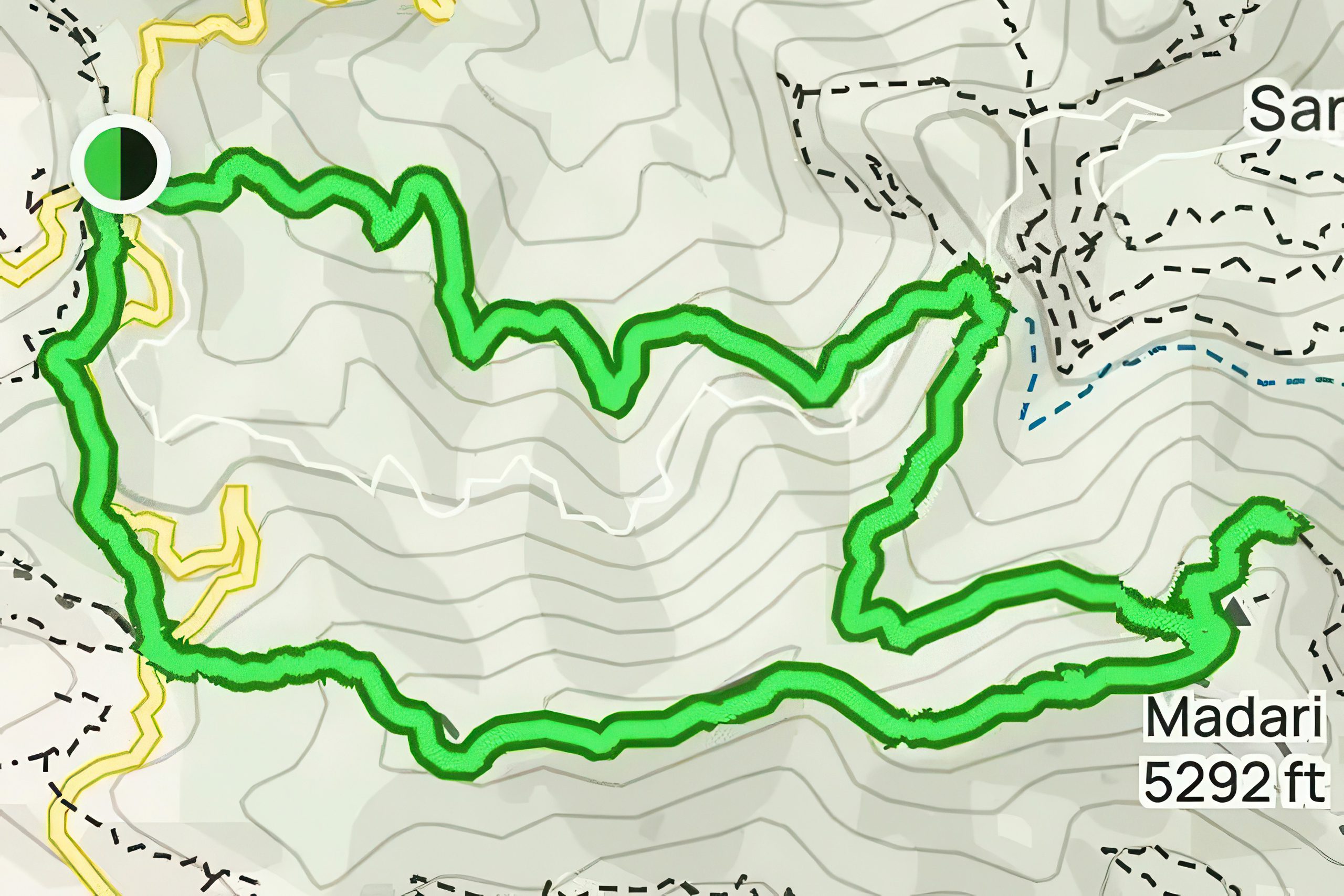
The Madari Circular Trail starts just outside the village of Kyperounta in the eastern Troodos Mountains and follows a well signed 13 kilometer route with approximately 650 meters of elevation gain through some of the most beautiful scenery the island has to offer. The trail is considered difficult based on the routes available in Cyprus, and the peak of the mountain reaches 1,600 meters. This superb circular trail winds around Madari mountain peak in the Pitsilia area of the Troodos mountain range.
The circular hike takes around 4 to 5 hours to complete. The route combines ridge walking with spectacular panoramic views, dense forest passages through the Adelfoi Forest, and unique geological formations. The trail ranks among the most beautiful hiking routes in Cyprus for its combination of vertical exposure, varied vegetation, and 360-degree vistas that span from the Mesaoria Plain to the Mediterranean coast.
- The creation of Cyprus's mountain trails
- Two distinct sections create one memorable journey
- The spectacular Madari Fire Lookout viewpoint
- Endemic plants make Madari botanically unique
- Dramatic geology shapes the mountain landscape
- Planning your hike on Madari trail
- Why this trail defines Cyprus hiking
The creation of Cyprus’s mountain trails
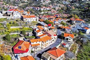
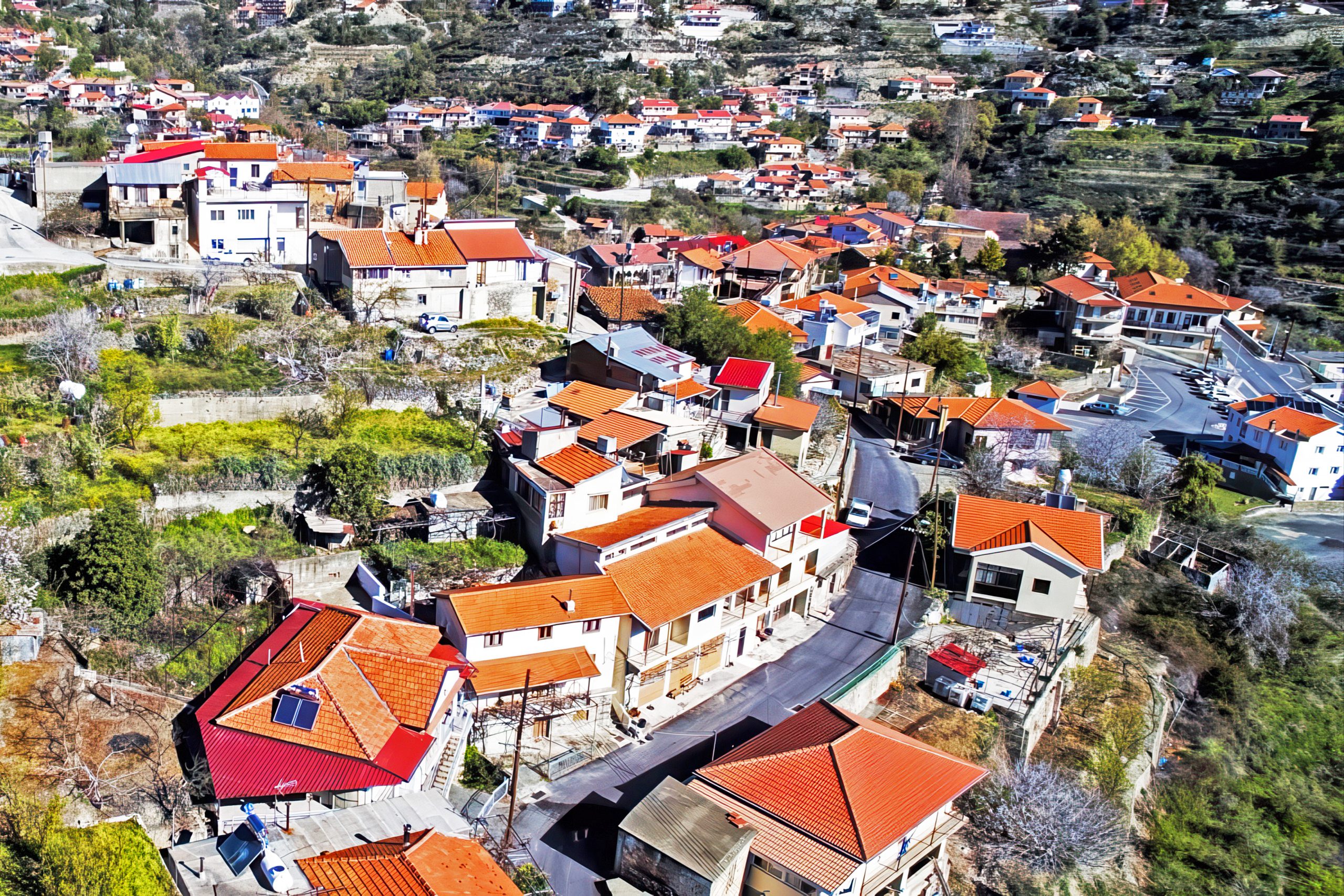
The Cyprus Forestry Department developed the Madari trail system as part of a broader initiative to create accessible nature trails throughout the Troodos Mountains. The Adelfoi Forest forms a natural boundary near Agia Marina Xyliatou in the Nicosia district and spans across more than 120 square kilometers. The trail network around Madari includes several interconnected routes that allow hikers to customize their experience. The starting point is called Doxa si o theos, which means praise God, just outside Kyperounta village.
The location received its name because of the route’s difficulty, and when hikers finish it they usually praise God for helping them out. The Department of Forests maintains the trail with clear markers, wooden signposts, and regular maintenance to ensure safety and accessibility. The Madari trail system connects with the European Long Distance Trail E4, which crosses Cyprus from north to south. Multiple starting points exist for the circular route, with Doxa si o theos being the most popular among local hikers.
Two distinct sections create one memorable journey
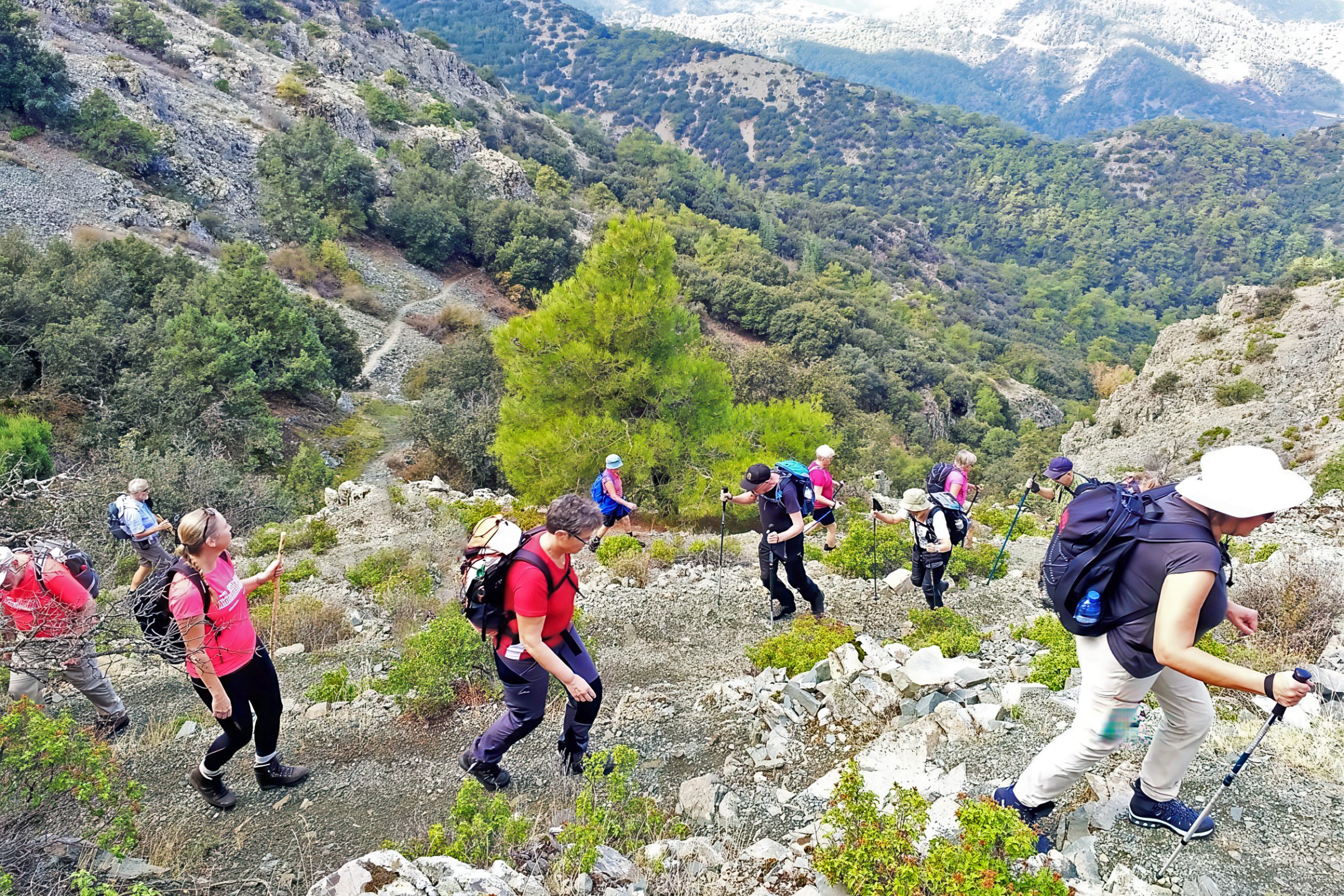
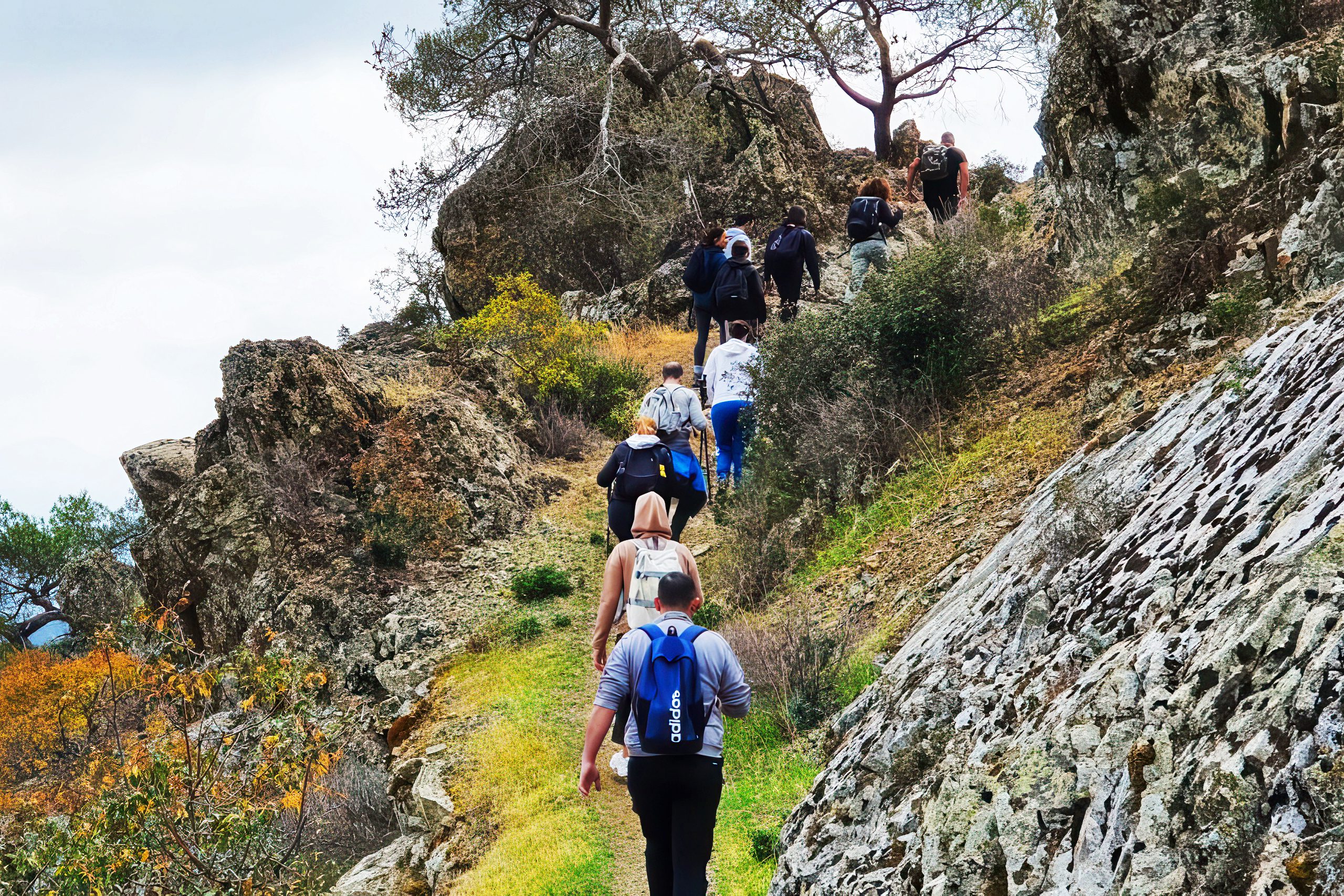
The first section extends from Doxa si o theos toward the Madari Fire Lookout and goes uphill, providing stunning panoramic views from both south and north at several viewpoints. To the south you can see the villages of Kyperounta and Chandria, and to the north you can see the coast of occupied Morfou and Mesaoria. This 4 kilometer section has some amazing views left and right with several rows of mountains to the north which belong to the greater mountain line of Troodos.
The ridge walk exposes hikers to wind and sun, with minimal tree cover creating unobstructed sightlines in all directions. The second section leaves Adelfi peak and goes downward for over six kilometers through one of the most beautiful forests in Cyprus.
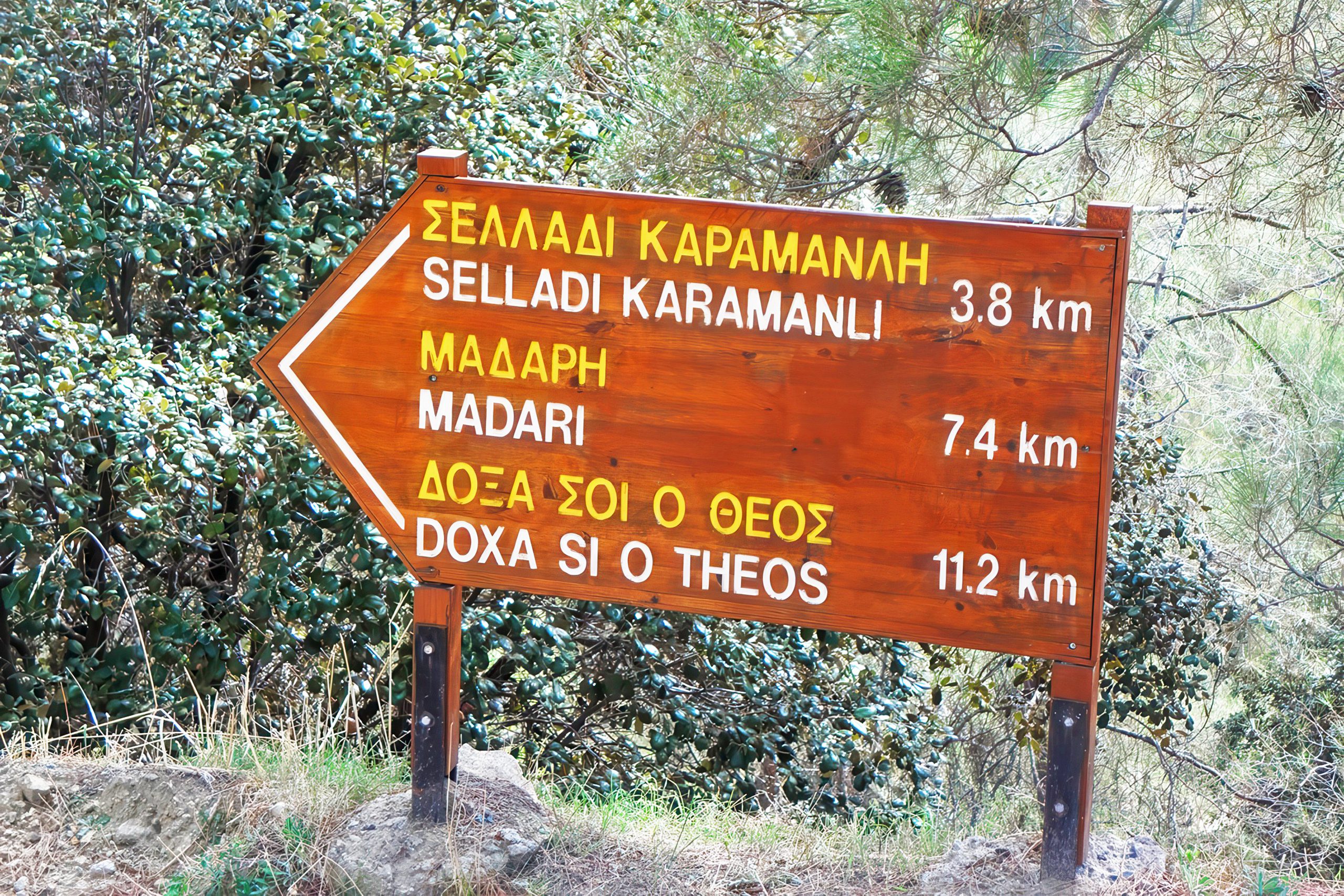
This section takes hikers to the location Selladi tou Karamanli via one of the most isolated routes on Troodos, with dense pines and centuries old junipers covering the Madari trail and providing broad shade. The forest descent offers completely different scenery from the exposed ridge, with cool temperatures even during summer months.
The spectacular Madari Fire Lookout viewpoint
At the highest point of Adelfoi mountain at 1,613 meters, you will find the Madari fire lookout tower. Madari stands at 1,612 meters above sea level as one of the prominent peaks in the Troodos range. The fire lookout tower operates during the summer fire season, with forestry personnel maintaining a constant watch for smoke or signs of wildfire. Hikers can climb the tower for 360-degree views that extend across nearly the entire island. On clear days, visibility reaches the Pentadaktylos Mountains to the north, the Akamas Peninsula to the west, and the southern coast near Limassol.
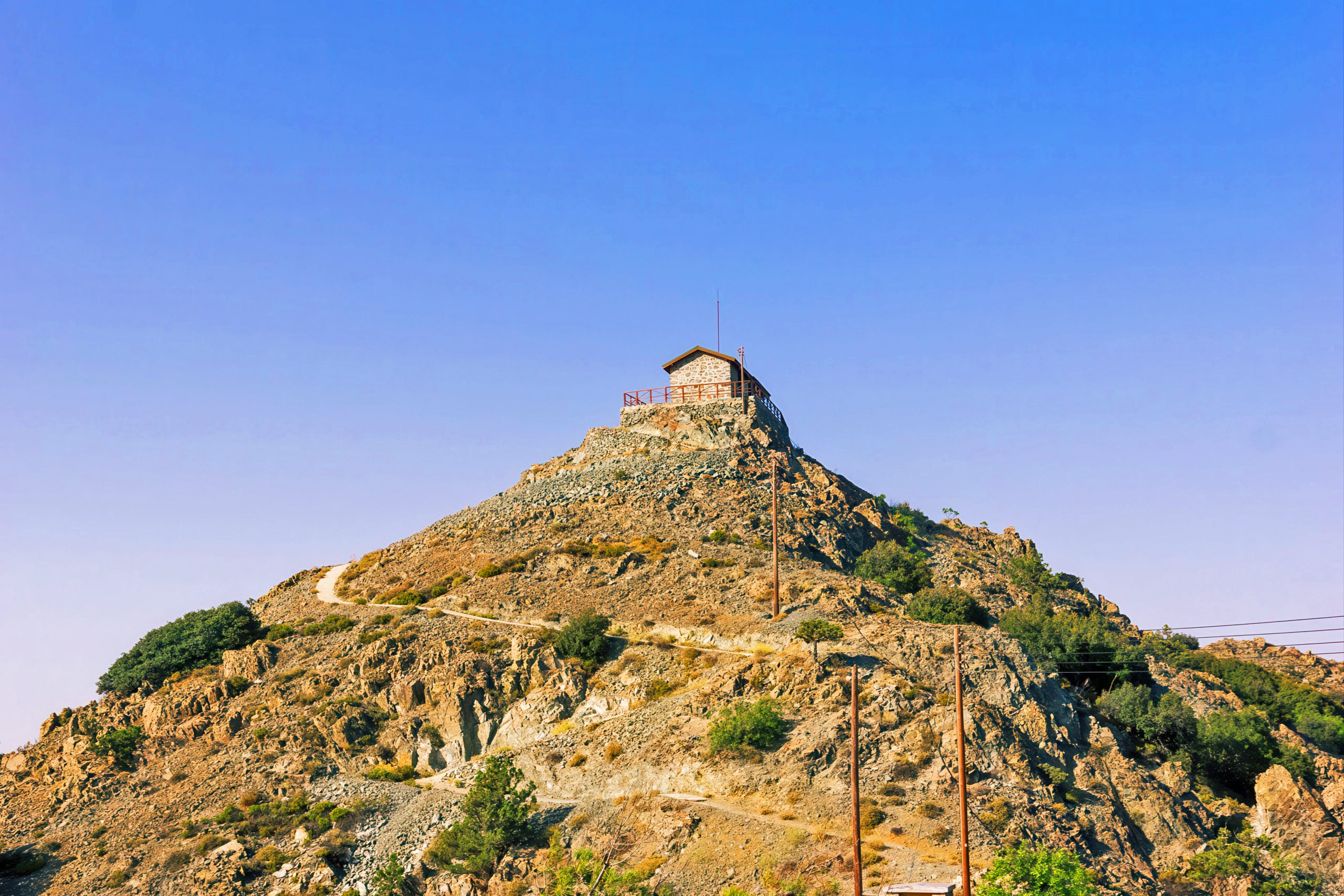
The tower stands as a landmark visible from many points along the trail, helping hikers gauge their progress. Hikers can shorten the full circular route by returning the same way from the fire station, reducing the total distance to 7.6 kilometers. Many people drive directly to the fire lookout via a paved road from Chandria village, though the final 800 meters becomes a narrow dirt road. This access allows visitors who cannot complete the full hike to still experience the summit views.
Endemic plants make Madari botanically unique
The Madari trail allows hikers to study endemic plants including Troodos rose, Troodos catmint, Star of Bethlehem, Chamomile, Manouthkia, Golden oak, Cyprus cedar, Cyprus crocus, and Thyme. The golden oak grows only on the igneous geological substrate of the Troodos Massif between elevations of 400 to 1,800 meters, either in a dense maquis by itself or in association with Turkish pine. Cypriot law protects the golden oak, while European Union law protects the scrub and low forest vegetation of the golden oak biota. Manouthkia is an evergreen small shrub with pale pink flowers.
The Cyprus cedar exists in small pockets within the Adelfoi Forest, representing one of only two endemic conifer species on the island. Travelers walk past golden oak, wild rose and mastic bushes, junipers, pine, strawberry trees, rock rose and sage, and even cedar, plane trees and bracken. Spring brings the most colorful displays, with crocuses and other wildflowers covering the meadows near the ridgeline. Autumn transforms the golden oak leaves into bronze hues that contrast with the evergreen pines.
Dramatic geology shapes the mountain landscape
There are tall impressive cliffs along the Madari trail as well as areas of geological interest. The area of Madari has interesting geology due to its vertical rocks and steep cliffs. The Troodos mountain range consists of ophiolitic rocks which are the most well developed and better known ophiolite complex in the world. The Troodos ophiolite formed on the ocean floor millions of years ago and was later thrust upward by tectonic forces, creating the current mountain range.
The vertical rock faces visible from the trail represent fractures and faults in this ancient oceanic crust. The series of tall vertical rock formations known as Teisia look like giant stone walls rising from the earth. These formations can be explored on the Teisia tis Madaris trail, a shorter 3.5 kilometer circular route that connects with the main Madari trail near the fire lookout. The rock formations create dramatic backdrops for photographs and demonstrate the powerful geological forces that created Cyprus.
Planning your hike on Madari trail
The Madari trail is accessible from Kyperounta village, located approximately 45 kilometers north of Limassol via the E909 road. When entering Kyperounta, pass the hospital on your left and after 1 kilometer you will see the road to Spilia on your left, the F944 road. Turn and continue for another 1.8 kilometers until you reach a small crossroad where you will see the stone stairs of Doxa si o theos on your right. Parking is available at this location. Alternative starting points include the Moutti tis Choras junction and directly at the fire lookout tower via the Chandria to Polystypos road.
The best times to hike are between March and May or between September and November. Early start is advised during July and August. Winter hiking is possible but snow may cover the trail in January and February, particularly above 1,400 meters elevation. There are no refreshment stops or drinking water on the hike, so enough provisions should be taken. There is a fountain with drinking water at the starting point Doxa si o theos. Proper hiking boots are essential due to the rocky and sometimes steep terrain. Bring layers of clothing as temperatures can drop significantly with altitude and wind exposure on the ridge.
Why this trail defines Cyprus hiking
The Madari Circular Trail showcases the full range of what Cyprus mountains offer to hikers. The combination of ridge walking, forest passages, geological features, endemic plants, and panoramic views creates an experience that captures the essence of Troodos. The trail demonstrates how accessible wilderness can be maintained without sacrificing its wild character. For Cyprus residents, Madari provides an escape to nature without requiring extensive travel, reinforcing the island’s identity as a place where mountains and sea exist in close proximity.
The trail system around Madari supports ecological tourism that benefits rural mountain communities like Kyperounta while protecting natural resources. The fact that the route follows a circular path rather than an out and back design shows thoughtful trail planning that maximizes visual variety. Completing the Madari Circular Trail gives hikers a genuine sense of accomplishment, having conquered one of Cyprus’s most challenging day hikes while experiencing landscapes that few visitors to the island ever see.


