
Kionia – Profitis Elias Nature Trail
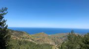
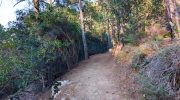
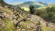
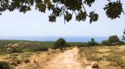
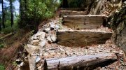
The Kionia to Profitis Elias Nature Trail represents a significant route within the Machairas forest network. This path connects the high peak of Kionia with the historic chapel of Profitis Elias. It offers a clear view of the eastern Troodos mountain range and the surrounding valleys. Visitors witness a landscape that transitions from dense pine thickets to open rocky ridges. The air at this altitude stays remarkably fresh and carries the scent of wild mountain herbs. This specific environment supports a variety of plants that flourish in the volcanic soil of the region. Each section of the track provides a new perspective on the natural history of the island. The path follows the ancient contours of the land to ensure…
Read more