Cyprus already had roads before the Romans arrived. The earliest routes date back to the Bronze Age, and by the end of the Hellenistic period, a road network circled the entire island. These pre-Roman roads connected cities with their surrounding territories and linked major settlements along the coast. However, they were often simple tracks suitable for pedestrians and pack animals rather than the engineered highways Romans built elsewhere in their empire.
When Cyprus became a Roman province in 22 BC under Emperor Augustus, the new administration inherited this existing network. The Romans added secondary roads and improved certain routes, but they did not rebuild the entire system to match the standards used in Italy or other provinces. This practical approach reflected Cyprus’s geography and peaceful status. The island was stable enough not to require a large military presence, so the roads served primarily civilian purposes rather than rapid military deployment.
Augustus and later Emperor Titus are credited in inscriptions as the creators of the formal Roman road system on Cyprus. The roads they established formed part of the imperial network, meaning they received official recognition and maintenance funding from Rome itself.
How the Road System Worked
The main roads formed a coastal highway that encircled the island, connecting all major cities. From this primary route, secondary roads branched inland to smaller towns and rural areas. The entire network converged on Salamis, the island’s economic center and most populous city. This layout demonstrates how economic forces shaped road development more than military strategy. Cities built roads to facilitate trade with their territories and to connect with neighboring urban centers.
Roman roads on Cyprus typically followed the natural terrain rather than forcing straight lines through mountains or valleys. In mountainous regions, roads used winding paths and switchbacks to manage steep grades. This practical approach differed from the famously straight Roman roads found in flatter terrain elsewhere. The topography of Cyprus, with its mountain ranges running east to west across much of the island, made aggressive engineering projects unnecessary and expensive.
The width and construction quality of Cyprus roads varied considerably. Many routes never reached the high engineering standards of roads in Italy or Gaul. Some sections used paving stones, while others remained packed earth. The Romans did not systematically upgrade all pre-existing roads to their usual specifications, though inscriptions indicate renovations occurred in 198 AD, particularly in western Cyprus.
Historical Background
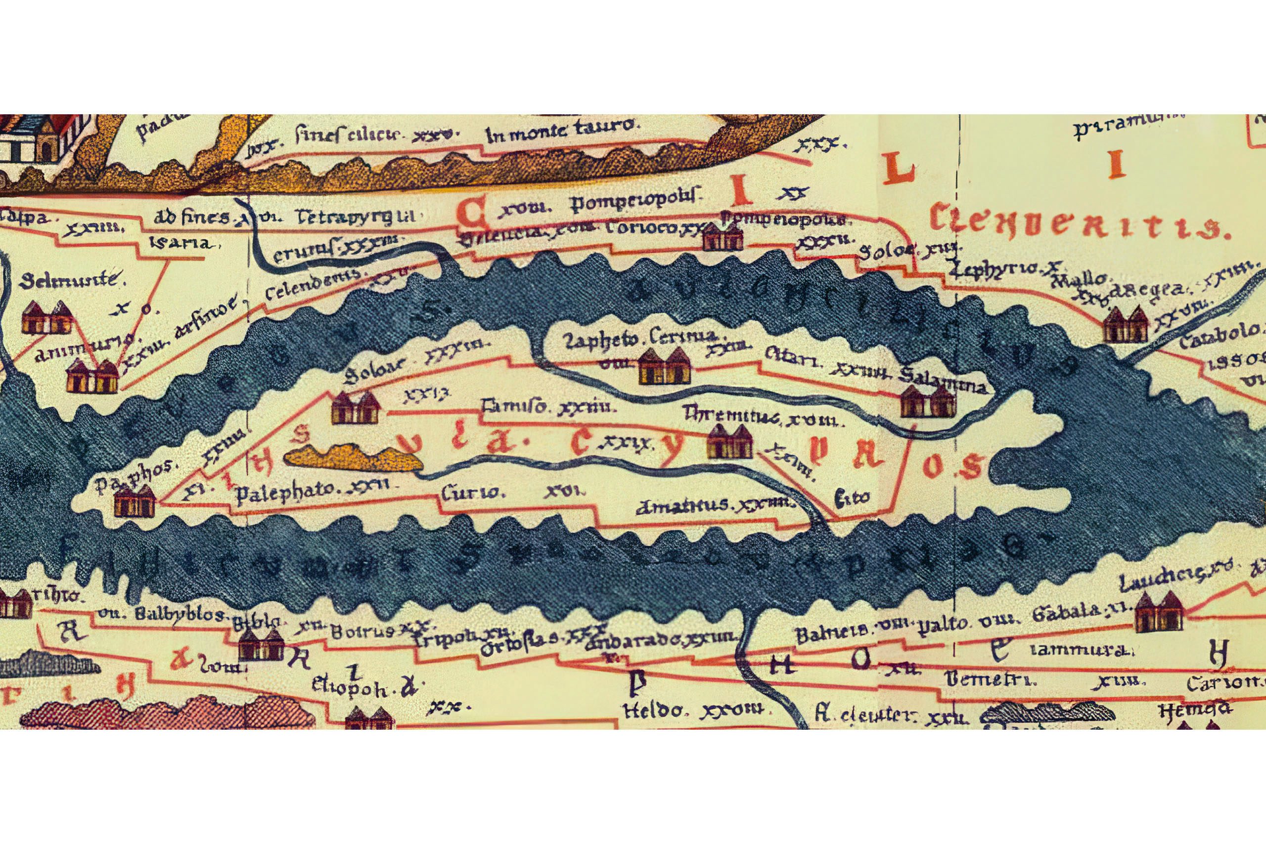
Roman milestones on Cyprus serve as valuable historical documents. Thirty milestones have been found and recorded, mostly in mountainous regions along the coastal highway. These cylindrical stone markers stood at intervals along roads.
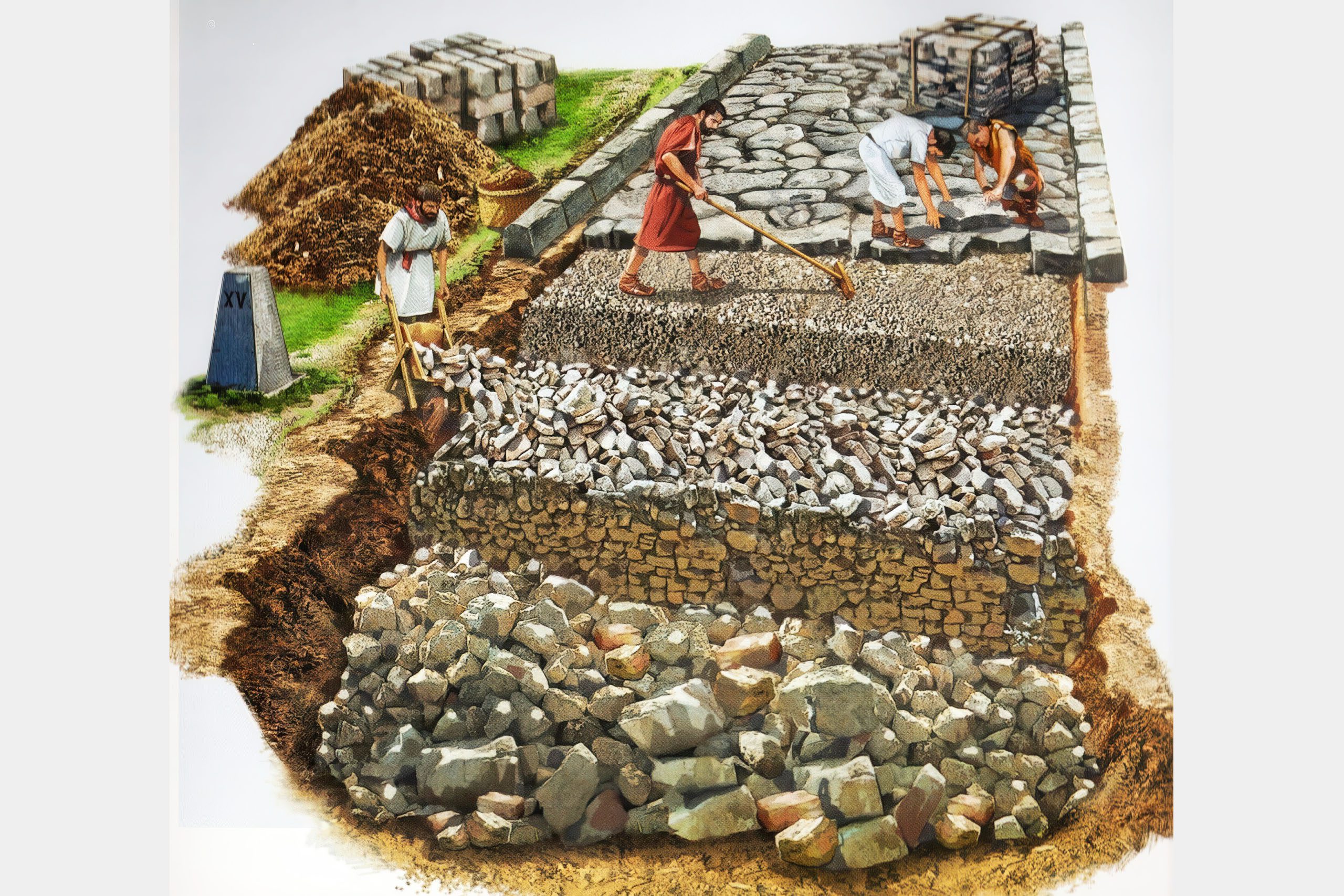
The inscriptions on milestones included several key details. They showed the distance to the nearest city, typically measured in Roman miles. They recorded the names and titles of emperors who funded road construction or repairs. Some milestones also mentioned local officials responsible for maintenance work. This information allows historians to date roads and track which emperors invested in Cyprus infrastructure.
The milestone inscriptions reveal three distinct phases of road development and maintenance. During the first phase under Augustus and Titus, emperors directly sponsored road building as part of establishing Roman administration on the island. The inscriptions emphasize imperial authority and present the roads as gifts from Rome to Cyprus.
In the second phase during the Severan period in the late second and early third centuries AD, responsibility shifted to local cities. The proconsul coordinated activities, but individual cities funded and maintained roads within their territories. This change made road upkeep a civic duty rather than an imperial project.
The third phase lasted approximately 150 years and saw little new construction. During this period of stagnation, old milestones were sometimes reused. New inscriptions on these recycled stones served more as imperial propaganda or expressions of loyalty than as markers of actual construction work.
In areas where building materials were scarce, milestones were frequently reused for other purposes. This practical recycling means some original road markers have been lost to time, making complete reconstruction of the ancient road network challenging.
Recent Archaeological Discoveries
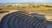
Australian archaeologists from the University of Sydney have uncovered significant evidence of Roman road infrastructure at Nea Paphos, the island’s capital during the Hellenistic and Roman periods. Their excavations near the ancient theater revealed two main colonnaded roads in the city center.
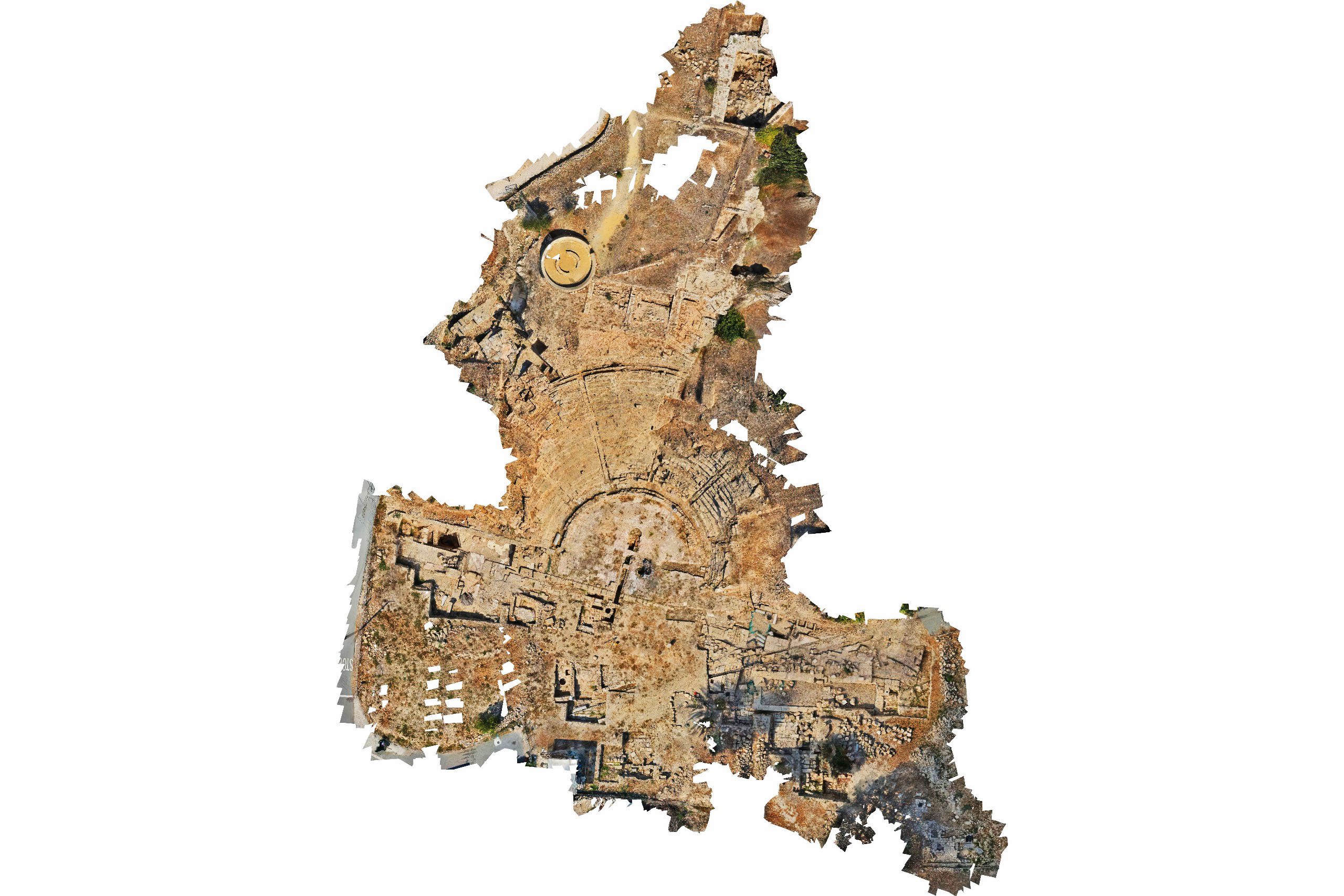
One road ran north to south, connecting the harbor directly to the theater district. This route would have been the main artery for goods and visitors arriving by sea. The second road, measuring 8.40 meters wide, ran east to west behind the theater. These colonnaded streets, lined with massive granite columns, demonstrated Roman civic order and provided shaded walkways for pedestrians.
The discovery of over 160 fragments of granite columns around the theater allowed researchers to map where these colonnades stood. The columns were imported architectural elements, part of the massive Roman trade in monumental building materials. As the capital city, Nea Paphos received architectural adornments that marked its importance within the empire.
Road Maintenance and Administration
During the Roman period, the question of who paid for road construction and maintenance remained somewhat unclear. The central government may have covered all costs for roads on the imperial network, or expenses may have been shared between Rome and local cities. Evidence suggests both arrangements existed at different times and for different roads.
Under the Severan emperors, road maintenance became explicitly a civic duty. Cities took responsibility for routes within their territories, though the proconsul coordinated their efforts. This system distributed the financial burden while maintaining centralized oversight.
In addition to formal roads, informal cross-country routes continued to be used. These unofficial paths connected rural areas and provided shortcuts for local travel. They represented the practical reality that not all movement required engineered roads, especially for people traveling short distances on foot or with pack animals.
Understanding the Broader Network
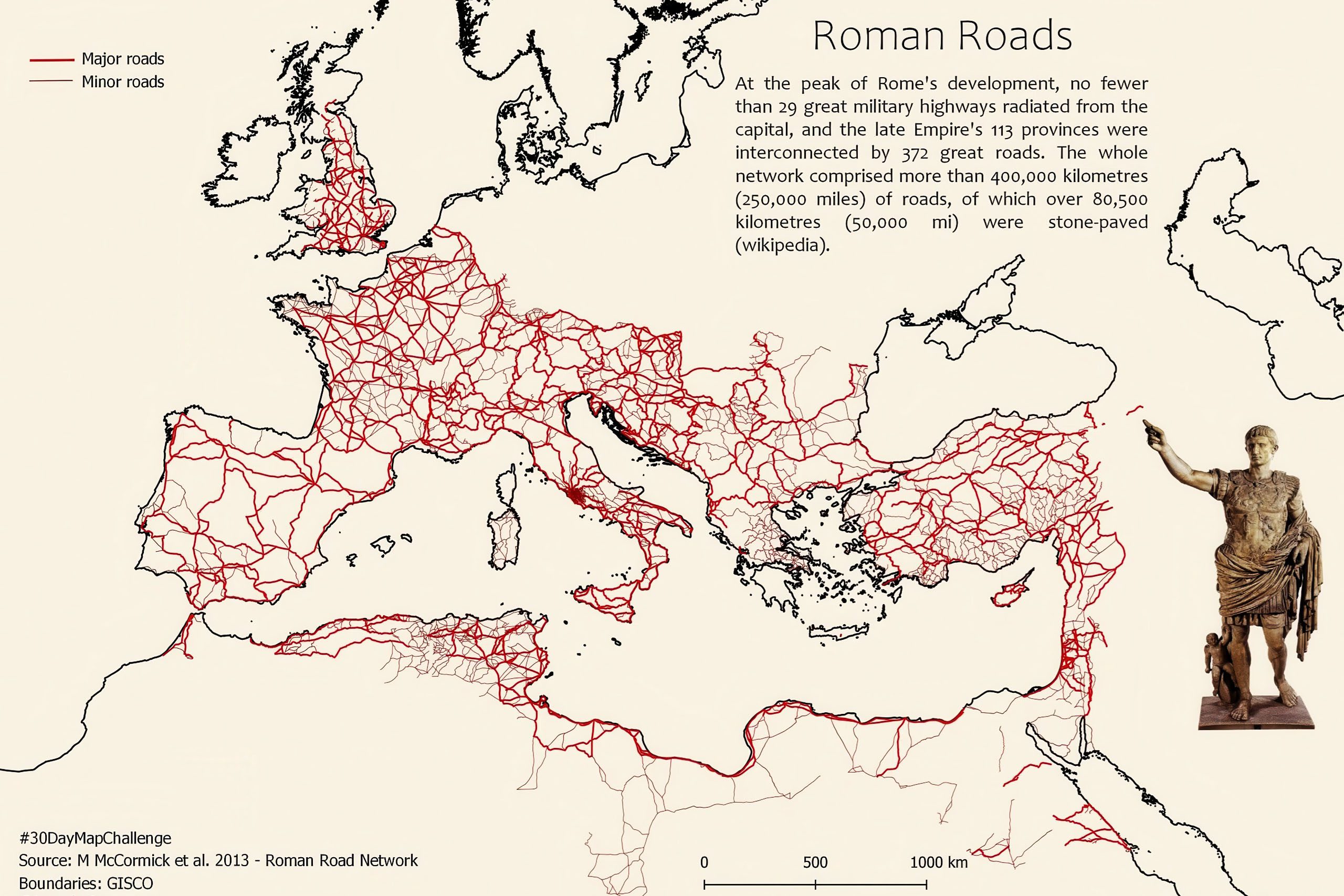
Recent digital mapping projects have revolutionized understanding of Roman roads across the empire. The Itiner-e project, published in 2025, increased the known length of Roman roads from approximately 188,555 kilometers to 299,171 kilometers. This nearly 100,000 kilometer increase resulted from improved coverage of regions including the Iberian Peninsula, Greece, and North Africa, as well as more accurate mapping that followed geographical reality rather than assuming straight lines.
Only 2.7 percent of Roman road locations are known with certainty. Nearly 90 percent are conjectured based on archaeological evidence like settlements, milestones, and other findings that indicate a road existed in that area. About 7.4 percent are hypothesized based on historical records and geographic inference.
The roads were classified into main roads and secondary routes. Main roads comprised 34.6 percent of the total network, while secondary routes made up 65.4 percent. This classification reflects the hierarchy of importance and traffic volume different routes handled.
Cyprus in the Imperial System
The Roman road system operated at a continental scale unprecedented until the industrial revolution. It enabled Rome to administer an empire spanning from Britain to Egypt and Syria, encompassing over 55 million people at its height around 150 AD. Cyprus occupied an important position in this network as a major Mediterranean island with valuable resources and strategic location.
The island’s copper mines and timber resources attracted Roman interest, but its prosperity under Roman rule depended heavily on maritime trade. The road network complemented sea routes by moving goods from inland areas to coastal ports and by connecting port cities with administrative centers.
Cyprus roads also served symbolic purposes. The presence of Roman-style roads and milestones bearing imperial names reinforced the island’s integration into the empire. When emperors funded road work, the milestones celebrating their generosity reminded travelers of Rome’s benevolent power. When cities maintained roads as a civic duty, it demonstrated local participation in the imperial system.
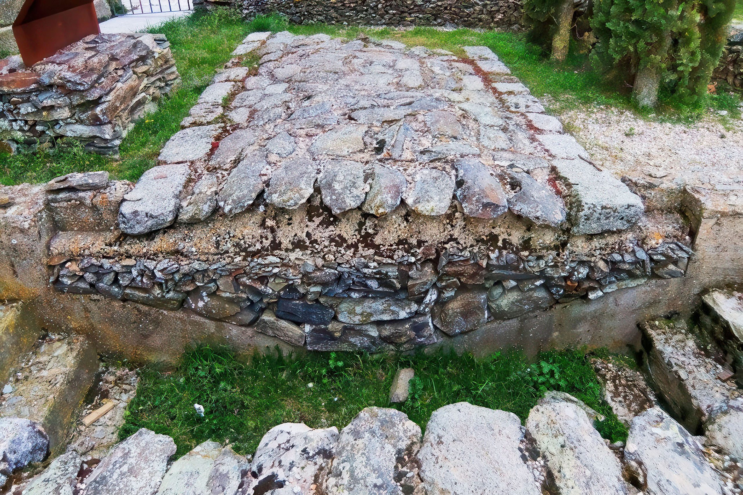
Preservation and Current State
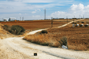
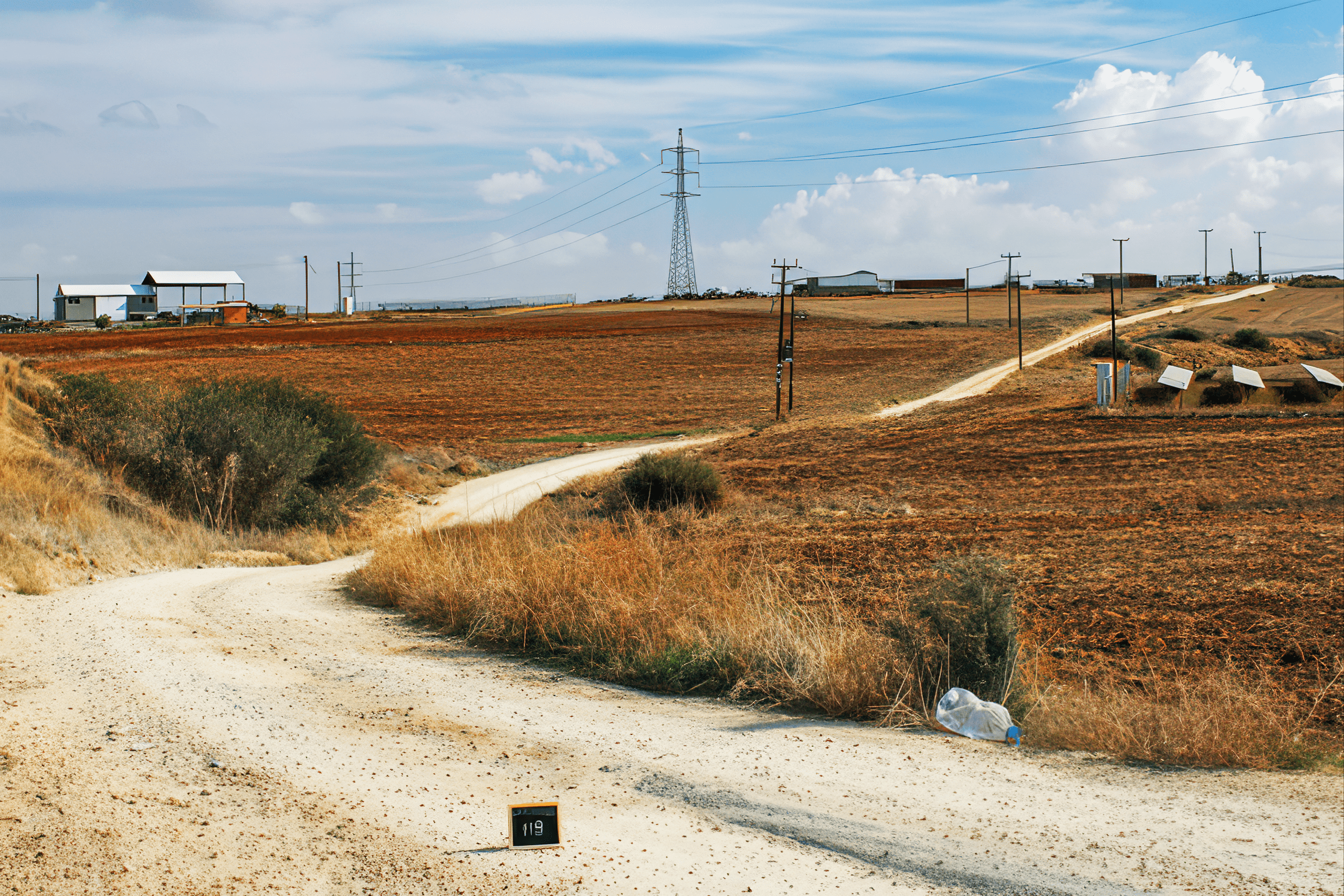
Today, only fragments of ancient Roman roads remain visible on Cyprus. In upland areas, some sections survive as hiking tracks or rural paths. Modern roads often follow the same routes ancient engineers selected, demonstrating the lasting logic of connecting certain points through specific mountain passes or valleys.
The division of Cyprus since 1974 makes approximately 10 percent of the island inaccessible for archaeological study. This limitation means parts of the ancient road network cannot be thoroughly investigated with current fieldwork.
Preservation efforts face challenges. Unlike castles, mosques, and churches, roads do not inspire the same degree of public interest or protection. However, historians hope that at least some sections of ancient roads in upland areas can be preserved, perhaps as hiking tracks in natural reserves. Such preservation would give future generations a tangible connection to the vast effort ancient inhabitants invested in the island’s road network.
The Roads’ Continuing Legacy
Roman roads on Cyprus demonstrate that infrastructure shaped ancient life as profoundly as it shapes modern existence. These routes enabled economic growth, administrative efficiency, and social connection. They made it possible for the island to participate fully in Mediterranean commerce and Roman governance.
The practical approach Romans took on Cyprus, adapting existing routes rather than imposing uniform standards, shows flexibility in their engineering philosophy. They built what the island needed rather than what imperial pride might have demanded. The result was a functional network that served Cyprus well for centuries.
The milestones that marked these roads stand as silent witnesses to specific moments in history. Each inscription records an emperor’s reign, a proconsul’s administration, or a city’s effort to maintain its infrastructure. Together, they tell the story of how a small island integrated into and benefited from membership in history’s most extensive land empire.
Modern research continues to reveal new information about these ancient routes. Each discovery adds detail to our understanding of how people moved, traded, and communicated across Cyprus two thousand years ago. The roads may be fragments now, but their influence on settlement patterns, urban development, and economic networks lasted long after Rome’s fall.