Semi-Arid Inland Plains Climate (Mesaoria) is characterized by low rainfall and hot summers, a pattern that has shaped Cyprus’s central lowlands with drought-resistant vegetation and adapted agricultural practices. This climate, with annual precipitation under 350mm and temperatures soaring above 40°C in July-August, creates a landscape of dry riverbeds, thorny shrubs, and resilient crops like barley. It influences everything from biodiversity to human settlement, highlighting how the island’s interior has fostered unique ecosystems and cultural responses to aridity.
- A Harsh Yet Resilient Inland Environment
- The Formation and Historical Impact
- Features of Low Rainfall and Hot Summers
- Notable Aspects That Highlight Its Uniqueness
- Deeper Environmental and Cultural Impacts
- Semi-Arid Inland Plains Climate in Cyprus Today
- Opportunities for Exploration
- A Climate of Resilience and Adaptation
A Harsh Yet Resilient Inland Environment
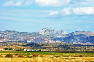
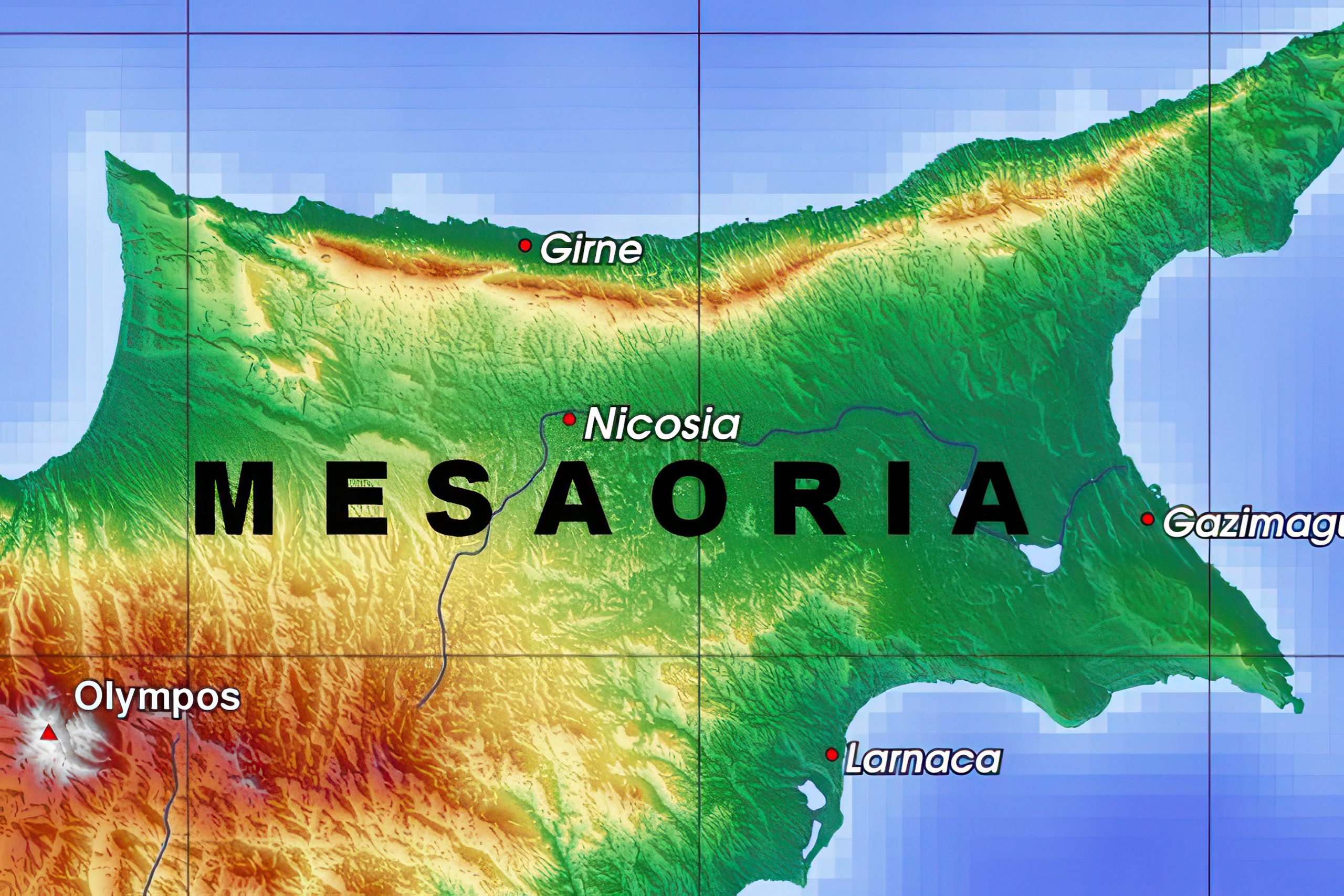
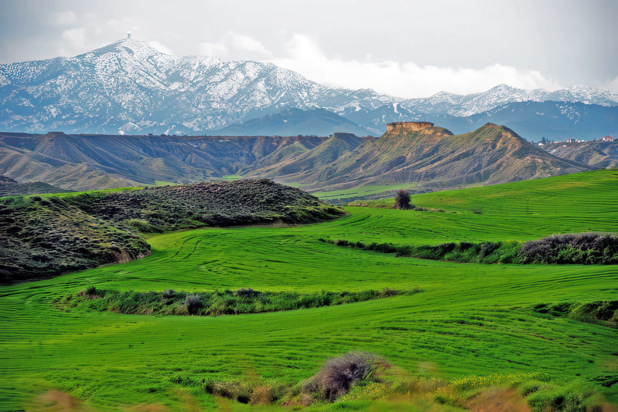
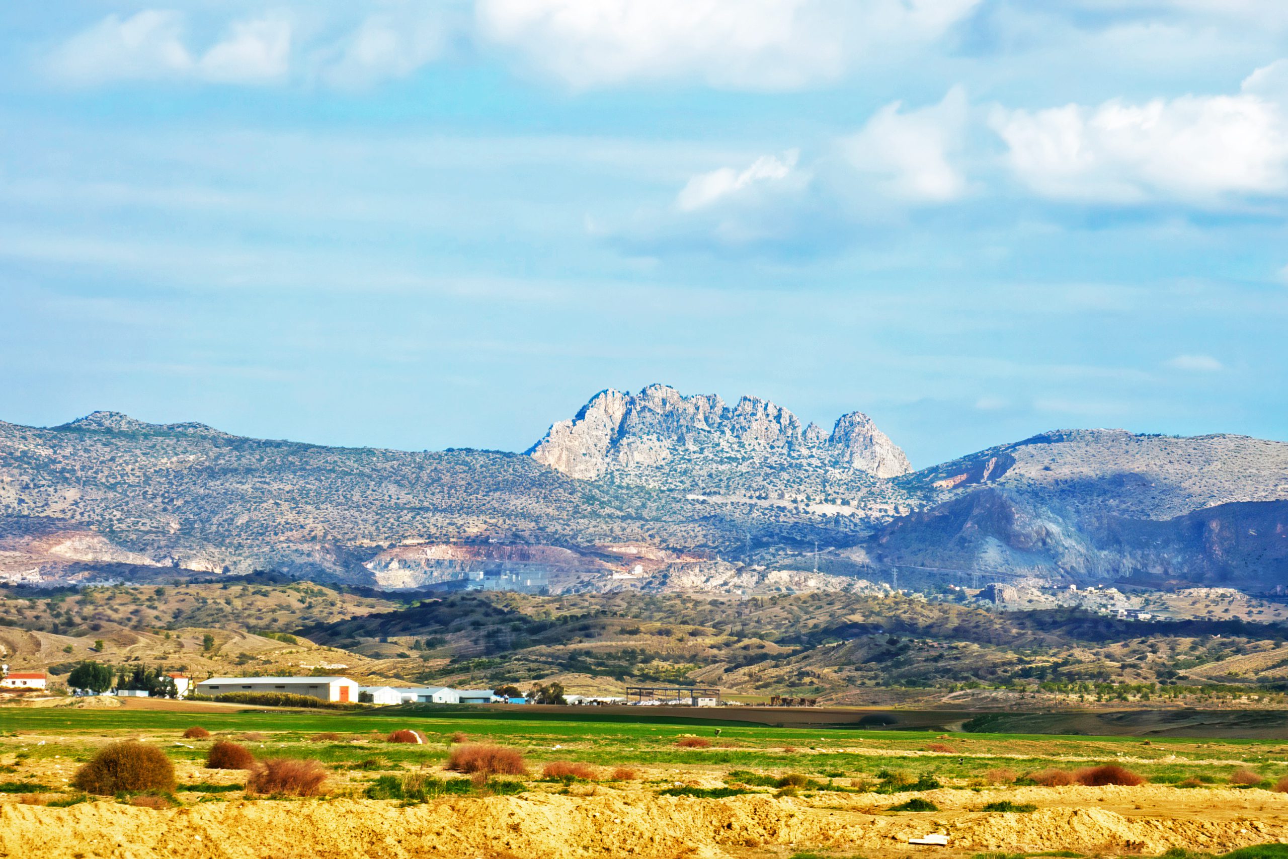
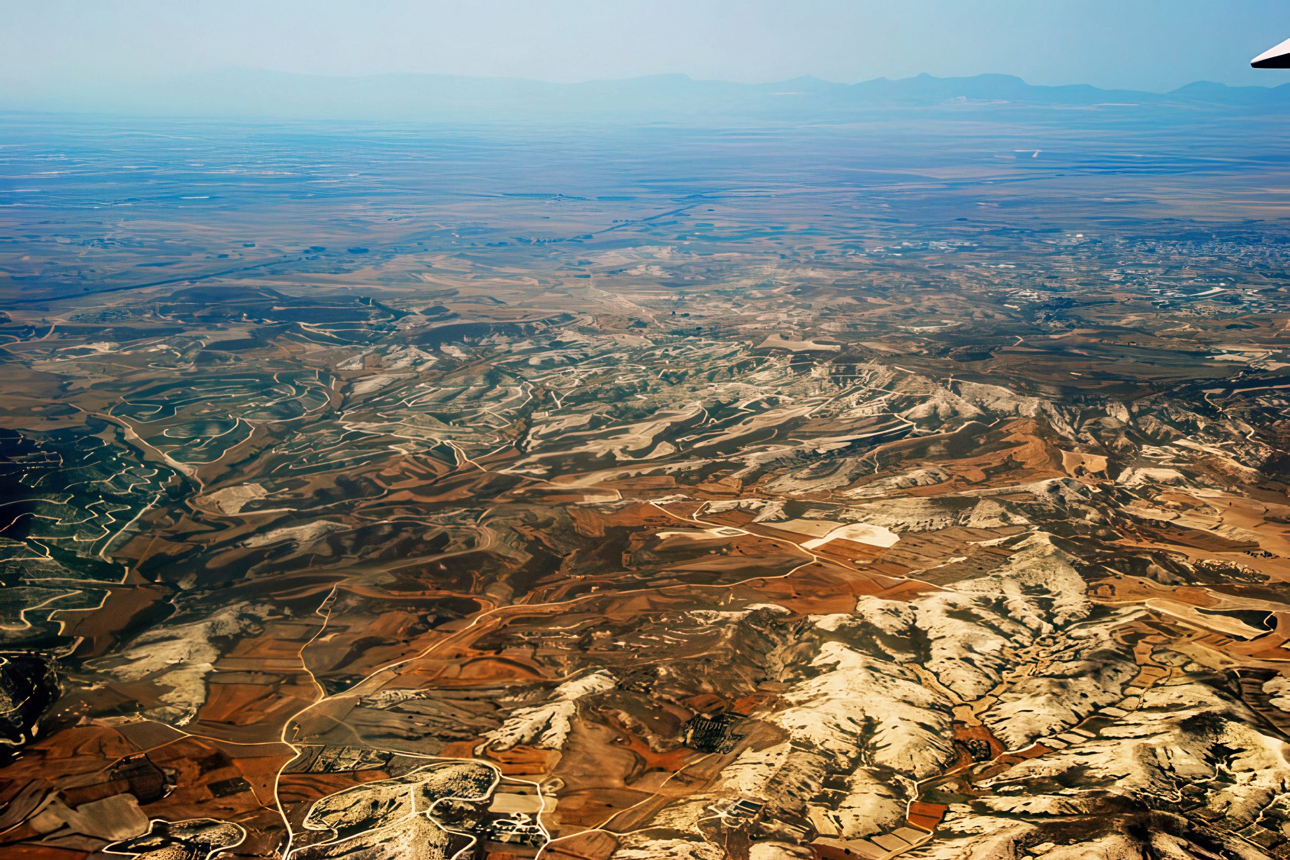
The Mesaoria Plains, often called the “breadbasket” of Cyprus, span the island’s central region between the Troodos and Kyrenia Mountains, covering approximately 2,500 square kilometers. This semi-arid zone experiences extreme seasonal contrasts, where scorching summers give way to mild winters with sporadic rains. Low rainfall, averaging 300-400mm annually, concentrates in short winter bursts, leading to high evaporation rates that deplete soil moisture and create a challenging environment for life. Hot summers, with daytime highs frequently exceeding 35°C and occasional peaks at 45°C, intensify water scarcity, promoting vegetation that conserves resources through deep roots and reduced leaf surfaces.
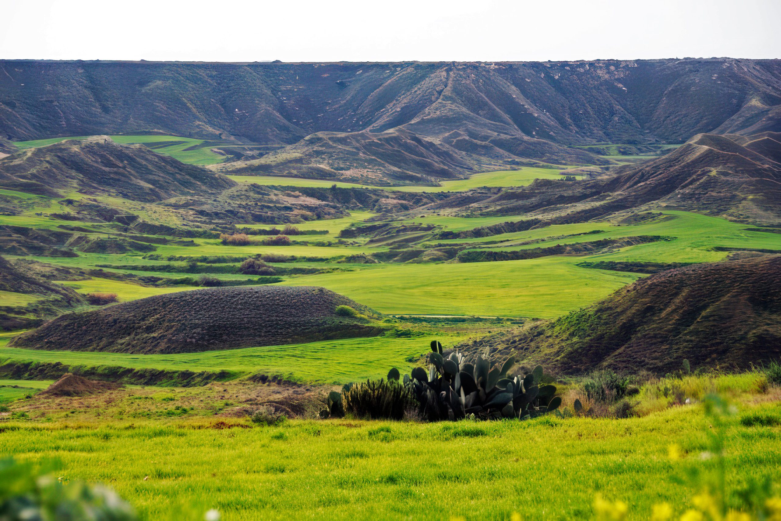
This climate has molded a resilient ecosystem, where plants like the thorny burnet (Sarcopoterium spinosum) and wild thyme dominate, forming maquis scrublands that prevent soil erosion on the plains’ calcareous soils. Agriculture adapts with drought-tolerant crops such as carob and olives, which thrive on minimal water, contributing to the region’s economic backbone. The plains’ flat topography, formed by alluvial deposits from mountain rivers, facilitates farming but also leads to flash floods during rare heavy rains, shaping settlement patterns with villages on slight elevations for safety.
The Formation and Historical Impact
The semi-arid climate of Mesaoria resulted from geological processes beginning in the Miocene epoch around 8 million years ago, when the Troodos uplift created a rain shadow effect, blocking moist westerlies and leaving the plains drier than coasts. Paleoclimatic studies using sediment cores from the Larnaca Salt Lake by the Cyprus Geological Survey since the 1980s show shifts from wetter Pleistocene conditions to current aridity around 5,000 years ago, coinciding with human settlement.
Historical records from ancient times, like Herodotus’s Histories (5th century BC), describe the plains as fertile yet water-scarce, with early inhabitants building dams for irrigation. Neolithic farmers at Khirokitia (7000 BC), excavated by Porphyrios Dikaios in the 1930s, relied on winter rains for barley, as carbonized seeds indicate. Bronze Age (2500 BC) societies at Enkomi adapted with storage jars for dry seasons, while Iron Age (1050 BC) Greeks introduced olives, drought-resistant trees now covering 20,000 hectares.
Byzantine era (4th-15th centuries AD) texts like the 12th-century “Life of Saint Spyridon” note droughts leading to prayers for rain, influencing monastic farming with cisterns. Lusignan rule (1192-1489) expanded wheat cultivation with windmills for grinding, as chronicled by Leontios Makhairas in the 15th century. Venetian (1489-1571) and Ottoman (1571-1878) periods used qanats for underground irrigation, as seen in 18th-century traveler Ali Bey’s descriptions of Mesaoria fields. British colonial rule (1878-1960) introduced modern dams like Asprokremmos in 1982, boosting agriculture but altering ecosystems. Post-1960, climate data from the Meteorological Service shows 10% rainfall decrease since 1950, linking to global warming, with the 1974 division affecting water sharing in the plains.
Features of Low Rainfall and Hot Summers
Low rainfall in Mesaoria, averaging 300mm yearly, concentrates in winter storms from November to March, leading to ephemeral rivers like the Pedieos that dry in summer, creating salt flats with halophytic plants like samphire. Hot summers, with peaks at 42°C and low humidity (40-50%), cause high evapotranspiration, stressing vegetation but favoring heat-tolerant species like pistachio trees with deep roots accessing groundwater at 10-20 meters.
This shapes agriculture: barley and wheat sown in autumn for winter rain harvest in May, avoiding summer drought, with yields at 200,000 tons annually per the Department of Agriculture. Vegetation is xeric, with thorny acacias and wild olives forming maquis scrub that prevents erosion on loamy soils, covering 60% of the plains. Biodiversity includes adapted wildlife like the Cyprus hedgehog, with burrows for heat escape, as studied by the Game and Fauna Service since 1990.
Temperature extremes create microclimates: northern plains hotter due to Kyrenia rain shadow, southern milder with sea breezes. Winters’ rains recharge aquifers, but over-extraction for farming has lowered water tables by 20 meters since 1960, per hydrological reports.
Notable Aspects That Highlight Its Uniqueness
One captivating feature is the “kafkalla” crust – a hard soil layer from evaporation, breaking in rains to aid planting, as analyzed in soil studies by the Agricultural Research Institute. Mesaoria holds Cyprus’s heat record of 46.6°C in 2010, per meteorological data, creating mirages that inspired ancient tales of phantom oases. Endemic flora like the Cyprus tulip (Tulipa cypria) blooms in brief winter wet periods, a sight in February that draws botanists from the Nature Conservation Unit. And legends claim the plains’ dryness cursed by Aphrodite for unfaithful lovers, tying climate to myths in ancient texts like Nonnos’s Dionysiaca (5th century AD).
Wildlife adaptations include the Cyprus whip snake’s (Hierophis cypriensis) estivation in summer heat, studied by Herpetological Society since 1980. Winters’ rains create temporary wetlands hosting migratory birds like herons, with over 200 species recorded in the area.
Deeper Environmental and Cultural Impacts
The semi-arid climate’s low rainfall and hot summers have molded Mesaoria into a resilient ecosystem, hosting drought-resistant vegetation like the endemic Cyprus spurge (Euphorbia veneris), with milky sap for pest defense, as per botanical surveys by the Herbarium of the Forestry Department since the 1960s. Winter rains, though sparse (80-120mm monthly), support dry farming for cereals, producing 100,000 tons of barley annually, but climate change threatens with 15% less precipitation by 2050, per IPCC models adapted for Cyprus by the Cyprus Institute, potentially reducing yields by 20%.
Ecologically, it creates habitats for rare species like the Cyprus bee orchid (Ophrys kotschyi), pollinated in brief wet seasons, with populations monitored by Natura 2000 since 2004. Culturally, it influenced myths like Demeter’s sorrow drying lands in ancient lore, and festivals like Kataklysmos with water games celebrating winter rains. Socially, it dictated lifestyles – summer siestas to avoid heat, winter sowing for crops – and architecture, with flat-roofed homes for rain collection in villages like Athienou. Environmentally, it faces desertification from overgrazing, with EU projects since 2010 planting 50,000 drought trees to combat soil loss. This climate’s balance has sustained agriculture, with carob trees exporting 5,000 tons yearly, but rising heat risks 30% biodiversity loss by 2100, per national reports.
Human impacts include ancient irrigation from Bronze Age dams at Kalavasos, where winter rains filled reservoirs for summer use, as studied in geoarchaeology by Ian A. Todd in the 1980s. Cultural adaptations like Troodos monasteries used the plains’ grains for sustenance, with 12th-century records from Saint Neophytos describing drought prayers that shaped local folklore.
Semi-Arid Inland Plains Climate in Cyprus Today
The semi-arid climate of Mesaoria continues to define Cyprus’s central economy and environment, with hot summers driving tourism in nearby coasts while low rainfall challenges farming, prompting 60% of crops to use irrigation from dams like Kouris. Climate change exacerbates issues, with summers 2°C hotter since 1960 per Meteorological Service data, leading to 20% yield drops in wheat. Vegetation adaptations inspire biotech, with studies on spurge plants for drought-resistant crops at the Agricultural Research Institute. Biodiversity conservation through Natura 2000 protects 40% of the plains, with bird observatories at Oroklini Wetland hosting 150 species in winter. Modern farming uses solar desalination for water, reducing dependency on rains by 30%. This climate shapes identity, with festivals like “Harvest Day” in Athienou celebrating resilient crops, blending ancient rites with contemporary sustainability.
Opportunities for Exploration
The Mesaoria Plains offer drives through farmlands like those near Nicosia, with free access to viewpoints. Winter birdwatching at Oroklini Lake has guided tours by BirdLife Cyprus for €10, open year-round. Agricultural festivals in Dromolaxia in May feature crop displays, free to attend. Spring wildflower hikes in Athienou pair with village stays for climate insights. Many sites provide online maps for remote planning.
A Climate of Resilience and Adaptation
Semi-Arid Inland Plains Climate (Mesaoria), with low rainfall and hot summers, has shaped drought-resistant vegetation and agricultural patterns, defining Cyprus’s central landscape. This pattern’s balance has fostered unique ecosystems and human ingenuity, from ancient dams to modern irrigation. Knowing it deepens appreciation for Cyprus as a resilient inland haven. Engagement with its seasons or crops evokes wonder at nature’s adaptations. In a changing climate, it reminds of the need to safeguard this delicate balance.