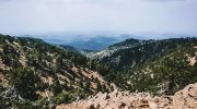
Stand on a small hill just outside Nicosia and look around. To the south the Troodos Mountains rise dark and rugged on the horizon, their volcanic slopes fading into forests. To the north the Kyrenia range appears as a long pale wall of limestone cliffs or rugged forms stretching as far as the eye can see. Between them lies an immense open landscape.
This is Mesaoria. In Greek it literally means “between the mountains”. This basin forms a natural wide corridor across the island, a broad open landscape framed by two very different geological worlds. At first glance the region may appear quiet compared with the dramatic mountains that surround it. There are no towering cliffs or deep gorges. Instead, the land spreads outward in broad plains and gentle plateaus where fields stretch toward distant villages.
Yet beneath this calm landscape lies one of the most revealing geological chapters of Cyprus.
Mesaoria is not simply a plain between mountains. It is the remnant of a vast sea basin that once separated the Troodos massif from the Kyrenia range. For millions of years this basin collected sediments washed from the surrounding highlands while marine life thrived in its waters. Later tectonic movements slowly lifted the seabed, turning the marine basin into dry land.
Now imagine travelling ten million years back in time. Where fields and villages stand today, you would see a broad shallow tropical sea stretching across the centre of the island. Warm waters shimmer under the Mediterranean sun, and beneath them live shells, corals and countless microscopic organisms slowly building the sediments that would one day become the soils of Mesaoria. To the south rises the volcanic island of Troodos, already standing high above the waves. To the north a second island forms the ridge that would later become the Kyrenia Mountains. Cyprus at this moment is not yet a single island, but a small archipelago separated by a calm inland sea.
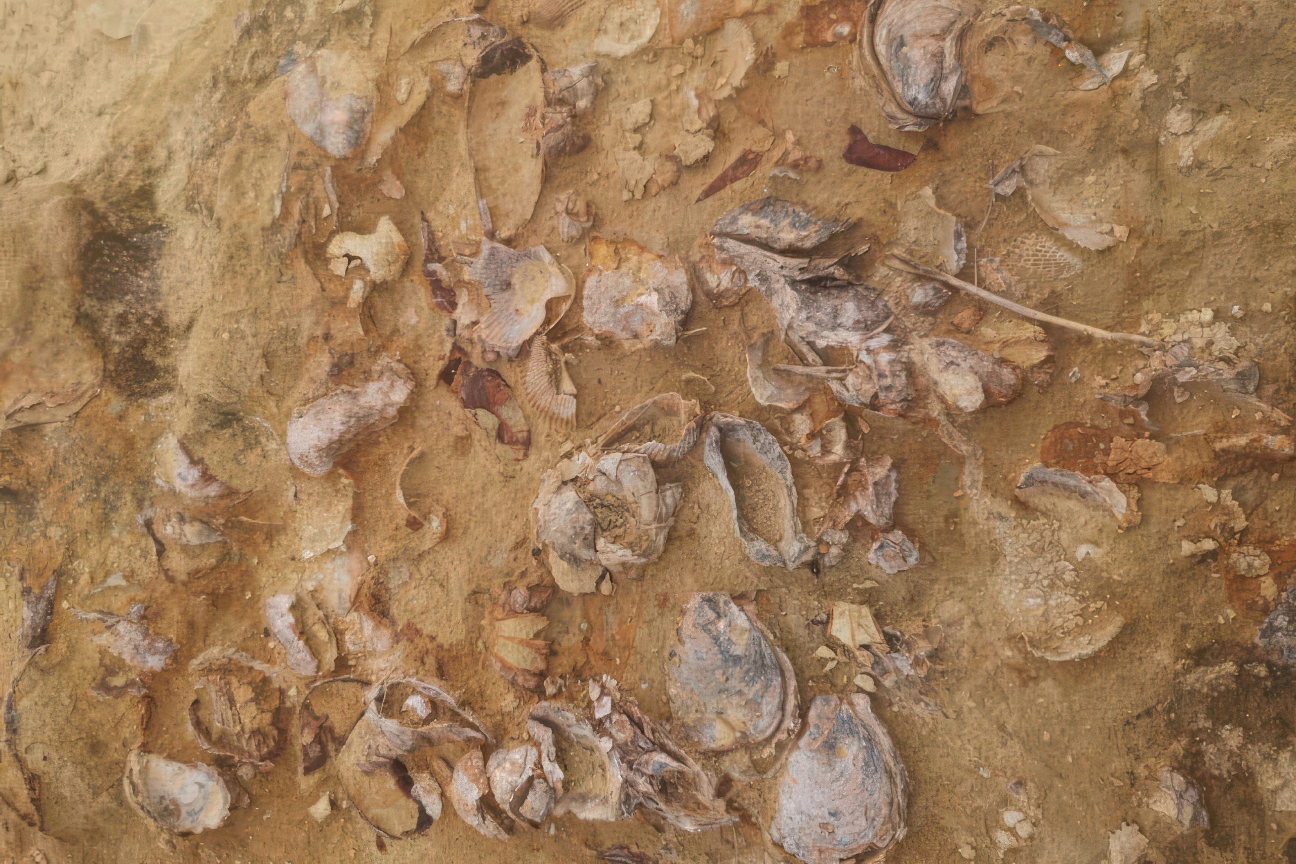
Today the rocks and soils of Mesaoria preserve evidence of that transformation. River valleys expose layers of sands, gravels and silts deposited by ancient streams and coastal environments. In some places the ground still contains shells and fossilised marine organisms that once lived in the waters of this vanished sea.
The basin therefore tells the story of the final stages of Cyprus’s geological formation. If Troodos reveals the deep volcanic origin of the island and the Circum-Troodos sediments record the surrounding marine basins, Mesaoria captures the moment when the island finally rose completely above the sea. And it did not stop shaping Cyprus there. Over time the sediments of Mesaoria created some of the island’s most fertile soils, turning the basin into one of the agricultural engines of the country.
1. Birth of the Mesaoria Basin
The Mesaoria Basin formed during the later stages of tectonic collision in the eastern Mediterranean. After the Troodos ophiolite had already risen from the sea and the Kyrenia mountains had begun to form along the northern edge of the island, a broad depression developed between the two mountain systems. This depression became a marine basin.
Between roughly 20 million and 1 million years ago, the basin collected sediments transported from both mountain ranges. Rivers flowing from Troodos carried volcanic debris, sands and gravels into the basin. At the same time the Kyrenia range contributed limestone fragments and marine sediments.
The result was a thick sequence of deposits filling the basin floor. Over time tectonic uplift gradually raised the region above sea level. The sea retreated and the former seabed transformed into a wide plain. Wind and rivers reshaped the surface, while new sediments continued to accumulate through floods and seasonal streams.
Today the Mesaoria plain stretches across central Cyprus from Morphou Bay in the west to the Famagusta region in the east, forming one of the largest continuous landscapes on the island.
From a geological perspective it represents the youngest major chapter in the island’s development.
2. The Alluvial Landscape
Much of the surface of Mesaoria consists of alluvial deposits. Alluvium is the material transported and deposited by rivers. In Mesaoria this includes sands, gravels, silts and clays laid down by seasonal streams flowing from the surrounding mountains.
These deposits often form river terraces, slightly elevated flat surfaces that mark previous levels of ancient river channels. Over thousands of years rivers gradually cut deeper into the sediments, leaving older terraces stranded above the modern valleys. The landscape created by these deposits is relatively gentle compared with the surrounding mountains. Rolling plains dominate the horizon. Long agricultural fields follow the natural contours of the terrain.
The soils vary depending on the mixture of sediments present. In some places gravel-rich layers produce well-drained soils suitable for orchards and vineyards. In others finer silts create deep fertile fields ideal for crop cultivation.
Because the basin lies between two mountain systems, it also collects sediments from a wide variety of rock types. Volcanic fragments from Troodos mix with limestone material from the Kyrenia range, producing complex soil compositions across the plain.
This geological diversity contributes to the agricultural richness of the region
3. Rivers and the Memory of the Sea
Although Mesaoria today appears as dry farmland, its rivers still carry clues to its marine past.
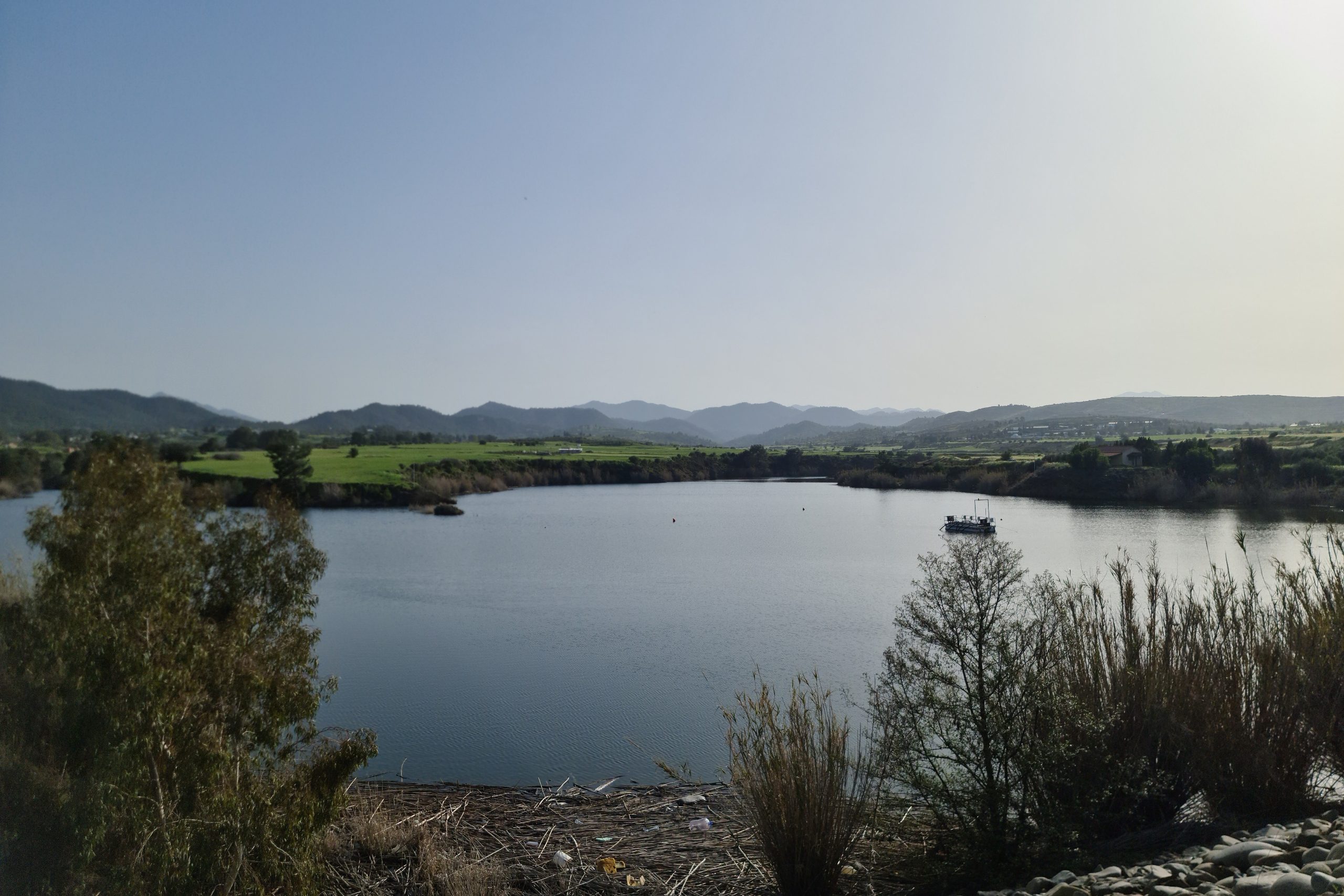
Several seasonal rivers cross the basin, including the Pedieos, the longest river in Cyprus. Flowing south from the Troodos slopes toward the central plain, it eventually passes through the capital city of Nicosia. In many places these river valleys cut deeply enough into the sediments to reveal ancient layers containing marine fossils.
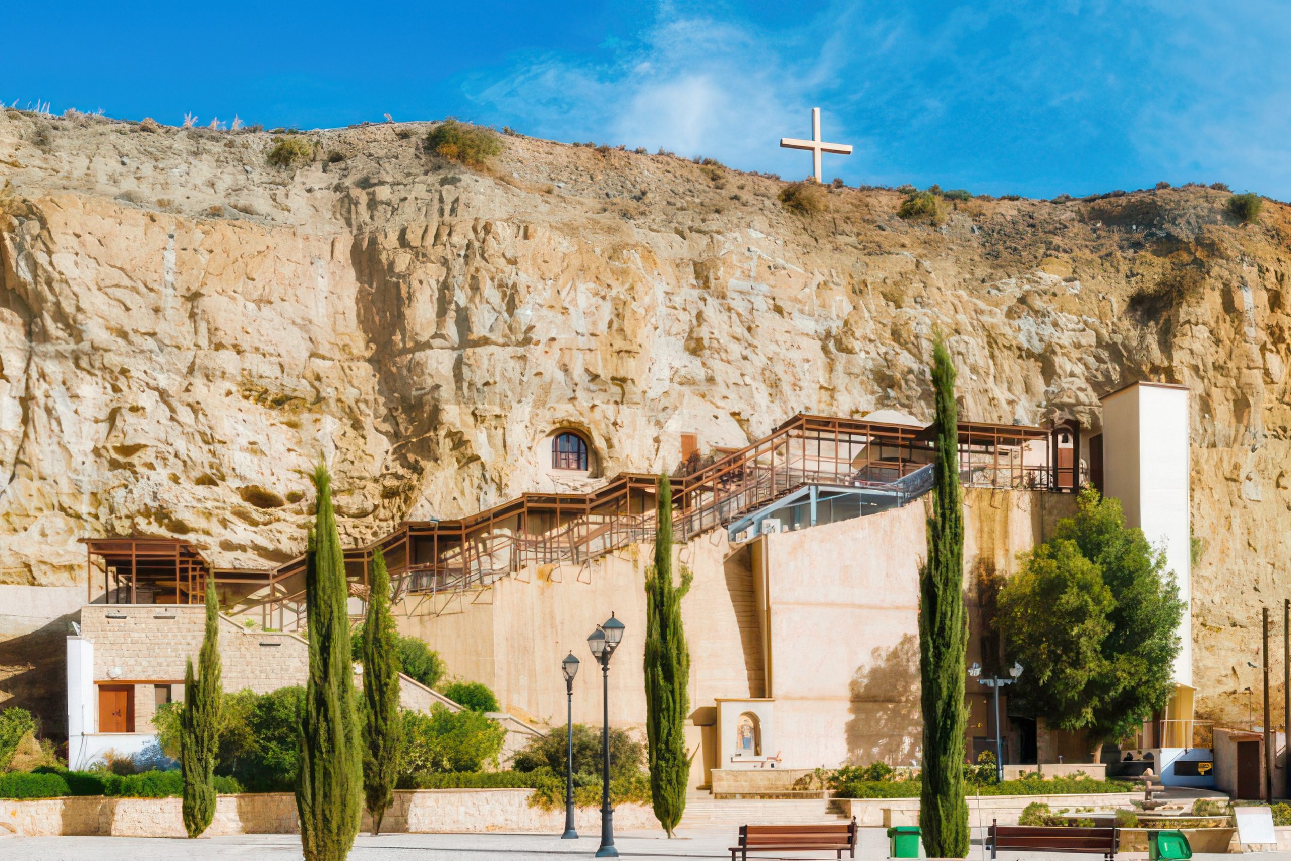
Along certain sections of the Pedieos valley near Panagia Chrysospiliotissa Church, observant visitors can find fossilised shells and traces of marine organisms embedded within the exposed sediments. These remains belong to creatures that once lived in the shallow sea that covered this region millions of years ago. Finding marine fossils in the middle of an inland plain can feel almost surreal. Yet it is one of the clearest reminders that the ground beneath modern Cyprus once lay beneath ocean waters.
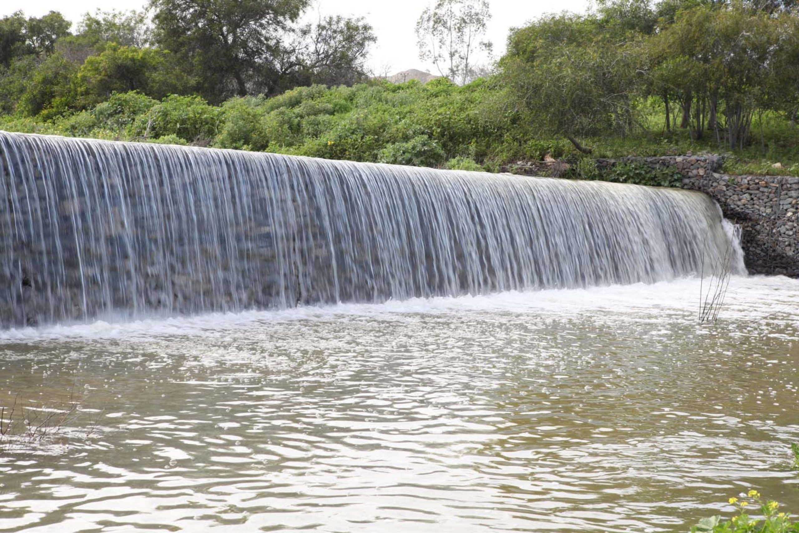
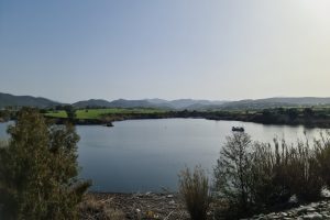
Gialia River in Mesaoria Plain. Source: Shutterstock
Rivers continue to shape the basin today. Seasonal floods redistribute sediments, carve channels and occasionally reveal new exposures of older layers. The geological story of Mesaoria is therefore still unfolding.
4. The Red Soils of Kokkinochoria
Toward the eastern end of the basin lies one of the most distinctive agricultural regions of Cyprus: Kokkinochoria, literally meaning “the red villages”.
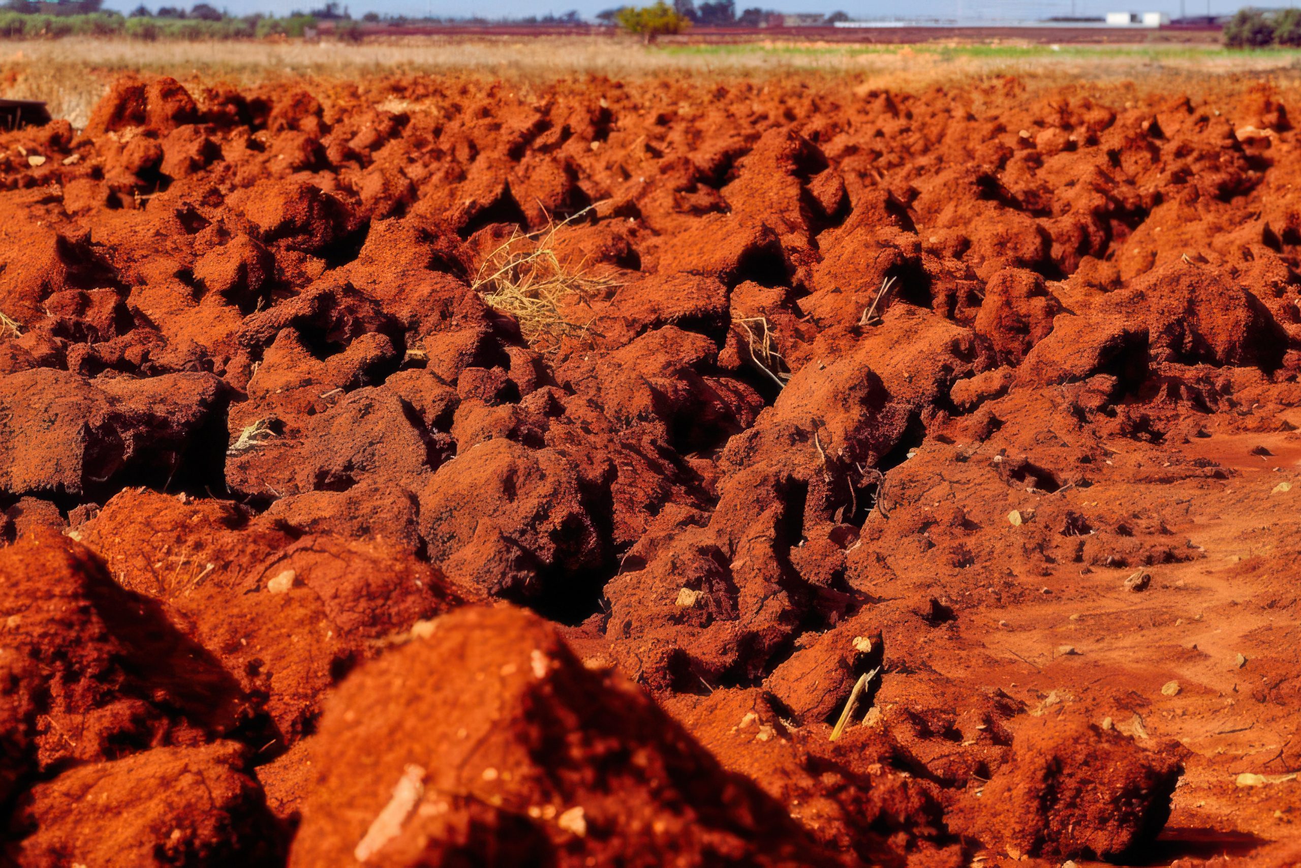
This area stretches roughly between Larnaca and Ayia Napa, where the soils take on a striking reddish colour. The hue comes from iron-rich clay minerals that formed as sediments weathered over long periods under Mediterranean climatic conditions. The red soils are exceptionally fertile and well suited for agriculture.
Kokkinochoria has become famous for its potatoes, which are widely exported across Europe. The region also produces large quantities of watermelons and honey melons, crops that thrive in the warm climate and mineral-rich soils.
The contrast between the vivid red earth, bright green fields and blue Mediterranean sky creates a landscape that feels almost painted.
These fertile soils are another example of how geology continues to shape everyday life in Cyprus. Without the sedimentary deposits of the Mesaoria basin, this agricultural heartland would not exist.
5. Landscapes and Life of the Plain
Beyond its agriculture, Mesaoria forms an important ecological and cultural region.
The open plains provide habitat for numerous bird species, particularly during seasonal migrations across the eastern Mediterranean. Fields and wetlands attract storks, herons and various raptors that pass through the island.
Human settlements have also adapted to the geography of the basin. Many villages developed along the edges of river valleys or near groundwater sources where agriculture could flourish.
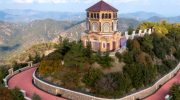
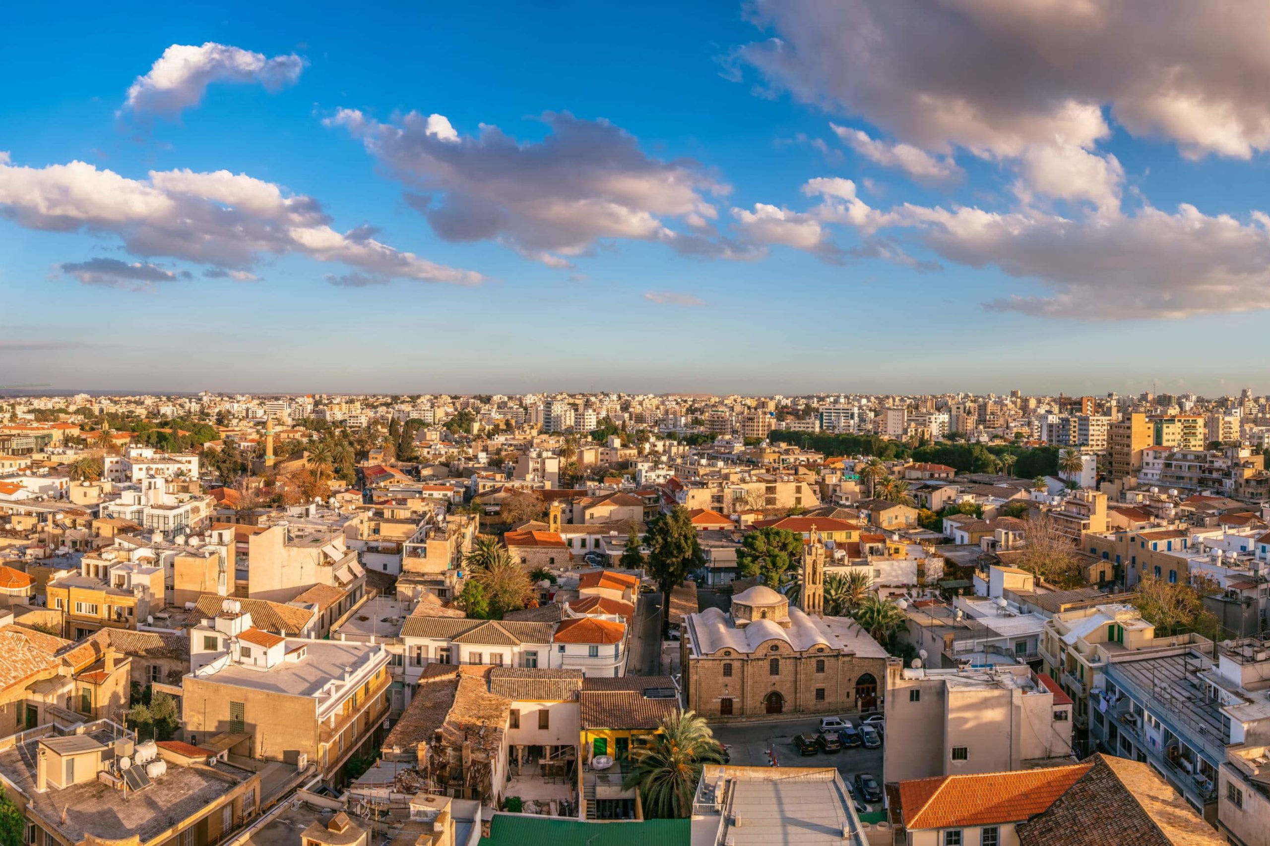
Nicosia, the capital of Cyprus itself stands within the Mesaoria basin. Its position reflects the historical advantages of the central plain as a crossroads connecting the northern and southern parts of the island. Even today the basin remains the geographical centre of Cyprus.
Roads, railways of the past and modern highways naturally follow the open terrain of the plain, linking coastal regions and mountain villages alike.
6. Conclusion
Mesaoria may not possess the dramatic cliffs and colours of Troodos or the rugged beauty of the Kyrenia mountains, yet it plays a crucial role in the geological story of Cyprus.
This wide plain marks the place where the island’s final transformation occurred. What was once a marine basin slowly filled with sediments, rose above sea level and became the landscape we see today.
The basin preserves traces of its ancient sea in fossil shells hidden within river valleys. It records the erosion of surrounding mountains through its layers of sand, gravel and silt. And it supports fertile soils that sustain agriculture across central and eastern Cyprus.
In this sense Mesaoria represents the island’s transition from ocean floor to living landscape. Troodos tells the story of fire beneath the sea. The Circum-Troodos sediments describe the island rising from water. Mesaoria shows the moment when the sea finally withdrew and the land of Cyprus fully emerged.