Between the Troodos Mountains in the south and the Kyrenia Range in the north lies a broad plain that has been the agricultural heart of Cyprus for thousands of years. The Mesaoria wasn’t always dry land. About one million years ago, this central area was still underwater, an ancient bay that slowly filled with sediments washed down from the surrounding mountains. Today, those sediments form the fertile soils that feed the island, delivered by rivers that flow only in winter and disappear completely by summer.
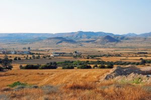
The Mesaoria is a flat plain that extends across central Cyprus from Morphou Bay in the west to Famagusta Bay in the east. The name comes from Greek and means “between the mountains,” which perfectly describes its position sandwiched between the Troodos and Kyrenia ranges. The plain measures 96 kilometers long and varies between 16 to 32 kilometers wide, covering roughly 1,000 square kilometers of land.
The average elevation across the Mesaoria sits around 100 meters above sea level, though some areas near Nicosia rise to 325 meters. Unlike the mountainous regions that surround it, the Mesaoria is mostly flat with gentle slopes. This flatness makes it ideal for agriculture but also creates drainage problems when the seasonal rivers flood.
Historical Background
About 25 million years ago during the Lower Miocene era, the Troodos mountains stood as an island while the area that would become Mesaoria was covered by sea. The Kyrenia Range to the north was also underwater at this time. Cyprus consisted of two separate islands with ocean in between.
Around 11 million years ago, the Kyrenia mountains began rising above sea level while Mesaoria remained submerged. The plain didn’t emerge from the ocean until about one million years ago during the Pleistocene era. This means the Mesaoria is geologically very young compared to the ancient mountains on either side.
As the plain rose from the sea, it became a shallow bay that gradually filled with sediments. Rivers flowing down from the Troodos and Kyrenia mountains carried rocks, sand, and clay into this bay. Over hundreds of thousands of years, these sediments built up layer by layer until they filled the entire basin and created the flat plain we see today.
The Pedieos River – Cyprus’s Longest Waterway
The Pedieos River is the longest river in Cyprus at roughly 100 kilometers. It rises near Machairas Monastery in the Troodos range and flows northeast toward Nicosia. Before the Venetians diverted it in the medieval period, the Pedieos actually flowed directly through Nicosia itself.
After passing Nicosia, the river turns east and crosses the Mesaoria Plain before ending at Famagusta Bay. The river once lost most of its water in marshes near the ancient city of Salamis, though modern drainage and agricultural development have altered these wetlands significantly.
Like all Cypriot rivers, the Pedieos is seasonal. During winter rains, it can become a rushing torrent that floods the surrounding plain. By summer, the riverbed is completely dry except for occasional pools in deeper sections. This extreme variation makes the river useless for navigation despite its length.
The Yialias River and Its Parallel Path
The Yialias River (also called Gialias or Idalias) rises very close to where the Pedieos begins in the Troodos foothills. It flows through the villages of Nisou, Dali (ancient Idalion), and Pyroi before crossing the Mesaoria roughly parallel to the Pedieos. The two rivers follow similar northeast to east paths and both end at Famagusta Bay.
The Yialias has an interesting feature where it meets a tributary called the Alikos River near the abandoned village of Agios Sozomenos. This confluence once supported extensive Bronze Age settlements because the combined water flow made irrigation easier. Some researchers suggest the Yialias may have been navigable for small boats during the Bronze Age, though this remains controversial since the river today is barely more than a seasonal stream.
Near its mouth, the Yialias historically created extensive marshes similar to those formed by the Pedieos. These wetlands were important habitats but also breeding grounds for mosquitoes that spread malaria until modern drainage programs eliminated the standing water.
Seasonal Rivers and Agricultural Life
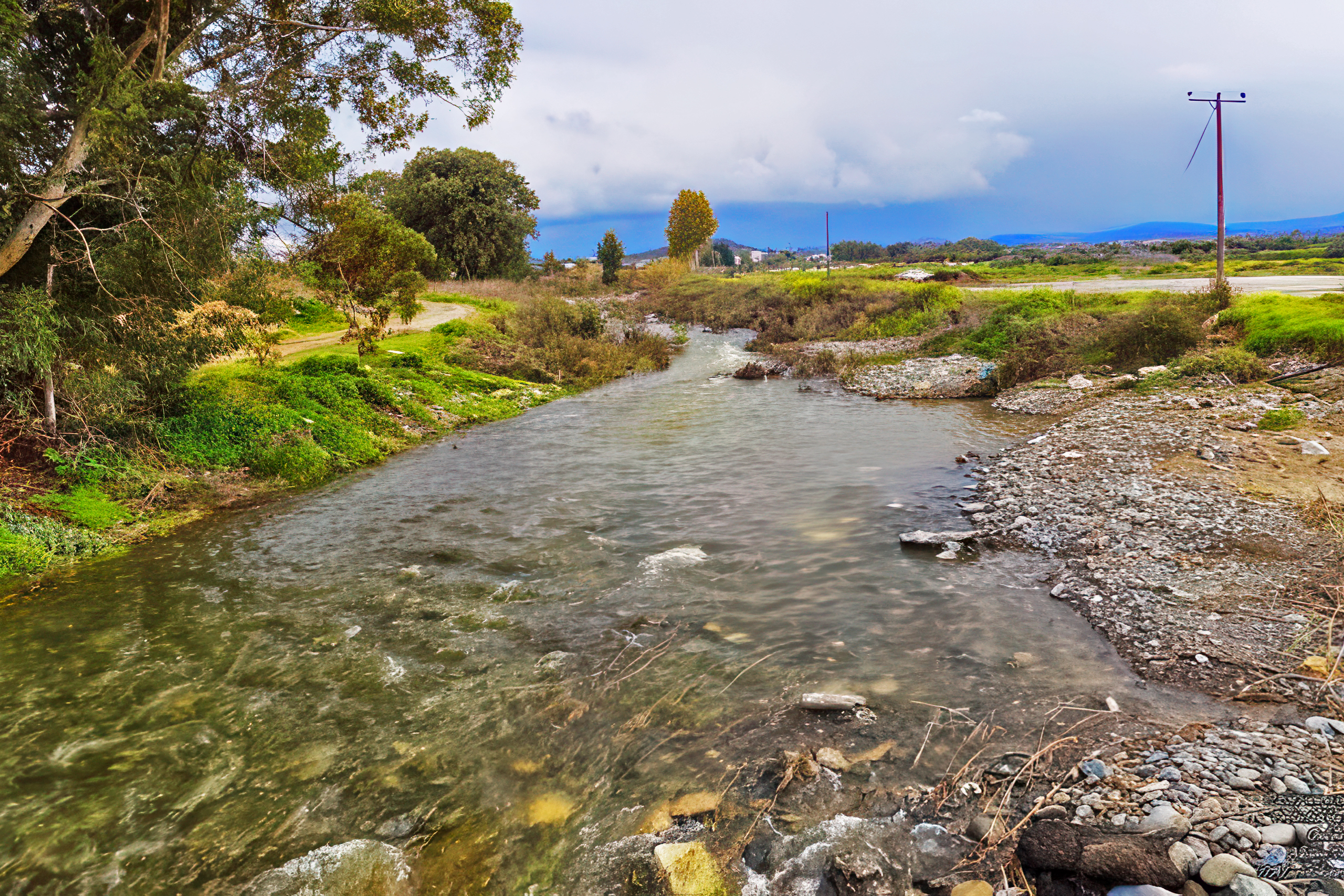
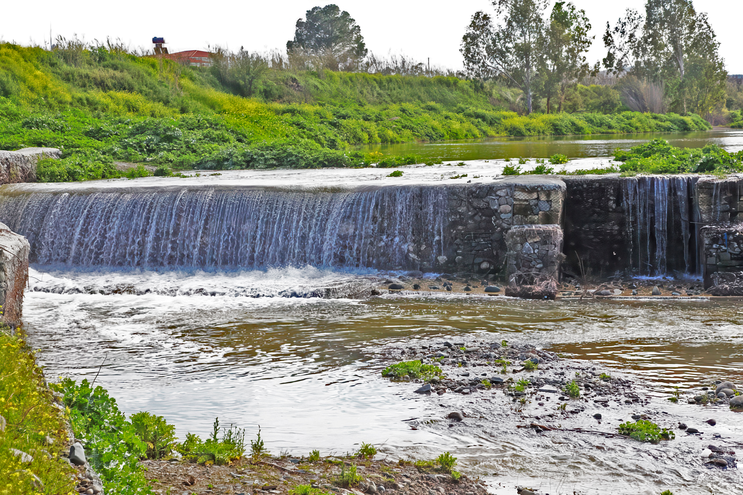
All the major rivers in Cyprus, including the Pedieos and Yialias, are what hydrologists call ephemeral or seasonal streams. They flow only during the wet season from roughly November through March and dry up completely during summer. Even during winter, flow can be unpredictable depending on rainfall patterns.
This seasonality shaped Cypriot agriculture for millennia. Farmers developed sophisticated systems to capture winter flood water and store it for summer use. Stone terraces slow water flow and allow it to seep into the ground instead of rushing directly to the sea. Cisterns collect rainwater from roofs and courtyards for household use during dry months.
The system of colmatage mentioned in historical sources refers to deliberately flooding fields with sediment-rich water to build up soil depth and fertility. During winter floods, farmers would direct water onto their fields and let it sit until sediments settled out. This practice raised land levels over time and helped reclaim marshy areas for cultivation.
How Rivers Changed the Landscape
Over the past two million years, the Mesaoria rivers delivered enormous quantities of sediment from the mountains to the lowlands. The Pedieos alone transported material along its 100-kilometer course from high in the Troodos to sea level at Famagusta Bay. Multiply that by hundreds of thousands of years and numerous rivers, and you get the thick blanket of alluvium that covers the plain.
The sediments brought nutrients from the mineral-rich volcanic rocks of Troodos. Basalt and gabbro weather to produce iron, magnesium, and other elements that plants need. The rivers essentially mined the mountains and spread this fertility across the lowlands.
The rivers also shaped the terrain through erosion. In some areas, rivers cut channels 6 meters or more into the plain. These incised valleys create local relief in an otherwise flat landscape. The table-like mesas along river valleys show where erosion removed softer sediments but left harder kafkalla layers as protective caps.
Why the Mesaoria Matters Today
The Mesaoria demonstrates how geology creates agricultural landscapes. The million-year process that filled an ancient bay with sediments from two mountain ranges created the soils that feed modern Cyprus. Understanding this history helps explain both the plain’s productivity and its limitations.
The seasonal river systems show how Mediterranean climates work. Wet winters and dry summers create dramatic contrasts in water availability. Civilizations that thrived here had to develop technologies for water storage and drought management, skills that remain relevant as climate change potentially makes droughts more severe.
The plain also illustrates human impacts on landscapes. Ancient deforestation to build ships and smelt copper contributed to erosion and kafkalla formation. Modern dams and irrigation changed river flow patterns and affected downstream ecosystems. The Mesaoria’s current state reflects thousands of years of human activity layered on top of geological processes.
Experiencing the Mesaoria Landscape
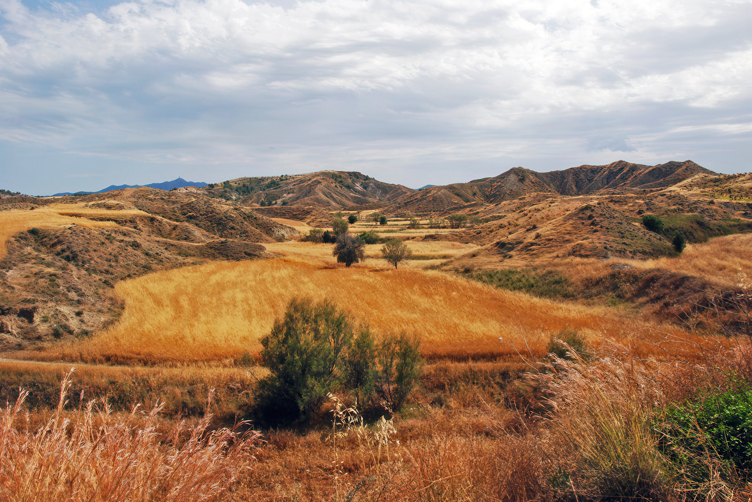
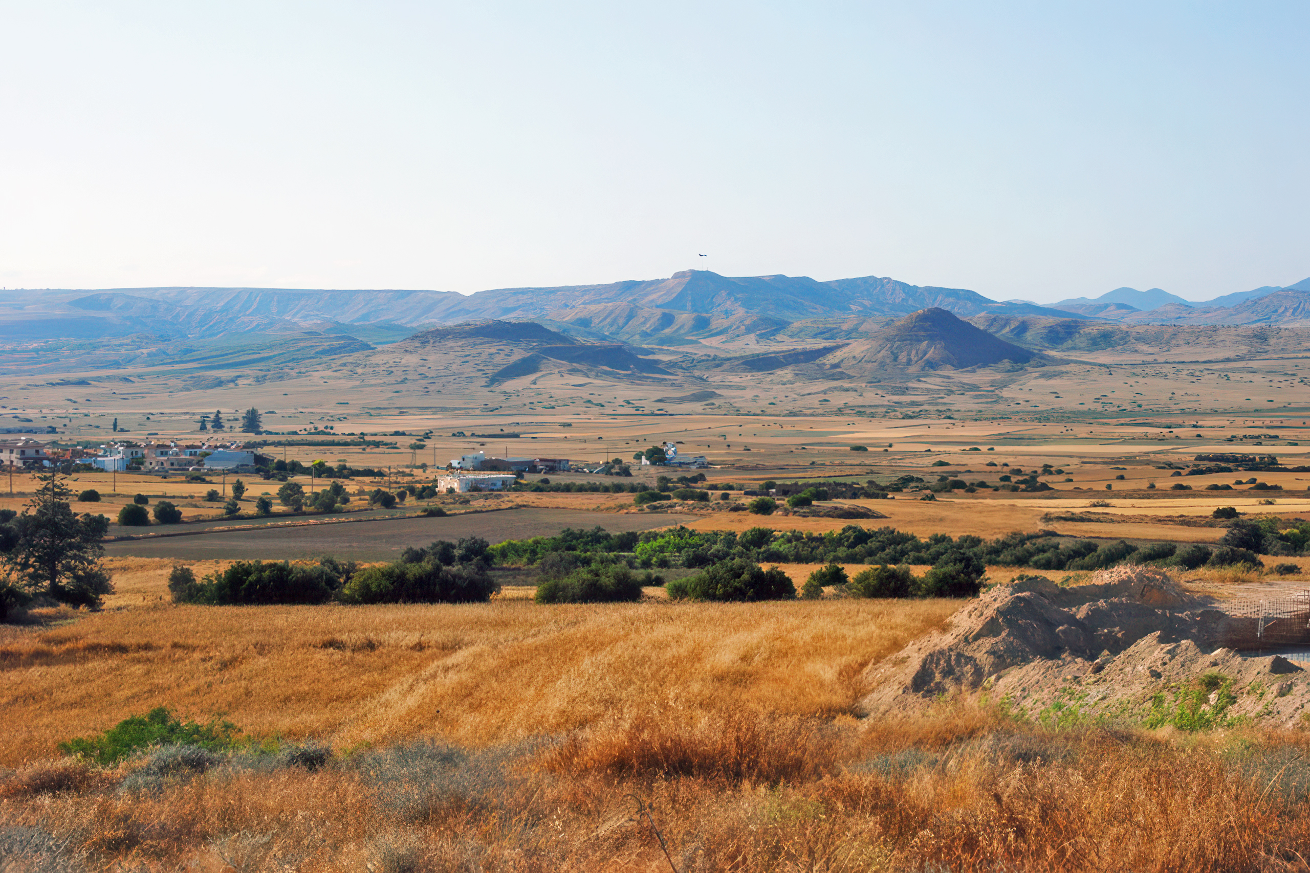
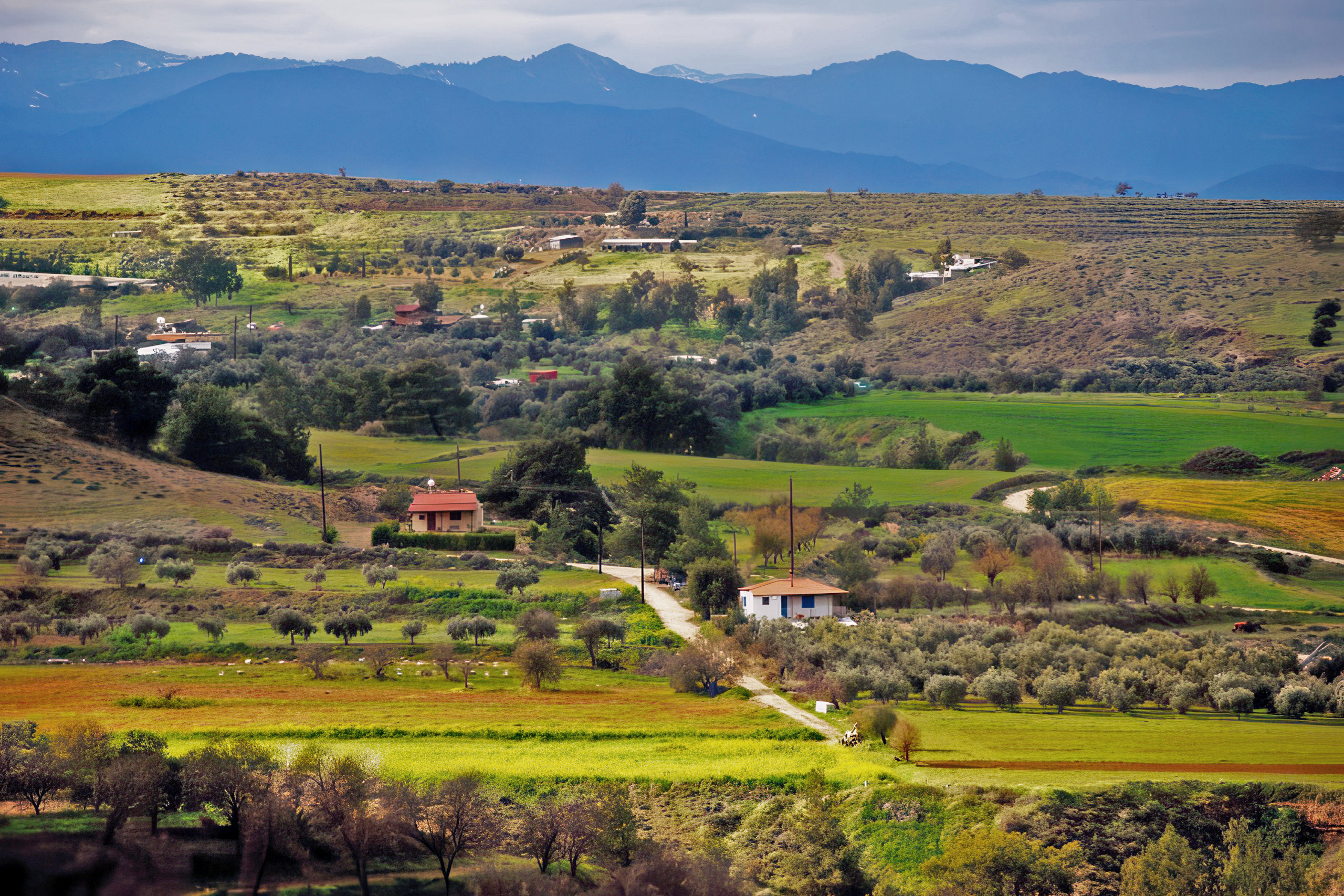
Driving across the Mesaoria between Nicosia and either Famagusta or Larnaca shows the plain’s character. The landscape appears flat and agricultural with occasional low hills. During winter after rains, the plain turns green with winter wheat and barley. Wild flowers including poppies and anemones create colorful displays in March and April.
By summer, the green fades to brown as vegetation dries out. The seasonal streams become empty channels filled with white stones. The heat can be intense, often exceeding 40 degrees Celsius, making the plain’s semi-arid climate very apparent.
Villages across the plain maintain traditional architecture adapted to the climate. Thick stone walls provide insulation from heat. Narrow streets and courtyard houses create shade. Many villages have springs or wells that historically provided drinking water when rivers were dry.
The abandoned village of Agios Sozomenos offers one of the best places to understand Mesaoria’s river systems. The ruined houses sit on cliffs above the Alikos River valley, with views across to where it joins the Yialias. The landscape shows both the fertility that water provides and the harsh reality when it disappears.
A Plain Built by Rivers
The Mesaoria matters because it connects Cyprus’s past, present, and future. The sediments deposited over a million years created the agricultural foundation that sustained civilizations from Neolithic farmers through Bronze Age kingdoms to modern communities. The seasonal rivers that built these deposits continue their work today, though dams and channels now direct their flow.
Understanding the Mesaoria means understanding how geology becomes geography becomes history. The rocks that eroded from Troodos became the soil that fed ancient Idalion and Salamis. The rivers that carved valleys through the plain also created the marshes where those same rivers lost their water. The hard kafkalla layer that frustrates modern farmers formed from the same calcium carbonate that ancient peoples quarried for building stone.
When you stand in the Mesaoria and look toward the mountains on either side, you see the sources of the sediments beneath your feet. Every field, every riverbed, every village sits on layers of material that journeyed from high peaks to low plains. That journey continues with every rainstorm, every flood, every load of sediment that moves a little bit farther downstream, slowly but constantly reshaping the island’s agricultural heart.