Explore Cyprus with Our Interactive Map

Explore our top stories and discover ideas worth your time.

Walking and Seaside Visits in Cyprus

Walking and Seaside Visits in Cyprus

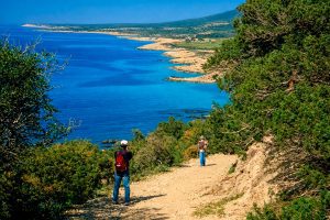
Cyprus life revolves around the Mediterranean Sea and the simple pleasure of walking. The island's 650 kilometers of coastline and 326 days of annual sunshine create perfect conditions for daily seaside visits that locals consider essential rather than optional.  Walking serves multiple purposes in Cypriot culture, from exercise and social connection to mental relaxation and community participation. The coastal promenades and beaches function as outdoor living rooms where families gather, friends meet, and strangers become acquaintances through repeated casual encounters. The History of Coastal Walking Traditions The tradition of evening coastal walks, known as the volta, traces back to ancient Greek and Roman practices of gathering in public spaces. During Byzantine times, promenades along harbor areas served as meeting points for merchants, fishermen, and community members. The Ottoman period introduced coffee culture that complemented these walking traditions, creating social patterns that persist today. British colonial rule added formal promenade design to coastal cities, particularly in Limassol and Larnaca where waterfront development emphasized public access. The modern promenade culture emerged after Cyprus independence in 1960, when cities began investing in coastal infrastructure. The Paphos promenade development connected the medieval harbor with archaeological sites, while Limassol created the Molos, a palm-lined waterfront park that opened in 2014. These projects reclaimed seafronts for public use after decades of commercial and industrial dominance, transforming…

Read more
Larnaca Salt Lake Cyprus

Larnaca Salt Lake Cyprus

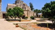
Larnaca Salt Lake is a complex network of four salt lakes of different sizes to the west of the city of Larnaca. The largest is Lake Aliki, followed by Lake Orphani, Lake Soros, and Lake Spiro. Three of these lakes interconnect to form the second largest salt lake complex in Cyprus after Limassol Salt Lake. The total surface area of the lakes adds up to 2.2 square kilometers, positioned between Larnaca International Airport and the historic Hala Sultan Tekke mosque. This location makes the salt lake one of the most visible natural landmarks for anyone arriving in Cyprus by air. Historical Background Archaeological finds show that the salt lake area has been inhabited since the Late Bronze Age, with a harbor that served the town unearthed near where the Hala Sultan Tekke mosque stands today. Ancient Larnaca, then known as Kition, functioned as one of Cyprus's major urban and commercial centers between 1650 and 1050 BC. The natural harbor provided strategic access to trading routes connecting Africa, Asia, and Europe. Before sediment deposit cordoned off the salt lakes, they formed a lagoon that was connected to the Mediterranean Sea. Over centuries, sediment accumulated in the channels linking the lagoon to the sea. Evidence suggests Bronze Age Cypriots dug an artificial channel to maintain port operations as natural waterways became increasingly…

Read more
Akamas Peninsula Microclimate

Akamas Peninsula Microclimate

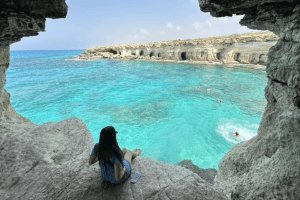
Akamas Peninsula Microclimate is defined by a unique blend of coastal and upland conditions, fostering rare ecological niches with exceptional biodiversity on Cyprus's northwest tip. This microclimate combines Mediterranean seaside warmth with cooler, moister hill zones, creating diverse habitats from sandy beaches to rocky gorges. It supports over 600 plant species and unique wildlife, making Akamas a natural treasure that highlights how small-scale climate variations can drive ecological richness on an island. A Distinctive Blend of Coast and Upland The Akamas Peninsula's microclimate arises from its geography - a rugged 230-square-kilometer area where low coastal plains meet uplands rising to 600 meters at peaks like Smigies. Coastal zones experience typical Mediterranean patterns: hot summers (30-35°C) with sea breezes keeping humidity moderate, and mild winters (15-20°C) with 500mm annual rain. Uplands, however, create orographic effects, where winds lift moisture from the sea, leading to cooler temperatures (5-10°C lower) and higher precipitation (up to 700mm), often as mist or fog that sustains unique niches. This combination forms isolated ecosystems: coastal dunes with salt-tolerant halophytes, gorges with perennial streams hosting freshwater crabs, and maquis scrub on hills with aromatic shrubs. Biodiversity thrives in these pockets, with 168 bird species migrating through and 39 endemic plants adapted to the gradient. Geological features, like limestone cliffs from Miocene uplift, trap moisture in crevices, creating micro-habitats…

Read more