Explore Cyprus with Our Interactive Map

Explore our top stories and discover ideas worth your time.

Atalanti Nature Trail

Atalanti Nature Trail

The Atalanti Nature Trail wraps around Mount Olympus at an altitude where black pines grow thick, and views stretch across the entire island of Cyprus. This 14-kilometer circular route offers a longer alternative to the more popular Artemis Trail, with the same mountain setting but fewer crowds. The path combines ecological education with genuine wilderness experience, complete with an abandoned chromite mine and an 800-year-old juniper tree. The Atalanti Nature Trail sits at 1,700 to 1,750 meters above sea level in the Troodos National Forest Park. The route starts and ends at Troodos Square, the main gathering point in the Troodos Mountains. Despite its 14-kilometer length, the trail maintains a relatively flat profile throughout most of its course, with only the final quarter showing noticeable elevation changes. The trail is officially designated as a geo-trail, which means it includes geological interpretation along with natural history. Walking time ranges from 3 to 5 hours, depending on pace and how often hikers stop to examine the landscape. Historical Background Atalanti takes her name from Atalanta, one of the few female heroes in Greek mythology who appears as a central figure. According to myth, her father abandoned her as an infant because he wanted a son. A she-bear found and nursed the child until hunters discovered her and raised her. She grew up…

Read more
Cyprus Biodiversity Protection

Cyprus Biodiversity Protection

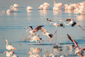
Cyprus holds exceptional biological diversity for an island of its size. The island hosts approximately 1,800 plant species, with 143 endemic taxa found only in Cyprus. Among animals, the island supports 385 bird species, 21 mammals, 24 reptiles, and 3 amphibians. Over 5,000 insect species have been documented. This diversity results from Cyprus's unique position at the crossroads of Europe, Asia, and Africa, combined with varied climate conditions and dramatic elevation changes from sea level to the 1,952-meter peak of Mount Olympus in the Troodos Mountains. The island's geological history as an uplifted oceanic plate rather than a continental fragment also contributed to the evolution of distinctive species. This combination of geographic isolation, habitat variety, and ancient history created conditions where unique life forms developed and thrived. Historical Background Cyprus's biodiversity reflects millions of years of natural evolution shaped by the island's complex geological formation. The Troodos Mountains rose from the ocean floor through tectonic forces, creating habitat diversity from coastal zones to alpine peaks. During the Late Pleistocene era, the island supported now-extinct megafauna including dwarf hippopotami and dwarf elephants, which died out after humans arrived around 10,000 BC. Human activity has shaped the Cypriot landscape for millennia. Neolithic settlers brought domesticated animals and began agriculture around 8,200 BC. Over thousands of years, traditional farming practices created a mosaic…

Read more
Cyprus Medieval Naval Fortresses

Cyprus Medieval Naval Fortresses

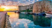
Cyprus has always occupied a strategic position between continents, and during the medieval period this geography transformed the island into one of the most heavily fortified maritime strongholds in the Mediterranean. Control of Cyprus meant control of ports, sea lanes, and access to trade routes linking Europe, the Middle East, and North Africa. As a result, successive powers reshaped its coastline with castles, harbor defenses, and naval infrastructure, turning the island itself into a living system of maritime control. This is not a story of isolated fortresses. It is the story of how the sea dictated power, architecture, and survival in medieval Cyprus. Why the Sea Defined Power in Medieval Cyprus In the medieval Mediterranean, maritime power was less about open naval battles and more about control of access. Harbors, fortified ports, and coastal strongholds determined who could trade, resupply fleets, or launch attacks. Cyprus’s location made it uniquely valuable, sitting at the intersection of east–west and north–south sea routes. Rather than relying on a single dominant port, rulers developed a network of coastal defenses. Each fortified harbor supported the others, allowing ships to move safely while creating overlapping zones of protection. Cyprus became both a gateway for commerce and a barrier against hostile fleets. Foundations Laid Before the Crusades Long before Western European rulers arrived, Byzantine authorities had already…

Read more