Explore Cyprus with Our Interactive Map

Explore our top stories and discover ideas worth your time.

Laouto (Lute)

Laouto (Lute)

The Cypriot laouto is a plucked string instrument with a distinctive accompaniment style that plays a crucial rhythmic and harmonic role in the island's music, supporting both instrumental ensembles and vocal traditions while embodying strong regional identities. Its pear-shaped body and resonant tone allow for improvisation within ancient modal systems inherited from Byzantine and Ottoman influences, making it a cornerstone of Cypriot folk expression. This instrument not only preserves historical musical practices but also adapts to contemporary settings, raising interest in how such traditions endure in a modern world. A Core Element of Cypriot Musical Heritage The laouto, a lute-like instrument central to Cypriot folk music, features a large pear-shaped body, long neck, and four strings tuned in a way that facilitates both melody and rhythm. Crafted from local woods like mulberry or walnut, with a soundboard often made from spruce or cedar for resonance, it produces a warm, bright sound that blends seamlessly with other instruments. In traditional settings, the laouto provides the backbone for dances, songs, and improvisations, its strings plucked with a plectrum to create driving rhythms and harmonic support. This role extends beyond mere backing; it shapes the music's texture, allowing vocalists or lead instruments like the violin to soar while maintaining a grounded, percussive foundation. Regional variations in playing styles—more ornate in the south, rhythmic…

Read more
Khirokitia UNESCO Chalcolithic Village

Khirokitia UNESCO Chalcolithic Village

Khirokitia (also spelled Choirokoitia) represents the peak of Cyprus's Aceramic Neolithic period, when communities built permanent settlements without any knowledge of pottery production. The site covers approximately 3 hectares at its maximum extent and consists of circular stone and mudbrick houses clustered together on a hillside. These structures were protected by massive stone walls that enclosed the settlement on multiple sides. The archaeological remains document a sophisticated farming society that thrived for over 1,500 years. Residents cultivated wheat and barley, raised domesticated sheep, goats, and pigs, and supplemented their diet through hunting and gathering wild foods. The settlement's name likely derives from the Greek words for pig (χοίρος) and cradle (κοιτίς), suggesting an area where pigs were raised, though several alternative etymologies exist in local tradition. Historical Background Porphyrios Dikaios, director of the Department of Antiquities of Cyprus, discovered Khirokitia in 1934 during archaeological surveys for the newly established Cyprus Museum. He identified surface scatters of prehistoric material on the terraced slopes of the Maroni River valley. Between 1936 and 1946, Dikaios conducted six excavation campaigns at the site despite interruptions from World War II between 1939 and 1945. His initial findings, published in The Journal of Hellenic Studies in 1934, first dated the settlement to around 4000 BC. However, radiocarbon dating later revealed a much earlier foundation date of…

Read more
Rugged Coastlines of Cyprus

Rugged Coastlines of Cyprus

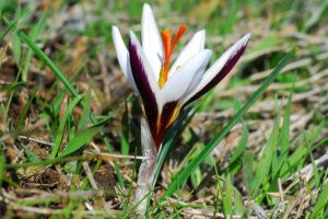
The rugged coastlines of Cyprus display dramatic geological contrasts where limestone cliffs plunge into turquoise Mediterranean waters, creating landscapes that combine raw natural beauty with mythological significance. The island's 648-kilometer coastline features two primary wild areas, the Akamas Peninsula in the northwest and Cape Greco in the southeast, both protected under the Natura 2000 European network. These areas showcase calcitic sandstones formed during glacial periods over the last 100,000 years, raised marine terraces representing ancient coastlines lifted by Cyprus's gradual tectonic uplift, and deep gorges carved through limestone bedrock by erosion. The Akamas covers 230 square kilometers with elevations reaching 419 meters, while Cape Greco's lower terrain emphasizes coastal features including sea caves, natural rock bridges, and vertical cliffs popular for cliff diving despite safety restrictions. Beyond their geological significance, these coastlines harbor rare endemic species including the Akamas tulip with only 200 plants worldwide and provide critical nesting sites for endangered Mediterranean monk seals and green sea turtles. Geological Formation and Ancient Uplift The coastline of Akamas is dominated by calcitic sandstones called Aiolianites formed during the glacial period in the last 100,000 years, with very characteristic raised marine terraces. Each terrace ledge represents an old coastline formed by wave action and raised as a result of Cyprus's tectonic uplift. This process continues today as the southern margin of…

Read more