Explore Cyprus with Our Interactive Map

Explore our top stories and discover ideas worth your time.

Ayios Herakleidios Mosaics

Ayios Herakleidios Mosaics

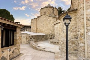
The mosaics at Ayios Herakleidios, in the inland territory of Tamassos, show an early Christian community expressing belief through geometry rather than mythic scenes or imperial display. Laid across successive basilica phases, the floors use repetition, careful placement, and durable materials to create a sense of order during periods of instability. This article explains how the site developed around the saint’s tomb, what the patterns and Chi-Rho symbol were designed to do, and how the mosaics survive alongside a living monastery today. An Inland Sanctuary at Tamassos Unlike Cyprus's major early Christian monuments along the coast, the Ayios Herakleidios complex developed inland, near copper-rich Tamassos, a former city-kingdom once dedicated to pagan gods. The location is essential to understanding the mosaics. This was not an imperial centre drawing wealth and artisans from across the Mediterranean. It was a rural heartland where Christianity spread through local networks, pilgrimage, and the authority of a revered saint. The basilicas rose beside the tomb of Saint Herakleidios, transforming an ordinary burial site into a spiritual anchor for the region. From the beginning, the focus here was not grandeur, but presence. A Tomb That Became a Centre The architectural history of the site unfolds in stages. The earliest Christian structure, a small 4th-century martyrion, was built directly over a Roman tomb believed to hold the…

Read more
Cape Greco Sea Cliffs And Caves

Cape Greco Sea Cliffs And Caves

Cape Greco rises from the Mediterranean Sea at Cyprus's southeastern tip, where limestone cliffs drop sharply into turquoise waters, and erosion has carved spectacular sea caves that extend up to 80 metres into solid rock. Cape Greco, also known as Capo Greco or Kavo Greko, forms a rocky peninsula jutting into the Mediterranean between the resort towns of Ayia Napa and Protaras. The headland marks the easternmost point of both the Republic of Cyprus and the European Union, excluding outlying territories. The area covers 385 hectares protected as National Forest Park under the Cyprus Forestry Department since 1993, with additional recognition as part of the Natura 2000 network for its European ecological significance. Historical Background The limestone cliffs at Cape Greco formed from sediments deposited when shallow seas covered the region millions of years ago. Marine organisms including mollusks, corals, and microscopic creatures contributed calcium carbonate that accumulated on the seabed and eventually compressed into rock layers. Tectonic activity lifted these sediments above sea level, creating the elevated plateau that characterizes the cape today. Wave erosion shaped the detailed features that make Cape Greco distinctive. Constant pounding by Mediterranean storms exploits weaknesses in the limestone, gradually hollowing out caves, cutting through narrow points to form arches, and creating vertical channels where waves compress and release with explosive force. This process…

Read more
How Ancient Harbors Shaped Cyprus Cities

How Ancient Harbors Shaped Cyprus Cities

Cyprus did not become influential in the ancient Mediterranean by expanding inland or building empires on land. Its power grew from the edge of the sea. During the Bronze Age, natural harbors along the Cypriot coast evolved into gateways that connected the island to distant worlds. These maritime entry points shaped cities, concentrated wealth, and transformed Cyprus from a resource-rich island into a central player in early Mediterranean exchange. To understand Bronze Age Cyprus, it is necessary to look not at walls or palaces first, but at the waterlines where ships arrived. Where Land Met Opportunity Bronze Age harbors were not abstract ideas or convenient backdrops. They were the practical foundations of coastal life. In Cyprus, sheltered bays, shallow inlets, and calm lagoons allowed early ships to anchor safely, beach their hulls, and unload heavy cargo. These locations quickly attracted people. What began as seasonal landing points became permanent settlements built around maritime access. Harbors created opportunity. Inland communities focused on farming and mining, but coastal settlements gained something more powerful. They gained connection. Through the sea came materials, skills, and ideas that reshaped how people lived and governed. Over time, the harbor was no longer just part of the city. It became its reason for existence. A Coastline Designed for Exchange Cyprus was unusually well positioned for Bronze Age…

Read more