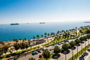
Explore Cyprus with Our Interactive Map

Explore our top stories and discover ideas worth your time.

Cyprus Green Line Today

Cyprus Green Line Today

The Green Line takes its name from a green chinagraph pencil used by British Major General Peter Young on December 30, 1963. He drew a ceasefire line on a map of Nicosia during a twelve-hour meeting following intercommunal violence between Greek and Turkish Cypriots. That pencil mark became the basis for one of Europe's most visible political divisions. Today the Green Line stretches 180 kilometers from Kato Pyrgos in the west to Paralimni in the east, cutting across the entire island. It varies from just 3.3 meters wide in central Nicosia to 7.4 kilometers wide in rural areas. The buffer zone covers 346 square kilometers, roughly 3.7 percent of Cyprus's total land area. After the Berlin Wall fell in 1989, Nicosia became the last divided capital city in the world, a distinction it still holds. From Pencil Line to Military Frontier The original 1963 Green Line addressed only Nicosia and remained relatively informal. The 1974 Turkish invasion changed everything permanently. Following a coup attempt by Greek Cypriot nationalists seeking union with Greece, Turkey intervened militarily and captured approximately 37 percent of the island. The ceasefire of August 16, 1974, froze the front lines in place. These lines became the boundaries of the current buffer zone, with the Turkish army holding the north and the Republic of Cyprus controlling the south.…

Read more
Atalanti Nature Trail

Atalanti Nature Trail

The Atalanti Nature Trail wraps around Mount Olympus at an altitude where black pines grow thick, and views stretch across the entire island of Cyprus. This 14-kilometer circular route offers a longer alternative to the more popular Artemis Trail, with the same mountain setting but fewer crowds. The path combines ecological education with genuine wilderness experience, complete with an abandoned chromite mine and an 800-year-old juniper tree. The Atalanti Nature Trail sits at 1,700 to 1,750 meters above sea level in the Troodos National Forest Park. The route starts and ends at Troodos Square, the main gathering point in the Troodos Mountains. Despite its 14-kilometer length, the trail maintains a relatively flat profile throughout most of its course, with only the final quarter showing noticeable elevation changes. The trail is officially designated as a geo-trail, which means it includes geological interpretation along with natural history. Walking time ranges from 3 to 5 hours, depending on pace and how often hikers stop to examine the landscape. Historical Background Atalanti takes her name from Atalanta, one of the few female heroes in Greek mythology who appears as a central figure. According to myth, her father abandoned her as an infant because he wanted a son. A she-bear found and nursed the child until hunters discovered her and raised her. She grew up…

Read more
Salamis to Paphos Historic Routes

Salamis to Paphos Historic Routes

The story of Cyprus roads spans over 3,000 years, from Bronze Age trade routes to Roman highways and modern infrastructure. This network transformed the island from scattered settlements into a connected civilization, linking major cities and remote villages while facilitating trade across the Mediterranean. The earliest roads in Cyprus date back to the Bronze Age, when the island served as a crucial trading hub between the Aegean, Egypt, and the Levant. Cyprus became the principal intermediary station for Mycenaean Greece in accessing Middle Eastern markets, largely due to its copper resources in the Troodos Mountains. By the end of the Hellenistic period, the road network encircled the entire island. During the Late Bronze Age between 1400 and 1150 BCE, trade with Minoan Crete and Mycenaean Greece increased dramatically. Archaeological evidence shows that Mycenaean pottery exports to Cyprus surged to over 3,500 vases across nearly two centuries. These goods traveled along established land routes that connected coastal ports to interior settlements. Historical Context The Romans transformed Cyprus's road infrastructure after annexing the island in 58 BCE. The first Roman roads were funded directly by the Emperor, though by the Severan dynasty the island had grown wealthy enough to finance its own construction. Roads converged on Salamis, the main economic center, with minor roads radiating outward to connect the surrounding agricultural areas…

Read more