Explore Cyprus with Our Interactive Map

Explore our top stories and discover ideas worth your time.

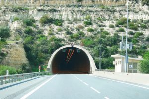
How Infrastructure Overcomes Cyprus’s Rugged Terrain

How Infrastructure Overcomes Cyprus’s Rugged Terrain

The Troodos Mountains cover roughly one-third of Cyprus, stretching across most of the western portion. Mount Olympus rises to 1,952 meters, making it the island's highest peak. These mountains formed through the collision of African and European tectonic plates, pushing ancient seabed rock formations skyward over millions of years. The landscape varies dramatically within short distances. Coastal areas sit at sea level while mountain villages perch at elevations exceeding 1,000 meters. Steep valleys cut through the terrain, with rivers carving gorges that modern roads must somehow cross. In 2011, heavy rainfall triggered 128 separate landslide incidents in Paphos, causing significant damage to roads and buildings. These geological realities force engineers to constantly assess slope stability when planning new infrastructure. The island's geology includes unstable clay-rich soils and fractured rock formations that shift during rainfall, creating ongoing maintenance demands. Building Motorways Through Mountains Cyprus developed its motorway network relatively recently compared to European neighbors. The A1, completed in October 1985, became the island's first motorway. Despite this late start, Cyprus now leads all European Union members with 36.8 kilometers of motorway per 100,000 inhabitants. The network totals approximately 7,206 kilometers of paved roads and 4,387 kilometers of unpaved routes. No toll roads exist anywhere on the island. The Public Works Department manages motorways and major roads, while municipalities handle urban streets…

Read more
The Cyprus Golden Oak

The Cyprus Golden Oak

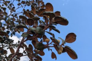
In the high, rocky landscapes of Cyprus's central mountains, one tree shines with a quiet golden glow. The Cyprus Golden Oak, an evergreen species found nowhere else on Earth, earns its name from the shimmering underside of its leaves. Walking through its groves offers a peaceful encounter with one of the island's most enduring natural wonders. Early history and naming The Cyprus Golden Oak, Quercus alnifolia, was first described in 1754 as a member of the genus Alnus (alders), hence the scientific epithet. Its local name, latzia (λατζιά), derives from Hylates — a title attributed by ancient Cypriots to the god Apollo. Hylates comes from the Greek word hyle (ὕλη), meaning forest. It’s an evergreen oak that grows only in Cyprus on basaltic and ultramafic rocks of Troodos ophiolite. Its most distinctive feature is the golden-coloured underside of its leaves, which gives the tree its common name. Notably, specimens cultivated outside their native habitat—such as those found in the Royal Botanic Gardens, Kew— fail to develop this characteristic golden coloration. Golden Oak ancestry and ecological role The Golden Oak branched off from its Turkish relatives to make a home on the volcanic rocks of the Troodos Mountains. It plays a crucial role on the mountain’s steep slopes, where its roots act as a natural anchor to stabilize the soil. Over…

Read more
Konnos to Agioi Anargyroi Trail

Konnos to Agioi Anargyroi Trail

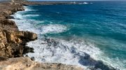
Cyprus offers some of the most beautiful coastal paths in the Mediterranean region. The trail from Konnos Beach to Agioi Anargyroi stands out as a prime example of natural beauty. This path winds along the rugged cliffs of the Cape Greco National Forest Park. Hikers enjoy a direct view of the turquoise sea while they walk on ancient limestone formations. The air smells of salt and wild thyme throughout the entire journey. Every step reveals a new perspective of the coastline. This route connects two iconic landmarks and provides a peaceful escape for nature lovers. It represents the raw, untouched spirit of the Cypriot landscape. Trail Overview Location: Cape Greco National Forest Park, Ayia Napa, Cyprus Distance: 3 miles (4.8 km) Route Type: Point-to-Point (can be done as Out & Back) Difficulty: Easy Elevation Gain: 40 meters Duration: 1 – 1.5 hours Best Time to Visit: September to May or at Sunrise Terrain: Rocky, Coastal, and Limestone paths The Path Along the Azure Coast The journey begins at the scenic Konnos Bay. This area serves as a gateway to the Cape Greco peninsula. You start the walk on a well-defined track that hugs the edge of the cliff. The trail remains mostly flat which makes it accessible for most fitness levels. To your left, the Mediterranean Sea stretches toward the…

Read more