Cape Greco National Forest Park sits at the southeastern tip of Cyprus, between Ayia Napa and Protaras. This protected area covers 385 hectares of dramatic coastline where limestone cliffs drop into turquoise Mediterranean waters.
The park became a National Forest Park in 1993 and forms part of the Natura 2000 network, recognized for its ecological importance across Europe. Cape Greco offers a network of interconnected nature trails that guide visitors through diverse coastal landscapes, past ancient ruins, and along some of the island’s most spectacular viewpoints.
Historical Background
The area has been inhabited since ancient times, with evidence of Neolithic settlements and later Greek and Roman influences. The landscape formed millions of years ago through tectonic activity and erosion from sea and wind. The ruins of a temple dedicated to Aphrodite can be found along one of the trails, connecting hikers to the island’s mythological past. The natural rock formations themselves tell the story of geological forces that shaped this coastline over countless millennia.
The area was designated as a National Forest Park in 1993, providing formal protection for its unique ecosystems and cultural heritage. Conservation efforts focus on preserving the delicate balance between public access and environmental protection. The park’s establishment reflected growing awareness of the need to safeguard Cyprus’s natural treasures for future generations.
The Nature Trail Network
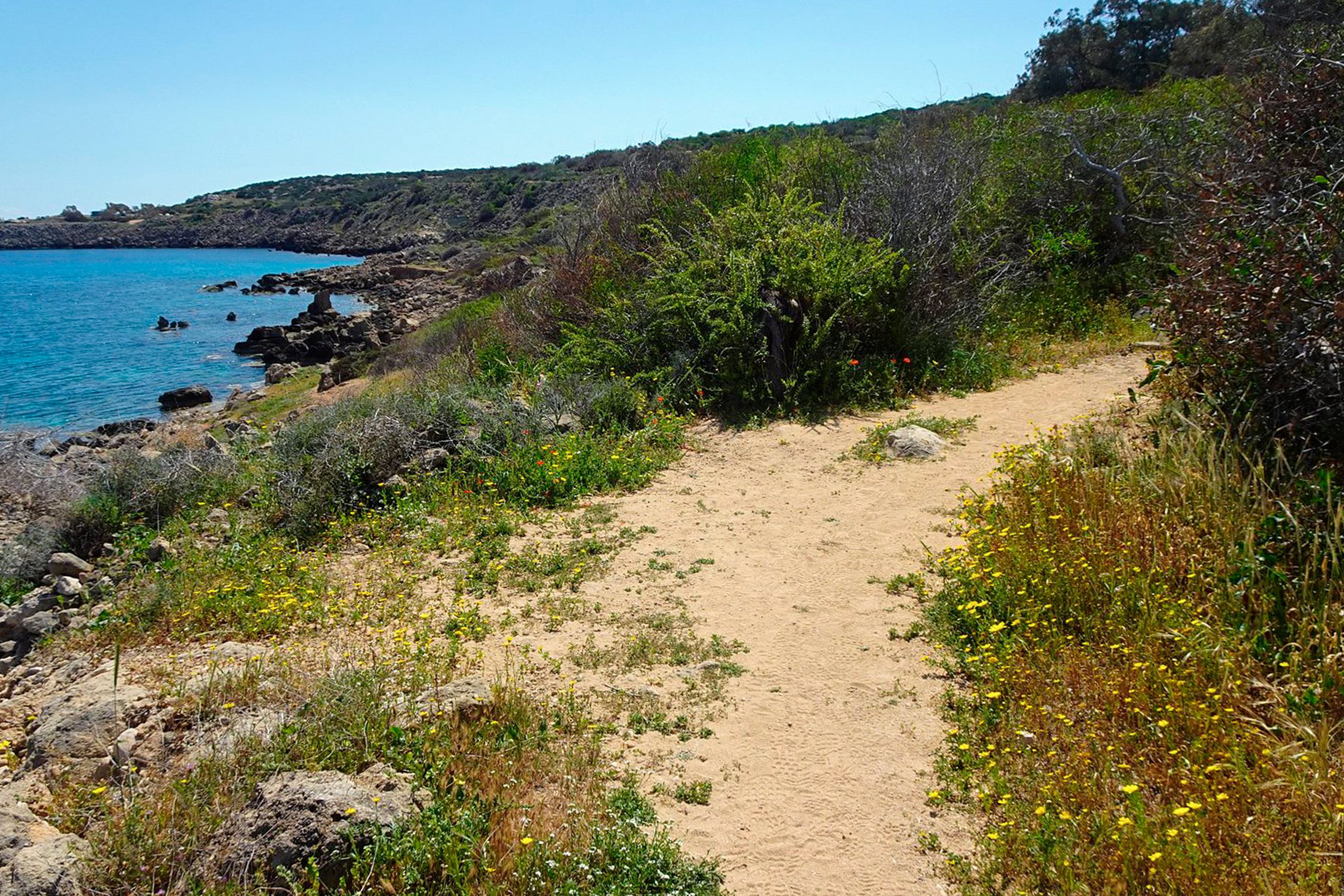
There are 9 nature trails with a total length of 16 kilometers that visitors can explore throughout the park. These trails vary in difficulty and duration, from easy 45-minute walks to more challenging two-hour hikes. The paths connect to form a larger network, allowing hikers to customize their routes based on time and fitness level.
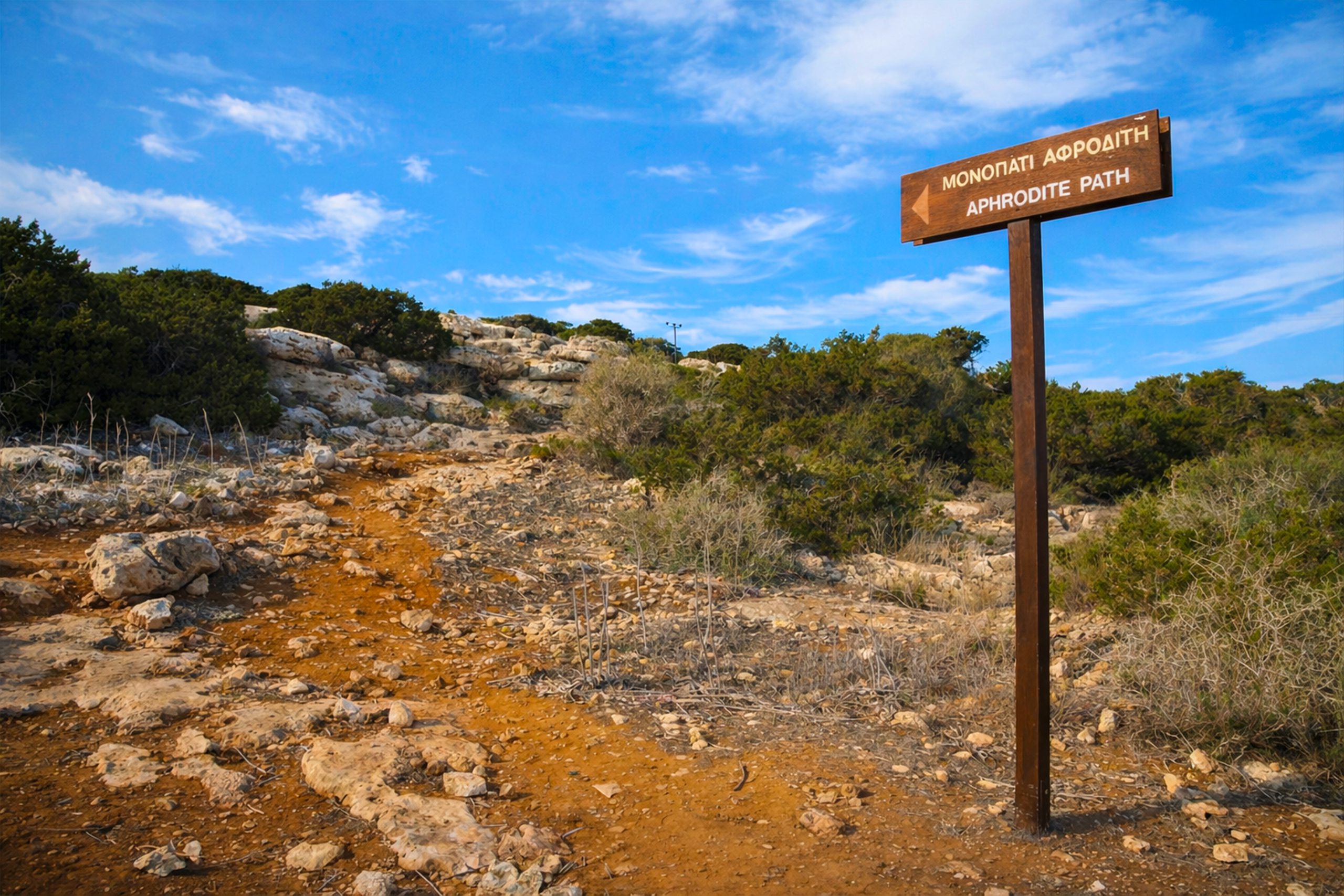
The Aphrodite Nature Trail stretches 2 kilometers along the northeast coast. This trail winds through stunning landscapes and is well-marked, making it accessible for all levels of walkers. The route passes the ruins of an ancient temple and continues through areas where shepherds once used natural caves and dry stone walls to shelter their animals.
The Ayioi Anargyroi circular nature trail is a 2.3 km loop taking approximately 45 minutes to complete. It starts at the whitewashed Church of Ayioi Anargyroi, built on a vertical coastal rock, and offers stunning sea views throughout. This trail connects with the Ayioi Anargyroi to Sea Caves trail, which extends the journey for those wanting a longer hike.
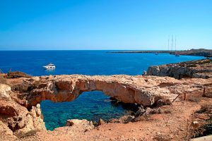
The Agioi Anargyroi to Sea Caves trail starts from an old quarry parking area, covers 2.5 km and takes about 45 minutes. Points of interest include fossilized marine organisms and a vantage point from which visitors can see as far as Stavrovouni Monastery. The trail passes through the natural arch formation known as Kamara tou Koraka before ascending slightly through shrub vegetation.
The Konnos to Ayioi Anargyroi trail offers a coastal walk that can be started from either Konnos Beach or the chapel. This 4.8 km trail takes about 2 hours and walks along the coast, providing continuous views of the Mediterranean. The path connects several key landmarks within the park.
Part of the E4 European Long Distance Path, which was inaugurated in 2005 and is 539 km long, connecting Larnaka and Pafos international airports, runs through Cape Greco. This section forms part of a hiking route that stretches from Spain to Cyprus, covering approximately 10,000 kilometers across Europe.
Rich Biodiversity and Endemic Species
The national park boasts over 400 species of plants, many of which are endemic to Cyprus. The Mediterranean climate creates ideal conditions for this diverse flora to thrive throughout the year. Among the endemic plants recorded are Bosea cypria, Allium willeanum, Anthemis tricolor, Onosma fruticosa, and Teucrium micropodioides. Additionally, 14 rare native plant species have been documented in the area.
The fauna includes mammals like foxes, hares, and hedgehogs that roam the park freely. Cape Greco is a breeding site for Cyprus wheatears, Cyprus warblers, and black francolins, all of which are endemic to the island. Researchers have recorded around 20 Annex I bird species from the EU Birds Directive in the area.
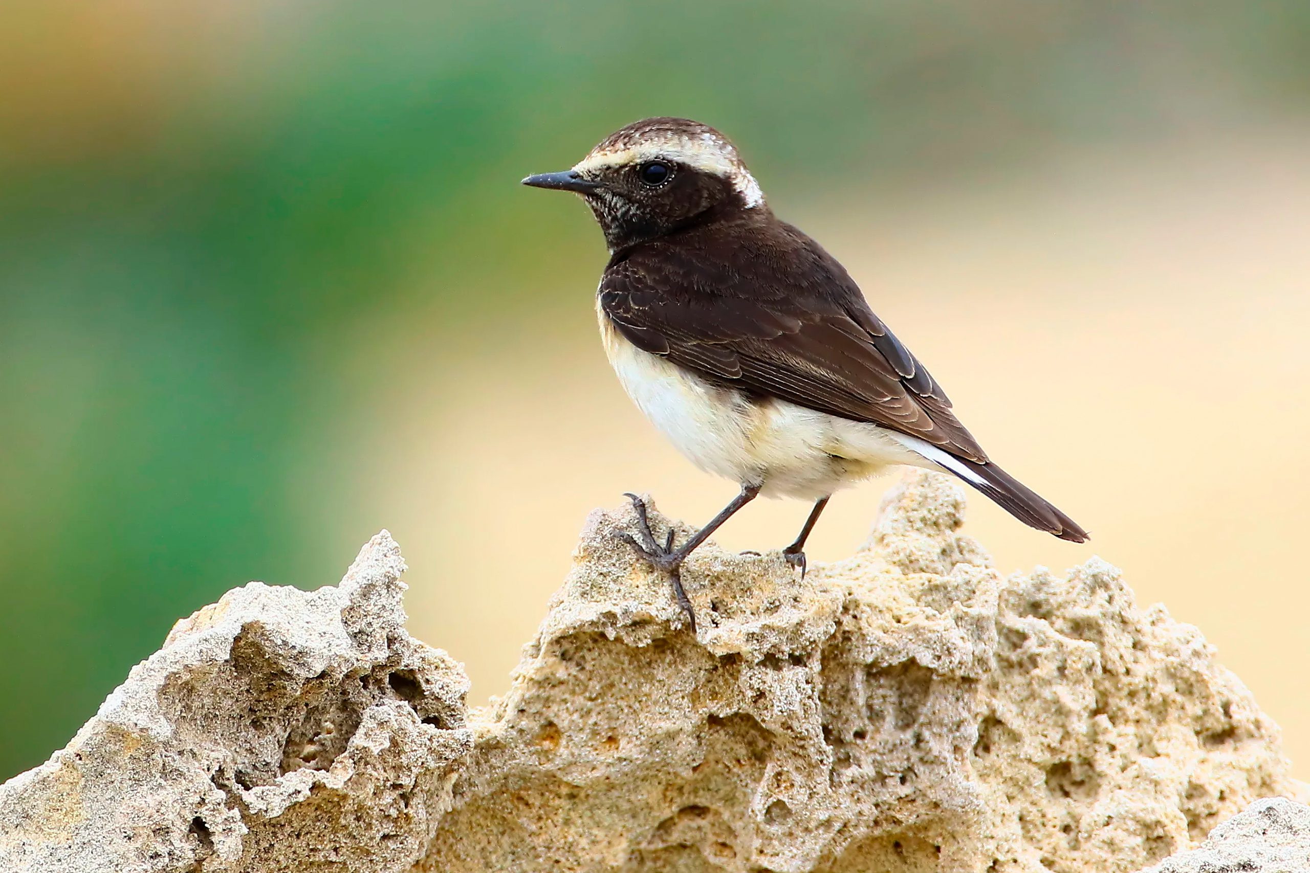
During migration seasons, the park becomes a crucial resting point for numerous species of birds traveling between Europe and Africa. This strategic location makes Cape Greco particularly important for conservation efforts and attracts birdwatchers from around the world.
Distinctive Natural Formations
The sea caves represent one of Cape Greco’s most remarkable features. These dramatic limestone formations are naturally carved by the sea and can be best appreciated from a boat trip. The Palace Caves and Smugglers’ Caves are notable examples, accessible only from the water. Some caves extend as far as 240 feet into the cliffs.
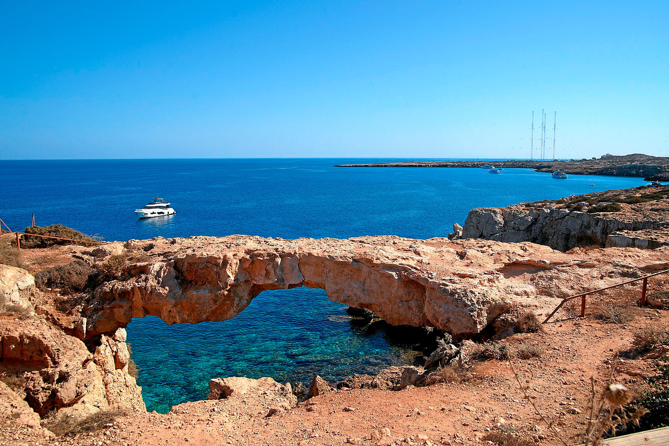
The Natural Bridge, known as Kamara tou Koraka, is a stone bridge considered an architectural wonder of nature. According to local lore, its name comes from the many crow’s nests that once surrounded it. Visitors can view this formation from designated safe areas, though walking on the bridge itself is prohibited.
Cyclops Cave holds mythological significance in the area. According to mythology, this large cave was once inhabited by a family of cyclops who were shipwrecked on the island after a sea disturbance. The cave offers a connection between natural geology and ancient Greek legends.
The Blue Lagoon showcases some of the clearest waters in Cyprus. Water visibility reaches up to 40 metres, and sea temperatures range from 16°C to 28°C. These conditions make the area particularly attractive for snorkeling and diving.
Interesting Details About the Park
The lighthouse at Cape Greco was built by the British in 1892 and served for decades to regulate navigation. It also informally functioned as an observation point for monitoring smuggling activities in the area.
Wild asparagus grows throughout Cape Greco, and foraging for it is a legal and popular activity. Visitors who forage should do so responsibly, taking only what they need and leaving sufficient plants for wildlife and regeneration.
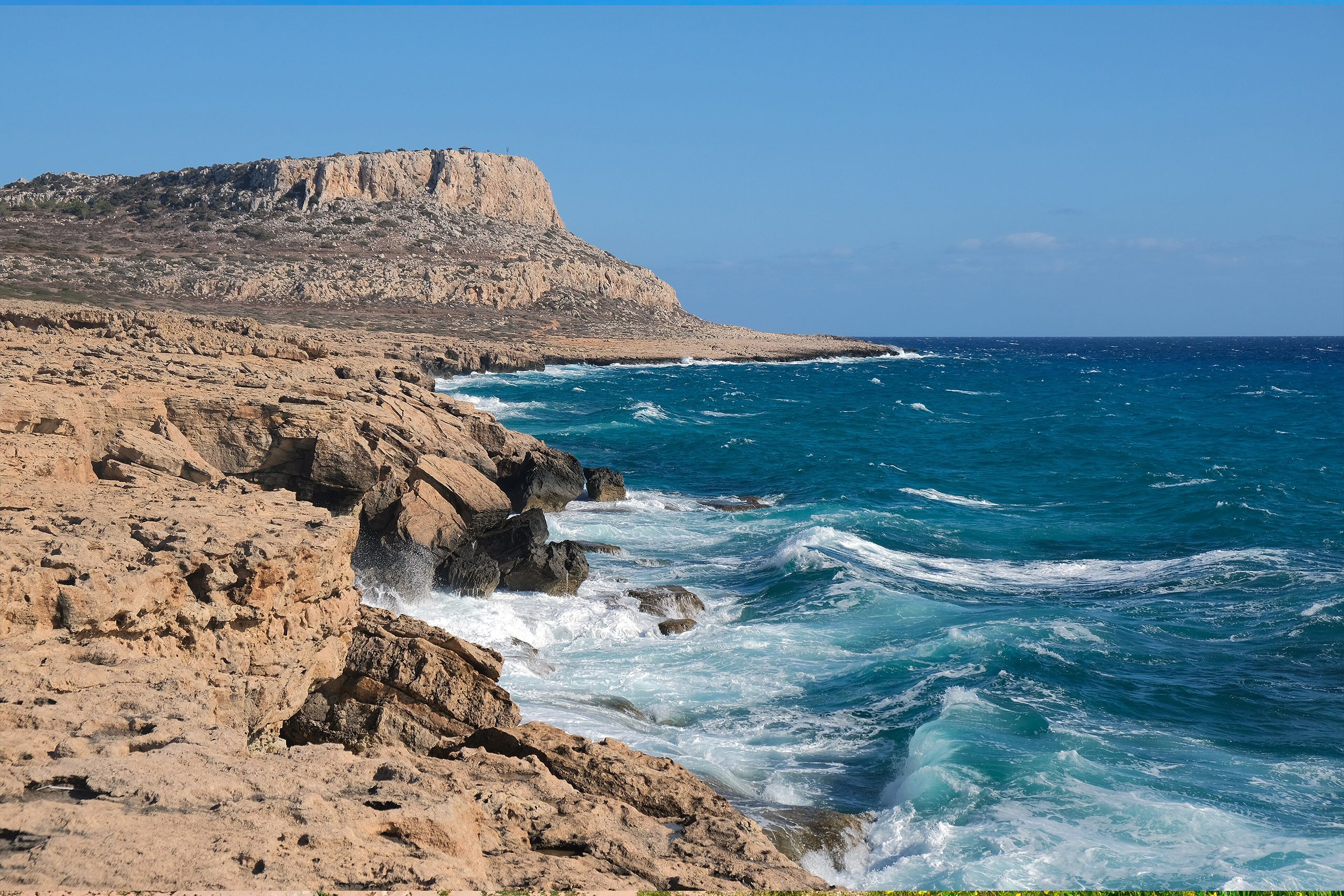
From the highest peak at Cape Greco, at 28 meters altitude, visitors can see remarkable distances across the island. The viewpoint provides 360-degree panoramas that take in both the coastline and inland landscapes.
The Phoenician juniper flourishes in certain areas of the park. The Agioi Anargyroi circular trail is known for its dense vegetation, mainly Phoenician Juniper, which creates shade and adds to the Mediterranean atmosphere of the hikes.
The Park in Contemporary Cyprus
Cape Greco serves multiple roles in modern Cypriot society. It functions as a recreational area for locals and tourists, an educational resource for understanding Mediterranean ecology, and a protected habitat for vulnerable species. The park’s designation as part of Natura 2000 reflects international recognition of its conservation value.
The proximity to Ayia Napa and Protaras means the park experiences significant visitor numbers, particularly during summer months. This has led to careful management strategies to balance tourism with environmental protection. Designated trails help concentrate foot traffic and minimize damage to sensitive habitats.
The park also contributes to Cyprus’s cultural identity as a place where ancient history and natural beauty intersect. The ruins, caves, and rock formations connect present-day visitors with thousands of years of human interaction with this landscape.
Visiting the Nature Trails
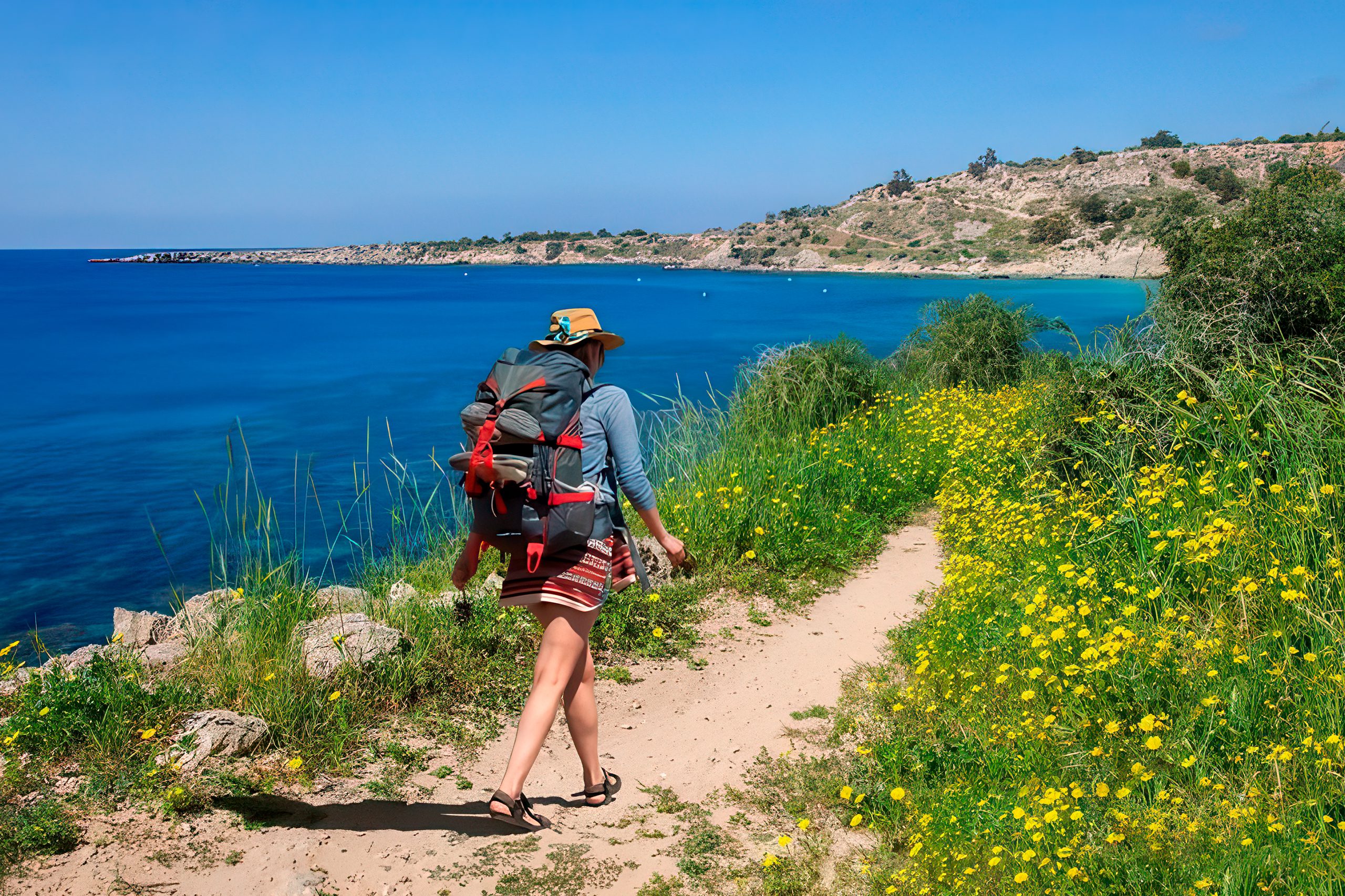
Cape Greco is accessible year-round and free to enter. The trails are well-marked, though comfortable footwear is essential due to uneven terrain. Early morning or late afternoon visits during summer months are advisable to avoid the intense midday heat.
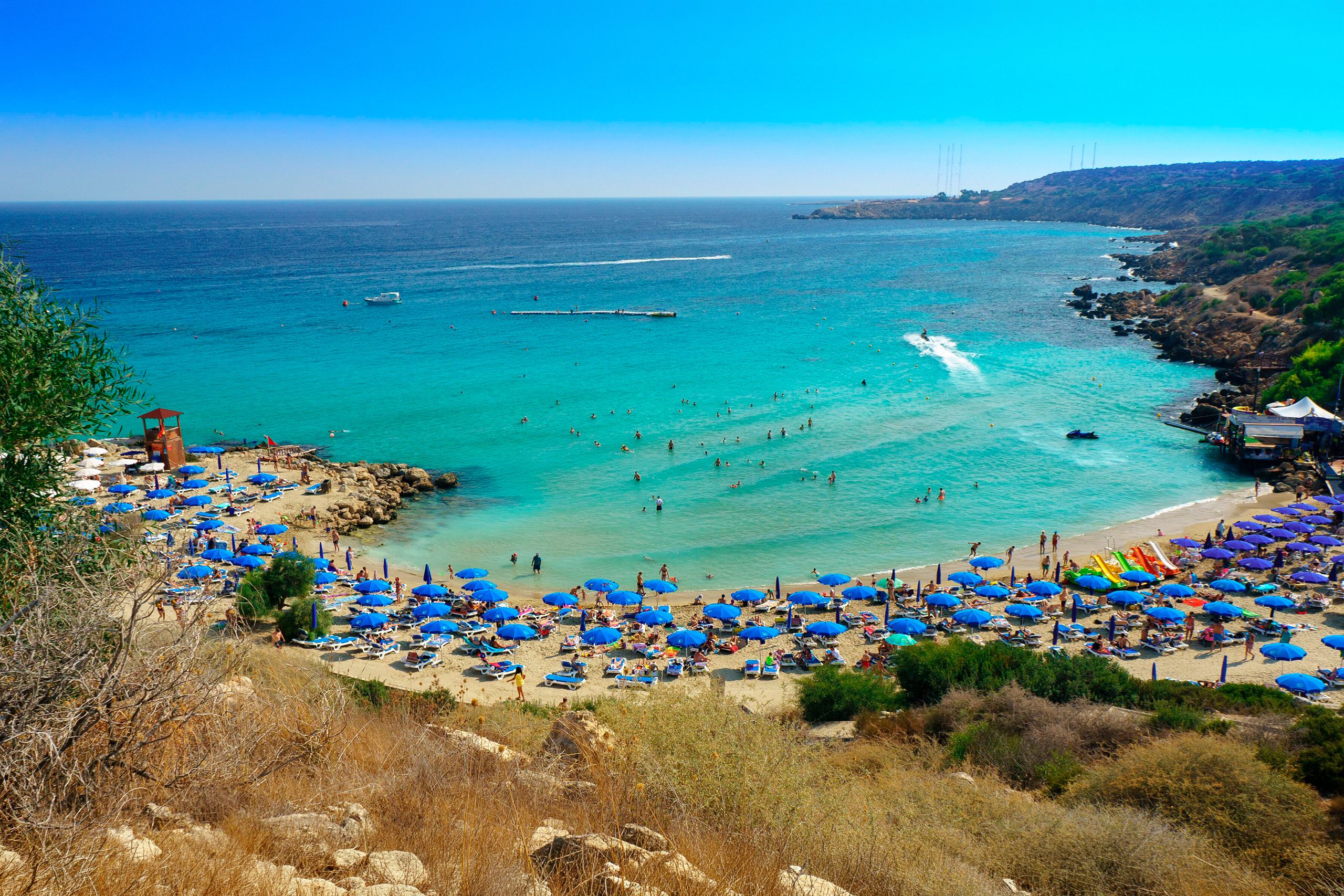
Konnos Beach, one of the most splendid beaches in Cyprus, provides a natural starting point for many hikes. The beach is merely 35 meters wide and 200 meters long, well-sheltered with golden sand. From here, several trail networks branch out into the park.
Parking areas are located at key points throughout the park, including near the Ayioi Anargyroi chapel, the Blue Lagoon, and the visitor center. Public transportation connects the park to nearby towns, though having a vehicle provides more flexibility for exploring different trail access points.
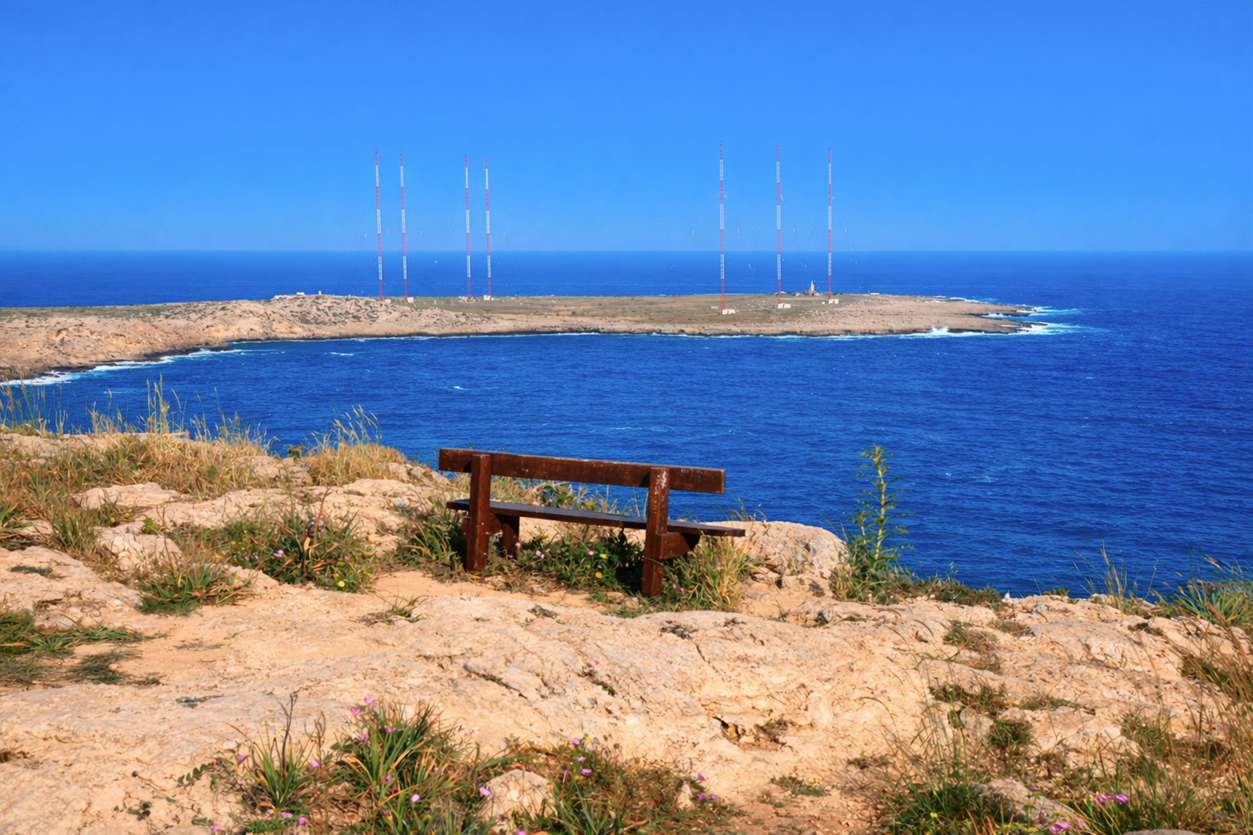
The park includes picnic sites, benches along trails, and information boards that explain the area’s ecology and history. A 4-kilometer cycling path offers an alternative way to experience the landscape for those who prefer biking to walking.
A Natural Treasure Worth Discovering
Cape Greco’s nature trails offer an accessible way to experience one of Cyprus’s most distinctive coastal landscapes. The combination of geological formations, endemic species, historical sites, and sweeping Mediterranean views creates an environment that appeals to hikers, nature enthusiasts, and anyone seeking to connect with Cyprus’s natural heritage. The trails demonstrate how protected areas can serve both conservation and recreation, preserving ecological integrity while allowing people to experience and appreciate the island’s remarkable biodiversity and beauty.