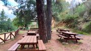
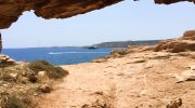
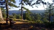
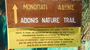
The Adonis Nature Trail sits near the Baths of Aphrodite within the Akamas Peninsula. This path follows a historic route where myth and nature meet on the northwest coast. A steep ascent leads toward the Pyrgos tis Rigainas, where ancient ruins stand silent. Every step reveals a wide view of the blue Mediterranean Sea below.
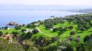
The air carries the scent of wild thyme and salty breeze throughout the year. This trek serves as a physical challenge for those who seek high vantage points. It offers a direct look at the rugged beauty of the Cypriot landscape. Each segment provides a unique perspective of the coastal cliffs.
Trail Overview
- Location: Akamas Peninsula, Paphos District, Cyprus
- Distance: 4.7 miles (7.5 km)
- Route Type: Loop
- Difficulty: Moderate to Hard
- Elevation Gain: 1,300 feet (400 meters)
- Duration: 3 hours
- Best Time to Visit: January to May
- Terrain: Rocky paths, dirt tracks, and coastal cliffs
Technical Ascent and Path Structure
The trek begins at the same point as the Aphrodite Trail near the botanical gardens. A clear split in the path marks the start of the Adonis loop. The incline starts almost at once and requires steady effort. Loose stones cover the track and demand focus for a safe foot placement.
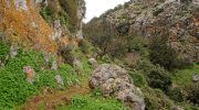
This part of the hill consists of limestone and sandstone formations. These rocks create a pale and dusty look to the ground underfoot. The gradient stays steep until the route reaches the middle ridge. This section tests the pulse as the trail climbs above the sea level.
Botanical Diversity of the Akamas Region
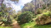
Juniper trees dot the landscape and provide a bit of shade in the early hours. The carob tree also grows in the rocky soil near the base of the hills. These trees have dark leaves that stay green in the dry months. This trait helps the plant survive the long summers on the island. No natural water taps exist on the higher parts of the ridge.
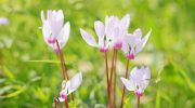
The soil is thin and rocky which limits the plant life to hardy shrubs. Rare cyclamens appear in the winter when the rain provides enough moisture. Wild sage and rockrose scent the air as the wind moves across the slope.
Navigation Along the Coastal Ridge
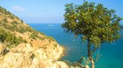
The path follows the edge of the plateau once the main climb ends. This part of the trek offers a total view of Polis Chrysochous bay. One sees the dark blue water that meets the sky on the horizon. The track stays narrow with sharp drops toward the valley floor.
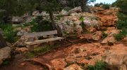
It is vital to watch the ground to avoid a trip on a root or stone. The wind picks up speed as the path leaves the shelter of the trees. This breeze provides a cool relief after the heat of the climb. The lack of tall woods allows for a clear sight of the Cape Arnaoutis.
Historical Sites and Ancient Ruins
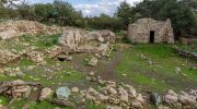
The trail passes the ruins of the Queen’s Tower at the highest point. This site tells a story of the medieval past of the island. Large stones sit in heaps where a grand building once stood. These blocks show the skill of the masons who worked the local rock. The peak area is a flat space with very little cover from the sun. It offers a 360 degree view of the entire Akamas Forest. One can spot the Lara beach to the south on a bright day. The sun feels intense here because the canopy is thin and sparse.
The return loop joins the Aphrodite Trail for a shared path back down. This descent is quite steep and tests the strength of the knees. The dry gravel makes the ground feel unstable under heavy boots. It is best to take slow steps on the most vertical parts of the hill. The pressure on the joints increases with every meter of the drop. One passes through areas of low scrub where small lizards hide. These reptiles stay on the warm rocks until they hear a footstep. The path eventually leads back to the lush green of the gardens.
Trail Markers, Route Maintenance & Flora Changes
The Department of Forests keeps the signs in good repair along the loop. Blue markers on the rocks show the way for the Adonis route. Several spots exist where the path meets other local farm tracks. It is easy to miss a turn if the eyes stray from the trail signs. The path stays in fair condition despite the winter rain and foot traffic. Small wooden fences protect the most fragile parts of the cliff edge. These steps ensure that the route remains a safe place for the public. The trail stays clean because the hikers take their trash home.
February brings a carpet of flowers that covers the hill in color. The weather is mild and perfect for a long walk at noon. Spring is the peak time for a visit to see the orchids in bloom. The grass stays green for a short time before the summer heat arrives. July offers a tough challenge as the sun beats down on the rocks. Autumn brings a cooler air but the ground stays dry and hard. Each month provides a new look to the sea and the coastal shrubs. The visibility reaches the far mountains when the air is clear.
Ecological Protection and Visitor Conduct
The Akamas Peninsula is a protected zone for many rare bird species. It is vital to keep the noise low to avoid a disturbance to the nests. One should stay on the path to keep the soil and plants safe.
The ecosystem is delicate and needs the care of every traveler. You must not take any stones or plants from the park grounds. This help ensures the site stays natural for the next generation. The path remains a gift for all who treat the earth with respect. Your visit supports the conservation of the wild coast.