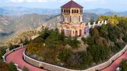
If you ever want to surprise someone in Cyprus, do not take them to a museum. Take them to Troodos. As you drive up from any direction you will first pass citrus groves, almond orchards and vineyards. Then pine appears. The air cools. The road winds higher. Somewhere above the clouds you stop, step out of the car and pick up a stone.
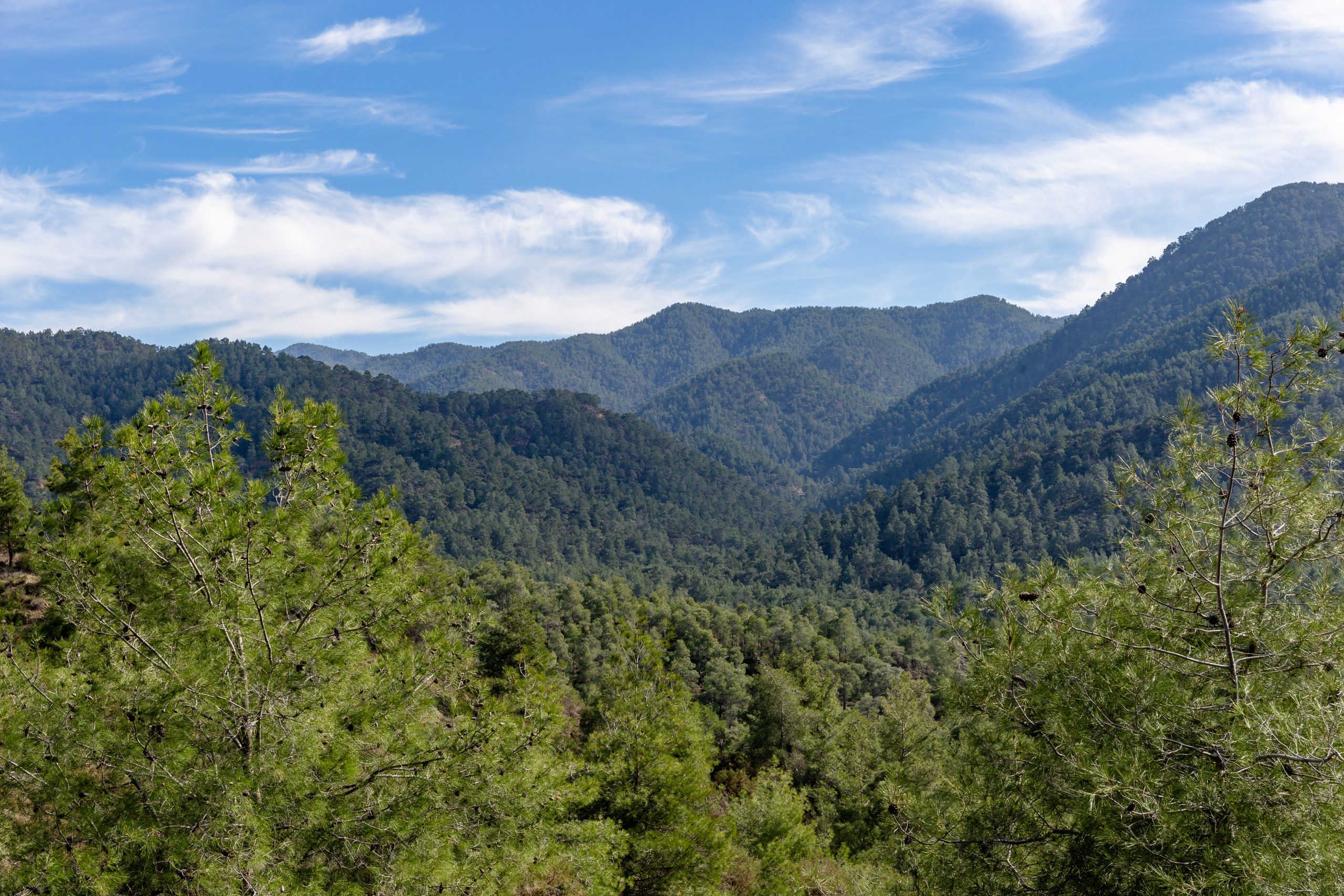
And you are holding a piece of the Earth that once lay kilometres beneath a vanished ocean. This is not a poetic exaggeration. Troodos is one of the very few places on the planet where a complete section of oceanic crust and upper mantle stands above sea level.
What scientists normally reach only with deep-sea drilling ships, submarines and expensive research programmes lies here beside hiking paths, picnic sites and village roads.
Within roughly fifty kilometres you can travel from rocks that formed deep inside the mantle to rocks that erupted on the seafloor, then into sediments that later surrounded the rising island. You are not simply climbing or going down a mountain. You are walking through the internal anatomy of the Earth itself.
In the 1960s geologists were still debating whether continents actually moved. The theory of plate tectonics existed but needed proof. Troodos provided it. Here, predictions matched reality: magma chambers, feeder dykes and submarine lavas appeared exactly where theory said they should. The argument ended on a Cypriot mountain.
But the importance of Troodos does not stay in textbooks. These rocks created Cyprus itself. They produced copper that drew settlers here from all-over mediterranean, soils that grew grapes and fruits, forests that trapped rainfall, building materials that allowed villages to grow and local art and traditions to thrive. Even the shape of the island’s ecosystems follows the outline of the ophiolite.
- 1. A Mountain Born Underwater
- 2. The great onion of Troodos
- 3. Layer 1. The Volcanic Ring
- 4. Layer 2. The Sheeted Dyke Complex
- 5. Layer 3. The Upper Plutonic Complex
- 6. Layer 4. The Mantle Crown: The Peridotite Core of Troodos
- 7. The Arakapas Fault Zone and the Limassol Forest Anomaly
- 8. Troodos UNESCO Global Geopark. The Mountain That Became a Classroom.
- 9. Conclusion. The Mountain That Explains Cyprus
1. A Mountain Born Underwater
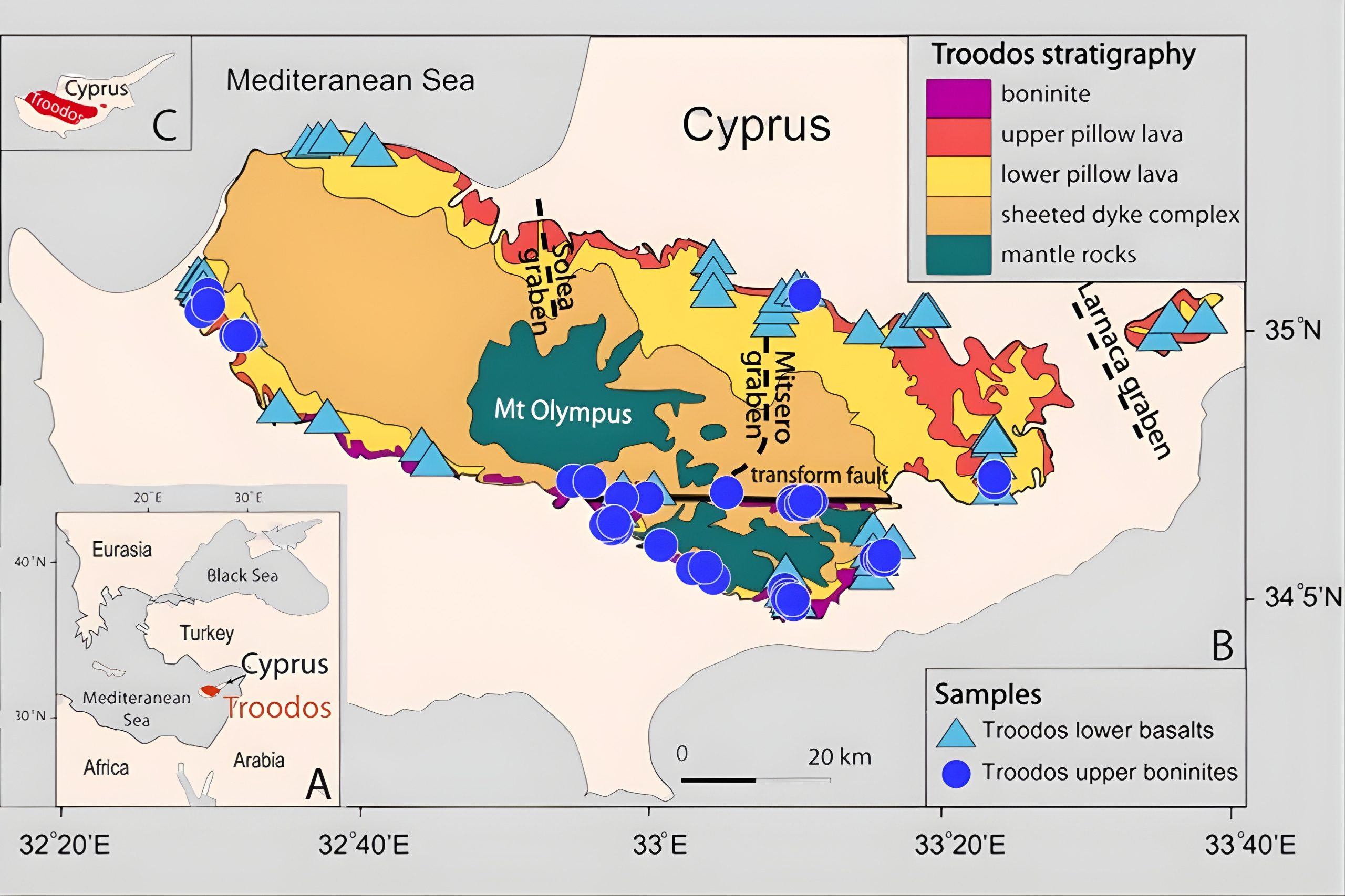
About 90 million years ago Cyprus did not exist. In its place stretched a deep ocean called the Neo-Tethys. On its floor ran a long volcanic ridge, similar to the Mid-Atlantic Ridge today.
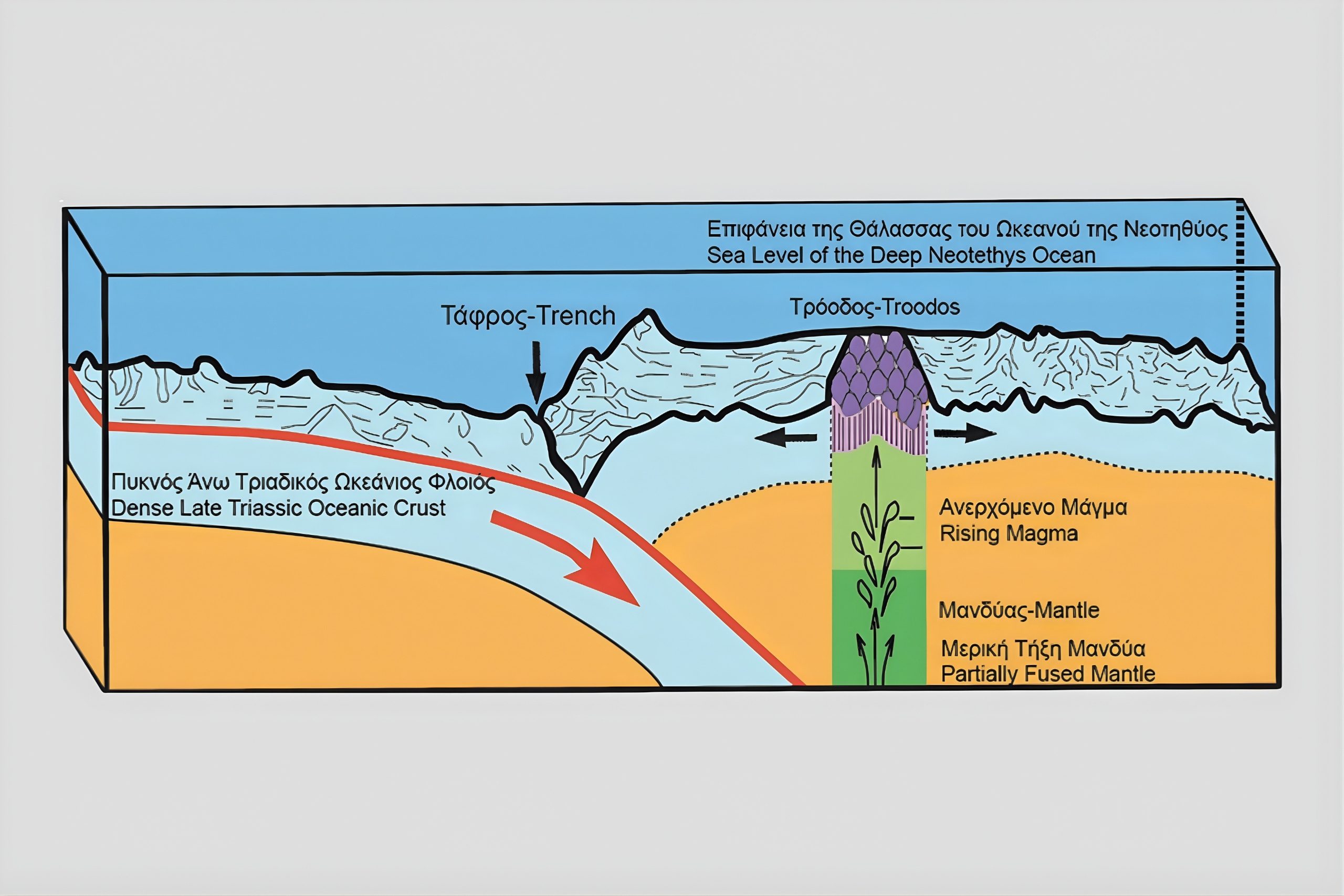
Along this ridge molten rock rose continuously from below, creating new crust. Picture a crack in the seafloor constantly opening. Magma rises, spills into water, cools instantly and cracks again as more magma pushes upward. Beneath this activity lay magma chambers feeding the eruptions. Usually, such oceanic crust eventually sinks back into the mantle when plates collide. Troodos escaped. Instead of disappearing, a large section of that ocean floor was pushed upward during tectonic convergence. The seafloor rose, fractured and slowly emerged above water.
The strange result: deep layers ended up at the top of a mountain. To the west, the Mamonia complex records the continental margin of Africa. Around Troodos younger sediments later formed farmland and plateaus. The Mesaoria basin developed after uplift. The Kyrenia range rose separately to the north.
Troodos therefore became the backbone of the island, its beating green heart.
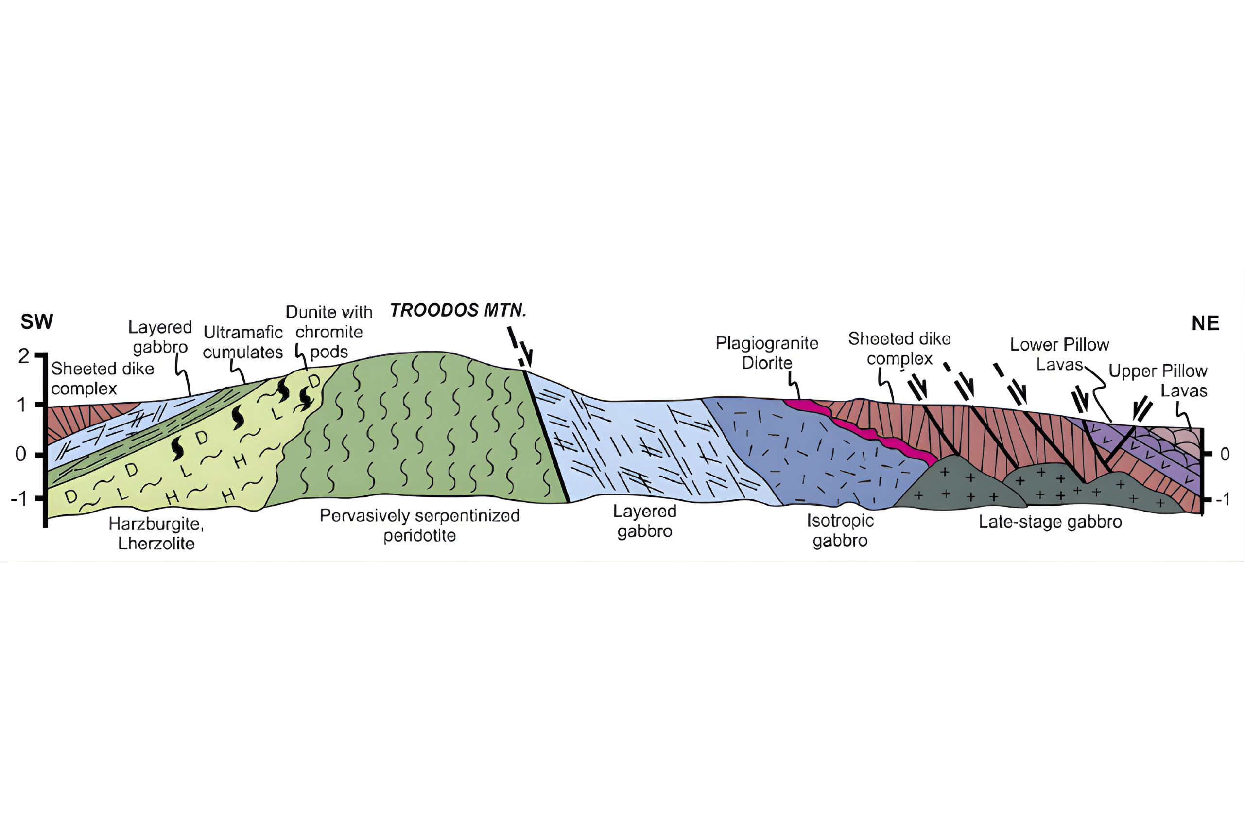
2. The great onion of Troodos
To understand the geology of Troodos, picture a vertical slice through the Earth under the ocean:
● At the top: submarine lava flows, the seafloor itself
● Beneath: vertical sheets of magma channels, the feeding system
● Beneath: large magma bodies that cooled slowly, the chambers
● Beneath: mantle rocks, the deep engine room
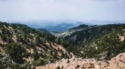
Troodos places these layers on the landscape in a way you can travel through. The highest part of the mountain, around Olympus, exposes the deepest rocks. As you move outward and downward, you encounter progressively shallower layers, until you reach the pillow lavas that once erupted directly onto the seafloor.
This is why Troodos is so valued by geologists. It is not merely exposed, it can be read.
The same structure also explains why the mountains are so physically diverse. The slopes, the colours, the shape of valleys, the way the forest sits on the ridges all shift from one zone to another. Even vegetation and wildlife all change with each major layer.
Geologists regard Troodos as a classic, almost textbook example of an ophiolite. The term comes from Greek roots meaning “snake stone”, originally used for serpentinite, whose colour and smooth texture resemble snakeskin, and which almost always appears within such formations. Over time the name came to describe entire mountain complexes formed when oceanic crust is lifted onto land during tectonic convergence.
In simple terms, Troodos is a cross-section of our planet that can be seen and touched every day. What is normally hidden beneath kilometres of ocean lies open here on footpaths and road cuts, making it invaluable not only to scientists but to anyone who walks or drives along its slopes.
3. Layer 1. The Volcanic Ring
Let’s go on the exciting journey through the layers of Troodos starting from the very bottom.
The first formations we’ll encounter belong to the volcanic complex. They form a broad outer ring around the Troodos core. Dark rocks, rounded forms, rust coloured streaks, occasional green tones.
This ring stretches in two great disjointed arcs around the Troodos’s main ridge foothills:
● from Pomos and Kato Pyrgos in the west where the mountains touch the sea
● to Stavrovouni in the east, the last prominent Troodos high point before Mesaoria plain and the Larnaca coastline
● from the Limassol side near Parekklisia and Pyrgos
● to the northern slopes that lead toward the Nicosia’s outskirts and contain most of the historic copper mine zones
In many places this volcanic sequence rises from sea level to close to 800 metres.
What are pillow lavas?
Pillow lava rocks form when lava flow erupts underwater. The outer skin cools instantly and hardens. The inside remains molten for a moment, pushing out, swelling, bursting, forming another rounded “pillow”. The result is a stack of bulbous shapes, like a pile of melted cushions frozen in motion.
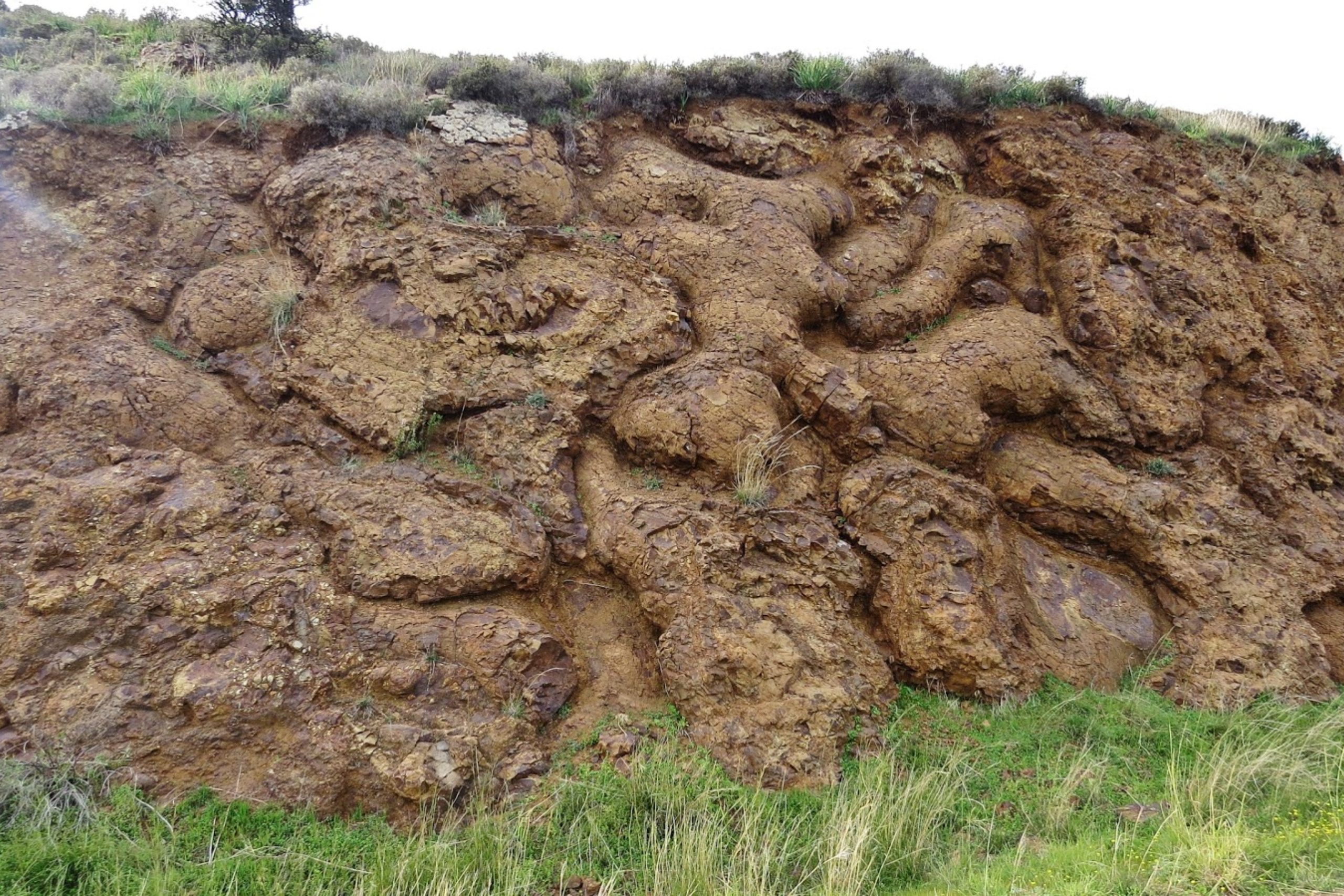
They can look brown-black, dark grey, sometimes greenish where minerals altered the rock. In some exposures you can often trace the rounded shapes with your hand.
Upper and Lower pillow lavas
You can think of them as different chapters of the same underwater volcanic story. The lower sequence tends to be older, often more altered, sometimes more mineralised. The upper sequence records later eruptions. The exact details vary by location, but the story stays consistent. Repeated seafloor eruptions built a thick volcanic pile around the Troodos ridge.
The Basal Group
Slightly higher than the pillow lavas lies the Basal Group, a transitional layer containing both volcanic and sedimentary material. It represents the boundary where the erupting seafloor lavas give way to deeper crustal processes. Here the environment shifts from pure submarine lava flows to rocks formed by fracturing, alteration and accumulation on the ancient ocean floor.
The group includes volcanic breccias, ash deposits and sediments that settled between eruptions in the deep sea. It also contains “metabasalts” – core volcanic rocks that were later altered by heat and pressure as the crust evolved. These rocks often house minerals such as plagioclase and greenstone assemblages, giving them pearly and greenish tones and slightly crystalline textures. In many places the Basal Group appears as a complex mixture of broken volcanic fragments, altered basalt and deep-sea deposits a living record of the restless environment that existed along the ancient ocean ridge.
Copper, sulphides and why the volcanic ring mattered to civilisation
The volcanic complex is also where Troodos meets human history with full force.
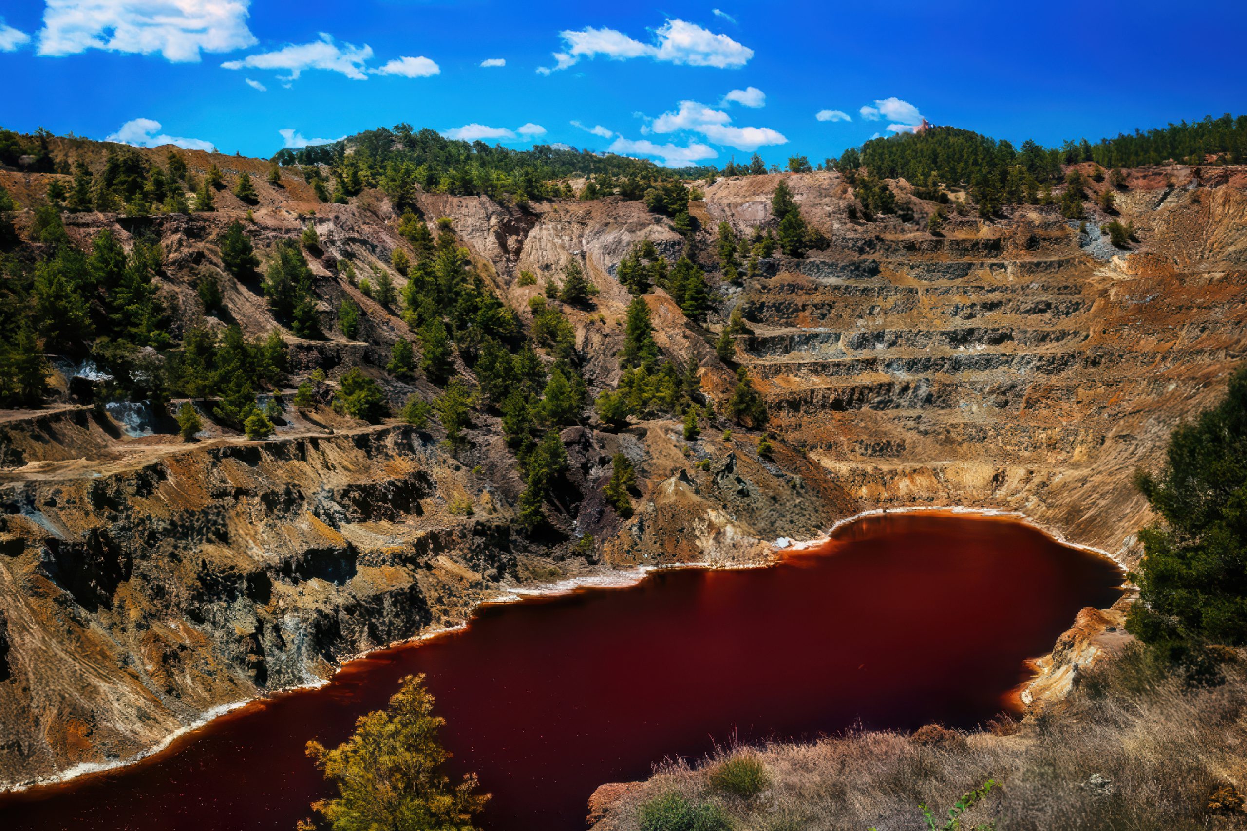
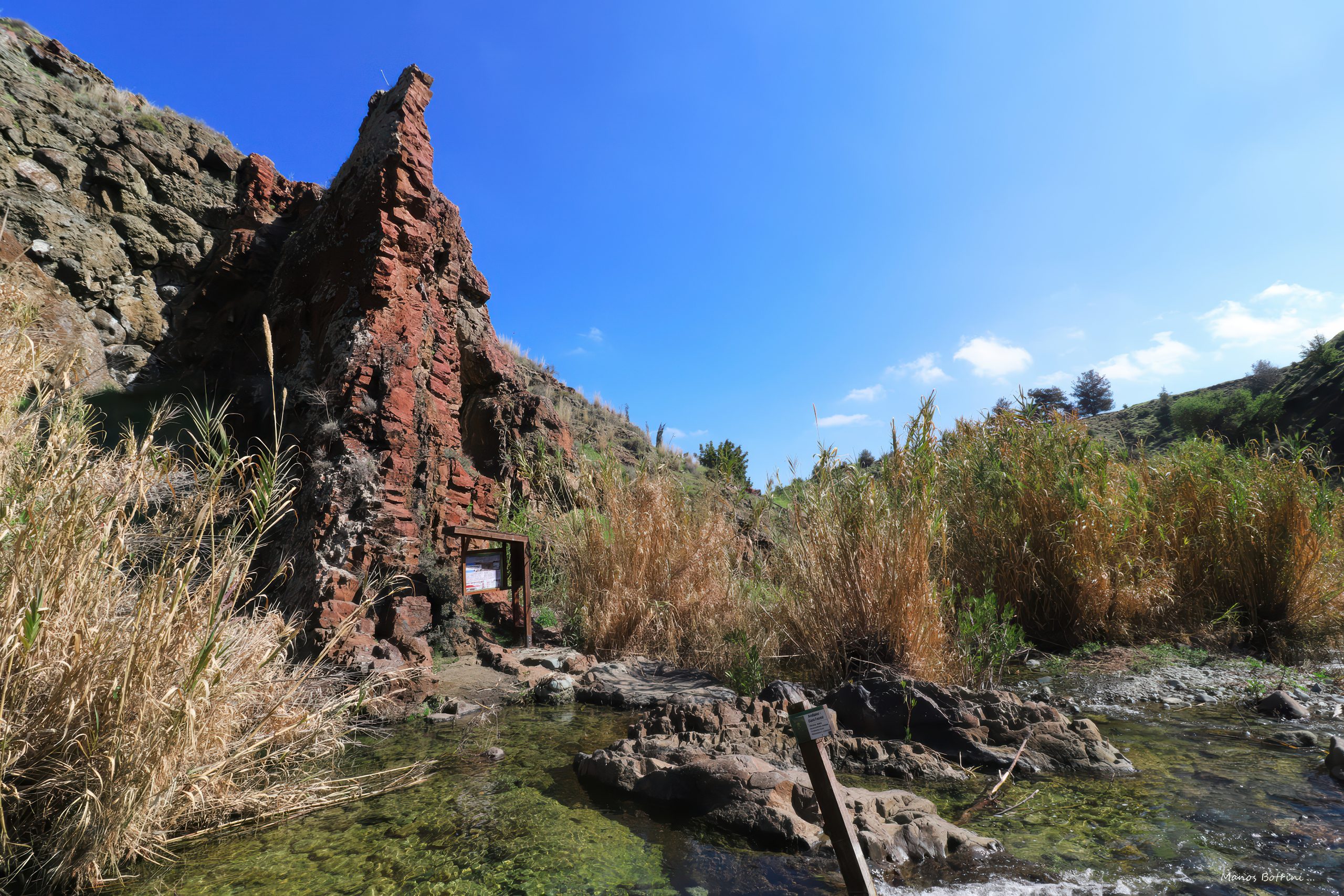
Along ancient ocean ridges, hot seawater circulated through cracks in the newly formed crust. The water descended deep into the rock, was heated by underlying magma and rose again through fractures carrying dissolved metals. When these mineral-rich fluids reached the cold ocean floor they rapidly cooled, forming sulphide deposits around hydrothermal vents known as “black smokers.” These vents built chimney-like structures and mineral mounds rich in copper, iron and other metals. When the Troodos oceanic crust was later uplifted onto land, these ancient hydrothermal deposits remained preserved inside the volcanic rocks.
Skouriotissa and Lefke are among the most famous examples of this process, but they represent only part of a much wider mining landscape. Across Cyprus dozens of copper mines once operated, both open-pit and underground. Their exposed rock faces display striking colours that reflect their mineral content: dark red tones from iron-rich rocks, bluish-green stains from oxidised copper minerals and mustard-yellow patches from sulphides.
Mining here began long before the arrival of the Achaean Greeks and continued through the Classical, Roman, Byzantine and Venetian periods. Entire communities grew around these deposits. One of the most important was the ancient city of Tamassos, located in the Troodos foothills and flourishing largely because of nearby copper mines. For centuries Cyprus became the Mediterranean’s principal copper exporter. Copper is also responsible for the island’s earliest written historical mention. It appears in Egyptian records from the second millennium BCE, where pharaonic clay tablets refer to Cyprus as the chief Egyptian supplier of the metal.
In the early twentieth century the copper industry experienced a major revival under the American-owned Cyprus Mining Corporation, which reopened and modernised many mines. Although production declined after the events of 1974, the Skouriotissa mine continues to operate today and is widely considered the oldest continuously worked copper mine in the world.
Where to See the Volcanic Ring?
Pillow Lavas
● Troodos Geosite N32 between the villages of Vavla and Ora
● Stavrovouni Mountain
● Troodos Geosite N3 along the Maroulena River near the village of Kalo Chorio in Nicosia District – one of the most spectacular geological formations on the island
Basal Group
● Troodos Geosite N5 near the village of Mitsero
Historic Copper Mines (the most impressive ones)
● Skouriotissa
● Kalavasos
● Mitsero
● Mathiatis
● Lefke
4. Layer 2. The Sheeted Dyke Complex
Above the volcanic ring lies one of the most extraordinary structures in Troodos. At first glance it looks almost architectural: long vertical walls of rock standing side by side, sometimes rising hundreds of metres along mountain slopes. At dusk these formations begin to resemble a castle built by giants, or the towering pipes of an enormous, petrified organ.
These are the sheeted dykes.
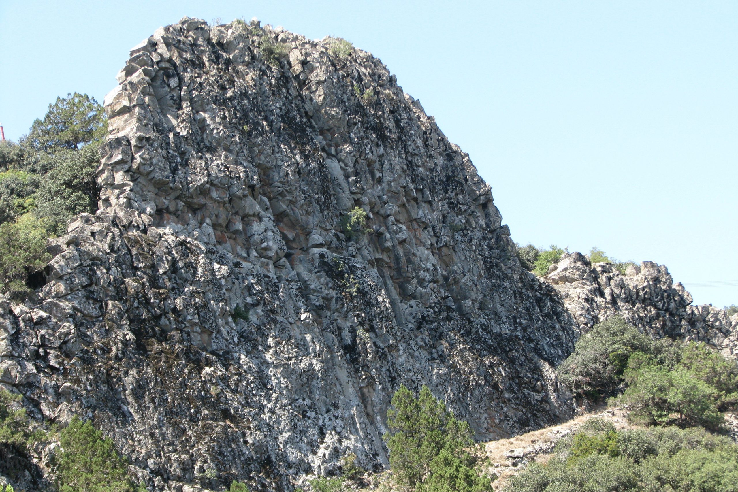
Imagine the ancient ocean floor repeatedly cracking as tectonic plates slowly pulled apart. Each crack opened a narrow pathway for molten rock rising from deeper magma chambers. Magma rushed upward, cooled and solidified within the fracture. Then the crust cracked again nearby and the process repeated. Over millions of years thousands of these injections formed a dense network of vertical sheets packed tightly together, like the pages of a giant geological book.
What you see today are the frozen conduits of that ancient plumbing system.
The dominant rock here is diabase, a medium-grained volcanic rock closely related to basalt but formed slightly deeper below the seafloor. It typically appears dark grey or black, though at lower altitudes it could have yellow-brown tones. Cutting through these darker rocks are occasional veins and bodies of plagiogranite, a much lighter rock with a pale, almost pearly appearance that formed from the last silica-rich remnants of cooling magma.
The sheeted dyke complex forms the largest portion of the Troodos ophiolite in terms of area. In some western locations, such as near Pachyammos, it can descend almost to sea level. More commonly it occupies elevations between roughly 500 and 1600 metres, forming much of the mountainous backbone of central Cyprus.
Many of the island’s most prominent peaks belong to this complex, including Trypillos, Kykkos, Kionia and Papoutsa. Perhaps the most spectacular exposure appears on the northern face of Madari Mountain, the second-highest peak in Cyprus. Here enormous vertical dyke walls rise like stone pillars and towers, creating one of the most dramatic geological landscapes on the island.
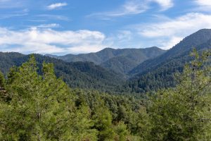
These mountains are not barren. The fractured rocks allow water to circulate and springs to emerge, helping support rich vegetation. Much of the complex lies within Cyprus’s two largest forest regions Paphos and Machairas Forests which cloak the slopes in pine and cedar.
Human settlements also followed the geology. Many villages in the region, including the historic mountain villages of Fikardou and the nearby Askas, used local diabase and plagiogranite as building stone. Even two of Cyprus’s most revered monasteries: Kykkos and Machairas were constructed largely from these rocks, meaning the mountain itself literally forms their walls.
The complex also plays a key role in the island’s water system. Many Cypriot rivers originate here, including the Pedieos (the longest river in Cyprus), Gialia, Peristerona, Xeros, Ezousa and Stavros tis Psokkas. As these rivers carve through the dyke swarms they often form steep gorges and dramatic valleys that today attract hikers and explorers.
In many ways the sheeted dyke complex is the hidden engine of Troodos. It fed the volcanoes above it, channels water through the mountains today and shapes both the landscapes and settlements of central Cyprus.
Where to See It?
Diabase and Sheeted Dykes
● The northern face of Madari Mountain, one of the most spectacular geological formations in Cyprus. Steep towers and vertical walls of sheeted dykes can be observed up close along the Tesia tis Madaris Trail.
● Most prominent peaks of the Troodos range aside from Mount Olympus itself are formed largely from this complex.
Plagiogranite
● Troodos Geosite N33, located near the village of Palaiochori, where pale plagiogranite bodies contrast sharply with the darker surrounding rocks.
5. Layer 3. The Upper Plutonic Complex
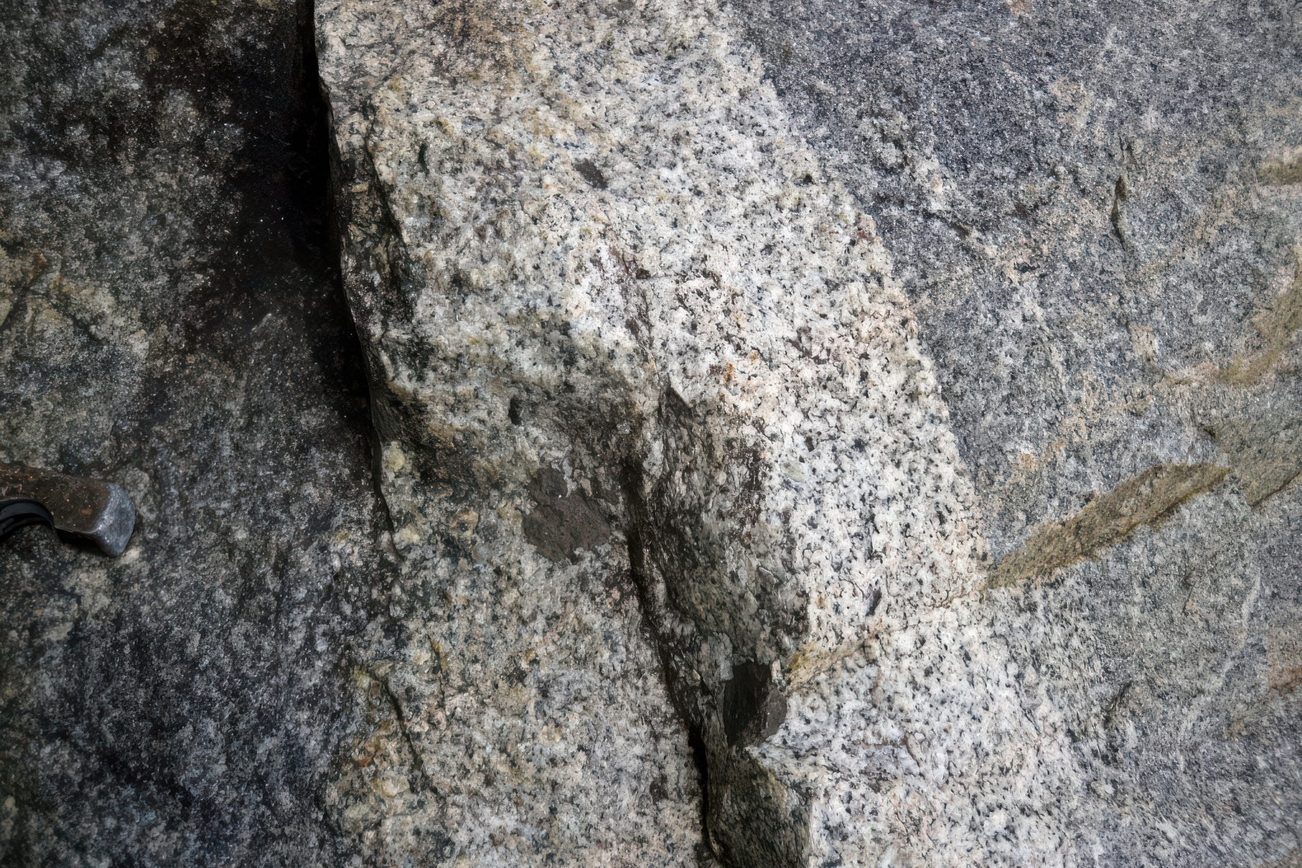
Sometimes the Troodos landscape suddenly changes character. The slopes become rougher, almost primordial. Grey rock appears with large sparkling grains, resembling chocolate chips scattered through vanilla ice cream. At other times you may come across an old Byzantine church whose walls are built from almost perfectly cut, dark grey blocks of stone.
Both are signs that you have entered the plutonic complex. The name comes from Pluto, the Roman god of the underworld (Hades in Greek mythology), and it reflects the origin of these rocks. Unlike the volcanic layers above them, which erupted on the ocean floor, plutonic rocks formed deep underground where magma cooled slowly inside vast chambers beneath an ancient ocean ridge.
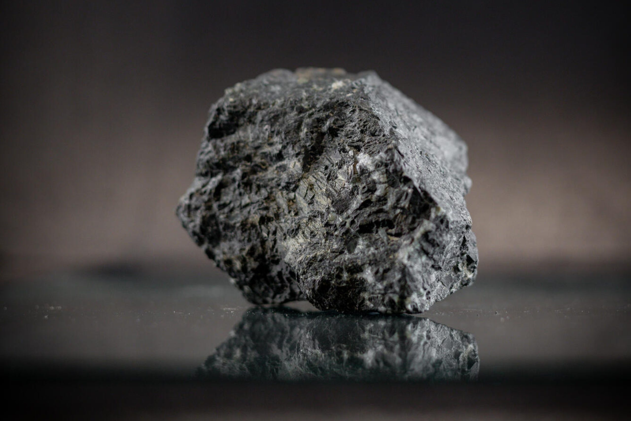
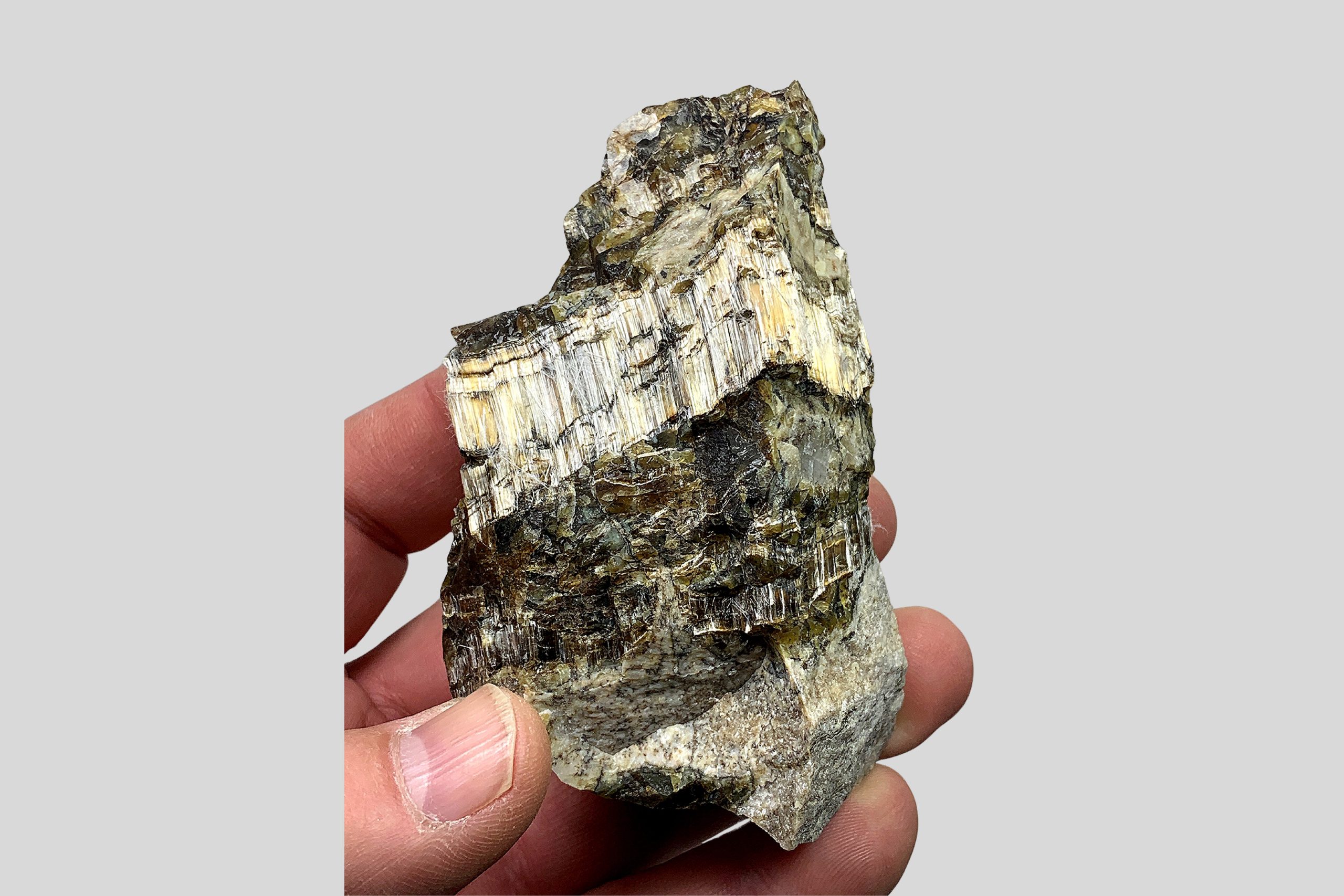
In a way, these rocks are the fossilised remains of a deep submarine volcano, the internal machinery that once fed the eruptions above. The magma here cooled gradually over thousands of years, allowing large crystals to grow. This slow crystallisation is why plutonic rocks look coarse and speckled rather than smooth. In Troodos the dominant rock of this complex is gabbro. It typically appears dark grey, greenish-grey or almost black, and is made of visible crystals of minerals such as plagioclase and pyroxene. Because it cooled slowly, the grains are large enough to be seen with the naked eye.
Cutting through the gabbro are lighter veins of diorite and tonalite, rocks formed from the final portions of magma that separated chemically as the chamber cooled. These lighter veins often stand out sharply against the darker gabbro, creating striking patterns in cliffs and road cuts.
The upper plutonic complex generally occupies elevations between 1000 and 1600 metres across the Troodos Mountains. Excellent exposures can be found around Platres, Prodromos and Kakopetria, as well as along the eastern part of Mount Olympus.
These rocks also proved extremely useful for human construction. Gabbro weathers into durable blocks that can be shaped into building stone. Many villages of this Troodos region used it for houses, walls and terraces. Even several of the famous painted churches of the Troodos UNESCO World Heritage sites incorporate local gabbro in their construction.
The result is that entire settlements carry the colour and texture of the mountain beneath them.
Standing among these rocks is a strange thought. You are not looking at lava that once flowed across the surface. You are standing inside what used to be a magma chamber beneath the ocean floor, part of the deep volcanic engine that once built the ancient crust of the Neo-Tethys Ocean.
Where to See It?
Massive Gabbro Outcrops:
● Troodos Geosite N34, located between Karvounas and Pano Amiantos, where impressive gabbro walls rise along the road.
● The road approaching Platres village, where large slopes of coarse crystalline gabbro are exposed on both sides.
These exposures allow visitors to observe the deep interior of the Troodos ophiolite: rock that formed far below the ancient seabed, now resting high in the mountains.
6. Layer 4. The Mantle Crown: The Peridotite Core of Troodos
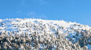
And now we arrive at the strangest and most extraordinary part of the Troodos mountains: the summit world of Mount Olympus.
In the long-forgotten past, the mountain had another name. Locals called it Chionistra: “the Snowy One.” Later, tradition says, Alexander the Great renamed it Olympus because its broad summit reminded him of the eponymous mythic mountain of the gods in his Macedonian homeland. Cypriots like to joke that when Zeus grows tired of quarrelling with his wife Hera, he comes here on winter holiday. That is why, they say, the Cypriot Olympus receives the island’s fiercest winter storms.
Whether myth or coincidence, the summit truly does feel like another realm.
It does not matter which direction you arrive from: Platres, Karvounas, or Prodromos. Almost instantly the landscape changes. Something feels different even before you understand why.
The trees announce the transition first. The familiar Calabrian pine, with its slender Mediterranean silhouette, begins to disappear. In its place appear towering Troodos black pines, among the rarest trees in Europe. Their trunks rise thick and dark, their enormous branches bending downward like arms frozen in mid-gesture.
Local legend says that when the Byzantine emperor Alexios Komnenos brought the miraculous Kykkos icon of Virgin Mary to the island, these trees bowed before it in reverence and remained spread in reverent curtsy ever since.
Among them grow ancient junipers, some more than five hundred years old. Their twisted trunks coil and spiral like mythological creatures turned to wood. In winter fog they resemble silent figures standing guard on the mountain.
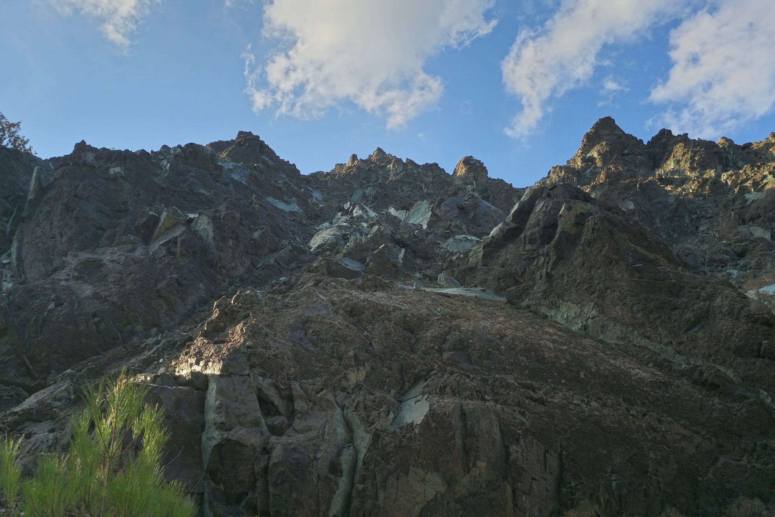
And then the rock itself begins to change. The slopes become broken, rugged and strangely coloured. Rusty reds replace greys. Massive blocks lie scattered like the ruins of a shattered fortress.
You have reached the deepest and the oldest exposed layer of the Troodos ophiolite. Geologically this is the mantle core of the island, rock that once lay tens of kilometres beneath the ocean floor. These rocks belong to the peridotite family, material normally hidden deep within the Earth. Their presence at the surface is one of the reasons Troodos is so famous among geologists worldwide.
These rocks formed roughly 90 million years ago within the mantle beneath the Neo-Tethys Ocean. Later tectonic forces lifted them upward together with the overlying crust. As seawater penetrated cracks deep within the rock, chemical reactions altered some of the minerals, transforming parts of the mantle into serpentinite.
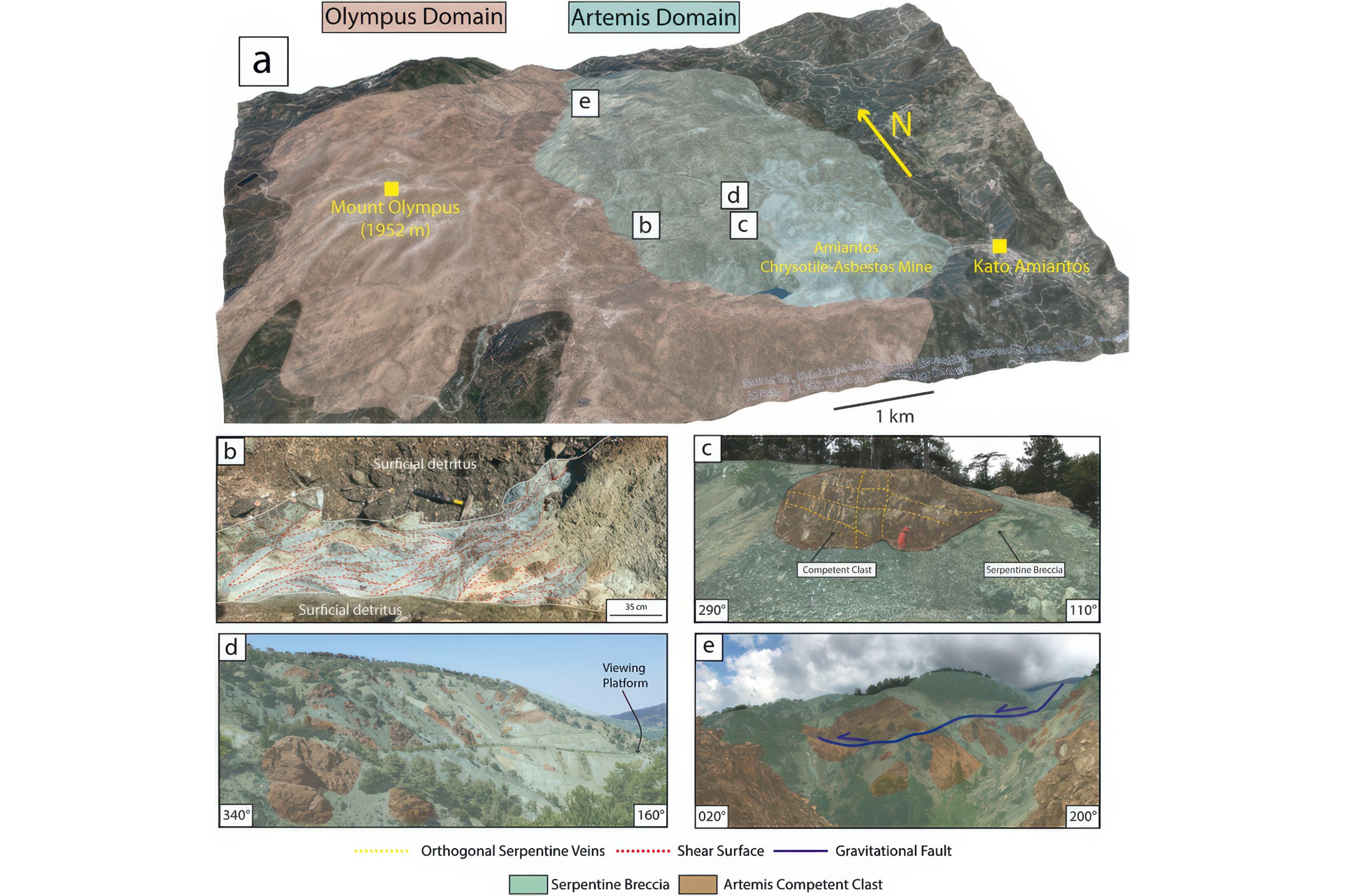
For this reason, geologists divide the summit region into two major zones:
● Olympus Domain: the exposed mantle rocks surrounding the main peak (all the way to 1952 metres above sea level)
● Artemis Domain: the altered mantle rocks and serpentinites dominating the eastern shoulder of the mountain (to around 1750 metres)
Together they form one of the most complete and best preserved mantle sections visible anywhere on Earth.
Olympus Domain: The Exposed Mantle
Around the main summit of Mount Olympus the rock is raw, heavy and ancient.
Here you encounter the classic peridotite minerals:
● Pyroxenite – dark, dense rock rich in pyroxene minerals
● Wherlite – grey-green rock containing both olivine and pyroxene
● Dunite – pale yellow or olive-coloured rock made almost entirely of olivine
● Harzburgite – rusty red rock coloured by iron oxidation
Seen from a distance the slopes appear warm and bronzy. Up close the ground sparkles in sunlight because many of these rocks contain chromite, a chromium-rich mineral that reflects light in tiny metallic grains.
The sound underfoot changes here. The rock feels heavier, more solid. Walk across the slopes and the stones crunch sharply beneath your boots. Standing here means standing on former mantle rock, material that once existed tens of kilometres below the Earth’s surface.
Chromite deposits in this zone were once mined. Two large underground workings remain visible today: Kokkinorotsos and Kannoures. These mines remind visitors that even the deepest geological layers eventually became part of human history.
Yet despite the mines and roads, the landscape still feels primeval. On clear days the summit resembles a vast amphitheatre of stone rising above forests and valleys below.
Artemis Domain: The Green Serpent Mountain
If the Olympus Domain feels ancient, the Artemis Domain feels almost mythical.
To reach it from Troodos Square you must cross a narrow saddle between two mountain gorges: Kannoures to the North and Loumata to the South. These dramatic ravines cut through the eastern shoulder of the mountain like enormous scars in the rock. Beyond them the landscape transforms again.
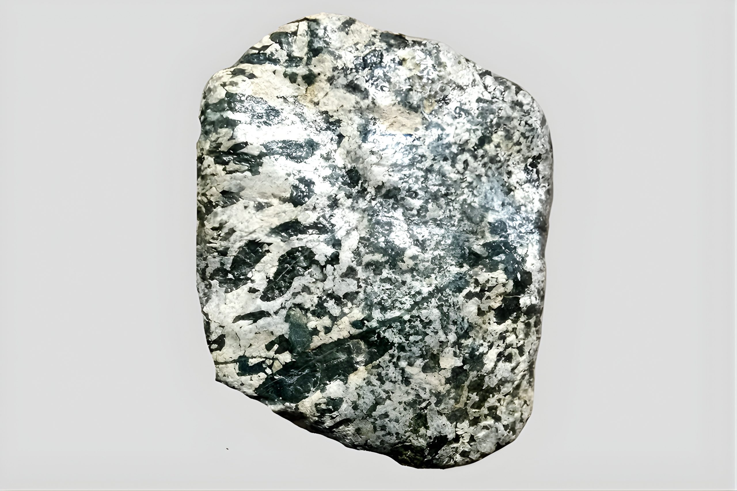
The rusty mantle rocks give way to something stranger. Green.
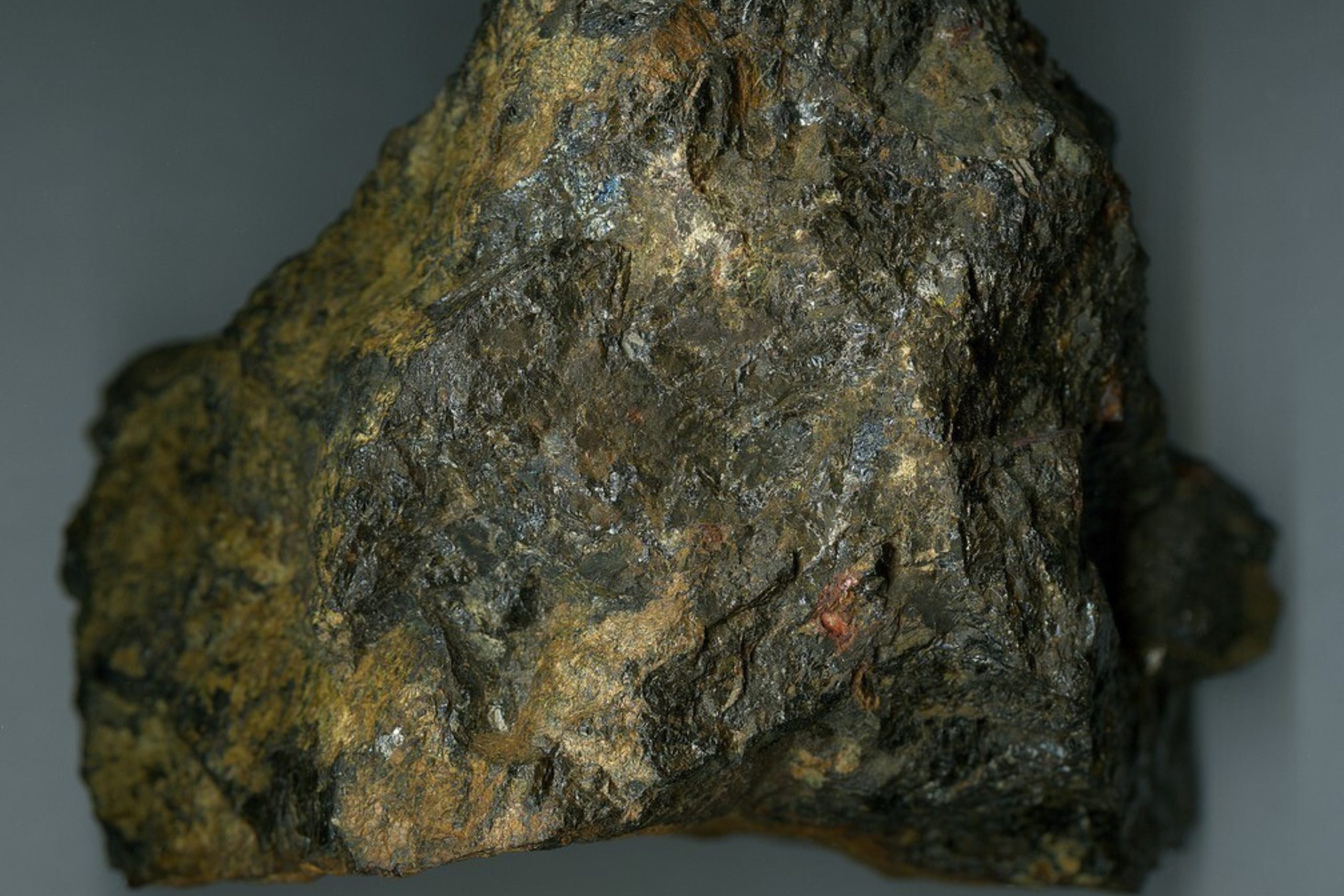
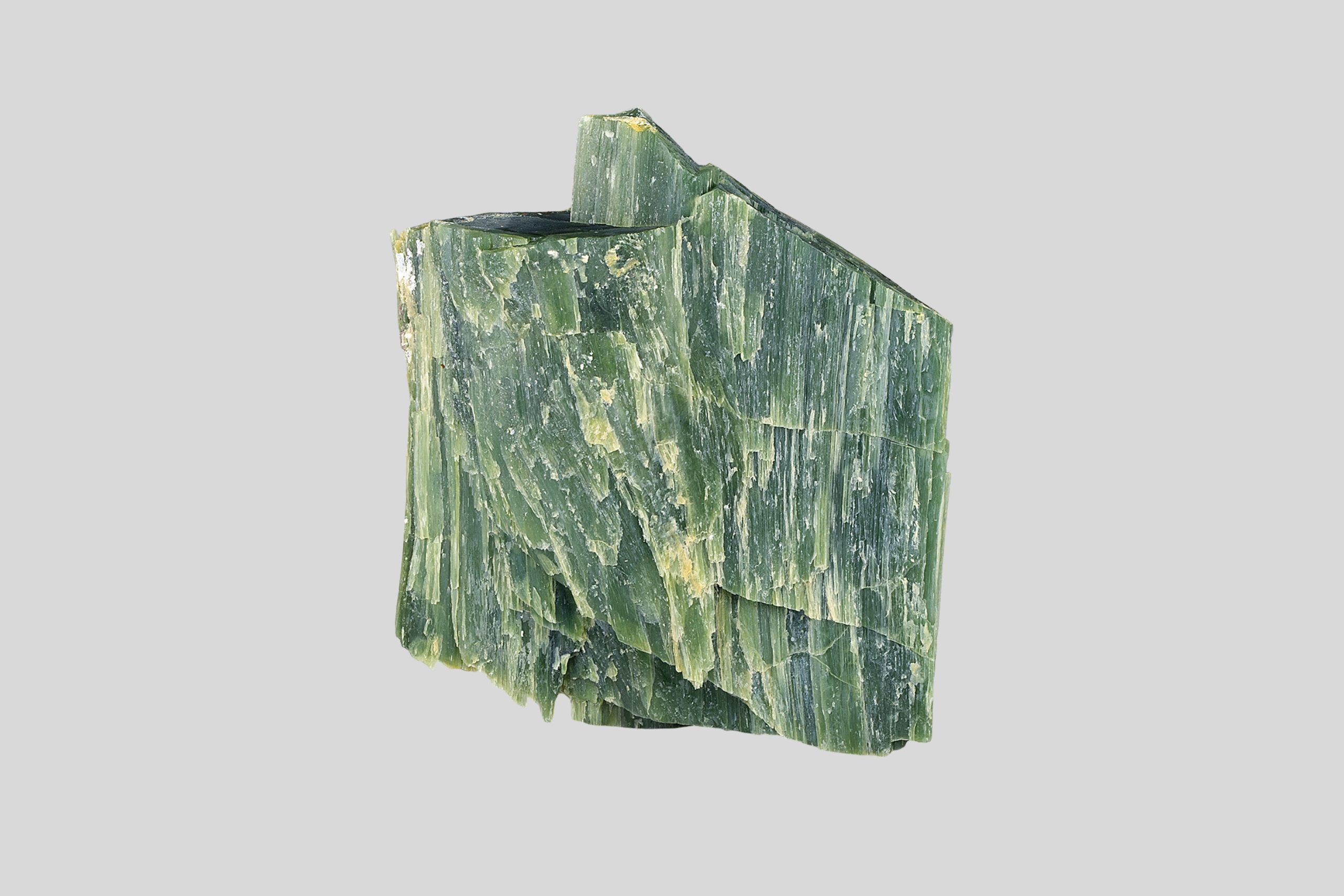
The ground begins to glow with shades of olive, emerald and turquoise. These colours come from serpentinite; rock created when seawater chemically altered mantle peridotite deep beneath the ocean floor. The process is known as serpentinisation, and it transforms hard mantle rock into smoother, often greenish stone.
We have already encountered serpentinite earlier in our journey, the smooth green “snake stone” that gave ophiolites their name and appeared in the Mamonia Mélange of western Cyprus. Yet the serpentinites of Troodos tell a different story altogether. While the Mamonia varieties are older and were formed along the ancient continental edge of Africa, the serpentinites of the Artemis Domain originate from deep mantle rocks of the oceanic crust itself. Here, seawater penetrated fractures far beneath the ancient seabed and chemically transformed peridotite into new minerals, producing darker, denser serpentinites rich in chrysotile and picrolite. In other words, if Mamonia serpentinites represent the chaotic margin of a continent, those of Troodos reveal the altered heart of an underwater volcano.
Here you find veins of picrolite, a turquoise variety of serpentinite unique to Cyprus and considered the island’s national stone. In ancient times it was carved into small ritual objects, including the famous Pomos Idol, one of the oldest symbolic sculptures discovered on the island.
White streaks occasionally appear within the green rock. These are fibres of chrysotile, the mineral once mined here as asbestos.
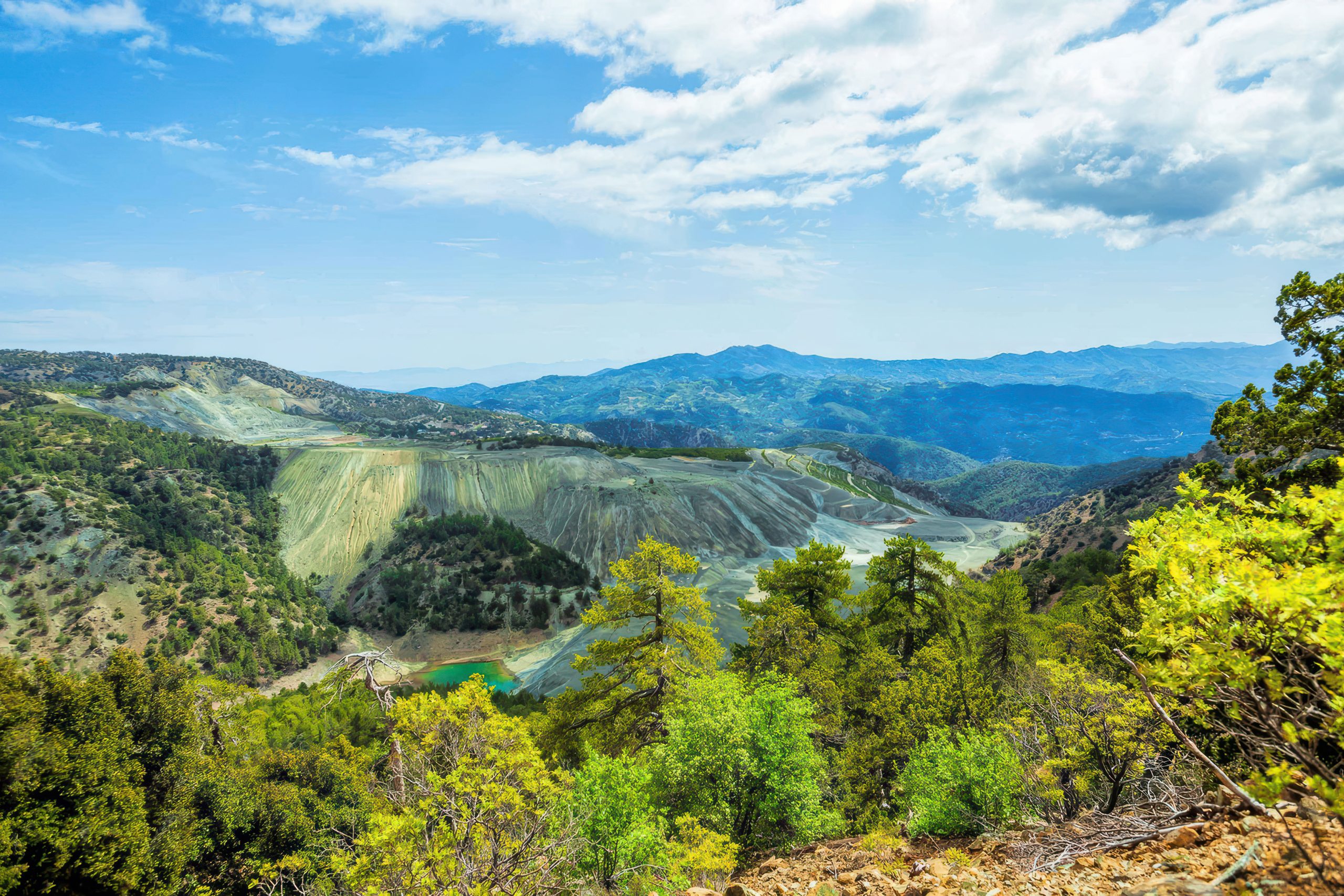
For much of the twentieth century the Amiantos asbestos mine dominated this landscape. At its peak it was the largest open-pit asbestos mine in Europe. In recent decades the long-term exposure to industrially processed asbestos fibres was discovered to be highly harmful to human health and the utilisation of asbestos in many developed countries have been outlawed.
When the mine closed in the early 1990s the scar it left behind became the focus of Cyprus’s most ambitious environmental restoration project. Today the former mine hosts the Troodos Botanical Garden and Visitor Centre, surrounded by thousands of newly planted trees.
Nature is slowly reclaiming the mountain.
Yet Artemis Domain still feels otherworldly. Some valleys here remain strangely quiet. The slopes shimmer in shades of green and blue. After rain the stones appear polished, almost luminous. Hikers often describe an unusual stillness in the air, a silence broken only by wind moving through the pines.
Even the chemistry of the rock adds to the mystery. When seawater reacts with mantle peridotite it produces hydrogen and alkaline fluids. Modern scientists study similar environments on the ocean floor as possible settings for the earliest microbial life on Earth. In that sense the rocks of Artemis are not only ancient, but they may also resemble environments where life itself first began.
Nearby lies another surprising feature: the Almyrolivado peatland, located along the upper reaches of the Loumata valley near the eponymous picnic site. It is the only evergreen peat bog in Cyprus, a rare wetland ecosystem hidden high in the mountains.
Between serpentine rock, silent forests and strange geological chemistry, the Artemis Domain feels like a forgotten corner of the planet.
Where to See It?
Olympus Domain: Peridotite Rocks
● Along the Platres-Troodos and Prodromos-Troodos main roads
● Along the 7 km Artemis Nature Trail circling Mount Olympus
● Along the 14 km Atalante Trail surrounding the summit slopes 200 metres lower
● Along the linear Persephone Trail running down from Troodos Square toward the South-East
Artemis Domain: Serpentinite Landscapes
● Along the Karvounas-Troodos road
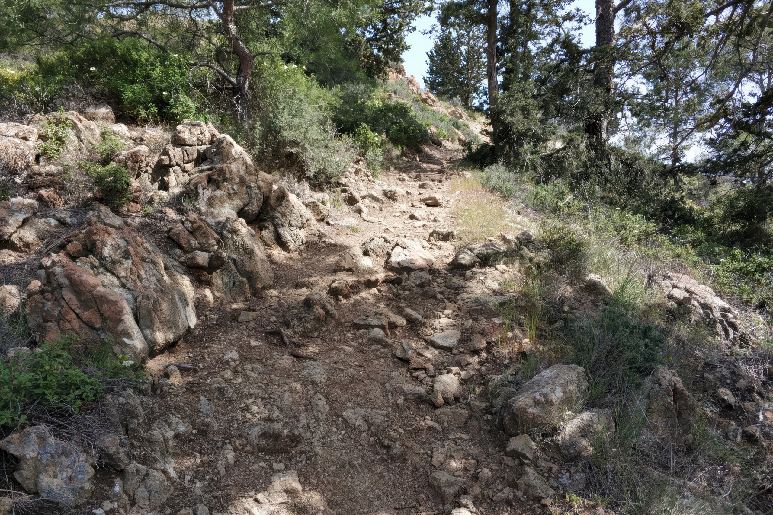
● Kannoures Nature Trail through one of the island’s most spectacular gorges
● Loumata Nature Trail leading toward the hidden “Secret Asbestos Lake”
● Amiantos Asbestos Mine, now home to the Troodos Botanical Garden and Visitor Centre
● Sections of the E4 European Trail between Platania and the eastern shoulder of Troodos
High above the island’s villages and vineyards lies this strange geological crown. Rust-red mantle rock, green serpentinite slopes, ancient forests and silent valleys. It is here, on the very summit of Troodos, that the island’s deepest past finally reaches the surface.
7. The Arakapas Fault Zone and the Limassol Forest Anomaly
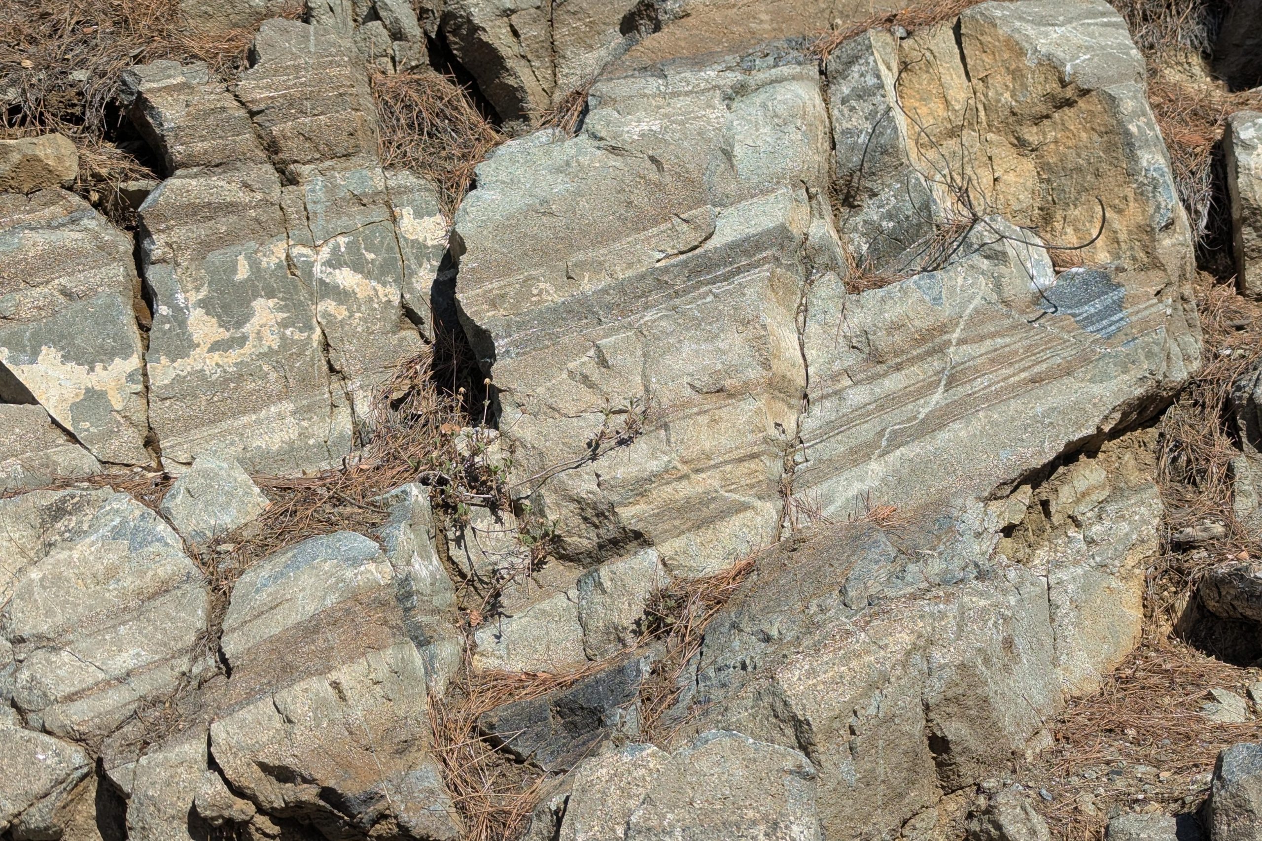
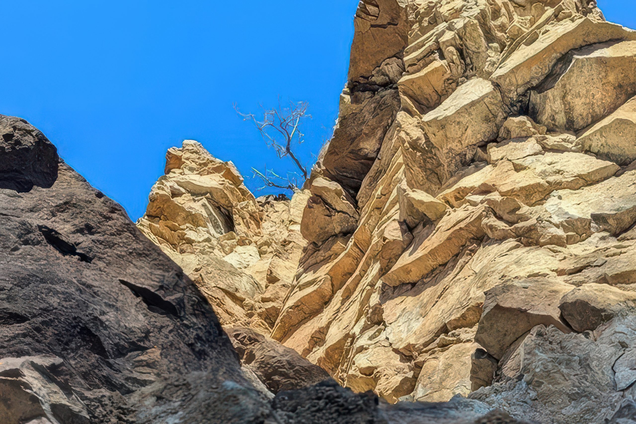
Troodos did not rise quietly. The uplift of an entire slice of oceanic crust created enormous stresses inside the rock. The mountain bent, cracked and shifted as it emerged from the sea. Even today these fractures remain visible in the landscape. Some valleys follow them. Some rivers cut through them. In a few places they form geological boundaries so sharp that different worlds of rock stand side by side. One of the most striking of these fractures is the Arakapas Fault Zone.
Seen from satellite imagery, the Arakapas Fault appears as a nearly straight line cutting across the southern flank of the Troodos Mountains. It runs roughly between the villages of Agios Mamas and Kato Drys, forming one of the clearest tectonic structures visible on the island.
On the ground the fault reveals itself through a dramatic landscape of broken and deformed rock. Massive blocks appear twisted, fractured and displaced as if enormous forces once tore the crust apart. Dark volcanic rocks dominate the scene, especially heavily altered pillow lavas and basaltic formations. Some of them appear folded or shattered into chaotic shapes that seem almost sculptural.
The colours can be striking. Black and charcoal-grey lava surfaces sit beside rust-red mineralised layers. In certain places the rock appears melted or warped, as if frozen mid-motion.
Fault zones like this are far more than simple cracks in the ground. They act as geological crossroads where rocks from different depths and ages are pushed together. Movement along faults can expose rare formations, concentrate minerals and reveal structures normally hidden deep underground.
For geologists the Arakapas Fault is like an open wound in the mountain, allowing a glimpse into the immense forces that shaped Cyprus.
The Limassol Forest Anomaly
Not far away to the South lies another geological curiosity.
In the wooded hills between Kalo Chorio, Vavla and Parekklisia lies the area known informally as the Limassol Forest Anomaly. At first glance it looks like ordinary Troodos foothills. Pine forests cover the slopes and small valleys hide almond and olive orchards.
But beneath the soil the rock tells a surprising story.
Here geologists discovered plutonic rocks similar to those found much higher in the Troodos core, including gabbro, peridotites, even serpentinites and other deep crustal material normally associated with the central mantle zones around Mount Olympus. Their presence here is puzzling because this area lies far from the main plutonic and peridotite core of the mountain.
The most likely explanation is tectonic displacement. During the violent uplift of the ophiolite, large blocks of deep crust were transported outward along fault systems. Over millions of years erosion exposed them again in unexpected places.
In simple terms, pieces of the mountain’s deep interior were scattered across its flanks.
For visitors the result can be startling. Walking through what appears to be ordinary forest, you suddenly encounter rock types that belong hundreds of metres higher in the geological sequence. The ground feels subtly different. The stones are heavier, darker and more crystalline.
The mountain reveals that it once moved.
Where to See It?
Arakapas Fault Zone
● The road between Eftagonia and Kalo Chorio, where the fault line crosses the landscape and volcanic rocks appear heavily fractured and deformed.
Limassol Forest Anomaly
● Kyparissia Trail, where deep plutonic rocks appear within the forest landscape.
● The Louvaras Fire Station viewpoint, offering a broad view across the geological boundary where these unusual formations occur.
8. Troodos UNESCO Global Geopark. The Mountain That Became a Classroom.
By now one thing should be clear: Troodos is not just another mountain range. It is one of the clearest windows into the structure of our planet anywhere on Earth. Because of this unique geological value, a large part of the Troodos Massif has been designated as the Troodos UNESCO Global Geopark, part of the Global Geopark Network.
The geopark protects and interprets the island’s most important geological landscapes. Covering a large portion of the central Troodos Mountains, it includes around fifty designated geosites, each representing a different piece of the ophiolitic sequence. These sites allow visitors to see the mountain’s geological layers directly in the field: from pillow lavas and sheeted dykes to deep mantle rocks.
Many of these locations are equipped with interpretive panels in Greek and English, explaining the rocks, landscapes and geological processes in clear and accessible language. Special geotrails guide visitors through particularly interesting formations, while museums and visitor centres help translate complex geological concepts into engaging stories.
The geopark was officially recognised in 2007 and is managed by the Troodos Development Company, a non-profit organisation working in cooperation with the Forest Department and the Geological Survey Department of Cyprus. Its activities are supported through funding from the European Union, the Republic of Cyprus and Greece. Beyond tourism, the geopark also runs educational programmes, research initiatives and environmental projects aimed at helping people understand how geology shapes landscapes and ecosystems.
At the heart of this network lies the Troodos Botanical Garden and Environmental Information Centre in Amiantos, opened in 2010. The centre combines geological interpretation with information about Troodos biodiversity and environmental protection. Nearby stands the Troodos Visitors Centre, where visitors can explore interactive exhibits explaining the region’s natural history, culture and geology.
9. Conclusion. The Mountain That Explains Cyprus
Troodos is often described as the backbone of Cyprus, yet the comparison hardly captures its true importance. The mountain is not only a physical centre of the island but also its geological heart. Almost everything that makes Cyprus unique begins here.
The rocks of Troodos were born deep beneath an ancient ocean around ninety million years ago. They travelled upward through time and tectonic upheaval until the internal structure of the Earth itself appeared at the surface. What normally lies hidden kilometres below the seabed can be touched here along forest roads, hiking trails and mountain passes.
Seen as a whole, the Troodos massif reads like a geological narrative. The outer volcanic rocks record the eruptions that once built the ocean floor. The sheeted dykes reveal the pathways through which magma rose. The plutonic rocks mark the chambers where that magma cooled slowly underground. At the summit of Mount Olympus the story reaches its deepest chapter, where mantle rocks stand exposed to sunlight.
Yet Troodos shaped far more than scientific understanding. The mountain provided copper that made Cyprus famous throughout the ancient Mediterranean. It trapped winter snow and rainfall that later fed springs and rivers. Its mineral soils supported vineyards and orchards. Its forests created habitats for rare plants and animals found nowhere else on the island. Villages, monasteries and roads followed the logic of the mountain long before people understood its geology.
Even today Troodos continues to influence how Cyprus lives and breathes. Perhaps this is what makes the mountain so compelling. It is not simply an object to admire from afar. It is a place where the deep past of the Earth remains visible in everyday landscapes. A road cutting may reveal a magma chamber. A hiking path may cross the rocks of the mantle. A village church may be built from stone that once cooled beneath an ancient ocean ridge.
Troodos does not hide its history. It places it openly in the landscape, waiting to be noticed.