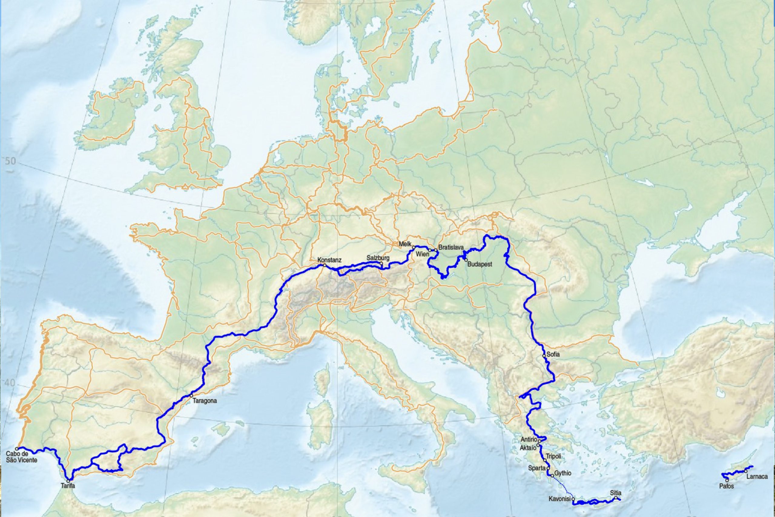
The E4 European Long Distance Path stretches over 10,450 kilometers from Tarifa in southern Spain to Cyprus, making it one of the most ambitious hiking routes in the world. The Cyprus section was added to the route in 2005 following a proposal by the Greek Ramblers Association to the European Ramblers Association.
The trail connects Larnaca and Paphos international airports across approximately 540 to 660 kilometers depending on the route taken. The path crosses Spain, France, Switzerland, Germany, Austria, Hungary, Serbia, Bulgaria, Greece, and Crete before reaching Cyprus as its final destination.
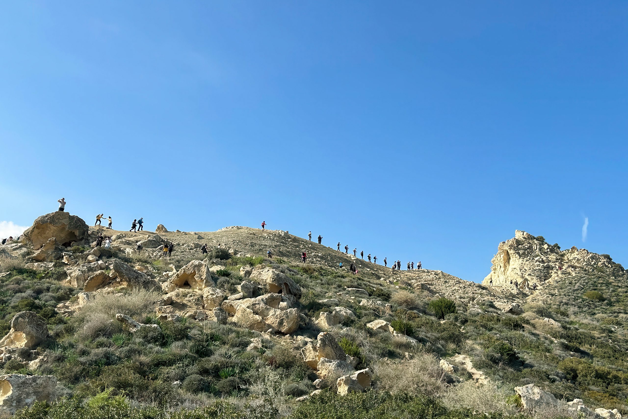
The Cyprus segment traverses the Troodos mountain range, the Akamas Peninsula, and long stretches of countryside through regions of exceptional natural beauty and ecological importance. Cyprus became only the second island on the entire E4 route, after Crete, making it a unique endpoint for this continental trail system.
The development of Cyprus’s section
The Cyprus Forestry Department developed the island’s E4 section in collaboration with the Cyprus Tourism Organisation to create a cross country route that showcases the island’s diverse landscapes. The trail follows a primarily west to east direction, though it includes a significant loop at the eastern end near Larnaca. The route was carefully designed to balance accessibility with wilderness experience, passing through remote forest areas, traditional mountain villages, and coastal regions.
The Department of Forests created clear trail markers with yellow and black diamond shaped waymarks that guide hikers along the route. Information boards at key points provide details about the landscape, flora, and cultural sites. The trail connects with many of the island’s existing nature trails and forest roads, creating a network that allows hikers to customize their journey.
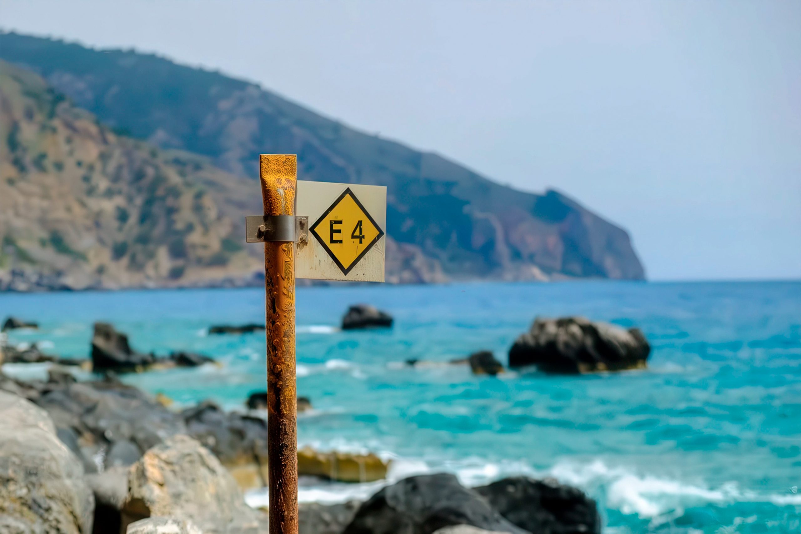
Maps showing the E4 route are available from the Cyprus Tourism Organisation, with the trail marked as a dotted green line on official tourist maps. The development of this section took several years of planning and infrastructure development to ensure hikers could safely traverse remote areas.
From coastal plains to mountain peaks
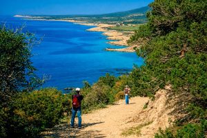
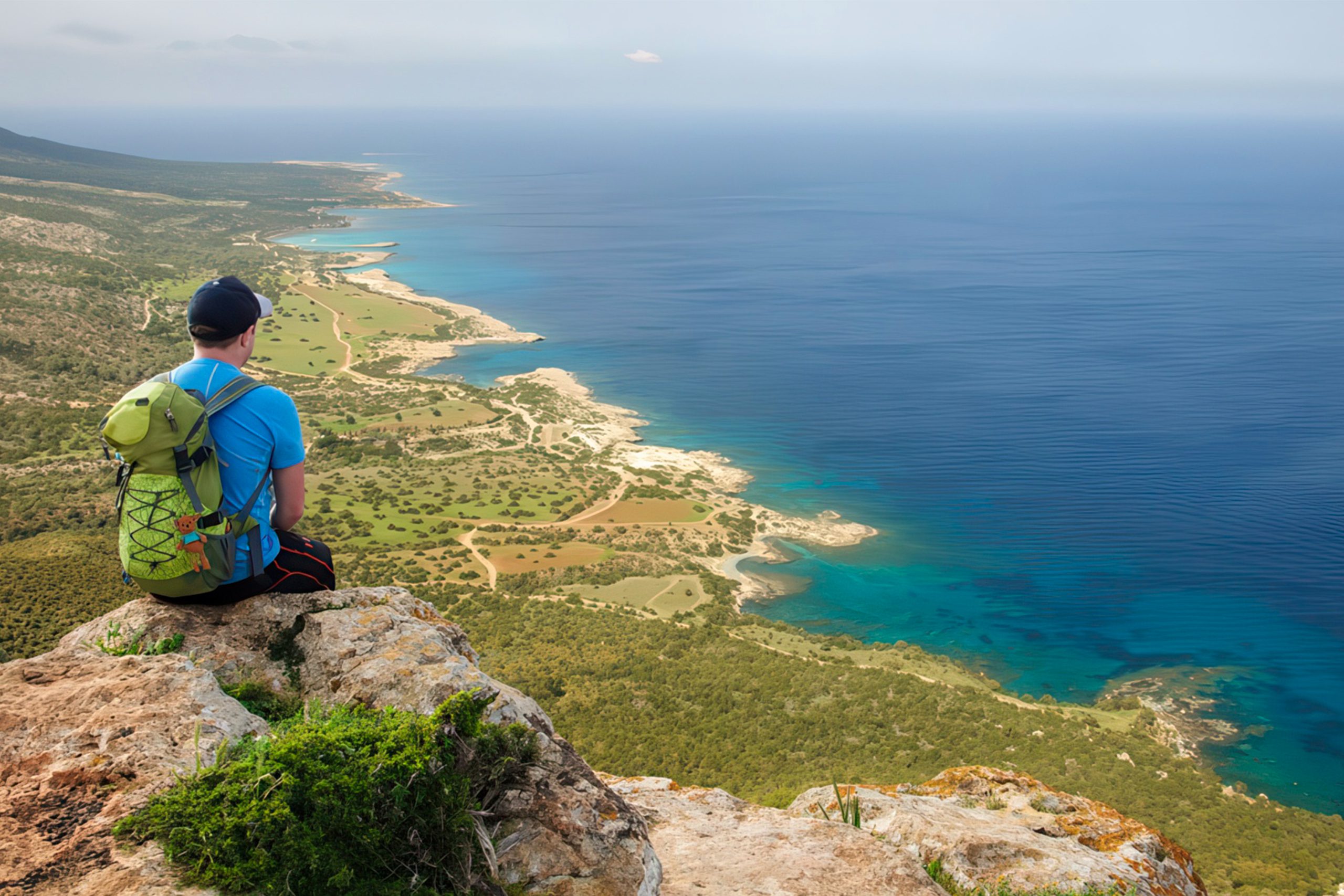
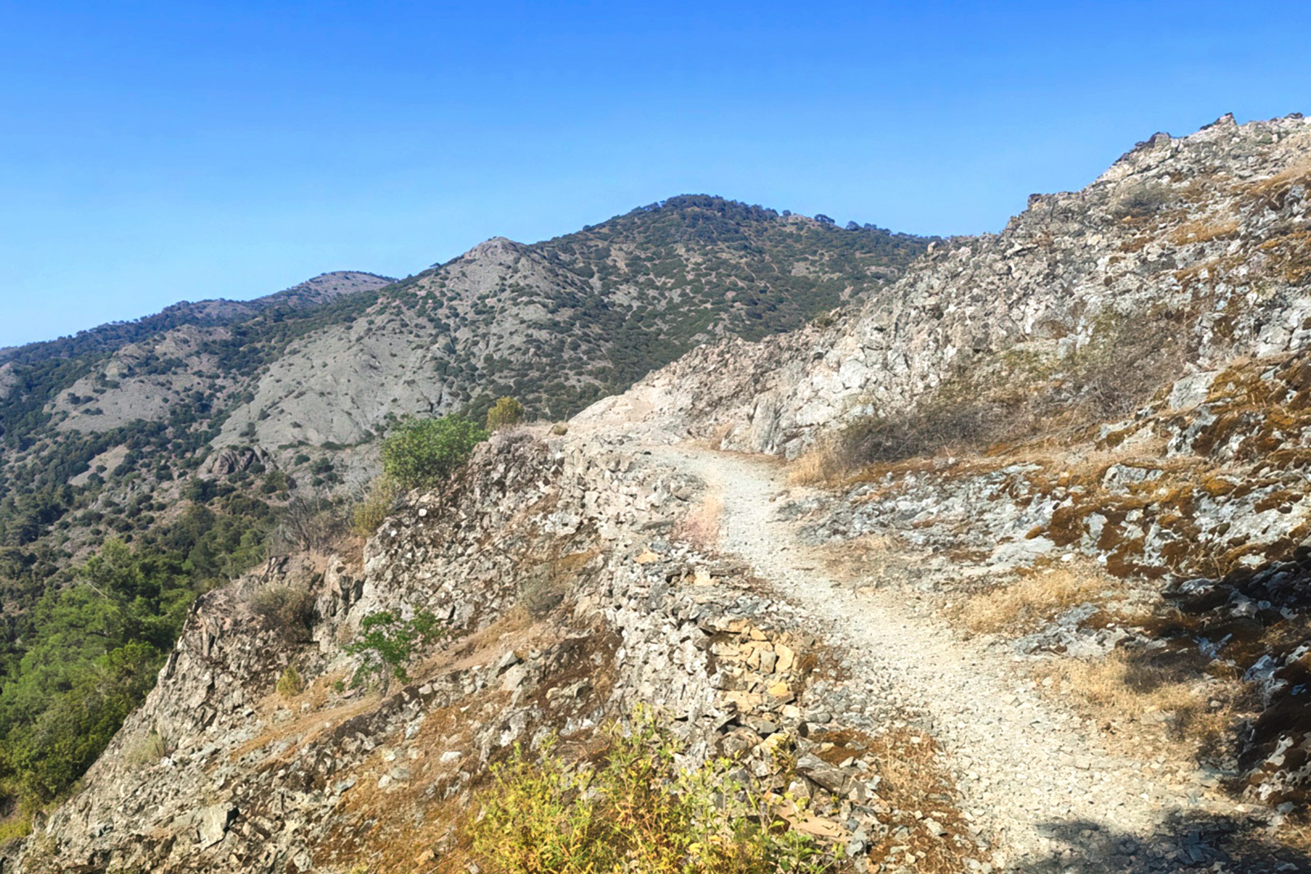
The E4 in Cyprus starts at sea level and climbs to nearly 2,000 meters through the interior, creating dramatic elevation changes that test fitness and endurance. The western section from Paphos airport begins with a traverse of coastal plains before entering the Akamas Peninsula, one of the most rugged and wild areas of Cyprus. The trail passes Lara Bay, known for turtle nesting sites, and continues through the Akamas with its steep gorges and panoramic coastal views.
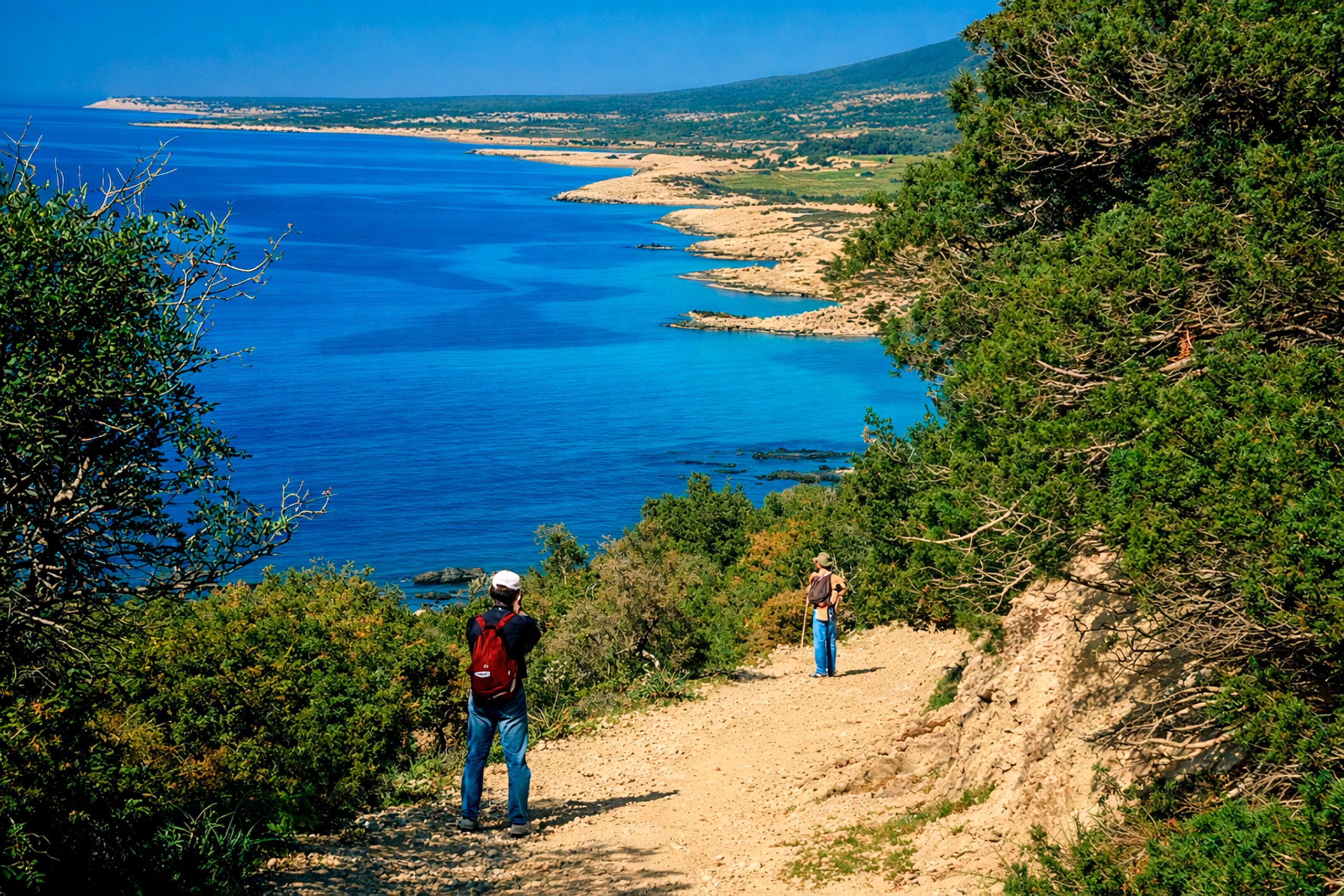
From the Baths of Aphrodite, the route turns inland and climbs into the Paphos Forest, a vast wilderness area of pine trees and cedar groves. The trail reaches its highest elevations in the Troodos Mountains, crossing peaks and ridges with views that extend across the entire island.
The route descends through vineyard regions and traditional villages on the eastern slopes of Troodos before crossing agricultural plains toward Larnaca. The final section includes Cape Greko in the southeast, a limestone peninsula with sea caves and cliff top paths. Temperature differences between the coast and mountains can be extreme, with snow possible at high elevations even when beaches remain warm.
Wildlife encounters in remote forests
The Paphos Forest section provides the best opportunities to see the Cyprus moufflon, an endemic wild sheep that exists nowhere else on earth. The moufflon population was reduced to just a few dozen animals in the early 20th century but strict protection has increased numbers to over 3,000. Hikers walking quietly through forest areas between Stavros tis Psokas and the Troodos range might spot these shy animals grazing in clearings or drinking from streams.
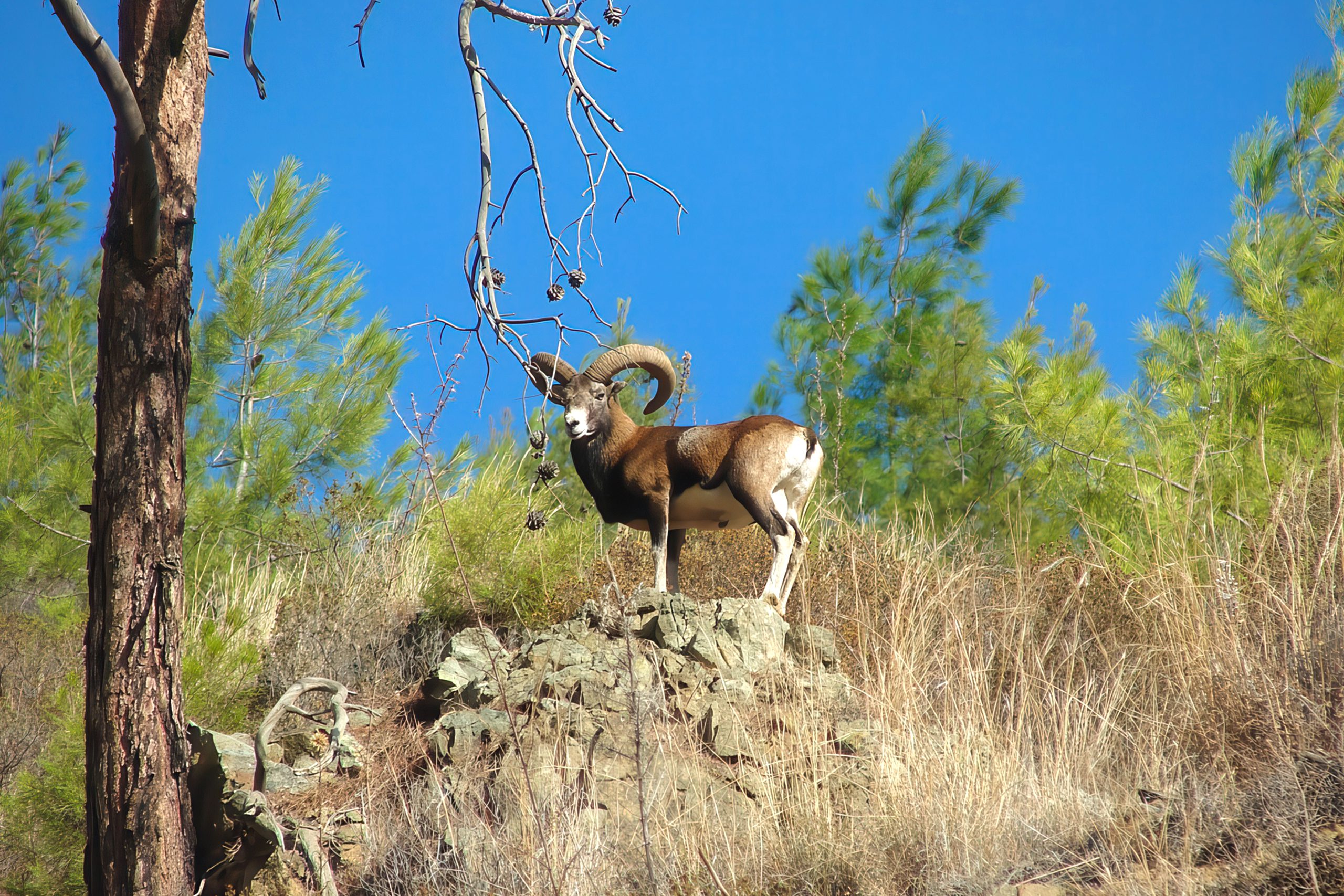
The trail passes through the moufflon enclosure at Stavros tis Psokas forest station, which cares for orphaned and sick animals. Foxes and hares are common throughout the route, while the Akamas Peninsula hosts large lizards that grow bigger at higher elevations. Several snake species live in forest areas near riverbeds, including the Cyprus viper which is venomous but rarely aggressive.
Bird watchers can spot Bonelli’s eagles, Eurasian jays, wood pigeons, and endemic species like the Cyprus warbler and Cyprus wheatear. The remote sections of the trail, particularly in the Troodos and Paphos forests, can go for many kilometers without any human habitation, making wildlife encounters more likely for patient hikers.
The trail today serves multiple purposes
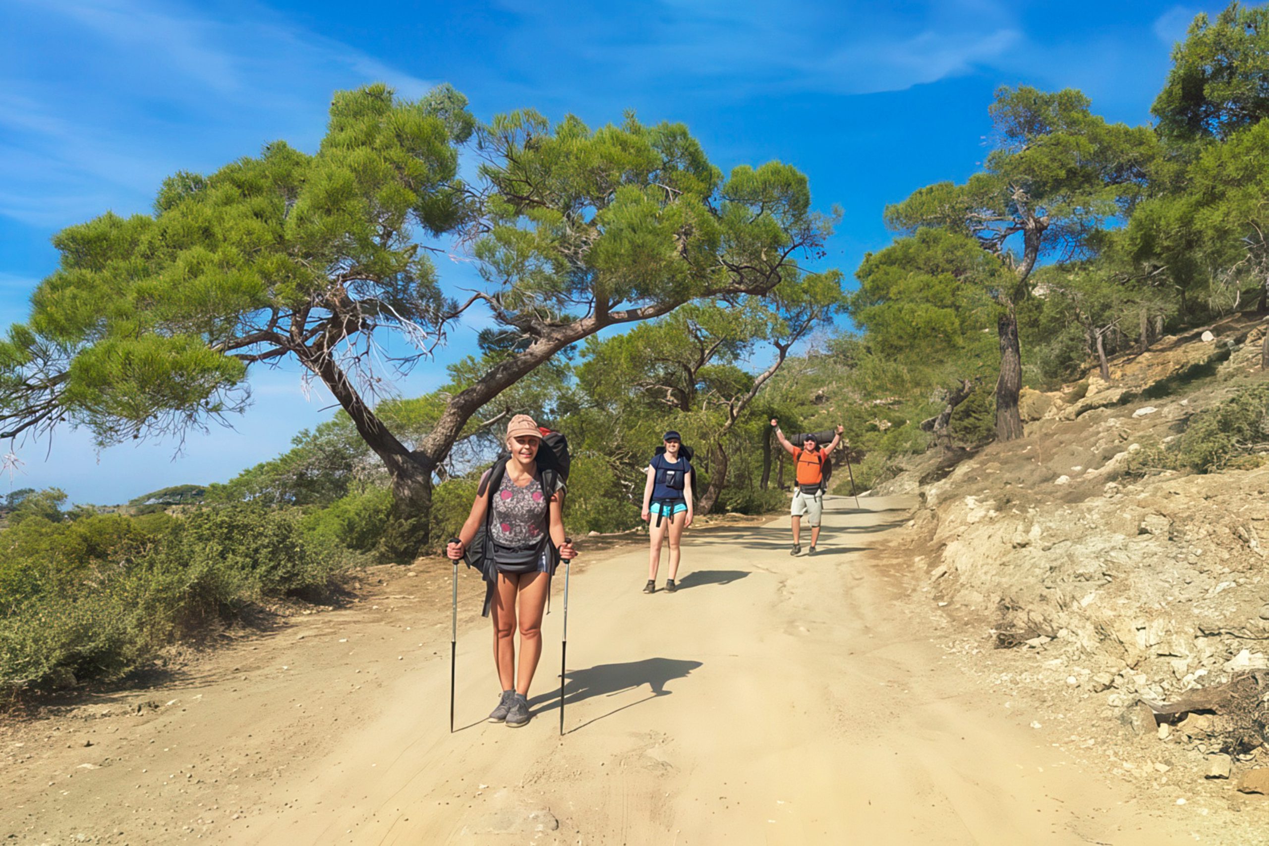
The E4 has become increasingly popular among Cyprus residents who use sections for weekend hikes and fitness activities. Local hiking clubs organize group walks on the most scenic portions, particularly in the Akamas Peninsula and Troodos Mountains. International hikers attempting the full European E4 route arrive in Cyprus to complete the final section of their multi year journey.
The trail supports ecological tourism that benefits rural mountain communities by bringing visitors to areas that might otherwise remain isolated. Villages along the route have developed small guesthouses and traditional taverns that cater to hikers. The path connects with nine UNESCO World Heritage painted churches in the Troodos region, allowing cultural exploration alongside wilderness experience.
The trail system demonstrates how outdoor recreation infrastructure can protect natural areas while making them accessible. Hikers share experiences through blogs and social media, creating a community of people who have walked the Cyprus section. Some attempt the route in segments over multiple visits, returning each year to complete another section. The trail provides economic benefits to remote communities while encouraging conservation of the landscapes it traverses.
Planning your E4 adventure
The official starting point is Paphos International Airport, though hikers can begin at Larnaca and walk west if preferred. A modified version omits the less scenic loop at the eastern end, reducing the total distance to approximately 500 kilometers over 25 stages. GPS tracks and detailed route descriptions are available from hiking websites and guidebooks dedicated to the trail. Maps at 1:25,000 scale covering the mountainous regions show the E4 route and are useful for navigation. The trail is generally well marked but some sections require map reading skills and GPS for confirmation.
Hikers should carry comprehensive first aid supplies as medical facilities are distant in remote areas. Mobile phone coverage is limited or absent in many forest sections of the route. A walking stick helps with steep sections and provides protection against the rare encounter with snakes. Proper hiking boots are essential as terrain varies from paved roads to rocky mountain paths. Weather appropriate clothing for both hot coastal sections and cold mountain conditions is necessary. Sunscreen and sun protection are critical even in winter at high elevations. Most hikers resupply in villages every three to four days depending on the section being walked.
Why the E4 defines Cyprus wilderness
The E4 trail reveals Cyprus that most visitors never see, connecting the coast with the mountain interior through landscapes that range from Mediterranean scrub to alpine forests. The route demonstrates that Cyprus contains genuine wilderness areas where hikers can walk for hours without encountering roads or buildings.
The trail system preserves traditional footpaths and mule tracks that connected villages before modern roads, maintaining historical routes through the landscape. Completing the Cyprus section gives hikers intimate knowledge of the island’s geography, flora, and rural culture that cannot be gained from coastal resorts. The E4 connects Cyprus to the broader European network of long distance trails, establishing the island as the eastern terminus of a path that began in Gibraltar.
For Cyprus, the trail represents commitment to outdoor recreation and ecological tourism as alternatives to beach focused development. The route protects forest and coastal areas by designating them as hiking destinations worthy of conservation.


