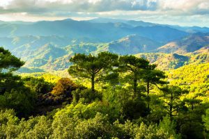
The mountains of Cyprus hold secrets carved into their slopes. For thousands of years, people built stone terraces across steep hillsides, creating agricultural systems that still influence the landscape today. These terraces supported orchards and crops in places where farming seemed impossible, showing the remarkable skill of ancient communities in managing their environment.
Recent archaeological work reveals that terrace farming on Cyprus dates back at least 3,000 years. The Bronze Age settlement of Politiko-Troullia, occupied between 2050 and 1850 BCE, provides clear evidence of this practice. Located in the foothills of the Troodos Mountains, this village sat at the interface between the fertile Mesaoria Plain and the copper-rich mountains, making it an ideal location for both agriculture and metal production.
- Historical Background
- The Orchards That Fed Ancient Cyprus
- Why Terraces Worked So Well in the Mountains
- The Broader Landscape of Ancient Agriculture
- Differences Between Ancient and Modern Terraces
- Terrace Agriculture in Modern Cyprus
- What Makes Terrace Systems Sustainable
- The Legacy of Ancient Land Management
Historical Background
The terraces at Politiko-Troullia were not simple structures. Archaeological surveys identified 168 ancient terrace walls in the study area, constructed with local stone and designed to serve multiple purposes. Longer terrace walls created level plots for agriculture, while shorter walls focused on erosion control and supporting fruit trees.
These ancient farmers understood their environment well. They built terraces on slopes with specific geological features, particularly near pillow lavas and limestone deposits where sediment availability and water drainage were optimal. Surface geology played a crucial role in determining where to construct terraces, as the walls needed both stable foundations and access to arable soil.
The terraces served more than one function. Besides creating flat surfaces for planting, they managed water flow down steep hillsides, retained nutrient-rich topsoil, and prevented erosion. This engineering created stable field plots that could sustain productive agriculture generation after generation.
The Orchards That Fed Ancient Cyprus
Plant remains from Politiko-Troullia tell a clear story. The villagers specialized in arboriculture, focusing heavily on tree crops rather than grains. Carbonized olive seeds appear frequently in the archaeological record, alongside evidence of grape and fig cultivation. The combination of ground stone troughs, olive remains, and local terracing suggests household-scale olive oil production.
The emphasis on orchards made economic sense. The terraced slopes provided excellent conditions for fruit and nut trees, which could thrive on the well-drained soil and benefit from the water retention properties of the terrace systems. Interestingly, cereal grains were rare at the site, and pulses were completely absent from plant assemblages. This suggests the community relied on other protein sources, particularly meat from domesticated animals and hunted deer.
The pine and oak woodlands surrounding Troullia remained largely intact, unlike contemporaneous settlements on the mainland where deforestation was common. Analysis of seed-to-charcoal ratios confirms that woodlands persisted in the area, providing timber resources and supporting populations of fallow deer that supplemented the local diet through hunting.
Why Terraces Worked So Well in the Mountains
The success of terrace agriculture stems from solving fundamental problems of slope farming. On steep hillsides, rainwater rushes downward with enough force to strip away topsoil. The terraces broke this destructive flow into manageable segments. Each level terrace slowed water velocity, allowing moisture to infiltrate the soil rather than run off.
This water management created multiple benefits. The soil retained more moisture between rainfalls, critical in the Mediterranean climate with its dry summers. The reduced water velocity prevented erosion of fertile topsoil. The level surfaces made planting, tending, and harvesting crops much easier on otherwise unusable slopes.
Modern studies confirm what ancient farmers knew through experience. Terraces create microclimates that protect crops from high winds while maximizing solar radiation. The stepped design increases the effective surface area for cultivation. Each terrace essentially functions as a small watershed, reshaping the micro-topography to enhance rainwater harvesting efficiency.
The Broader Landscape of Ancient Agriculture
The settlement at Politiko-Troullia covered about 20 hectares across village structures and surrounding fields. The adjacent slopes of Politiko-Koloiokremmos featured extensive terracing associated with Bronze Age pottery and ground stone tools. This pattern suggests that the terraced hillsides were not peripheral to village life but central to economic activities.
The terraces supported diverse activities beyond just growing crops. Archaeological evidence shows that people processed agricultural products on the terraces themselves, including crushing olives for oil. Copper ore processing also took place on terraced areas, taking advantage of the level work surfaces and proximity to water sources.
The location of Politiko-Troullia proved ideal for this diversified economy. Perennial springs provided reliable water access less than a kilometer from the village. The Pediaios River to the east offered arable land for supplementary crops. Copper deposits in the nearby pillow lavas supported a metallurgical industry alongside agriculture. This combination of resources made the settlement sustainable for about 200 years.
Differences Between Ancient and Modern Terraces
Researchers comparing Bronze Age terraces to modern ones in the same area discovered systematic differences. Ancient terraces show strong correlation with specific geological features, particularly the location of arable sediments needed for construction and the presence of water sources. Modern terraces, in contrast, depend more heavily on topographic factors and show less sensitivity to surface geology.
This difference reflects changing priorities. Ancient communities building terraces for the first time focused on locations where construction was most feasible with available materials and where water management requirements could be met. Modern farmers, working with existing terrace systems and different tools, could overcome geological limitations more easily.
The proximity to water-dependent copper metallurgy at sites like Politiko-Troullia added another dimension. The interrelation between mining activities in the pillow lavas and agricultural practices created a landscape shaped by both industries, with water management serving dual purposes for irrigation and ore processing.
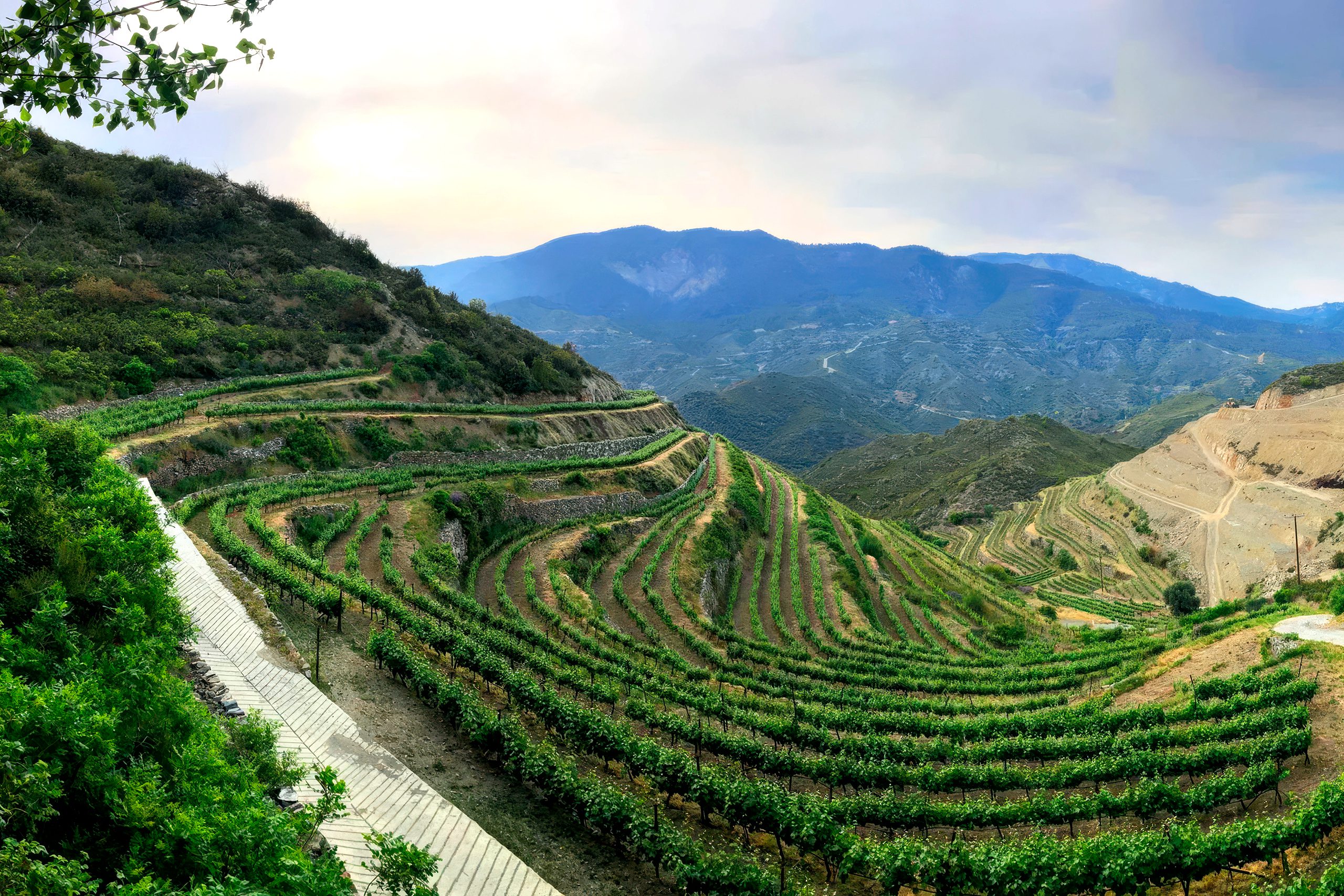
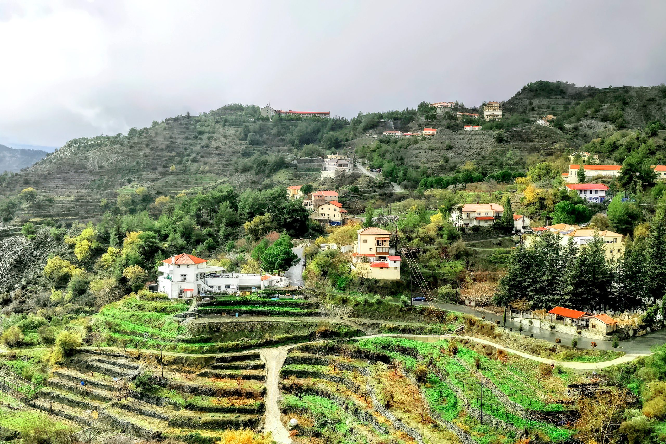
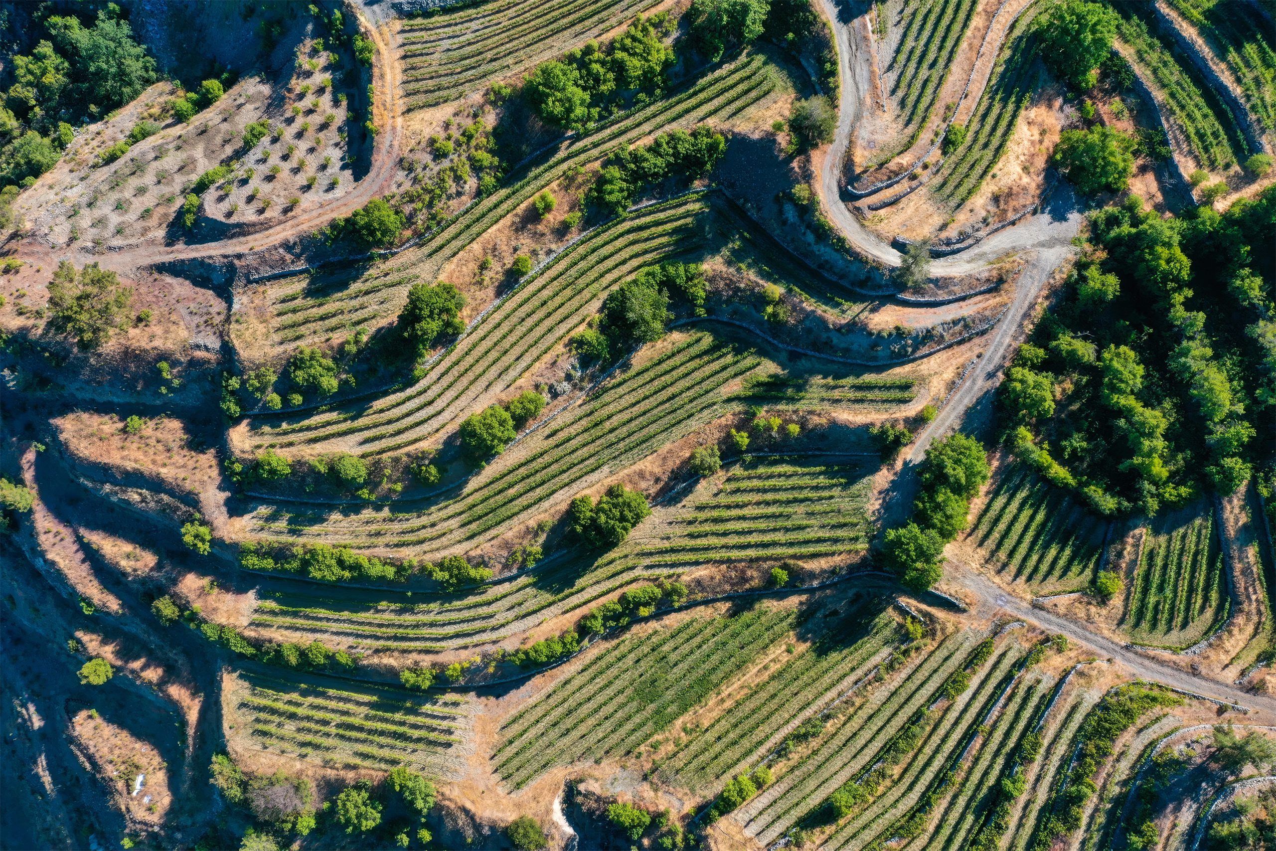
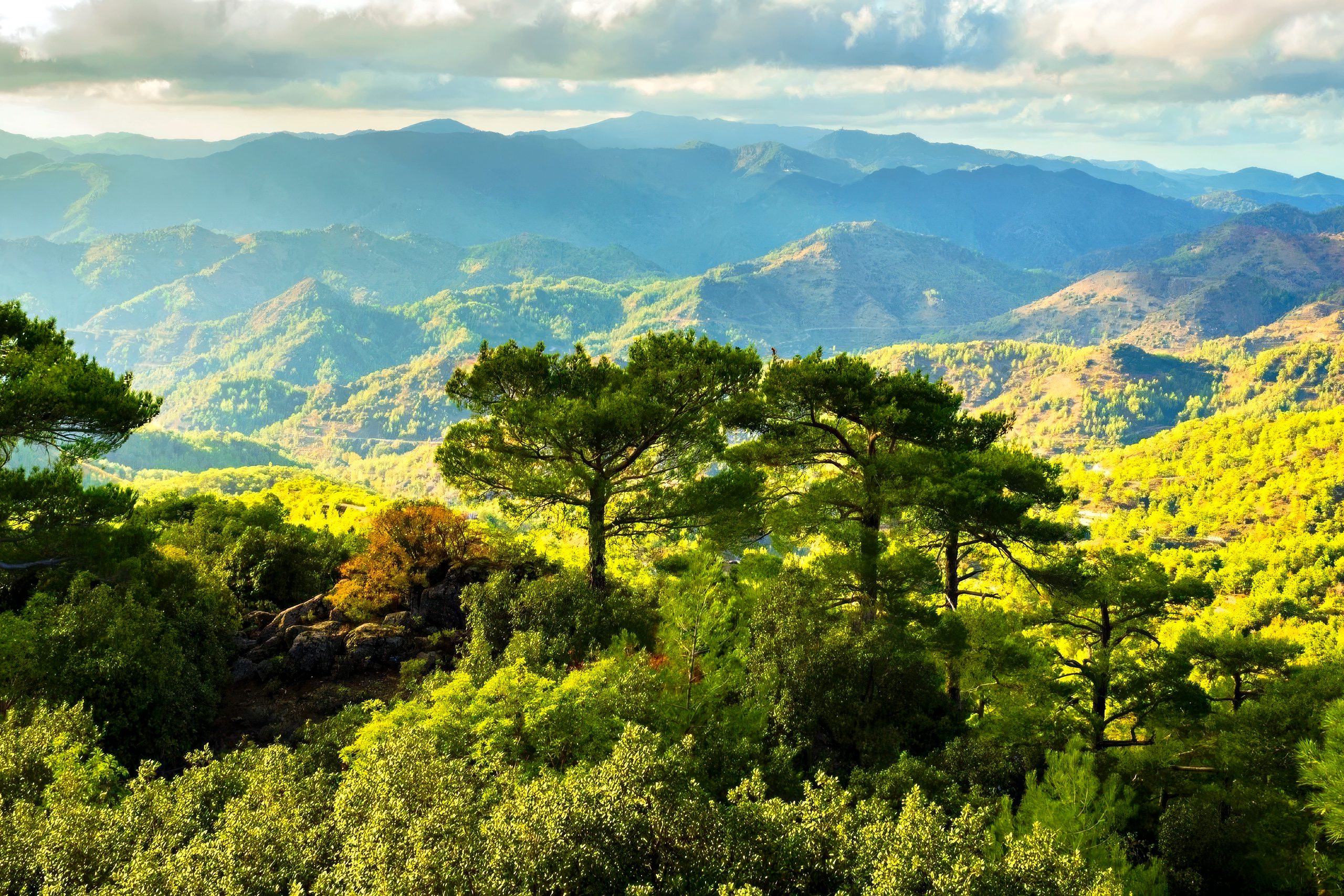
Terrace Agriculture in Modern Cyprus
Terrace farming continues in the Troodos Mountains today, though it faces significant challenges. The Troodos Ophiolite Complex covers 2,332 square kilometers with an average slope gradient of 31 percent. About 140 small communities with roughly 50,000 inhabitants practice agriculture on terraces with bench widths between one and six meters, constructed on slopes of 20 to 40 percent gradient.
Wine grapes represent the main crop grown on modern terraces. However, many vineyards on terraced hillsides face gradual abandonment as farming populations age and younger residents move to urban areas. When terrace walls go unmaintained, a domino effect occurs where collapsing terraces lead to soil erosion and sedimentation of downstream infrastructure.
Government programs have attempted to preserve terraced landscapes. Between 1968 and the early 2000s, Cyprus bench-terraced about 1,000 hectares annually through government or contractor work, supported by FAO and the World Food Program. After joining the European Union in 2004, Cyprus received subsidies for terrace maintenance, though support has varied over different program periods.
What Makes Terrace Systems Sustainable
The survival of terrace systems for millennia demonstrates their fundamental effectiveness. Terraces reduce soil loss by transforming long erosive slopes into shorter, contained segments. They slow water runoff dramatically, preventing the velocity needed to carry away topsoil. The water that would rush downhill instead infiltrates the soil, maximizing moisture availability.
The environmental benefits extend beyond erosion control. Terraced landscapes create diverse microhabitats that support various plant and animal species. The stepped design produces distinct microclimates at different elevations, allowing cultivation of crops with varying requirements on a single hillside. The organic-rich soil maintained on terraces can sequester atmospheric carbon dioxide, providing climate benefits.
Economic advantages reinforce the environmental ones. By conserving water and topsoil, terraces sustain land fertility and lead to predictable crop yields. Reduced erosion means less money spent replacing washed-away fertilizers and amending degraded soil. Converting steep slopes into productive terraced farmland increases the long-term value of marginal properties.
The Legacy of Ancient Land Management
The terraced landscapes around sites like Politiko-Troullia represent more than agricultural infrastructure. They exemplify sophisticated understanding of environmental management that developed over generations. Bronze Age communities created what researchers call anthropogenic landscapes, deliberately engineered to support diversified economies combining agriculture, animal husbandry, hunting, and metallurgy.
These ancient systems provide models for modern sustainable agriculture. The principles behind terrace construction remain relevant for addressing current challenges like water scarcity, soil degradation, and climate change. Cyprus faces increasing pressure on agricultural water resources as climate scenarios project higher temperatures and altered rainfall patterns. The water conservation properties of traditional terraces offer time-tested solutions.
Preservation of terraced landscapes has gained recognition as a cultural and environmental priority. Many terrace systems around the world now hold UNESCO World Heritage status as cultural landscapes representing the combined work of nature and humans. On Cyprus, maintaining viable terrace agriculture depends on supporting quality wine production, developing niche markets that value mountain-grown products, and promoting recreational tourism that appreciates traditional farming landscapes.
The stone walls climbing the slopes of the Troodos Mountains connect modern Cyprus to its ancient past. These terraces, some built 4,000 years ago, demonstrate human ingenuity in transforming challenging terrain into productive farmland. They supported orchards that fed Bronze Age communities and continue to sustain agriculture today. As Cyprus confronts water scarcity and land management challenges, these ancient terraces offer both practical solutions and inspiration from communities who thrived by working with their environment rather than against it.