Explore Cyprus with Our Interactive Map

Explore our top stories and discover ideas worth your time.

Church of Panagia Podithou

Church of Panagia Podithou

The Church of Panagia Podithou, located near the village of Galata in the Troodos Mountains of Cyprus, is one of the monuments included in the UNESCO World Heritage group known as the Painted Churches of the Troodos Region. Built in 1502, during the period of Venetian rule over Cyprus, the church represents a distinctive moment in the island’s artistic history when Byzantine traditions interacted with Western Renaissance influences. While the building maintains the architectural form typical of Cypriot mountain churches, its wall paintings reveal stylistic changes that reflect exposure to Italian artistic trends. The church stands as a visual document of cultural exchange in the eastern Mediterranean at a time when political authority had shifted but Orthodox religious identity remained strong. Under Venetian administration, Cyprus became more closely connected to Italian artistic currents, particularly those associated with the Renaissance. Venetian merchants, officials, and clergy moved between Cyprus and the Italian mainland, facilitating the circulation of ideas and artistic models. Despite these influences, Orthodox communities continued to commission church decoration rooted in Byzantine iconographic tradition. Panagia Podithou exemplifies this balance, preserving the theological framework of Orthodox art while incorporating stylistic features inspired by Western painting. The monument therefore illustrates how Cypriot artists and patrons negotiated cultural change without abandoning their spiritual heritage. Architectural Form and Mountain Adaptation Architecturally, Panagia Podithou follows…

Read more
Vertical Cyprus: Where the Island Rises and Reveals Itself

Vertical Cyprus: Where the Island Rises and Reveals Itself

Most visitors meet Cyprus at sea level, through beaches and coastal towns. But the island's character is shaped just as much by what rises behind it. From volcanic peaks and forested ridges to monastery balconies and fire lookout stations, Cyprus's high ground offers a different kind of understanding. These elevated viewpoints are not simply scenic stops. They explain how the island was formed, how people survived, and how geography quietly directed history, belief, and daily life. This is Cyprus seen vertically, where altitude changes perspective. An island lifted from the sea Cyprus’s mountainous backbone exists because the island itself was pushed upward from the ancient Tethys Ocean. The Troodos Mountains are one of the world’s most complete examples of exposed oceanic crust, known as an ophiolite. What was once seabed now reaches nearly 2,000 metres above sea level, creating an interior landscape that feels unexpectedly vast for an island. This geological lift matters visually. Dark volcanic rock, steep valleys, and broad domed summits give the highlands a sense of scale that contrasts sharply with the coast. From many viewpoints, you can see both shores of Cyprus on a clear day, a reminder of how compact yet varied the island really is. The calm authority of the Troodos peaks At the centre of this vertical world stands Mount Olympus (Chionistra), the…

Read more
Cyprus Ancient Naval Influence

Cyprus Ancient Naval Influence

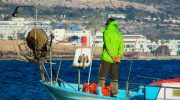
For much of antiquity, Cyprus was less an island on the map and more a working platform of the sea. Positioned between the Aegean, the Levant, and Egypt, it became a testing ground where Phoenician and Greek seafarers refined ships, navigation, and maritime organisation. This article explains how those two cultures approached the sea differently, why Cyprus mattered to both, and how their overlapping naval traditions quietly transformed the island into one of the Mediterranean’s most connected societies. An Island That Made Sense Only from the Water Cyprus’s importance is easiest to understand when viewed from a ship’s deck. Sitting at the eastern edge of the Mediterranean, the island lies directly along the sea lanes linking the Aegean world with the Levant and North Africa. Any vessel moving between these regions benefited from a stop that offered fresh water, timber, copper, and sheltered anchorages. The coastline itself encouraged maritime use. The south and east are broken into bays and coves that provide natural protection from storms, while prevailing currents make Cyprus a logical waypoint rather than a detour. Long before political borders mattered, geography had already decided the island’s role. This is why Cyprus rarely functioned in isolation. Its history unfolded in dialogue with the sea, shaped by those who knew how to use it. Two Seafaring Cultures, Two Ways…

Read more