Explore Cyprus with Our Interactive Map

Explore our top stories and discover ideas worth your time.

Diarizos Valley, Cyprus

Diarizos Valley, Cyprus

The Diarizos Valley stretches through the heart of western Cyprus, where ancient traditions meet rare wildlife in one of the island's most important conservation zones. Located east of Paphos and carved by the fourth-longest river in Cyprus (Diarizos River), this valley combines ecological significance with centuries of winemaking heritage across 14 traditional villages. The area covers 8,804 hectares and serves as both a Natura 2000 protected site and an Important Bird Area recognized for its unique biodiversity. The Diarizos River flows for 42 kilometers from two sources on the southeastern slopes of the Paphos Forest near Mount Olympus. Its name derives from the Greek word for two roots, referencing the Platys and Kaminaria tributaries that merge north of the historic Tzelefos Bridge to form the main river channel. Unlike most Cypriot rivers, the Diarizos maintains water flow throughout all seasons, making it one of only five permanently flowing rivers on the island. The river basin extends across 278 square kilometers between the western slopes of Mount Olympus at 1,951 meters elevation and the Paphos Forest peaks. The elevation gradient ranges from 800 meters near the source down to 50 meters where the river approaches the Paphos plain before reaching its Mediterranean outlet near Kouklia village. This dramatic descent creates varied habitats that support different plant and animal communities at each…

Read more
Mesaoria Plain, Cyprus

Mesaoria Plain, Cyprus

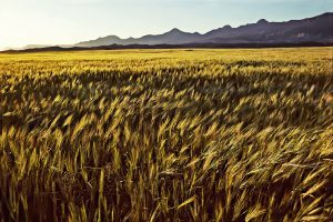
The Mesaoria Plain stretches 96 kilometres across central Cyprus between two mountain ranges. Mesaoria, meaning "between the mountains" in Greek, is a broad central plain that extends from Morphou Bay in the west to Famagusta Bay in the east. The Troodos Mountains rise to the south, while the Kyrenia Range forms a wall to the north. The plain covers approximately 1,000 square kilometres with elevations ranging from 100 metres on average up to 325 metres at its highest points. Nicosia, the capital of Cyprus, sits roughly in the centre of the plain along the Pedieos River. This positioning reflects centuries of strategic thinking, as the location provided access to both coasts. The plain contains dozens of villages and several major towns, making it the most densely populated region on the island despite its harsh summer climate and winter-dependent water supply. Historical Background Twenty million years ago, Cyprus existed as two separate islands corresponding to what would become the Kyrenia and Troodos mountain ranges. Approximately one million years ago, tectonic forces pushed up the land between these islands, creating the Mesaoria Plain and joining them into the single landmass known today as Cyprus. The Mediterranean Sea covered and exposed the plain multiple times as sea levels changed, but it has remained in its current form since the end of the Pleistocene…

Read more
Cyprus Ancient Naval Influence

Cyprus Ancient Naval Influence

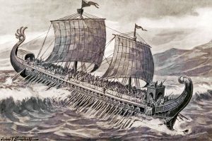
For much of antiquity, Cyprus was less an island on the map and more a working platform of the sea. Positioned between the Aegean, the Levant, and Egypt, it became a testing ground where Phoenician and Greek seafarers refined ships, navigation, and maritime organisation. This article explains how those two cultures approached the sea differently, why Cyprus mattered to both, and how their overlapping naval traditions quietly transformed the island into one of the Mediterranean’s most connected societies. An Island That Made Sense Only from the Water Cyprus’s importance is easiest to understand when viewed from a ship’s deck. Sitting at the eastern edge of the Mediterranean, the island lies directly along the sea lanes linking the Aegean world with the Levant and North Africa. Any vessel moving between these regions benefited from a stop that offered fresh water, timber, copper, and sheltered anchorages. The coastline itself encouraged maritime use. The south and east are broken into bays and coves that provide natural protection from storms, while prevailing currents make Cyprus a logical waypoint rather than a detour. Long before political borders mattered, geography had already decided the island’s role. This is why Cyprus rarely functioned in isolation. Its history unfolded in dialogue with the sea, shaped by those who knew how to use it. Two Seafaring Cultures, Two Ways…

Read more