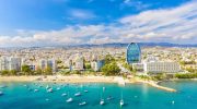
Explore Cyprus with Our Interactive Map

Explore our top stories and discover ideas worth your time.

Famagusta Martinengo Bastion

Famagusta Martinengo Bastion

In the northwest corner of Famagusta's historic walled city stands one of the Mediterranean's most impressive examples of Renaissance military architecture. The Martinengo Bastion, also known as Tophane, represents a turning point in defensive technology and remains a testament to 16th-century engineering brilliance. When the Republic of Venice took control of Cyprus in 1489, military engineers quickly recognized a serious problem. The existing fortifications throughout the island were outdated and vulnerable to modern artillery. Medieval walls, built tall and thin to defend against siege towers and scaling ladders, could not withstand the devastating impact of cannon fire. Famagusta presented a particular challenge. As Cyprus's main port and commercial hub, the city required strong defenses. Yet its northwest corner remained especially weak, creating a dangerous gap in the defensive perimeter. The Venetians understood that this vulnerability could prove fatal if the Ottoman Empire decided to expand its territory into Cyprus. Giovanni Girolamo Sanmicheli Takes Command In 1550, the Venetians brought in Giovanni Girolamo Sanmicheli, nephew of the renowned fortification architect Michele Sanmicheli of Verona, to redesign Famagusta's defenses. The younger Sanmicheli arrived with experience in the latest military engineering techniques and an understanding of how warfare had evolved. Construction took approximately nine years. Sanmicheli died in Famagusta in 1559 before seeing his masterwork completed, but his vision resulted in a bastion…

Read more
Akrotiri Environmental Protected Area

Akrotiri Environmental Protected Area

The Akrotiri Peninsula stands at the southernmost tip of Cyprus, where wetlands, salt lakes, and coastal habitats create one of the most important wildlife sanctuaries in the Mediterranean. This protected area combines ancient traditions with modern conservation to safeguard a landscape that supports rare species found nowhere else on Earth. Akrotiri Peninsula covers 60 square kilometers within the British Sovereign Base Area, just southwest of Limassol. The area centers around the Akrotiri Salt Lake, Cyprus's largest aquatic system, surrounded by coastal dunes, Mediterranean juniper forests, saltmarshes, and reedbeds. It holds designations as a Ramsar Wetland of International Importance, a Special Protection Area for birds, and a Special Area of Conservation. Historical Background Thousands of years ago, Akrotiri existed as an island separated from Cyprus. The Kouris River carried sediment to its delta over millennia, building up land that formed a bridge connecting the western side to the mainland. Later, a second bridge formed on the eastern side from sediment deposited by the Garilis River. This double tombolo formation trapped the salt lake in the center and took at least 56,000 years to complete. A Remarkable Concentration of Wildlife The peninsula hosts over 800 plant species, representing 40 percent of all plants found on Cyprus. About 300 bird species use the area, with 70 percent of Cyprus's entire bird population passing…

Read more
National Flag of Cyprus and Its Meaning

National Flag of Cyprus and Its Meaning

The national flag of Cyprus came into use on August 16, 1960, when the island gained independence from British colonial rule under the Zürich and London Agreements. Turkish Cypriot artist İsmet Güney designed the flag following constitutional requirements that it employ neutral symbols without incorporating blue or red, colors associated with the Greek and Turkish flags. The design deliberately avoided religious symbols including crosses or crescents to indicate harmony between the Greek and Turkish Cypriot communities. The white background represents peace and purity, while the copper-orange silhouette of the entire island references Cyprus's famous copper deposits from which the island's name derives. Two green olive branches positioned below the map symbolize peace and reconciliation between the two ethnic communities. Until Kosovo, a partially recognized state in Europe, adopted its current flag in 2008, Cyprus was the only country to display its complete land area on its national flag. The Design Competition and Selection Process Upon independence, Cyprus needed a new flag distinct from the British colonial banner that had flown over the island since 1878. Article 4 of the constitution specified the flag should be chosen jointly by President Archbishop Makarios III and Vice President Fazil Küçük and required a neutral design avoiding colors and symbols that favored either Greek or Turkish communities. The British colonial administration initially proposed a…

Read more