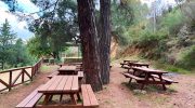
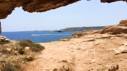
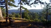
The Troodos Mountains host a remarkable path known as the Ariadni Nature Trail. This route offers a direct look into the heart of the forest. Nature enthusiasts travel here for the calm atmosphere. The air stays cool even in the heat of the summer months. It serves as a sanctuary for many local plants.
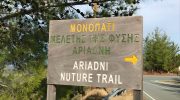
The terrain consists of diverse rock formations and dense tree cover. Hikers find a sense of peace among the tall pines. Each step reveals a new view of the deep valleys below. The site remains a top choice for those who seek quiet beauty. It provides a unique window into the island’s wild interior.
This journey starts near the village of Gerakies and winds through the woods. The path is clear and easy to follow for most visitors. It connects several points of interest within the state forest. People admire the craft of the old stone walls along the way. This trail stands as a testament to the natural wealth of the region.
Trail Overview
- Location: Gerakies Village Troodos Mountains
- Distance: 3.1 miles (5 km)
- Route Type: Point to Point
- Difficulty: Moderate
- Elevation Gain: 650 feet (200 meters)
- Duration: 2 to 2.5 hours
- Best Time to Visit: April to June or September to November
- Terrain: Forest Floor and Rocky Slopes
Geological Context
The Ariadni Nature Trail sits within the Pitsilia region on the northern slopes of the mountain range. The ground reflects the volcanic past of the island. Igneous rocks dominate the landscape and provide a solid base for the path. These rocks belong to the Troodos Ophiolite complex which attracts scientists from around the world. The soil is rich in minerals and supports a vast array of life.
The elevation changes as the route climbs higher into the peaks. This shift in altitude affects the temperature and the moisture levels. You notice a change in the earth as you move along the bends. Some sections feature loose stones while others remain firm under the shade of trees. The geology shapes the very path that hikers tread upon. It tells a story of the planet that spans millions of years.
Botanical Diversity
Flora on this trail is both rare and beautiful. The Cyprus Cedar stands tall as a symbol of the local heritage. This tree exists only on this island and nowhere else in the wild. Its scent fills the breeze and creates a fresh feel in the lungs. You also see the Golden Oak which has thick leaves to trap moisture. These trees offer a dense canopy that keeps the path cool and dark.
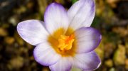
Wildflowers sprout from the forest floor during the spring months. The Cyprus Crocus and various orchids add color to the brown earth. These plants depend on the specific climate of the mountains to thrive. Shrubs like the rock rose and wild lavender line the edges of the track. Each plant plays a role in the health of the local forest. The lack of human interference allows these species to grow without limit.
Route Dynamics
The trail begins at a high point and descends toward the valley. This direction makes the walk feel less strenuous at the start. However the return trip requires a steady climb back up the slope. The path is narrow in some spots but remains safe for most adults. Wooden signs point the way at every major turn or fork in the road.
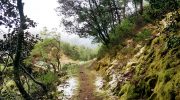
Hikers pass through areas of dense woodland before they reach open clearings. These clearings offer views that stretch all the way to the northern coast. You can see the sea on a clear day if the mist stays low. The route passes near small streams that flow after the winter snow melts. These water sources are vital for the survival of the forest creatures. The sound of water adds a layer of calm to the trek.
Wildlife Encounters
Animals find a safe home within the borders of the Troodos Forest. The Mouflon is the most famous resident of these hills. This wild sheep is shy and hides when it hears footsteps. Luck is necessary to catch a glimpse of its curved horns. Birds are much easier to find and watch from the path. The Bonelli Eagle soars high above the peaks in search of prey.

Smaller creatures like the Cyprus wheatear nest in the rocky cliffs. Lizards sun themselves on the warm stones during the mid day heat. These reptiles move fast when they sense a shadow nearby. The forest acts as a bridge for migratory birds twice a year. They stop here to rest before they continue their long flights across the sea. The balance of life is evident in every corner of the trail.
Cultural Heritage
Human history also leaves a mark on the Ariadni Nature Trail. Old stone structures stand as ruins near the path. These walls once served as pens for livestock or shelters for shepherds. They show how people lived in harmony with the mountains in the past. The village of Gerakies nearby keeps these traditions alive through its architecture and food.

The name Ariadni itself comes from ancient Greek myths. It links the natural world to the stories of old gods and heroes. This connection adds a sense of mystery to the walk. Locals treat the land with respect and care for the trails as part of their duty. They keep the paths clear of debris and fix the signs when they break. This effort ensures that the trail remains open for future generations.
Climate and Safety
Weather in the mountains changes fast and requires prep. Clouds can roll in and hide the sun in a matter of minutes. It is wise to check the forecast before the start of the trip. The temperature drops as the sun goes down so a light jacket is a good idea. Water is essential as the climb can cause thirst even in the shade.
Sturdy boots protect the feet from sharp rocks and uneven ground. The trail can become slippery if a sudden rain shower occurs. Most hikers choose to walk in pairs for safety in case of a trip or fall. Cell phone signals are weak in the deep parts of the valley. A map or a compass helps to stay on the right track. Safety is the first priority for any outdoor activity.
Environmental Preservation
The park service works hard to protect the Ariadni Nature Trail. They enforce rules to keep the forest clean and wild. Fires are strictly forbidden as the pine trees burn very fast. Trash must go back home with the hiker to keep the soil pure. Staying on the marked path prevents the crush of rare plants.
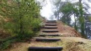
Education plays a big part in the conservation efforts. Signs explain the types of trees and the importance of the insects. These tiny creatures pollinate the flowers and feed the birds. The trail serves as an outdoor school for children from the city. They learn the value of nature and the need to save it. Every visitor has a role in the guard of this green space.
Conclusion!
Ariadni Nature Trail provides a deep look at the soul of Cyprus. It combines the thrill of a hike with the peace of the woods. The path is rich in facts and sights that satisfy the mind. It is a place where the air is pure and the views are wide. The trek leaves a lasting mark on the memory of those who complete it.
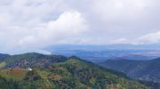
The mountains offer a challenge and a reward at the same time. You find strength in the climb and rest in the shade. The cycle of life continues here as it has for eons. Nature remains the boss of this land and humans are but guests. This trail is a gift to the world and a pride of the island.