The Diarizos Valley stretches through the heart of western Cyprus, where ancient traditions meet rare wildlife in one of the island’s most important conservation zones. Located east of Paphos and carved by the fourth-longest river in Cyprus (Diarizos River), this valley combines ecological significance with centuries of winemaking heritage across 14 traditional villages. The area covers 8,804 hectares and serves as both a Natura 2000 protected site and an Important Bird Area recognized for its unique biodiversity.
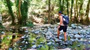
The Diarizos River flows for 42 kilometers from two sources on the southeastern slopes of the Paphos Forest near Mount Olympus. Its name derives from the Greek word for two roots, referencing the Platys and Kaminaria tributaries that merge north of the historic Tzelefos Bridge to form the main river channel. Unlike most Cypriot rivers, the Diarizos maintains water flow throughout all seasons, making it one of only five permanently flowing rivers on the island.
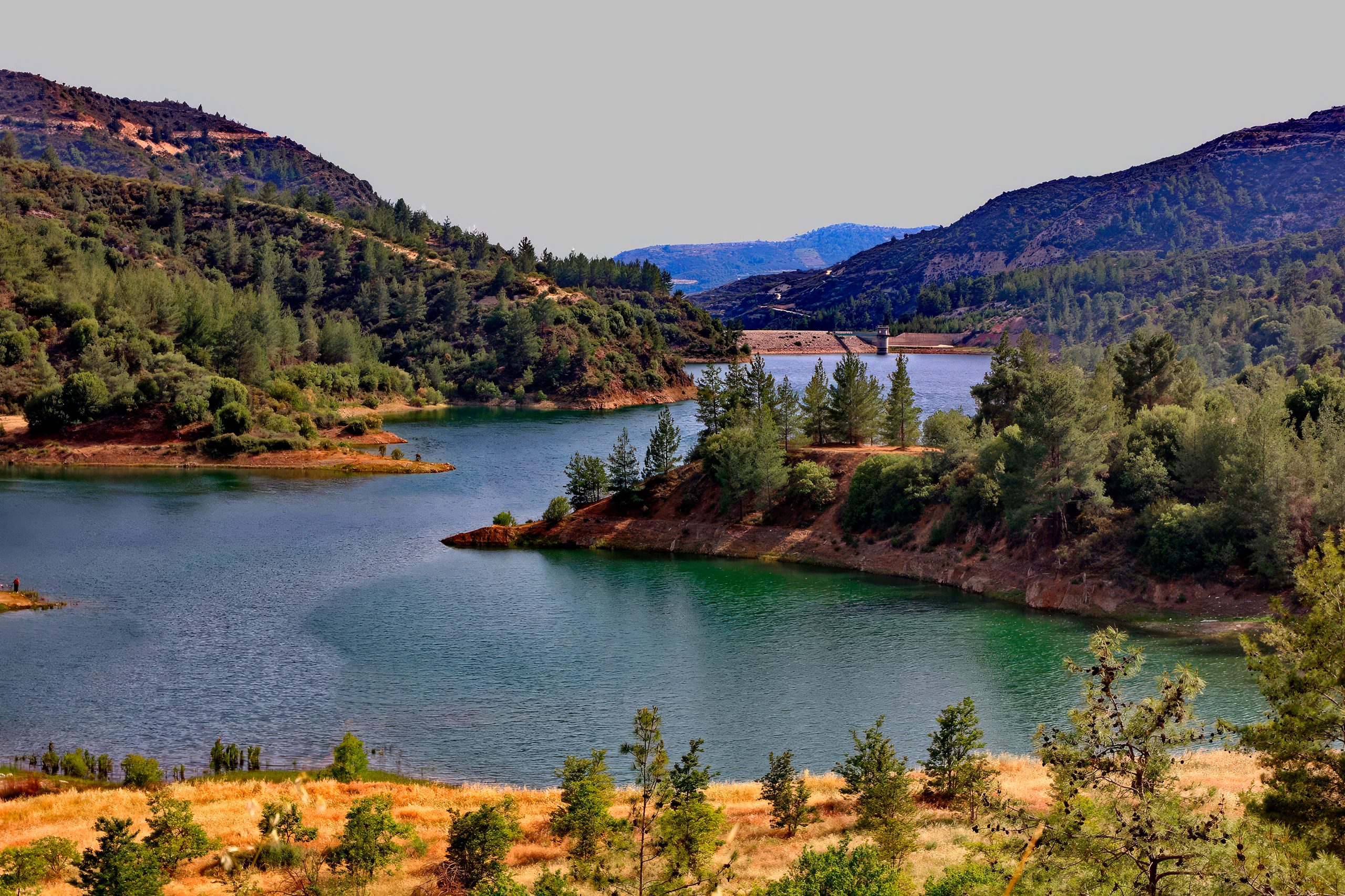
The river basin extends across 278 square kilometers between the western slopes of Mount Olympus at 1,951 meters elevation and the Paphos Forest peaks. The elevation gradient ranges from 800 meters near the source down to 50 meters where the river approaches the Paphos plain before reaching its Mediterranean outlet near Kouklia village. This dramatic descent creates varied habitats that support different plant and animal communities at each elevation zone.
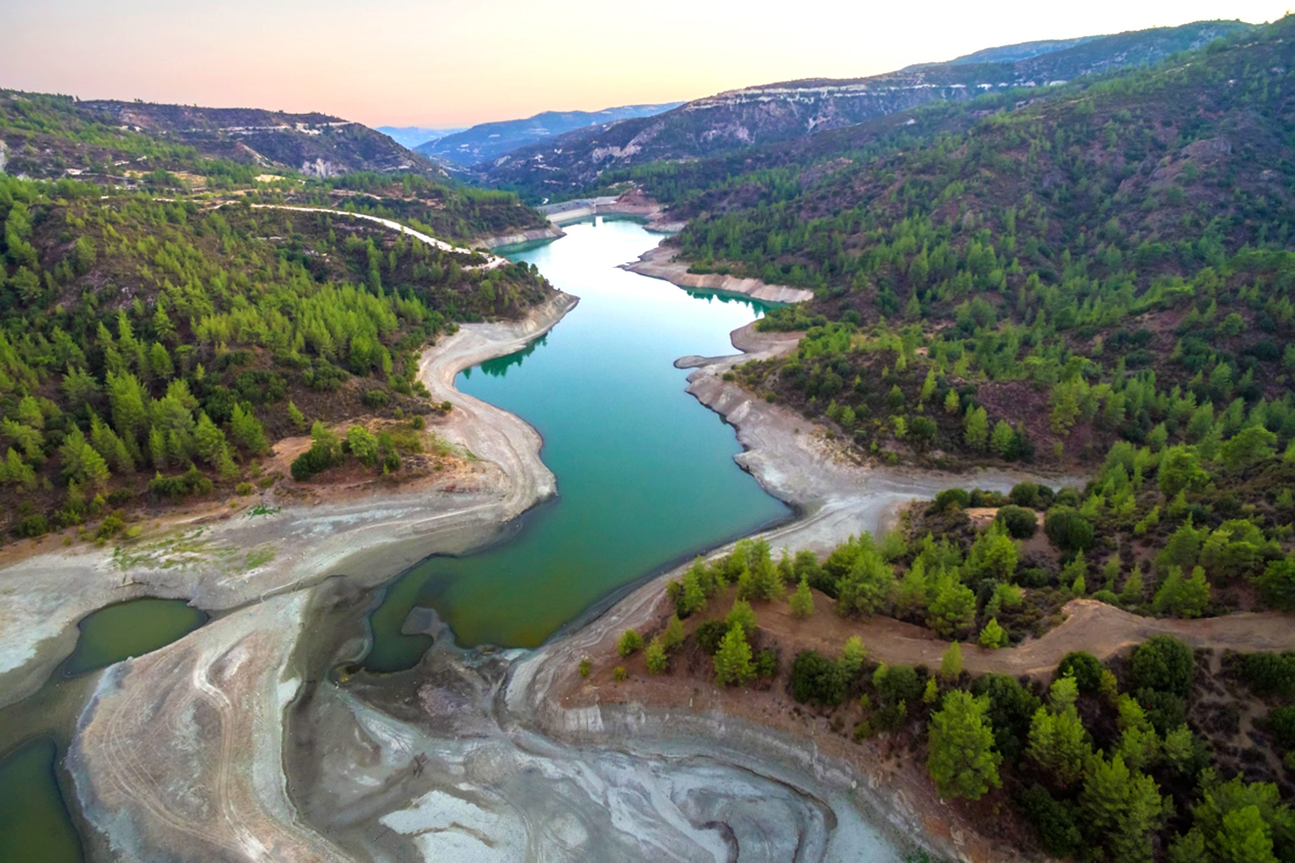
Water from the Diarizos contributes 20 percent of the total annual flow collected in Cyprus dams. Since the mid 1990s, authorities have diverted much of this water through a 14.5 kilometer underground tunnel from Arminou Dam to the larger Kouris Dam, part of the Southern Conveyor Project that transports water across 120 kilometers of southern Cyprus.
Protected Habitat Types Under European Oversight
The Diarizos Valley received formal protection as part of the Natura 2000 network, the European Union’s system of conservation areas. In 2008, management plans for the valley were approved by central authorities following the Comanacy project, the first LIFE Nature initiative funded in Cyprus. This project established conservation measures for five threatened Sites of Community Interest across the island.
One priority habitat type present in the valley is alluvial forest classified under code 91E0 in the Habitats Directive. These riparian forests grow along the riverbanks where periodic flooding deposits nutrient rich sediments. The forests contain alder and ash trees adapted to tolerate seasonal inundation while remaining well drained during low water periods. The valley also supports mixed pine forests, shrubland, and agricultural areas that create habitat variety within a relatively compact geographic area.
The vegetation remains only partially cataloged, with ongoing research documenting endemic and protected species. The fertile soils deposited by rivers flowing from the Troodos Mountains support diverse plant communities. The area experiences a mild climate with cold winters and cool summers compared to coastal regions, conditions that influence which species can establish themselves successfully.
Endemic Birds Find Refuge in Valley Habitats
The valley qualifies as an Endemic Bird Area, designated for its exceptional populations of species found nowhere else on Earth. The Cyprus Warbler represents the most significant endemic breeding bird in the valley. This small gray and black songbird nests exclusively on Cyprus, with the Diarizos Valley hosting particularly strong populations. Estimates suggest 70,000 to 140,000 breeding pairs exist across the entire island each year.
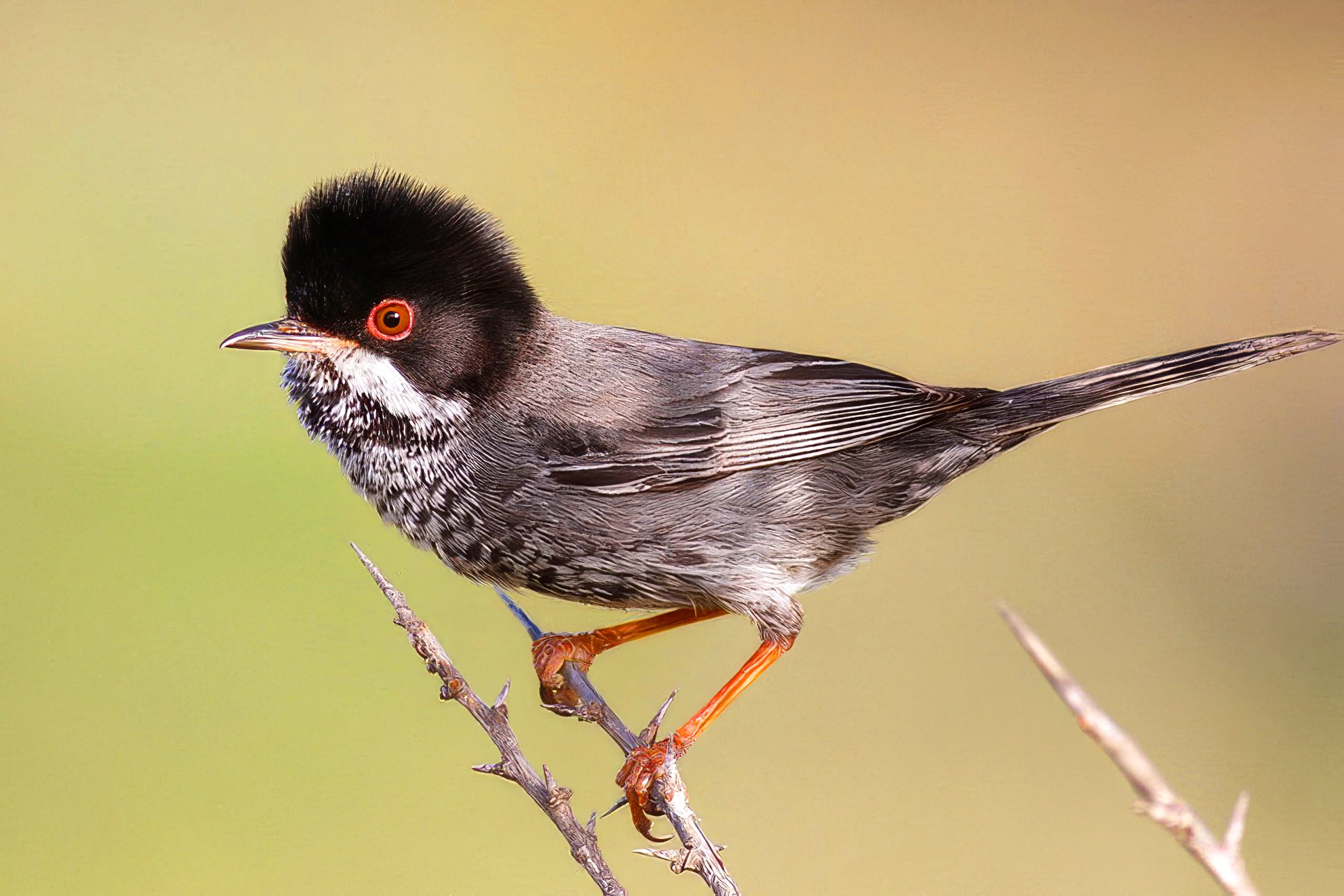
The Cyprus Warbler prefers dry open hillsides with bushes for nesting. Males display distinctive black streaking on their underparts, unique among European warblers, along with white malar streaks and a black head. Most birds migrate to Israel, Jordan, and Egypt for winter, though some remain on Cyprus during mild winters. Recent observations indicate population pressures as the Sardinian Warbler, which colonized Cyprus only in the early 1990s, expands into traditional Cyprus Warbler territories.
The Cyprus Wheatear breeds in good numbers throughout the valley. This summer visitor arrives in late March and departs by October. The valley also ranks as a top breeding location for the colorful European Roller and the Long-legged Buzzard, a large raptor that hunts across the open countryside. Additional notable species include the Black Francolin, Little Owl, and Cretzschmar’s Bunting.
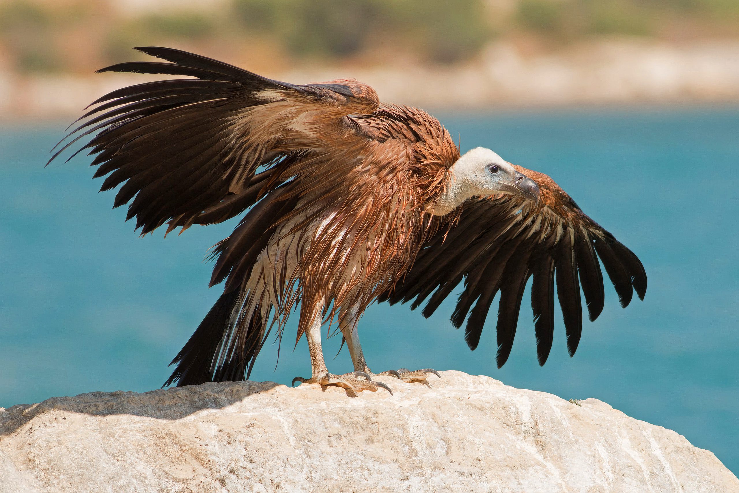
During autumn migration, the valley serves as an important corridor for raptors traveling between continents. The site provides crucial feeding areas for Griffon Vultures, one of Europe’s largest birds, and supports breeding pairs of Peregrine Falcons that nest on cliff faces and rocky outcrops.
Ancient Wine Route Connects Mountain Villages
The Diarizos Valley Wine Route follows the river through 14 hillside villages, each with its own character and history. The route begins in Paphos and climbs eastward through Acheleia, Kouklia, Nikokleia, Choletria, Stavrokonnou, Kelokedara, Salamiou, Mesana, Arminou, Filousa, Agios Nikolaos, Praitori, Kedares, Agios Georgios, Mamonia, and Fasoula. Archaeological evidence shows human settlement in this valley since Neolithic and Chalcolithic times, spanning more than 5,000 years of continuous habitation.
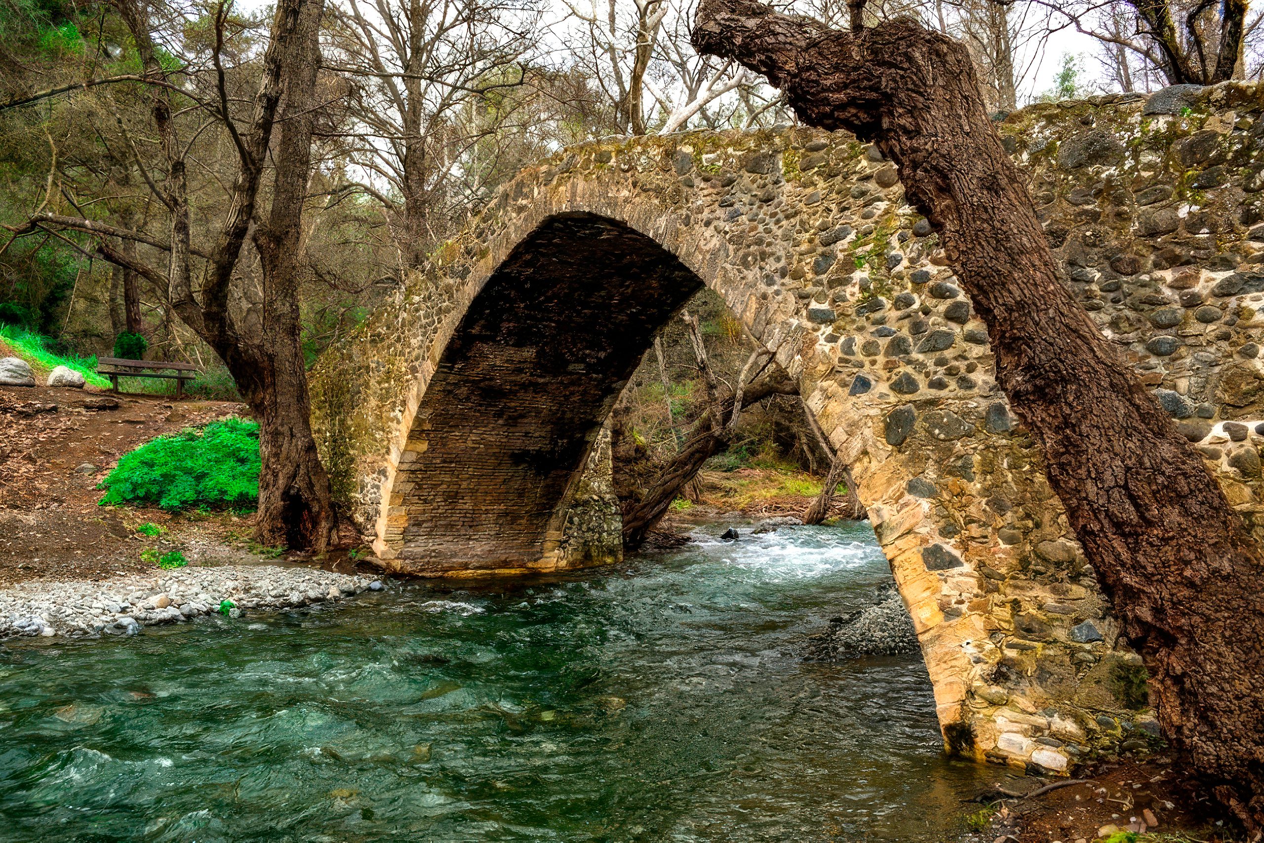
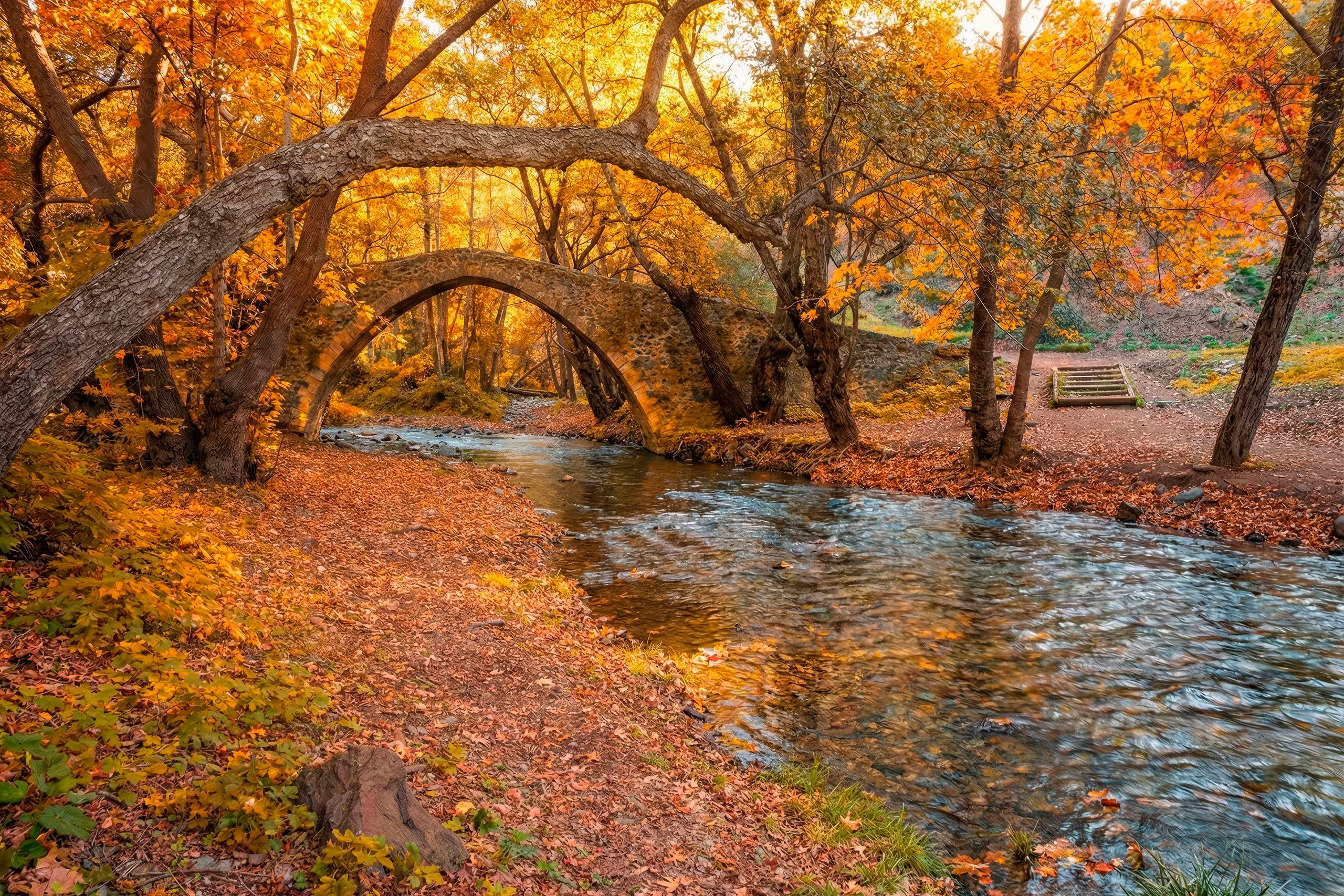
The route winds along the riverbed, occasionally crossing the water as it passes through the historic Venetian bridge at Tzelefos. Built during the medieval period, this stone bridge stands as the largest of its kind ever constructed in Cyprus. The surrounding 11 kilometer gorge features dense pine forests with some of the tallest trees found anywhere on the island. Photographers and newly married couples frequently visit this scenic location.
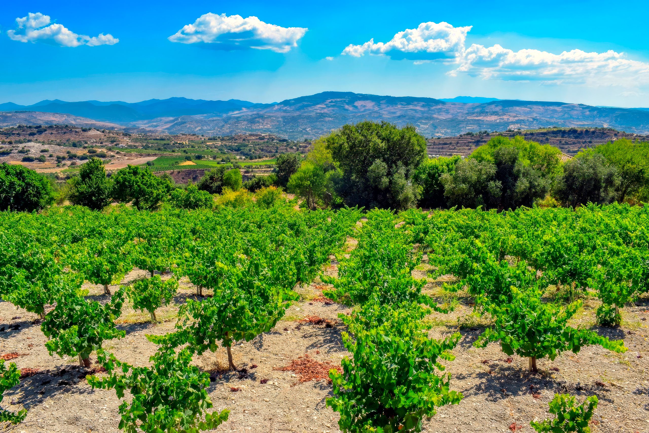
The valley’s position at lower altitude than other major wine producing regions creates distinct growing conditions. The terroir results from alluvial deposits laid down over millennia by the Troodos sourced rivers. Eighteen different grape varieties thrive in these fertile soils, though the indigenous Mavro red grape dominates plantings. This variety historically contributed to the production of Commandaria, the legendary sweet wine that dates back more than 800 years in Cyprus.
Two significant wineries currently operate along the route, placing the valley on the island’s wine production map despite its relatively modest status. Visitors can tour these facilities to learn about traditional and modern winemaking techniques. The expansion of the local wine trade brings economic opportunities to villages while maintaining agricultural landscapes that benefit biodiversity.
Conservation Challenges in Working Landscapes
The valley faces typical pressures that affect many protected areas with human populations. Recreation, water management for agriculture, fire risk, and the expansion of cultivated areas all create challenges for conservation managers. Maintaining the balance between traditional land uses and habitat protection requires ongoing coordination between local communities, agricultural producers, and conservation authorities.
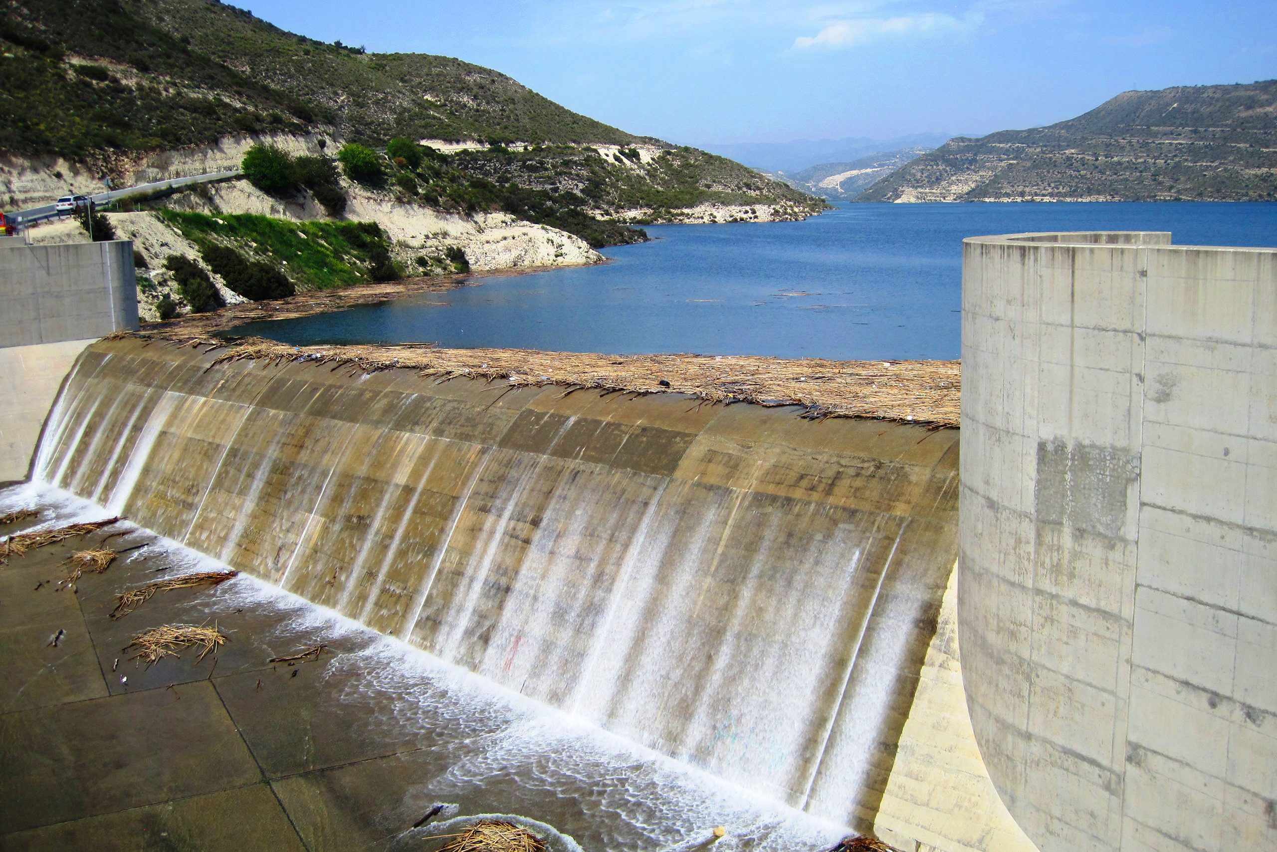
Water diversion to supply downstream urban areas and farms has altered natural flow patterns. The 14 kilometer tunnel to Kouris Dam reduces the amount of water flowing through the valley’s lower sections. This affects riparian habitats that depend on seasonal flooding to maintain their ecological functions. Conservation efforts must consider both human water needs and the requirements of valley ecosystems.
In 2020, Terra Cypria, the Cyprus Conservation Foundation, prepared a detailed assessment of restoration possibilities for the Diarizos River estuary along with neighboring Xeros and Ezousa estuaries. These studies identify specific actions needed to rehabilitate degraded habitats and restore natural ecosystem functioning in areas where past human activities have caused damage.
Tourism Brings Awareness and Resources
The wine route attracts visitors interested in rural tourism, traditional village life, and local food culture. Small tavernas and restaurants serve regional dishes paired with locally produced wines. This agrotourism model provides income for villages while encouraging preservation of traditional architecture, customs, and agricultural practices. Restored wine presses and small museums demonstrate historical winemaking methods and rural life.
The combination of natural beauty, endemic wildlife, and cultural heritage creates multiple reasons for people to visit and appreciate the valley. Birdwatchers come specifically to observe the Cyprus Warbler and other endemic species. Hikers explore trails through pine forests and along the riverbanks. Wine enthusiasts travel the route to taste regional varieties and learn about indigenous grape cultivation.
The genuine hospitality of local residents enhances the visitor experience. Many villages maintain traditional coffee shops where owners welcome guests with complimentary glasses of wine, either from their own production or from neighboring vineyards. This personal connection to place and product helps visitors understand why conservation matters to communities whose livelihoods depend on the valley’s continued health.
Future Management Requires Adaptive Approaches
The 2008 management plans established under the Comanacy project provided essential frameworks, but implementation continues at the local level. Effective long term conservation requires regular monitoring of habitat conditions, species populations, and the impacts of human activities. The relatively remote and undeveloped character of much of the valley provides advantages for wildlife, but also means fewer resources for active management.
Climate change introduces additional uncertainties. Cyprus already experiences water scarcity and extended drought periods. Changes in precipitation patterns could further stress river dependent ecosystems and increase competition for limited water resources. Conservation strategies must build resilience into both natural systems and human communities that share the landscape.
The Diarizos Valley demonstrates how conservation areas can serve multiple purposes when properly managed. The same landscapes that provide habitat for rare endemic birds also produce distinctive wines rooted in centuries of tradition. By protecting river ecosystems and the species that depend on them, authorities also preserve the natural beauty and ecological functions that make the valley valuable for both residents and visitors. This integration of conservation, culture, and sustainable economic activity offers a model for protecting Mediterranean landscapes while supporting the communities that call them home.