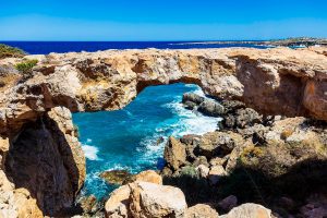
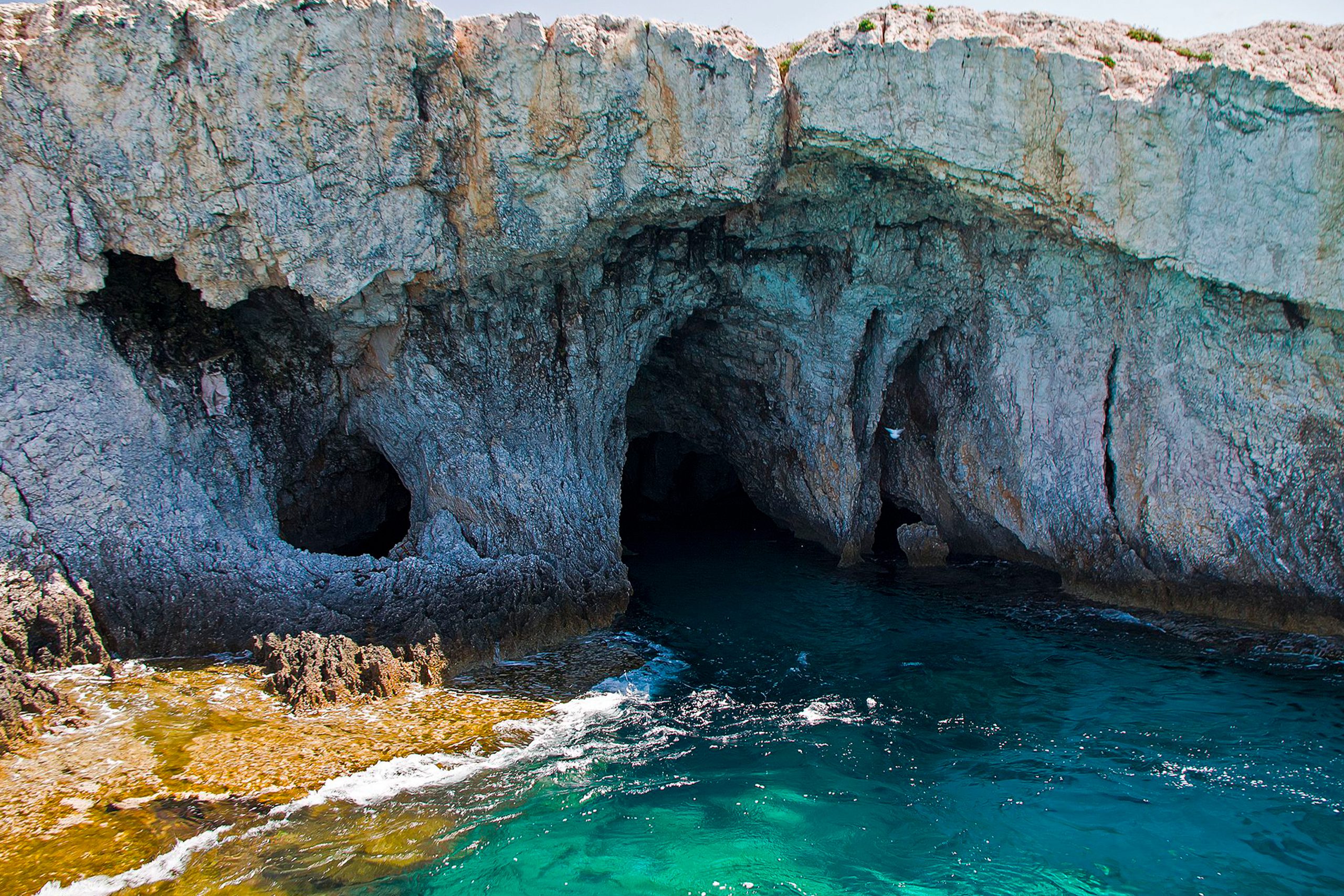
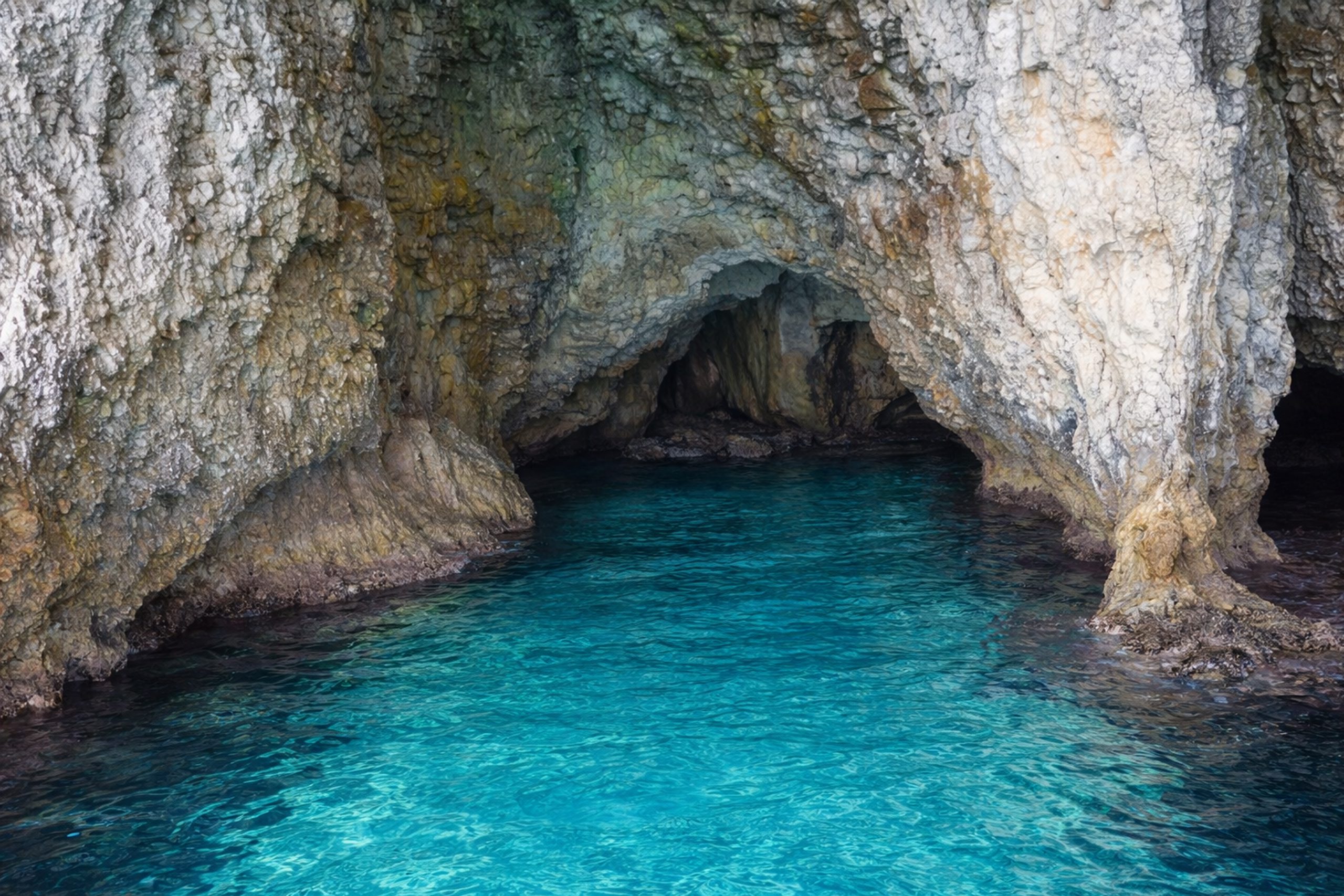
Cape Greco is a headland located between Ayia Napa and Protaras at the southern end of Famagusta Bay. The area covers 385 hectares and was designated as a National Forest Park under the administration of Cyprus’s Forestry Department. The coastline here features dramatic limestone cliffs that reach 30 feet (roughly 10 meters) in height and contains numerous sea caves carved by wave action.
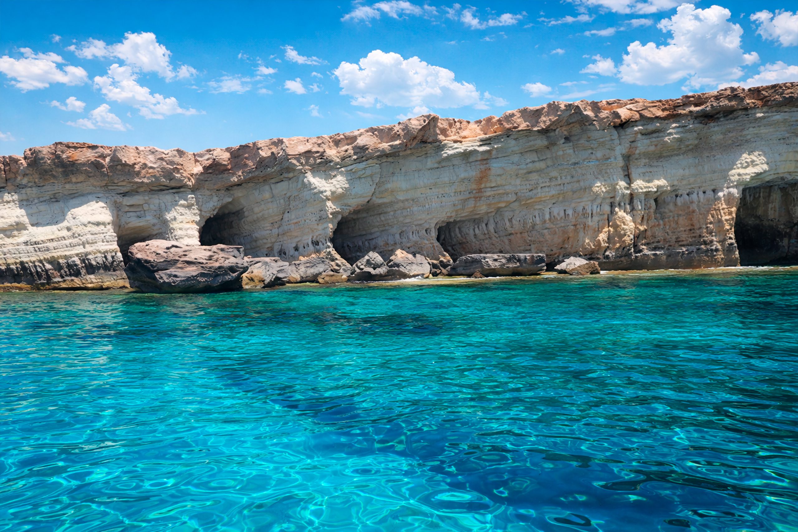
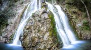
The caves are formed from layered limestone that was deposited in warm seas millions of years ago. The rock consists of hard and soft layers that erode at different rates. Waves constantly pound against the cliffs and dissolve the softer limestone faster than the harder layers above and below. This differential erosion creates the caves, arches, and tunnels that characterize the Cape Greco coastline.
- Historical Background
- The Ayioi Anargyroi Chapel and Smuggler's Cave
- Swimming and Exploring the Caves
- Cliff Jumping and Safety Concerns
- The Palace Caves and Deep Passages
- Marine Life and Underwater Environment
- Why Cape Greco Caves Matter Today
- How to Visit the Sea Caves
- Safety and Environmental Protection
Historical Background
The formation process began thousands of years ago when sea levels and wave patterns were different. Water enters cracks in the limestone and widens them through both mechanical force and chemical dissolution. Seawater contains salt and is slightly acidic, which helps dissolve calcium carbonate in the limestone.
The caves show an almost horizontal layer of soft limestone that waves eroded easily. The overlying harder layer protected the caves from collapse and created roof structures. The lower layer is also harder and forms a several-meter-wide ledge. At some locations, this ledge is submerged while at others it stays above sea level and provides access to the cave entrances.
Some resistant patches in the soft layer caused irregular erosion, so the layer was not completely removed. The result is a series of caves separated by columns of remaining rock. Some caves connect behind these columns and create tunnels that extend deep into the cliff face. A few passages reach up to 80 meters underground according to local estimates, though most caves are much smaller.
The Ayioi Anargyroi Chapel and Smuggler’s Cave
The small white chapel of Ayioi Anargyroi sits on a rocky cliff overlooking the sea near the main cave complex. The chapel is dedicated to Saints Cosmas and Damian, twin brothers who worked as doctors and healed sick people without accepting payment. The building is popular for wedding photos because of its picturesque setting.
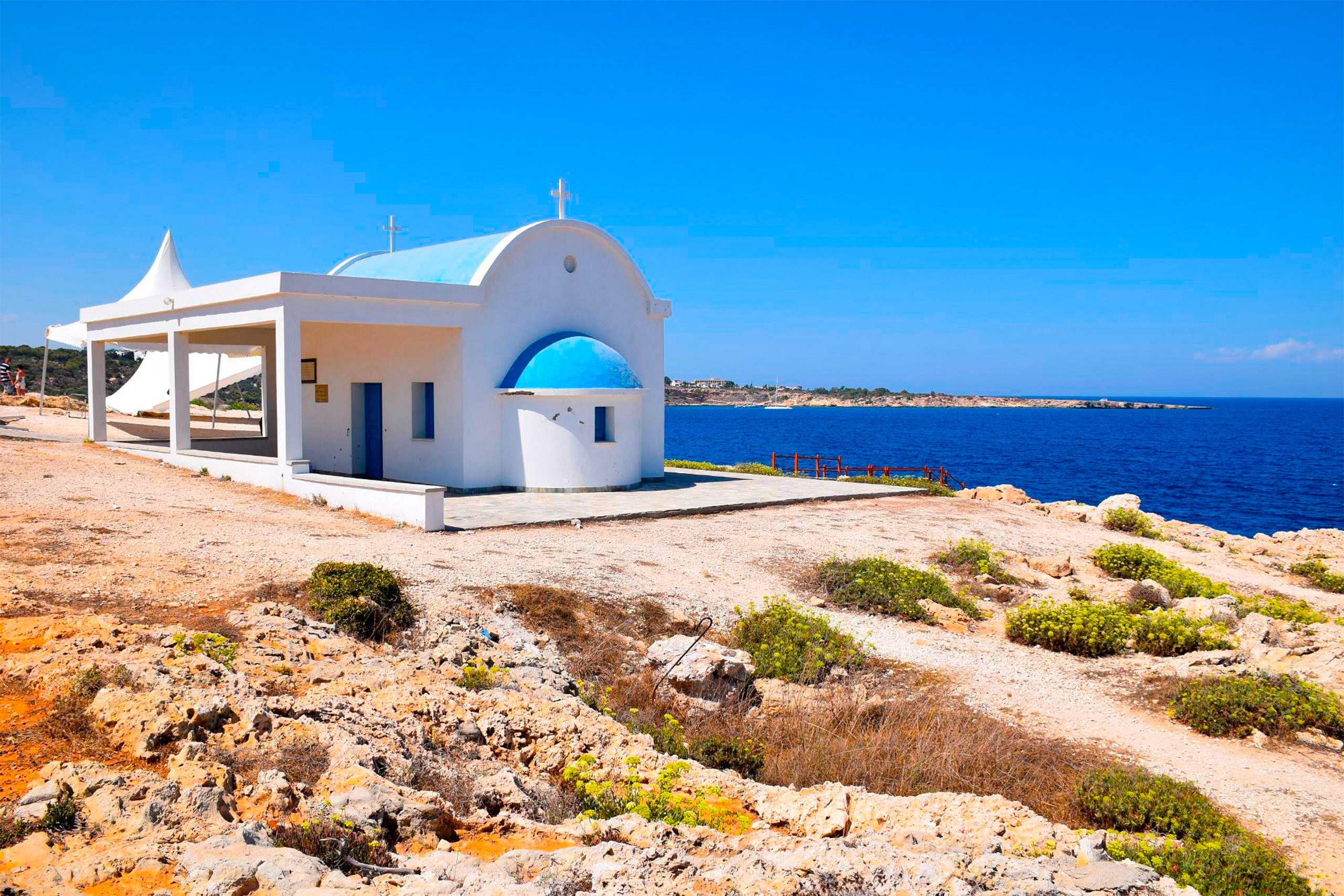
Steps lead down from the chapel to sea level, where a place for holy water exists. Below the chapel, a cave known historically as a smuggler’s cave can be accessed. This cave adds historical intrigue to the site, as Cyprus’s coastline was used for centuries by smugglers avoiding Ottoman and later British customs authorities.
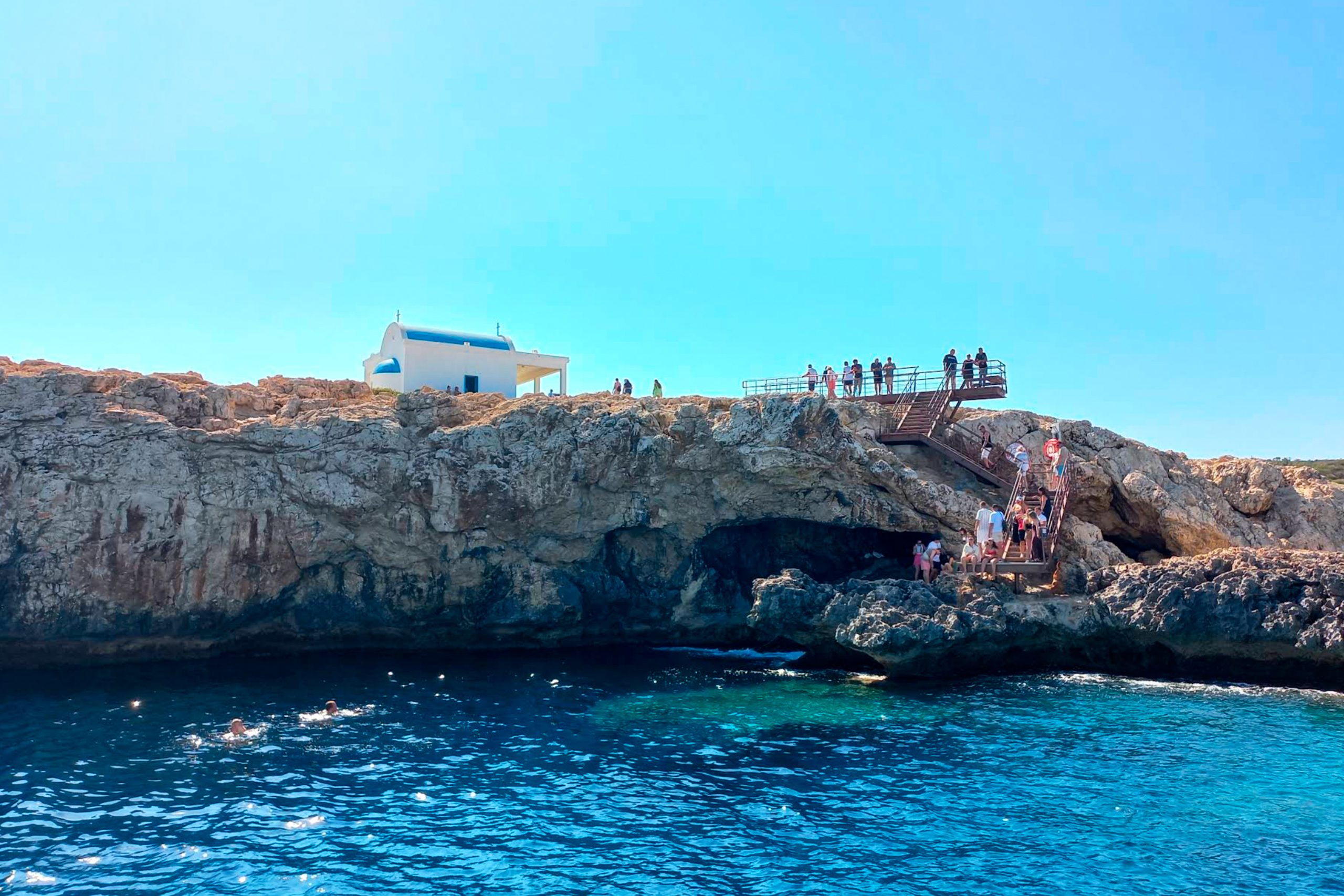
The smuggler’s cave is larger than many others in the area and extends back into the cliff. During calm seas and low tide, visitors can walk into the cave without swimming. The clear waters around the entrance allow views of marine life that uses the cave as shelter.
Swimming and Exploring the Caves
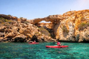
At one side of the cove, caves are partly submerged and swimmers can enter them by swimming. The water clarity is exceptional, often exceeding 20 meters of visibility, which makes swimming into caves relatively safe when conditions are calm. However, waves can suddenly increase and trap swimmers inside, so caution is essential.
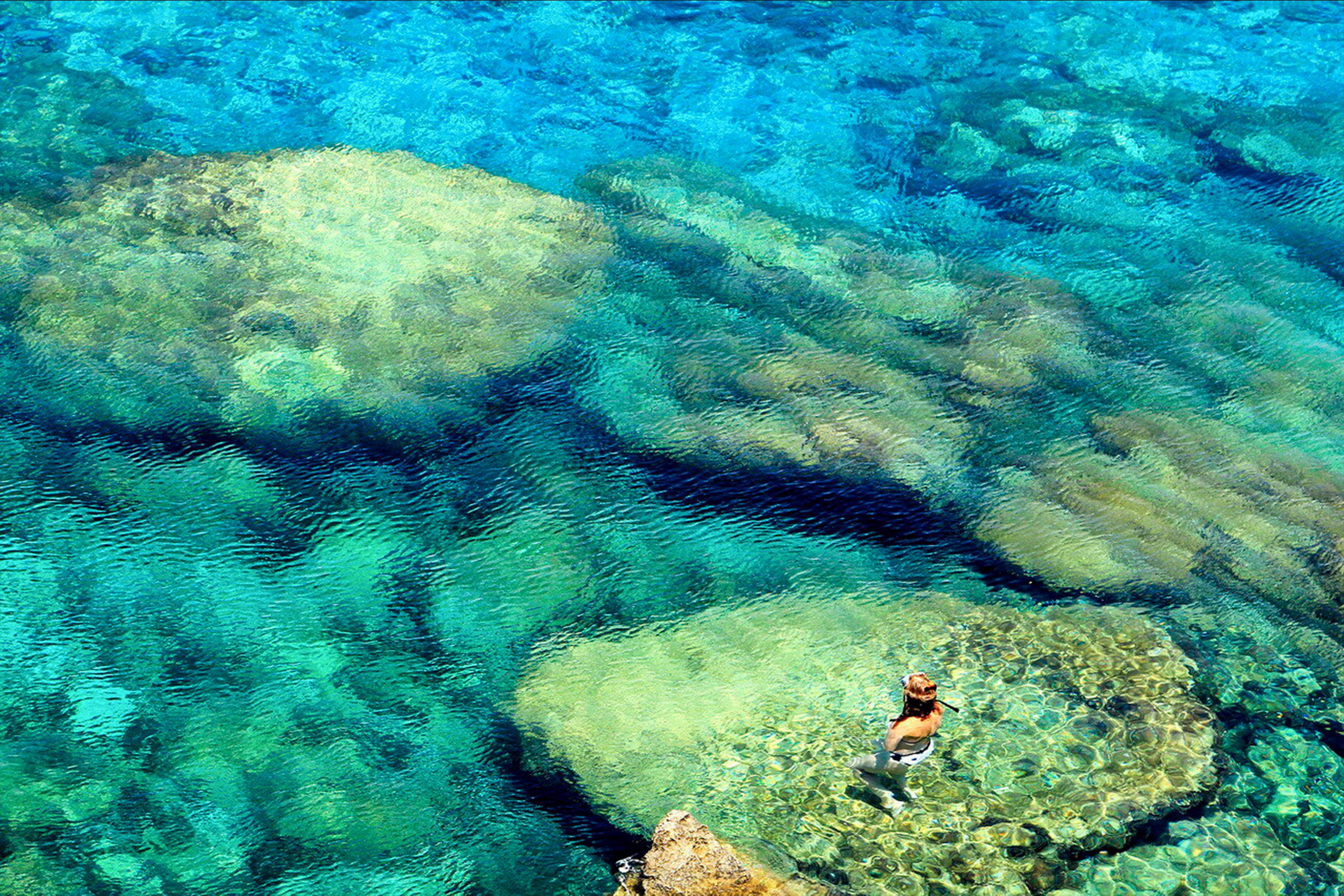
On the other side of the cove, caves open onto the ledge that is normally above sea level and dry. Visitors can walk along this ledge and peer into the cave entrances without getting wet. Some caves have small beaches of pebbles inside where the waves deposited sediment.
The caves provide excellent opportunities for snorkeling and free diving. Fish shelter in the caves, including groupers, octopuses, and small reef fish. The limestone walls support colorful algae and marine growth. Divers sometimes spot sea turtles in the area, though the caves themselves are generally too small for turtles to enter.
Cliff Jumping and Safety Concerns
Cliff jumping is a popular activity at the sea caves, with locals and tourists jumping from various heights into the deep water below. Some cliff edges provide jumps of 5 to 10 meters, while more adventurous spots reach 15 meters or higher. The activity is not officially sanctioned and carries real risks.
Before jumping, swimmers must check water conditions carefully. Hidden rocks beneath the surface can cause serious injuries. Water depth varies with tides and wave action. What was safe at low tide might be dangerous at high tide. The limestone is sharp and can cut feet and hands when entering or exiting the water.
Footwear is essential when exploring the caves and clifftops. The limestone is often wet from spray and becomes slippery. Sharp edges can cut bare feet. Sturdy water shoes or closed-toe sandals provide protection while allowing swimming.
The Palace Caves and Deep Passages
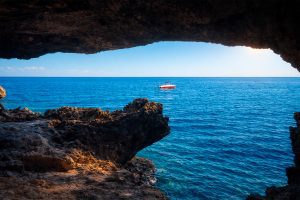
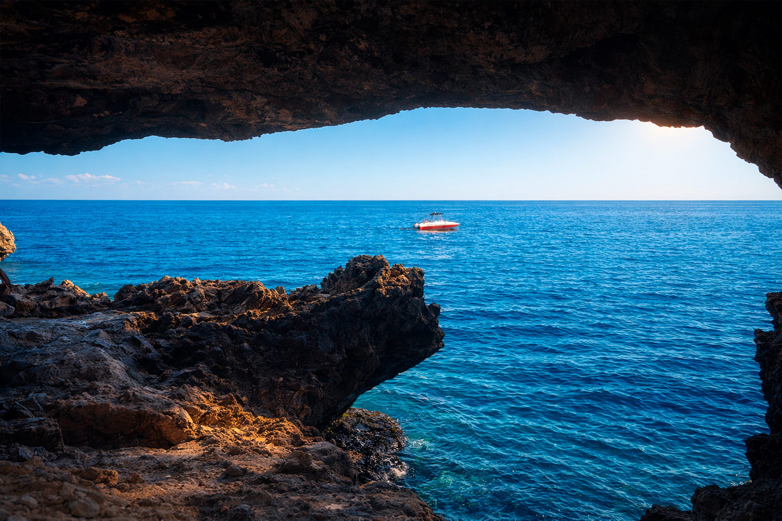
Some caves at Cape Greco extend much further into the cliffs than those near the chapel. The Palace Caves and similar formations create deep passages that are only accessible from the sea. These caves require boat access or long swims from shore.
The deepest caves are estimated to extend 240 feet (about 75 meters) into the rock, though these measurements are difficult to verify. These caves probably formed along fractures and weak zones in the limestone where groundwater once flowed. As sea levels rose, the ocean invaded these groundwater passages and widened them.
Most deep caves flood completely at high tide and are dangerous to explore without proper equipment and experience. Even experienced cavers should not enter these systems alone or without informing someone onshore of their plans.
Marine Life and Underwater Environment
The caves and surrounding waters host diverse marine life typical of the eastern Mediterranean. The area serves as essential marine habitat and teams with colorful fish, sea turtles, and occasional dolphins. Groupers, which can grow quite large, shelter in cave entrances during the day and hunt at night.
Octopuses live in smaller caves and crevices and can often be spotted by observant snorkelers. These intelligent animals collect shells and rocks to block their den entrances. Moray eels also inhabit cave systems, though they are shy and rarely aggressive toward humans unless provoked.
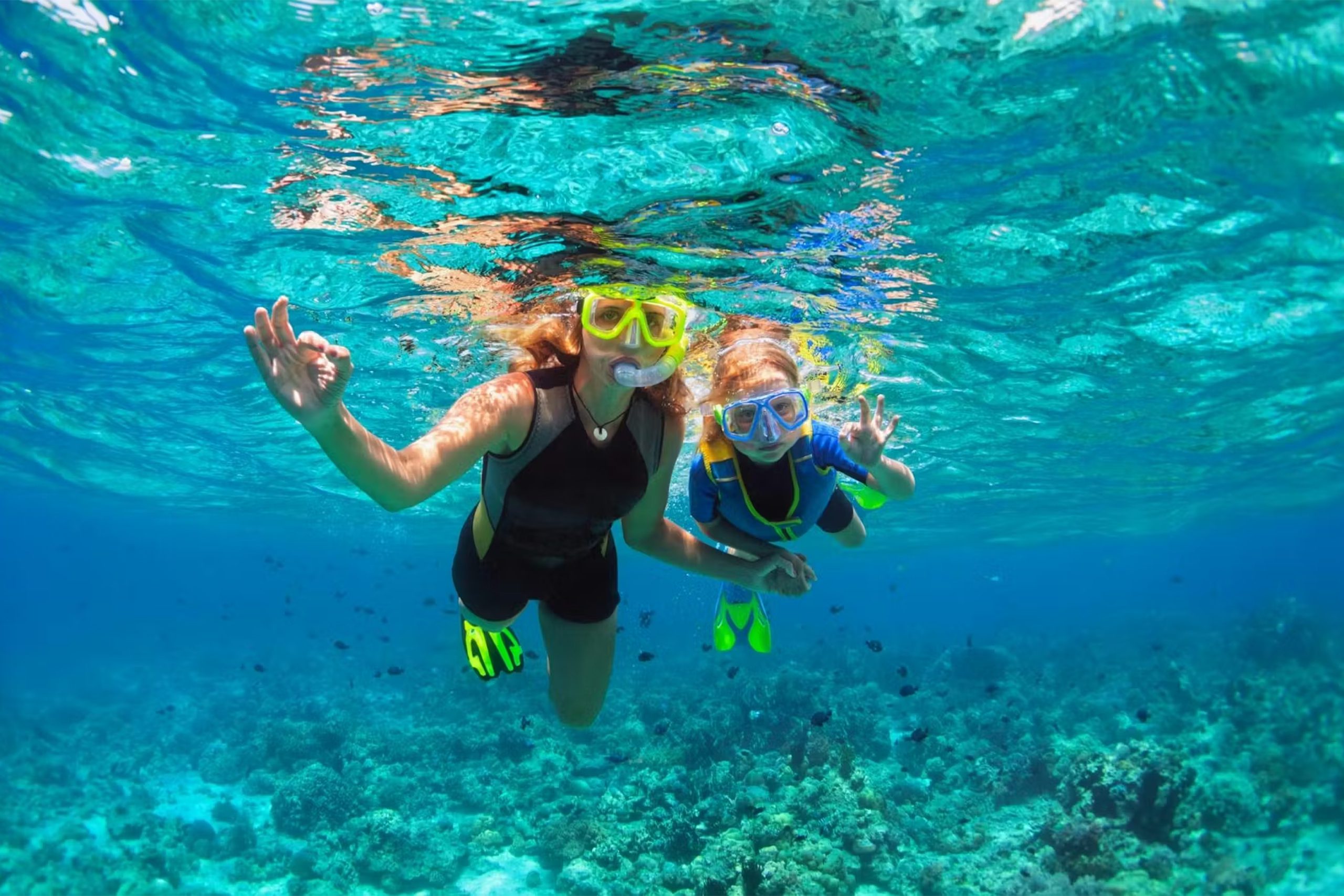
The clear waters and abundant marine life make Cape Greco caves popular with diving schools. Several dive centers in Ayia Napa offer guided tours to the caves for certified divers. These tours provide safe access to deeper caves that casual swimmers cannot reach.
Why Cape Greco Caves Matter Today
The sea caves demonstrate ongoing geological processes that continue to shape Cyprus’s coastline. Every wave that hits the cliffs removes tiny amounts of limestone. Over decades and centuries, this erosion changes the cave shapes and eventually causes some to collapse while new ones form.
The caves also provide important habitat for marine species in an increasingly developed Mediterranean. As coastal areas are built up with hotels and marinas, natural cave systems become rare. Cape Greco’s protection as a National Forest Park preserves these habitats for future generations.
The cape has been designated an Important Bird Area (IBA) by BirdLife International because it is a key migration site for large numbers of raptors and other birds. While the caves themselves don’t host birds, they are part of the larger protected ecosystem that makes Cape Greco valuable for conservation.
How to Visit the Sea Caves
The main sea cave area is located about 4 kilometers east of Ayia Napa on the road toward Cape Greco. A gravel road branches off from the main E307 road and leads to a parking area near the caves. The drive is only 650 meters from the turnoff and is manageable in a regular car, though the surface is rough.
Boat tours from Ayia Napa regularly visit the caves as part of coastal cruises. These tours provide views of the caves from the sea and often include swimming stops where passengers can explore cave entrances. The boat perspective shows the full scale of the limestone cliffs better than the view from land.
For visitors arriving by foot, a marked trail from the Ayioi Anargyroi Chapel leads to the cave area. The walk takes about 10 minutes from the chapel parking area. Trails are uneven and rocky, so proper footwear is necessary.
The best time to visit is early morning or late afternoon when temperatures are cooler and light is better for photography. Midday summer heat can be intense on the exposed cliffs. Spring and autumn offer the most comfortable weather for extended exploration.
Safety and Environmental Protection
Visitors should bring drinking water, sun protection, and appropriate footwear. There are no facilities at the cave sites, so plan accordingly. Cell phone coverage is generally good, but emergency help is far away if accidents occur.
Do not litter or damage the cave formations. The limestone is soft and easily scratched. Graffiti occasionally appears in accessible caves, which is both illegal and destructive to natural heritage. Visitors should leave no trace of their presence.
Swimming conditions can change quickly. Calm seas can become rough within minutes when wind shifts. Always check weather forecasts before swimming into caves.
Respect closure notices if authorities have restricted access. Occasionally, caves are closed for safety reasons or to protect nesting birds or other wildlife. These closures are temporary and protect both visitors and the environment.