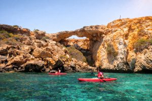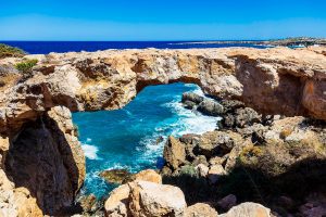
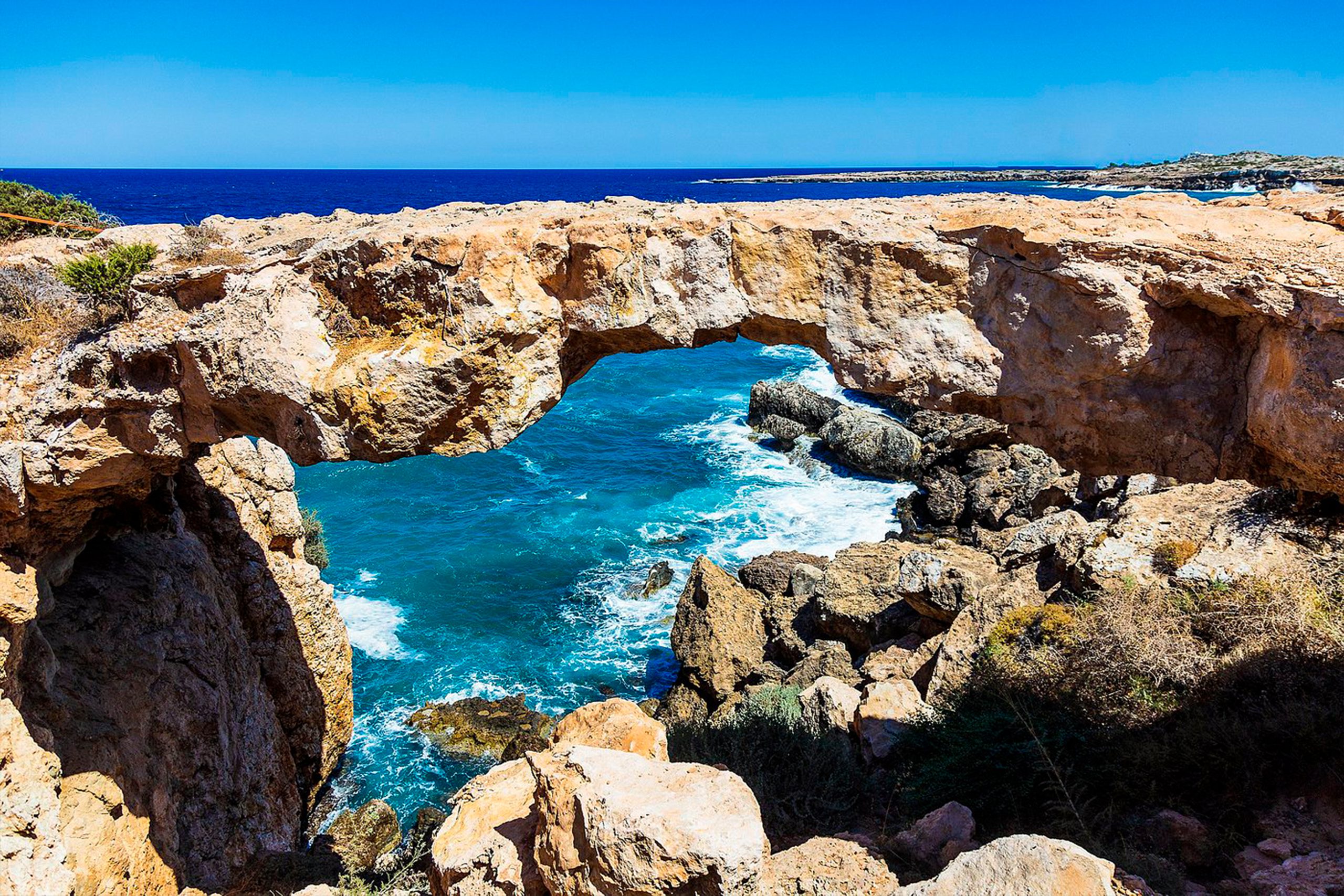
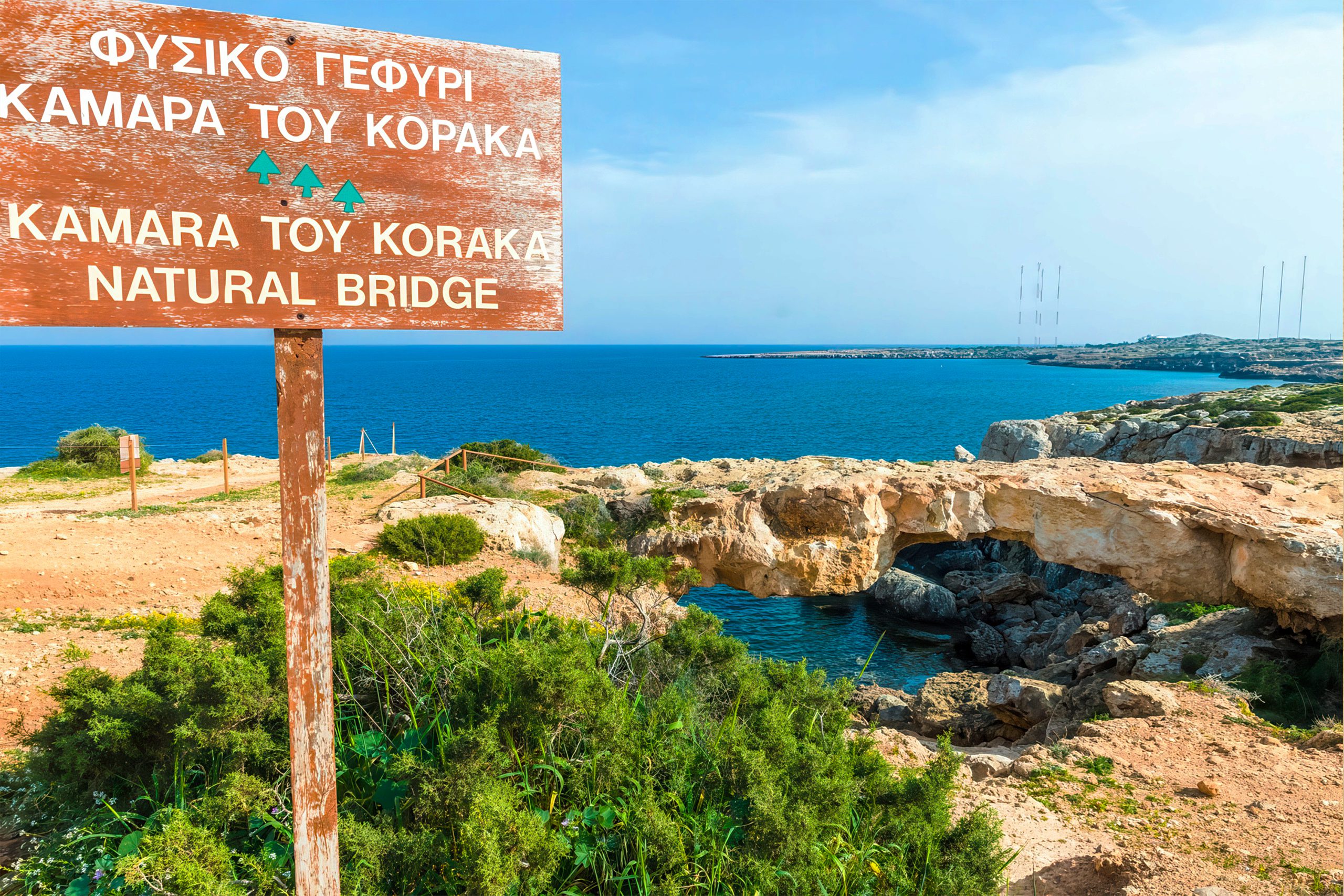
Cape Greco’s natural arch, known locally as Kamara tou Koraka or “Crow’s Arch,” stands as one of Cyprus’s most remarkable geological features. Located within Cape Greco National Forest Park on the southeastern tip of the island, this limestone bridge stretches over the Mediterranean Sea between the resort towns of Ayia Napa and Protaras.
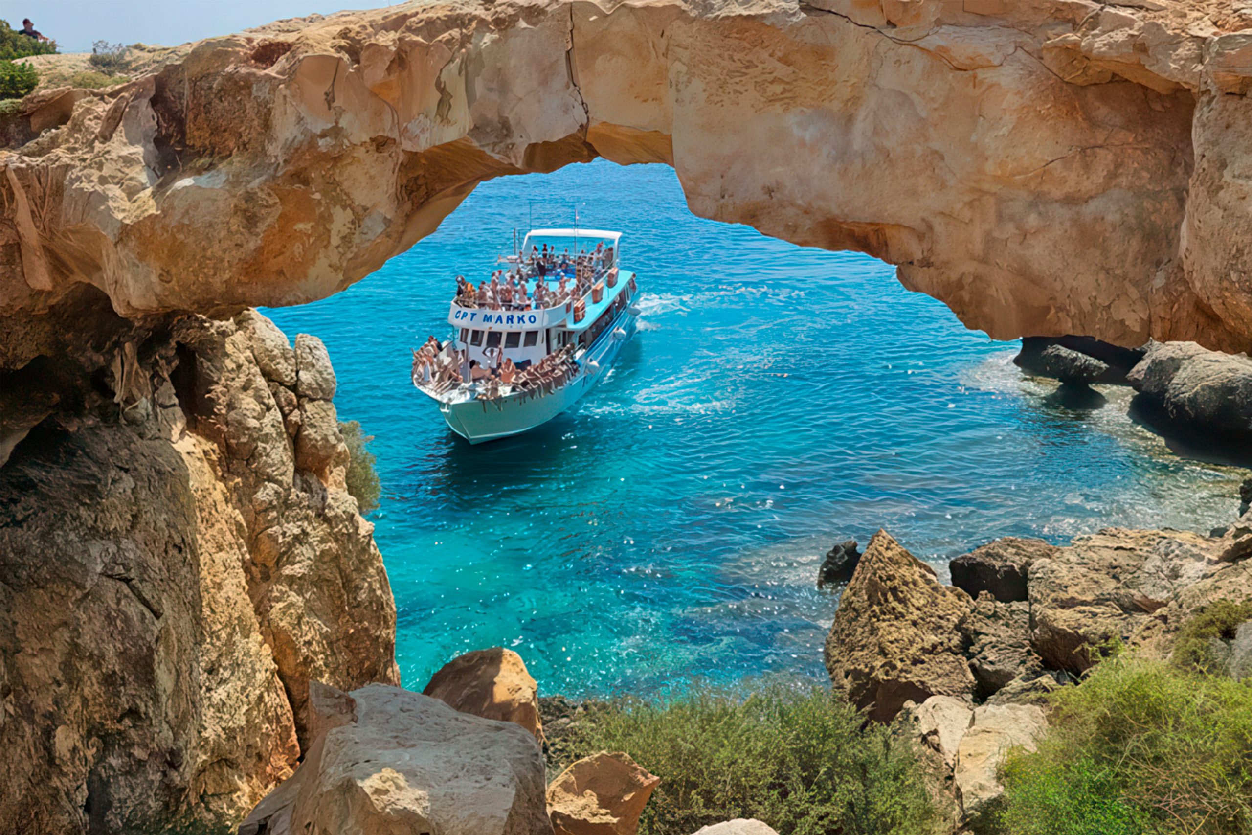
The arch sits alongside a coastal road that winds through the park, where visitors can observe this natural wonder without difficulty. The bridge was formed over millennia by the erosive forces of wind and water, creating a structure that appears both delicate and enduring.
How Ancient Seas Created This Natural Bridge
The geological story of Cape Greco’s natural arch begins millions of years ago when Cyprus was submerged beneath ancient oceans. During the Cretaceous period, Cyprus was situated near the equator and the region was characterized by a warm, shallow sea where the deposition of marine sediments led to the formation of limestone and marl. These calcium carbonate deposits accumulated layer by layer as countless marine organisms died and settled on the seafloor.
Cyprus sits near the boundary between the Eurasian and African tectonic plates, a position that has shaped the island’s dramatic geology. The collision of these plates triggered gradual uplift, eventually pushing the ancient seabed above water. This uplift continues today at a measurable rate, raising the island slowly over geological time.
Chemical weathering is prevalent in the region due to the presence of moisture during winter months, and the dissolution of minerals such as calcite in limestone leads to the formation of karst landscapes characterized by features such as caves, sinkholes, and underground rivers. The natural arch represents one expression of this karst weathering process, where selective erosion carved away softer rock while leaving behind more resistant formations.
Wave action played the primary role in shaping the arch. Centuries of Mediterranean waves crashed against the limestone cliffs, exploiting natural weaknesses in the rock. The natural bridge was created due to the natural action of the sea waves on the rocks over time. Salt spray, temperature changes, and wind contributed additional erosive pressure, gradually hollowing out the formation until only the arch remained.
Physical Characteristics of the Stone Bridge
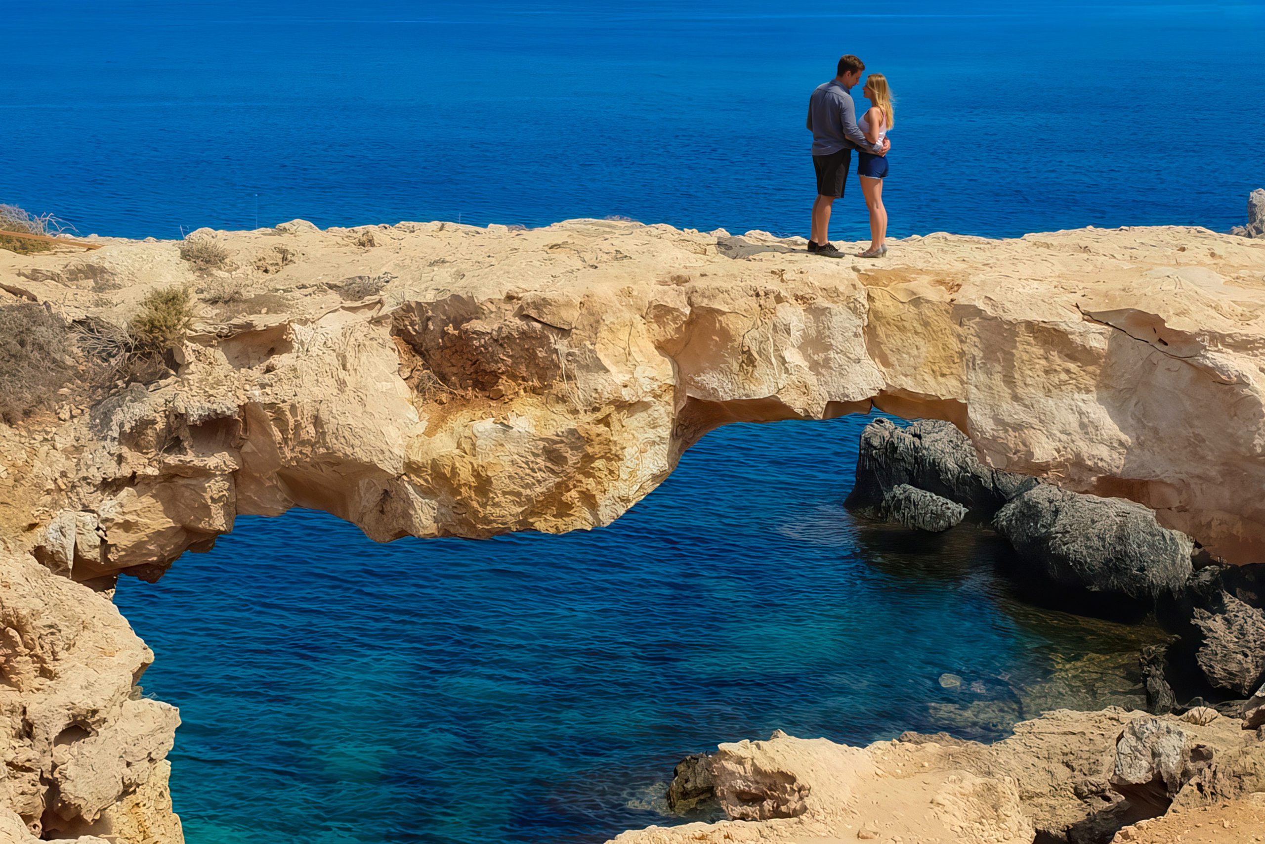
The natural arch measures approximately 6 meters in length and roughly half a meter in width at its narrowest point. The limestone shows characteristic weathering patterns, with irregular surfaces pockmarked by dissolution and wave erosion. The stone displays the pale gray and cream colors typical of marine limestones, sometimes tinged with orange or brown where minerals have oxidized.
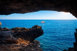
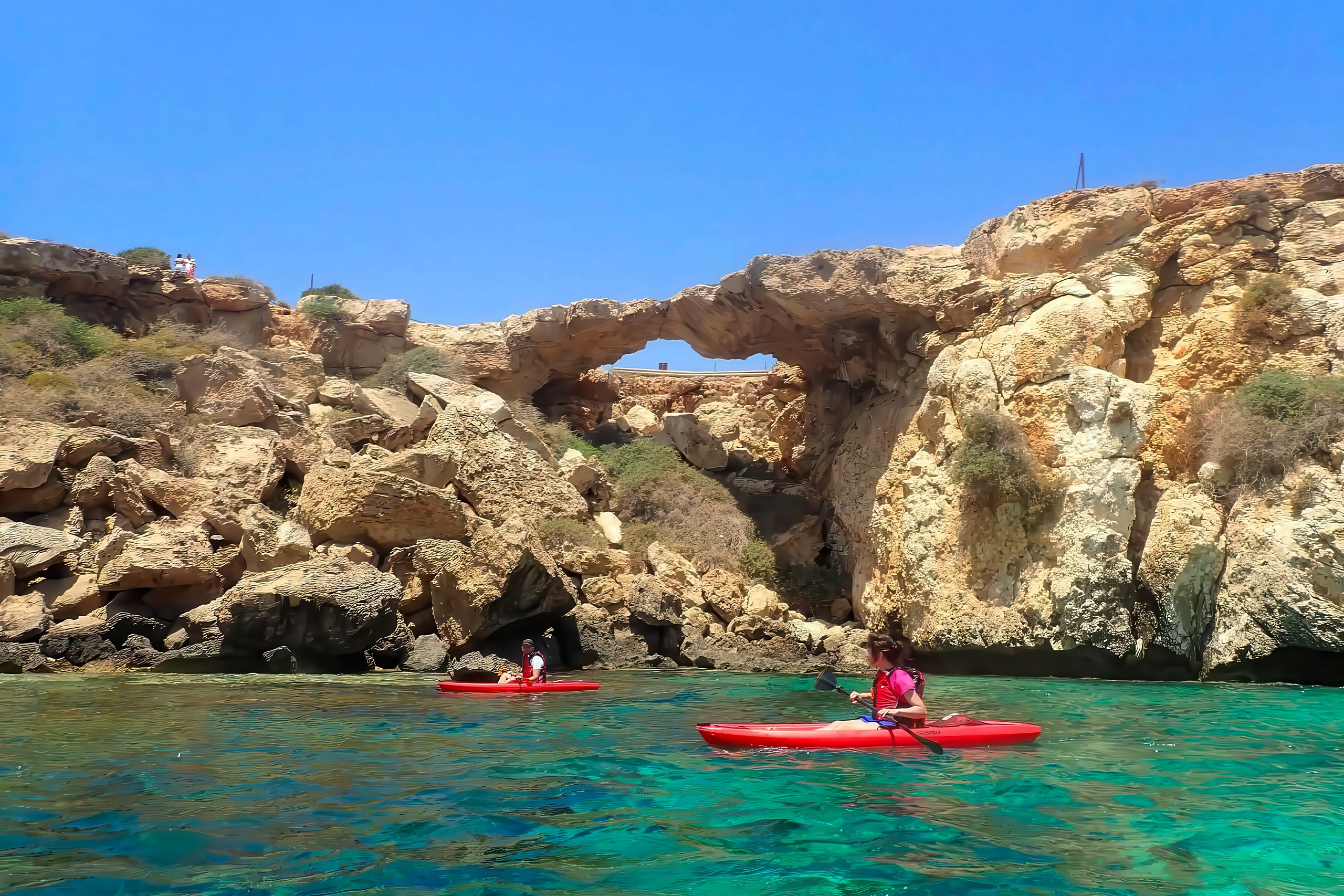
The structure extends from a coastal plateau into the Mediterranean, creating a bridge between land and sea. The surrounding coastline features additional sea caves, erosional notches, and wave-cut platforms that demonstrate the ongoing interaction between rock and water. Below the arch, the sea maintains exceptional clarity, revealing the rocky seabed and allowing excellent visibility for swimmers and snorkelers.
The limestone composition makes the arch vulnerable to continued erosion. Authorities have placed barriers around the structure to prevent people from walking across it, as the formation shows signs of structural weakness. The arch is fenced because erosion poses a risk of collapse. Nobody can predict when the arch might finally fail, but geological forces continue working to reshape it.
The broader Cape Greco area contains numerous similar features at various stages of formation or decay. Some arches have already collapsed, leaving behind isolated rock stacks. Others remain in early developmental stages, appearing as deep caves not yet broken through. The natural arch visible today represents one moment in a continuous cycle of geological change.
Remarkable Facts About This Coastal Wonder
The arch earned its local name, Kamara tou Koraka, from the Greek words for “arch” and “crow.” The exact origin of this name remains unclear, though some suggest crows once nested in the area, while others believe the dark color of the rock in certain lighting reminded observers of black crows.
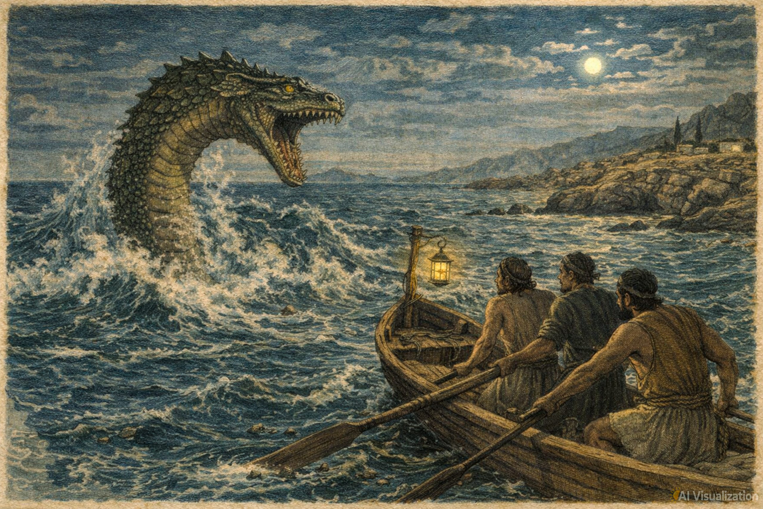
Legend has it that smugglers used to meet at this location due to its secluded position. The arch’s remote coastal setting and numerous nearby caves would have provided ideal cover for illicit activities in earlier centuries. Local stories also tell of the “Ayia Napa Sea Monster,” a creature supposedly inhabiting the waters near Cape Greco and described as resembling a mix between a giant serpent and a crocodile.
The formation appears most dramatic during sunrise and sunset when low-angle light illuminates the limestone and creates long shadows across the water. Photographers particularly value these golden hour conditions, which emphasize the arch’s three-dimensional structure and the contrast between stone and sea.
Access restrictions prevent visitors from walking across the arch, but the viewing areas nearby offer excellent vantage points for observation and photography. The prohibition serves both safety purposes and conservation goals, preserving the formation for future generations while protecting visitors from potential collapse.
The arch sits within a designated Important Bird Area, recognized by BirdLife International. The area serves as a key migration site for large numbers of raptors and other birds. Spring and autumn migrations bring waves of birds through Cape Greco, adding another dimension to visits.
The Wider Geological Context of Cape Greco
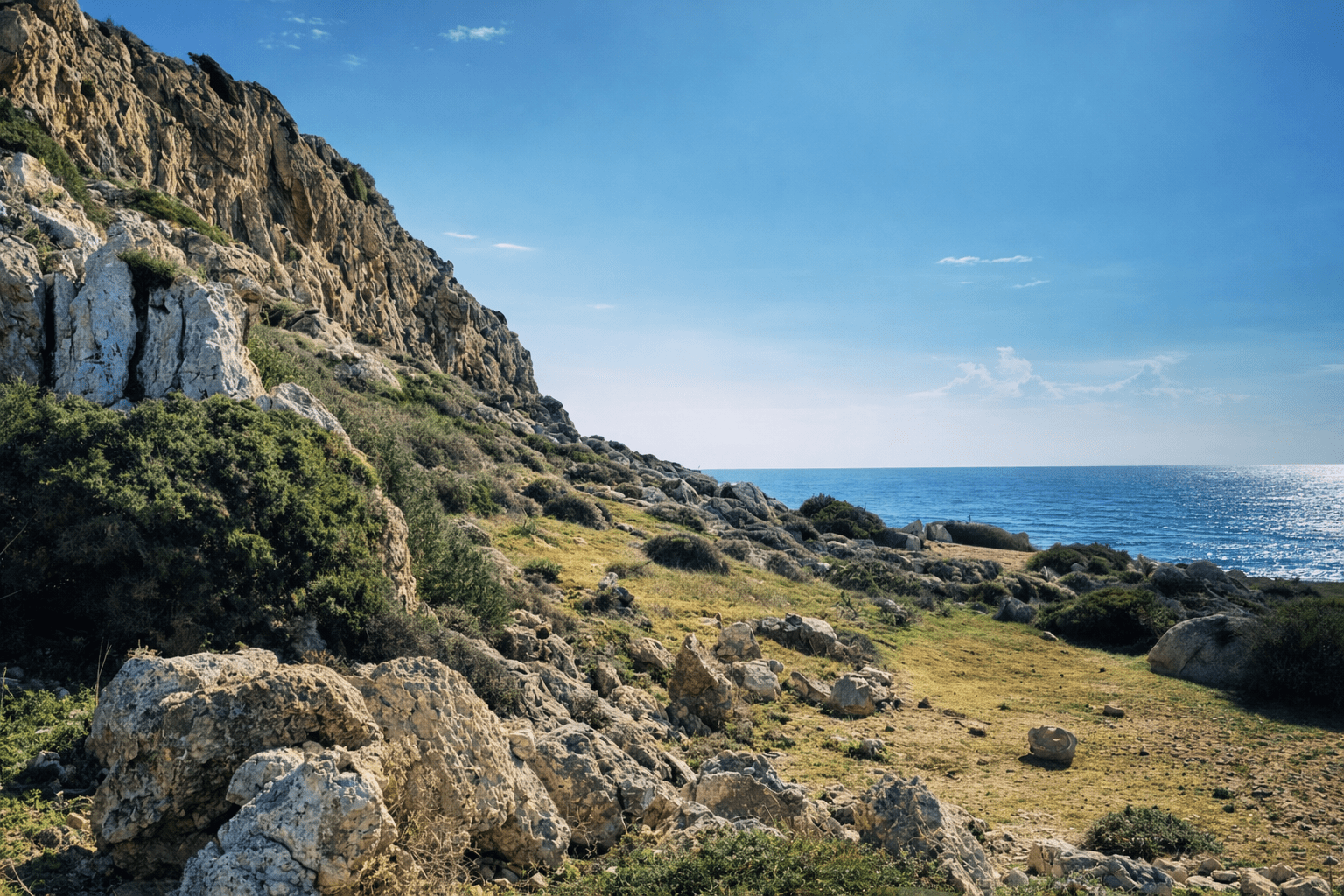
Cape Greco occupies the easternmost point of both the Republic of Cyprus and, when excluding outermost regions, the European Union. The peninsula consists primarily of limestone formations deposited during the Tertiary period when Cyprus experienced repeated cycles of submersion and emergence.
Cyprus is a mountainous island with steep slopes and a dry Mediterranean climate, and these conditions promote episodic but intense erosion, especially during heavy rainfall. At Cape Greco, seasonal storms generate powerful wave action that continues reshaping the coastline. Winter months bring the most intense weathering, while summer conditions allow slower chemical processes to proceed.
The limestone at Cape Greco contains numerous fossils, including ancient corals, shells, and microscopic organisms. These fossils provide evidence of the warm, shallow marine environment that existed millions of years ago. The rock also shows bedding planes, the horizontal layers marking different periods of sediment deposition, which create zones of weakness that erosion exploits.
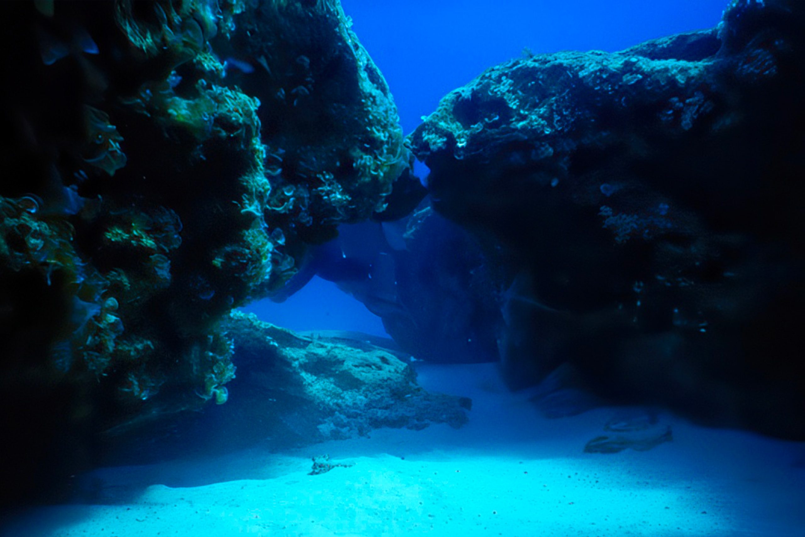
Underground, freshwater and saltwater meet in a zone where dissolution proceeds rapidly. This mixing zone creates caves and passages beneath the visible surface, some accessible to experienced divers. The underwater topography mirrors the dramatic cliffs above water, with caverns, tunnels, and overhangs extending into the depths.
Why This Formation Matters Today
The natural arch serves as a symbol of Cyprus’s geological heritage and demonstrates natural processes that continue shaping Mediterranean coastlines. For many Cypriots, the formation represents their island’s wild, undeveloped character, standing in contrast to the developed resort areas nearby.
Cape Greco National Forest Park, established in 1993, protects 385 hectares of land that includes the natural arch and surrounding environment. The park hosts over 400 plant species and has become a haven for botanists, while also supporting various animal species including foxes, rabbits, and hedgehogs. The park additionally contains more than 80 bird species, making it significant for both geology and ecology.
The formation contributes to scientific understanding of coastal erosion and limestone weathering in Mediterranean climates. Geologists study such features to better predict how coastlines will respond to rising sea levels and changing storm patterns. The arch provides a natural laboratory for observing these processes without the complications introduced by human development.
Tourism brings thousands of visitors annually to view the arch and explore Cape Greco’s trails. This economic value helps justify continued conservation efforts and park maintenance. The balance between access and preservation remains ongoing, with authorities working to allow enjoyment while preventing damage.
Educational programs use the arch to teach concepts of geology, erosion, and environmental change. School groups visit to observe firsthand how rocks form and transform over time. The visible results of erosion make abstract geological concepts concrete and understandable.
Visiting the Natural Arch
The natural arch sits approximately 4 kilometers from Ayia Napa and roughly the same distance from Protaras. Visitors can reach the site by car, motorcycle, bicycle, or on foot via several hiking trails. Public bus service operates along the coast road, though routes may have limited frequency depending on season.
Parking areas exist near the arch, with short walking paths leading to viewing platforms. The site remains accessible year-round, though summer heat can make midday visits uncomfortable. Early morning and late afternoon offer the most pleasant conditions for exploration, along with superior lighting for photography.
A 3.5-mile trail connects Kamara tou Koraka to the Ayia Napa Sea Caves and follows part of the E4 European Path. This route provides coastal walking with views of multiple geological features. Additional trails throughout Cape Greco range from easy strolls to more challenging hikes across rugged terrain.
The sea caves located near the arch attract swimmers, snorkelers, and cliff jumpers. Crystal-clear waters reveal underwater rock formations and marine life. Caution is necessary when entering the water, as rocks and wave conditions can create hazards. Local dive centers offer guided excursions for those wanting to explore underwater caves and passages.
The nearby Chapel of Agioi Anargyroi, a small whitewashed church dedicated to Saints Cosmas and Damian, sits on a clifftop overlooking the sea. The chapel provides additional cultural interest beyond the geological attractions. Below the chapel, a cave once sheltered hermits seeking solitude.
The Value of Natural Monuments
Cape Greco’s natural arch demonstrates how geological processes create beauty and scientific interest without human intervention. The formation exists because specific conditions aligned over millions of years, producing limestone deposits that later emerged from the sea and faced just the right combination of wave action, weathering, and structural integrity.
Such natural monuments connect present observers to deep geological time. Standing before the arch, visitors see evidence of ancient seas, tectonic forces, and ongoing erosion. These connections help people understand their place within Earth’s long history and the temporary nature of even seemingly permanent features.
The arch also highlights the fragility of geological formations. Despite appearing solid and enduring, the limestone continues changing. The same processes that created the arch now work to destroy it. This impermanence adds significance to current opportunities for observation and study.
For Cyprus, the natural arch represents one element of the island’s diverse geological heritage. From the Troodos Ophiolite in the island’s center to coastal formations like this arch, Cyprus offers remarkable examples of Earth’s processes. The arch at Cape Greco, accessible and photogenic, serves as an ambassador for this broader geological story.