Olive Groves, Vineyards, and Citrus Orchards Acting as Semi-Natural Habitats for Birds, Insects, and Pollinators
Agricultural Landscapes as Modified Ecosystems in Cyprus represent human-altered terrains where traditional farming practices blend with natural processes, creating semi-natural habitats that support diverse wildlife. These landscapes, dominated by olive groves, vineyards, and citrus orchards, cover significant portions of the island’s rural areas, providing food, shelter, and breeding grounds for birds like the Sardinian warbler, insects such as wild bees, and pollinators including carpenter bees. They illustrate Cyprus’s agricultural heritage, where centuries of cultivation have shaped ecosystems that balance productivity with biodiversity, offering resilience in a Mediterranean climate prone to drought and erosion.
- A Modified Agricultural Mosaic
- The Historical Formation and Evolution
- Features of Olive Groves, Vineyards, and Citrus Orchards
- Notable Aspects That Highlight Its Uniqueness
- Deeper Ecological and Cultural Impacts
- Agricultural Landscapes as Modified Ecosystems in Cyprus Today
- Opportunities for Exploration
- An Ecosystem of Cultivated Harmony
A Modified Agricultural Mosaic
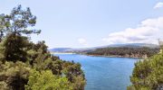
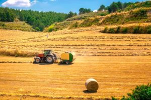
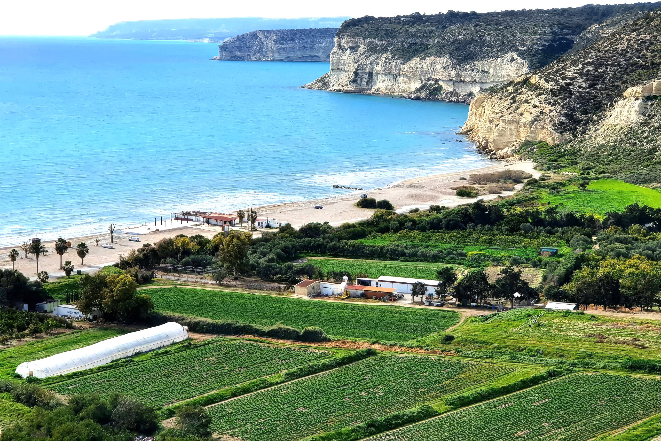
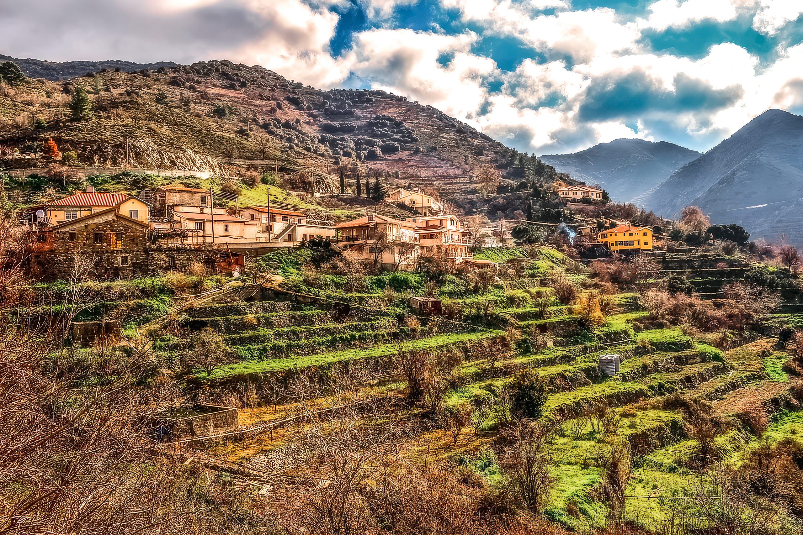
Agricultural landscapes in Cyprus form a patchwork of cultivated fields and groves that integrate human management with ecological functions, spanning lowlands and hillsides across the island. Olive groves, covering around 15,000 hectares, thrive on calcareous soils with trees spaced to allow undergrowth, while vineyards, approximately 7,300 hectares mainly in the Troodos Mountains, feature terraced slopes that prevent soil loss. Citrus orchards, concentrated in the Morphou and Famagusta areas, occupy about 3,000 hectares with dense plantings that create microclimates. These systems receive 300-500mm of annual rainfall, relying on irrigation from dams and boreholes, and support over 100 bird species, 200 insect taxa, and vital pollinators that enhance crop yields. The semi-natural character arises from low-intensity practices like minimal pesticide use in traditional farms, allowing wild flora such as thyme and cistus to coexist, fostering habitats where birds nest in branches and insects burrow in soil. This mosaic covers roughly 40% of Cyprus’s land, acting as corridors linking natural areas like forests to coasts, and contributing to soil fertility through organic matter from fallen leaves and fruits.
The Historical Formation and Evolution
These agricultural ecosystems evolved from prehistoric subsistence farming, with olives and vines introduced during the Neolithic period around 7000 BC, as evidenced by archaeobotanical remains from sites like Choirokoitia. By the Bronze Age (2500 BC), systematic cultivation transformed landscapes, with terracing for vines and olives exporting products across the Mediterranean under Phoenician, Greek, and Roman rule. Citrus arrived later, likely in the Hellenistic or Roman eras, expanding under Byzantine influence (4th-15th centuries AD) where orchards were noted in texts as “divine bounties.” Lusignan (1192-1489) and Venetian (1489-1571) periods intensified production with irrigation channels, while Ottoman rule (1571-1878) promoted rice alongside groves, as described by traveler Ali Bey in 1806. British colonial administration (1878-1960) modernized with dams like Germasogeia, boosting citrus exports but dividing resources post-1974 invasion, where the north retained most citrus lands. Independence in 1960 saw commercialization, with EU accession in 2004 introducing subsidies that reduced traditional areas by 15% but encouraged organic shifts. Climate change has since shortened growing seasons, prompting adaptive practices like drip irrigation.
Features of Olive Groves, Vineyards, and Citrus Orchards
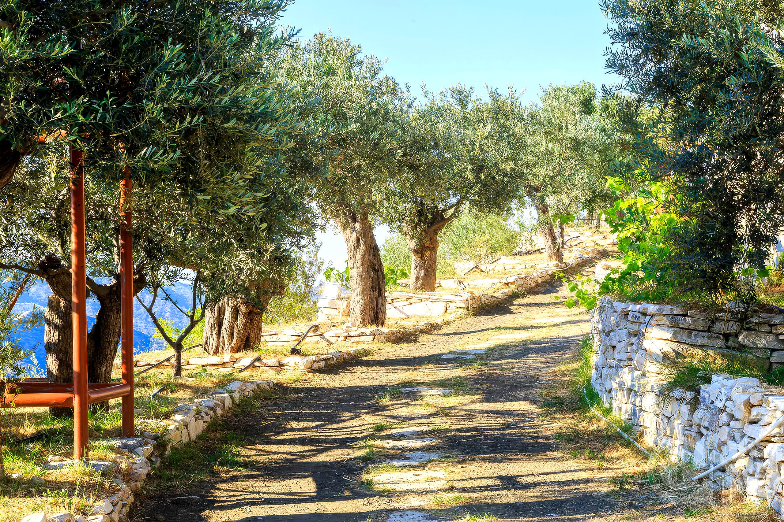
Olive groves feature ancient trees up to 1,000 years old with gnarled trunks providing cavities for birds like owls, while their evergreen canopies offer year-round shade for insects. Vineyards on slopes use indigenous varieties like Xynisteri, with vines trained low to retain moisture, supporting pollinators through flowering understory plants. Citrus orchards, with orange and lemon trees in rows, create humid environments from irrigation, attracting butterflies and bees to blossoms. These landscapes retain water through terracing, reducing erosion by 50%, and foster soil health via organic mulching. Biodiversity includes reptiles in groves and migratory birds in orchards, with low-intensity farming allowing 20% of Cyprus’s endemic plants to persist. Temperature ranges from 10°C in winter to 35°C in summer drive seasonal cycles, with spring blooms boosting pollinator activity.
Notable Aspects That Highlight Its Uniqueness
A striking feature is the “olive branch” symbolism, embodying peace as on the Cypriot flag, with ancient groves hosting rare birds like the masked shrike. Vineyards hold records for indigenous wines, supporting 150 bee species, while citrus areas feature pink spring blossoms drawing flocks of up to 5,000 waterfowl. Legends tie olives to nymphs in ancient texts like Strabo’s Geography, and adaptations like drought-resistant roots underscore resilience. Studies show these habitats reduce extinction risks for insects by 30%, with unique “honey roads” where bees forage across groves.
Deeper Ecological and Cultural Impacts
These ecosystems enhance biodiversity by acting as refuges, with groves filtering pollutants and orchards mitigating floods, supporting 345 bird species as stopovers. They foster food webs: nectar feeds pollinators, insects support birds, droppings enrich soils. Culturally, olives symbolize endurance in folklore, influencing festivals like Anthestiria with vine garlands, and providing livelihoods through exports worth €2 million annually. Socially, they sustain rural communities, with Ottoman taxes on harvests and modern herbal medicine from grove plants. Climate balance maintains habitats, but change predicts 20% loss by 2100, urging conservation. Human impacts include ancient terracing preserving soils, as in geoarchaeological studies.
Agricultural Landscapes as Modified Ecosystems in Cyprus Today
In 2026, these landscapes define Cyprus’s rural identity, with olive and vine production boosted 18% by precision farming amid climate challenges like 2°C warmer summers. Biodiversity threats from intensification are countered by EU projects protecting high-nature-value farmlands, increasing organic areas by 20%. Conservation via BirdLife Cyprus monitors species, while innovations like satellite monitoring enhance sustainability. Agro-tourism attracts 200,000 visitors yearly, blending heritage with eco-tours, generating €500,000 in revenue. Festivals like Olive Tree Day celebrate culture, merging ancient rites with modern practices.
Opportunities for Exploration
Troodos vineyard trails offer wine tasting, open year-round with free entry. Guided olive grove tours by Cyprus Tourism cost €15-20 to spot birds. Citrus orchard visits in Morphou include fruit picking in spring, no fee. Winter eco-walks in groves pair with village stays for insights. Many sites have online cams for remote viewing.
An Ecosystem of Cultivated Harmony
Agricultural Landscapes as Modified Ecosystems, with olive groves, vineyards, and citrus orchards as semi-natural habitats for birds, insects, and pollinators, define Cyprus’s rural diversity. This pattern’s balance has fostered unique habitats and human ingenuity, from ancient myths to modern challenges. Knowing it deepens appreciation for Cyprus as a resilient agricultural haven. Engagement with its groves or species evokes wonder at nature’s symbiosis. In a changing climate, it reminds of the need to safeguard this delicate balance.