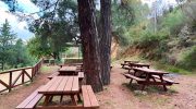
The Chrysovrysi Trail offers a majestic path through the heart of the Troodos mountains. This route connects the peaks of the island with the deep green valleys below. It serves as a vital link for those who want to witness the true alpine nature of the Mediterranean.
Hikers find a landscape that changes with every step toward the summit. The air stays crisp and clean even during the peak of the summer heat. Thick forests of black pine provide a cool canopy for much of the trek.
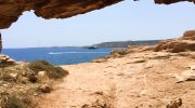
History and geology combine to create a unique atmosphere along this specific track. The path follows old routes that locals used for centuries to reach fresh water springs. Every turn reveals a new view of the rugged peaks and the blue sea in the distance.
Trail Overview
- Location: Troodos National Forest Park
- Distance: 5.2 miles (8.4 km)
- Route Type: Linear
- Difficulty: Moderate
- Elevation Gain: 1150 feet (350 meters)
- Duration: 3 – 4 hours
- Best Time to Visit: April – October
- Terrain: Rocky and Forest Floor
Path Conditions and Navigation Details
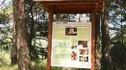
The track starts near the Troodos square and moves toward the east. The surface is mostly firm earth with frequent sections of loose rock and gravel. Good footwear is a requirement because the slope can be slippery in certain areas. Signposts mark the way at major junctions to prevent any confusion for the traveler. The path is narrow in some spots but remains safe for those with a steady foot. Maintenance crews clear fallen branches and rocks after the winter storms to keep the route open.
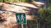
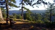
The elevation gain is steady which requires a decent level of physical fitness. There are several viewpoints where the forest opens up to show the vast plains below. From these heights the visitor can see all the way to the northern coastline on a clear day. The trail crosses several small bridges that span the mountain gullies. These structures help to prevent erosion and protect the delicate stream beds. The careful design of the path ensures that it does not disrupt the natural flow of the mountain side.
Botanical Diversity and Forest Composition
The Chrysovrysi Trail sits within the Troodos National Forest Park which hosts a vast array of plant life. The Pinus nigra or black pine dominates the upper elevations of this specific route. These trees grow to massive sizes and live for several centuries in the harsh mountain soil. Beneath the tall pines a layer of golden oak creates a dense understory. This oak species is endemic to the island and provides a rich habitat for local insects and birds. The trail also features the Greek juniper which adds a distinct scent to the mountain breeze.
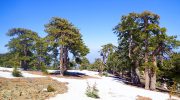
Flowers bloom in abundance during the spring months when the snow finally retreats. The Cyprus crocus and several types of orchids appear near the edge of the path. These plants depend on the high moisture levels found at this altitude. The forest floor stays damp and supports various mosses and ferns in the shaded gullies. This mix of flora creates a complex ecosystem that remains stable throughout the year. Scientists study these areas to understand how mountain plants adapt to long periods of drought. The diversity here is a primary reason for the protected status of the entire region.
Geological Features and Water Sources
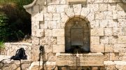
The name Chrysovrysi translates to the Golden Spring which refers to a specific water source on the mountain. This spring flows from the deep rock layers and provides a constant supply of fresh water. The geology of the area consists mainly of ophiolite rocks that formed on the ocean floor millions of years ago. These rocks pushed upward as the tectonic plates shifted over time. Hikers see dark green rocks known as harzburgite along the steep sections of the trail. The mineral content of these stones affects the types of plants that can survive in the soil.
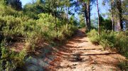
Water plays a crucial role in the shape of the landscape here. Small streams cut through the rock to form narrow valleys and steep cliffs. The sound of water often accompanies the hiker as the path nears the spring. This resource was essential for the survival of mountain communities in the past. Even today the spring remains a popular spot for a quiet break. The cool temperature of the water offers relief after a long climb under the sun. The geological history is visible in the exposed layers of earth that the trail cuts through.
Avian Life and Wildlife Observations
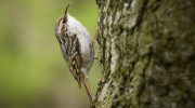
The high altitude of the Chrysovrysi Trail makes it a perfect place for bird watchers. Rare species like the Bonelli eagle soar on the thermals above the deep valleys. The Cyprus wheatear is a common sight as it hops between the sun bleached rocks. These birds find plenty of food among the pine cones and the thick brush. The forest also supports the short-toed treecreeper which blends perfectly with the bark of the black pines. Each season brings different migratory birds that rest in the Troodos before they continue their journey.
Larger animals also call this rugged terrain their home. The Cyprus mouflon is the most famous resident although it avoids the main paths when humans are near. These wild sheep move with incredible grace over the loose stones and steep drops. Foxes and hares are more common sights during the early hours of the dawn. The presence of these animals indicates a healthy and balanced mountain environment. Conservation laws protect these species from hunting and habitat loss. The trail allows a brief glimpse into the wild side of the island.
Safety Recommendations and Preparation
Preparation is key for any hike in the high Troodos mountains. The weather can change fast and clouds often roll in without much warning. A waterproof layer is a smart addition to the pack even if the sky looks clear at the start. Sun protection is also vital because the UV rays are much stronger at high altitudes. Hikers should tell someone their planned route and the time they expect to return. There is no reliable phone signal in the deeper parts of the forest.
Water is the most important item to carry despite the presence of the spring. A full liter for every hour of the walk is a good rule to follow. High energy snacks help to maintain stamina during the final climb back to the start. It is important to stay on the marked path to avoid damage to the rare plants. The soil is very thin and one footstep can destroy a flower that took years to grow. Respect for the environment ensures that the trail stays beautiful for the next person.