Explore Cyprus with Our Interactive Map

Explore our top stories and discover ideas worth your time.

Sakura in Cyprus

Sakura in Cyprus

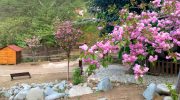
Cherry blossoms, known in Japanese as sakura, are among the most recognized natural spectacles in the world. Every spring, these trees produce large pink and white flowers that last only a few weeks before falling. In Japan, the bloom season draws millions of visitors each year and holds deep cultural significance. Cyprus may seem like an unlikely place to find sakura, but a small mountain village in the Nicosia district has changed that. Today, Cyprus has its own dedicated Sakura Park, where both Japanese and local cherry trees bloom side by side each spring, offering visitors a genuinely rare experience on the island. How Sakura Came to Cyprus The village of Kambos, already well known for its cherry orchards, was selected as the most suitable location for the park. It sits in the northwestern part of the Marathasa valley in the Nicosia district, at an altitude of around 900 meters above sea level. The cooler temperatures at that elevation create conditions close enough to what Japanese cherry trees need to thrive. The Sakura Park in Kambos was inaugurated in 2022 as part of the celebrations marking 60 years of diplomatic relations between Cyprus and Japan. The park was established on the initiative of then Japanese Ambassador Iseki Izumi. It was a joint effort between the Japanese Embassy and Cyprus's Forestry…

Read more
Circum Troodos White Ring Cyprus Route

Circum Troodos White Ring Cyprus Route

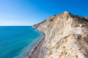
While climbing the high slopes of Troodos we’ve been walking on the frozen machinery of an ancient ocean. But now it’s time to step away from the mountain, slightly change our story and observe what had been happening under the sea, as the Olympus peak was rising into the sky. Leaving the cool shade of Platres behind, we approach the wine village of Omodos. The dark volcanic surfaces give way to pale rocks. Chalk breaks easily under your fingers. Hills become rounder. Valleys widen. Vineyards, orchards and white stone villages appear. The geology has shifted from fire to sediment. Encircling the Troodos massif lies a vast geological belt known as the Circum-Troodos Sedimentary Succession. It is the quiet counterpart to the violent ophiolite core. While Troodos itself formed through submarine volcanism deep beneath the Neo-Tethys Ocean, these surrounding rocks were created slowly, grain by grain, as sediments settled on the seabed around the rising mountains. For nearly eighty million years, currents carried shells, clay, volcanic fragments and microscopic marine organisms into the surrounding basin. Layer upon layer accumulated. Over time these sediments hardened into limestones, chalks, marls and sandstones that now form the foothills surrounding the Troodos range. If the ophiolite tells the story of the ocean floor, the Circum-Troodos formations tell the story of the island emerging from that…

Read more

Buffavento Castle Cyprus

Buffavento Castle Cyprus

Buffavento Castle stands at 960 meters above sea level in the Kyrenia mountain range of Cyprus. This medieval fortress is the highest and least preserved of three Byzantine strongholds built along the mountains. The name comes from Italian and means "Defier of the Winds," a fitting description for a castle constantly exposed to mountain winds at this elevation. The castle sits between St. Hilarion Castle to the west and Kantara Castle to the east, forming a defensive line across the Kyrenia Mountains. All three castles are visible from each other, allowing them to pass signals and warnings. Buffavento guarded the mountain passage from Kythrea to the north coast, controlling movement between the coastal plain and the interior. The location provides views in every direction. Looking north across the Mediterranean Sea, visitors can see the Turkish coast approximately 65 kilometers away on clear days. To the south, the Mesaoria Plain stretches toward Nicosia. On exceptionally clear days, Famagusta to the east and the Troodos Mountains to the south are visible. The castle overlooks nearly half the island from its rocky peak. The steep cliffs surrounding the fortress made it naturally defensible. The north, east, and west sides are protected by sheer drops, with only the southern approach allowing access. Historical Background The exact construction date remains unknown, though most historians believe…

Read more