Explore Cyprus with Our Interactive Map

Explore our top stories and discover ideas worth your time.

Church of Timios Stavros in Pelendri

Church of Timios Stavros in Pelendri

Church of Timios Stavros in Pelendri is a 12th-century Byzantine chapel in Cyprus's Troodos Mountains that evolved into a multi-part complex, famed for its Palaiologan frescoes blending spiritual depth with artistic refinement. Part of the UNESCO-listed Painted Churches, it showcases the island's medieval religious heritage through layered architecture and vivid paintings. This site captures how faith adapted over time, offering insights into Cyprus's enduring spiritual traditions. An Evolving Byzantine Chapel in the Mountains Timios Stavros exemplifies the organic development of Byzantine religious architecture in Cyprus, starting as a modest single-aisled chapel and expanding into a domed, multi-section structure that reflects centuries of theological and cultural shifts. Dedicated to the Holy Cross, a symbol central to Orthodox Christianity representing salvation and divine power, the church served as a spiritual focal point for mountain communities. Its location in the lush Marathasa Valley, surrounded by pine forests and terraced fields, underscores the Troodos region's role as a refuge for monastic and village life, where sacred spaces blended seamlessly with the natural environment. The site's evolution mirrors broader patterns in Cypriot ecclesiastical building, where practicality met piety, creating resilient havens amid the island's turbulent history of invasions, earthquakes, and political changes. The church's design emphasizes functionality suited to the high-altitude climate, with thick stone walls sourced from local quarries to withstand heavy rains and…

Read more
Cyprus Carob Black Gold

Cyprus Carob Black Gold

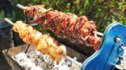
For centuries, the carob tree quietly underpinned life in Cyprus. Long before sugar, tourism, or modern industry reshaped the island, carob sustained rural families economically, nutritionally, and socially. Known locally as “black gold,” it was never glamorous, but it was dependable. In a land shaped by drought, invasion, and uncertainty, the carob tree endured, feeding people, funding villages, and anchoring tradition in the Cypriot landscape. A Tree Built for Hard Conditions The carob tree, Ceratonia siliqua, is perfectly adapted to Cyprus’s dry Mediterranean climate. Its deep roots draw moisture from far below the surface, allowing it to survive long summers without irrigation. Thick, leathery leaves reduce water loss, and slow growth produces a tree that can live for centuries. This resilience explains why carobs thrived where other crops failed. On rocky slopes and marginal land unsuitable for cereals, carob trees continued to produce reliable harvests. For rural communities, they were less a crop and more a form of insurance, offering stability in an unpredictable environment. Why It Was Called “Black Gold” The name "black gold" was not a poetic exaggeration. Ripe carob pods darken to a deep brown, almost black, and for generations, they ranked among Cyprus's most valuable exports. Even in years when wheat failed or rainfall was scarce, carob trees continued to bear fruit. For many families, a…

Read more
Akrotiri Peninsula

Akrotiri Peninsula

\nThe Akrotiri Peninsula in the Limassol District marks the southernmost tip of Cyprus and also the southernmost part of Europe. This 123 square kilometer area contains the largest complex of natural wetlands on the island, centered around Akrotiri Salt Lake.\n\n\n\n \n\n\n\nThe peninsula hosts over 300 recorded bird species, more than 800 indigenous plant species representing roughly 40 percent of all plants found on Cyprus, and critical habitats ranging from coastal sand dunes to Mediterranean juniper forests. Most of the peninsula lies within the British Sovereign Base Area of Akrotiri, territory retained by the United Kingdom when Cyprus gained independence in 1960.\n\n\n\n\n\nFrom Ancient Island to Protected Reserve\n\n\n\nThe Akrotiri Peninsula was once a small island that merged with the rest of Cyprus through processes spanning thousands of years, creating what geologists call a double tombolo. The Kouris River carried sediment to create a land bridge on the western side at least 56,000 years ago, while the Garilis River later formed a second connection on the eastern side. This gradual process trapped seawater between the two land bridges, forming Akrotiri Salt Lake.\n\n\n\nThe south cliffs of the peninsula, known as Aetokremmos, host the earliest known archaeological site in Cyprus and are believed to be the first part of the island inhabited by people during the pre-Neolithic period.\n\n\n\nThe site contains 12,000-year-old fossilized bones of pygmy…

Read more