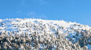
Madari Peak rises to 1,613 metres in the eastern Troodos Mountains, crowned by a fire lookout tower that watches over one of Cyprus’s most popular hiking destinations. Madari forms part of Mount Adelfoi in the vast Adelfoi Forest, a protected area of dense pine, cedar, and oak trees covering over 120 square kilometres.
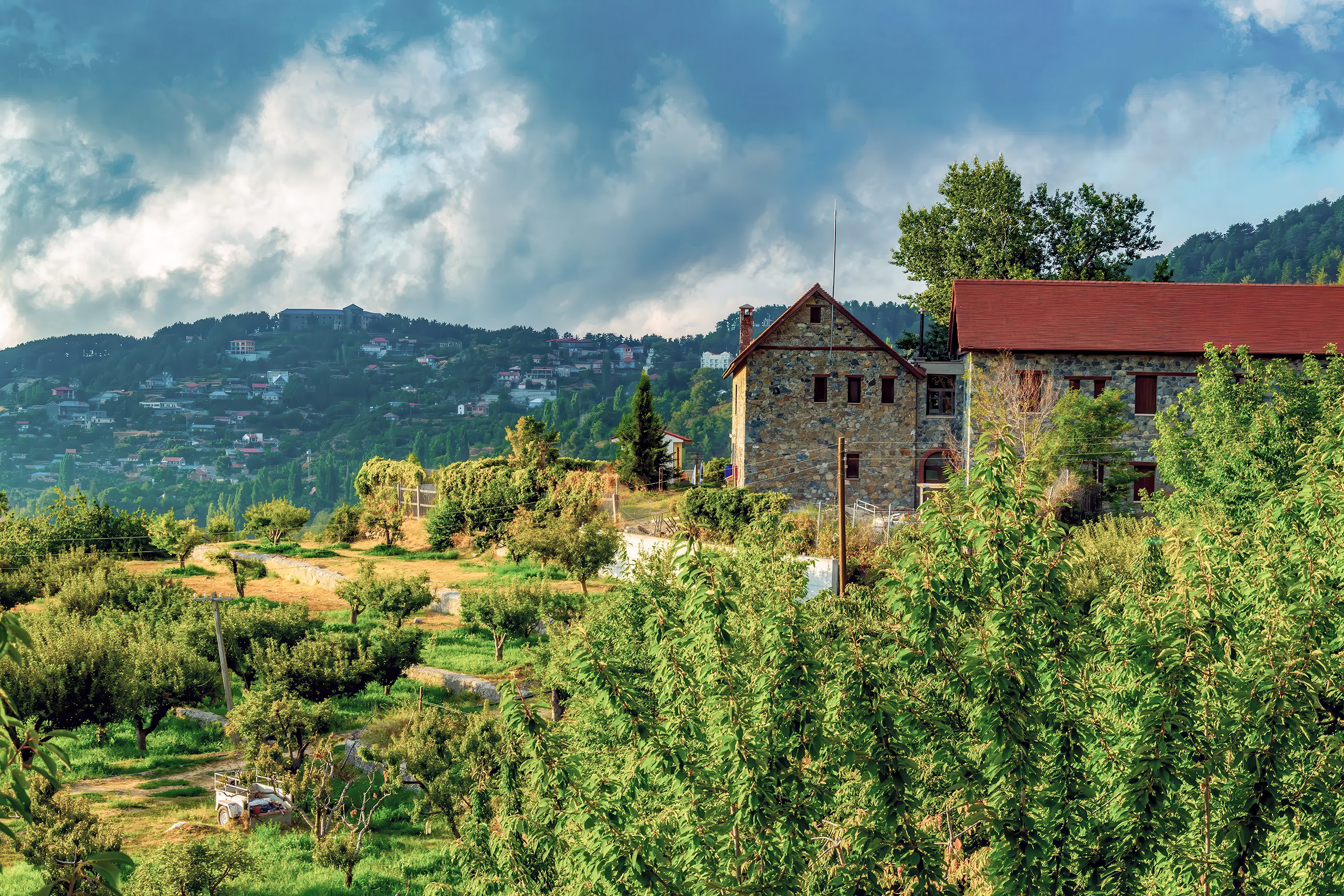
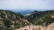
The peak sits between the Nicosia and Limassol districts, accessible from villages like Kyperounta, Spilia, and Chandria that cluster on the lower slopes. Unlike Mount Olympus, which attracts visitors mainly for its summit status, Madari draws hikers for its dramatic rock formations, exceptional viewpoints, and network of interconnected trails that suit different fitness levels.
The fire lookout station at the summit provides 360-degree views across the island. On clear days, the panorama extends from the Mesaoria Plain to the north, where Morphou Bay meets the sea, across to the central Troodos range in the west, and down to southern villages and coastline. The station remains operational, part of Cyprus’s forest fire prevention system, but visitors can climb to viewing platforms that offer the same sweeping perspectives.
Historical Background
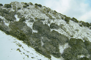
The Troodos Mountains emerged approximately 92 million years ago as part of the Troodos Ophiolite Complex, uplifted oceanic crust from the ancient Tethys Ocean. Madari consists of the same serpentinized harzburgite rock found throughout the range, representing mantle material pushed to the surface through tectonic forces. The exposed rock layers create the distinctive cliffs and vertical formations that make Madari’s landscape so striking.

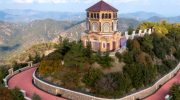
The name Madari likely derives from local dialect, though its exact origin remains uncertain. The peak is sometimes called Adelfoi, meaning “brothers” in Greek, possibly referring to the twin summits or the brotherhood of monks who once inhabited monasteries in the surrounding forests. Historical records mention hermits and religious communities seeking isolation in these remote heights during Byzantine times.
The “Five Fingers” cliffs below the summit inspired local legends similar to those told about the Pentadaktylos range in northern Cyprus. One story claims the Byzantine hero Digenis Akritas left his handprint when he gripped the rock while defending the island from Saracen invaders. The vertical orange and grey rock faces do resemble an outstretched hand, particularly when viewed from certain angles along the trails.
What Makes Madari Unique
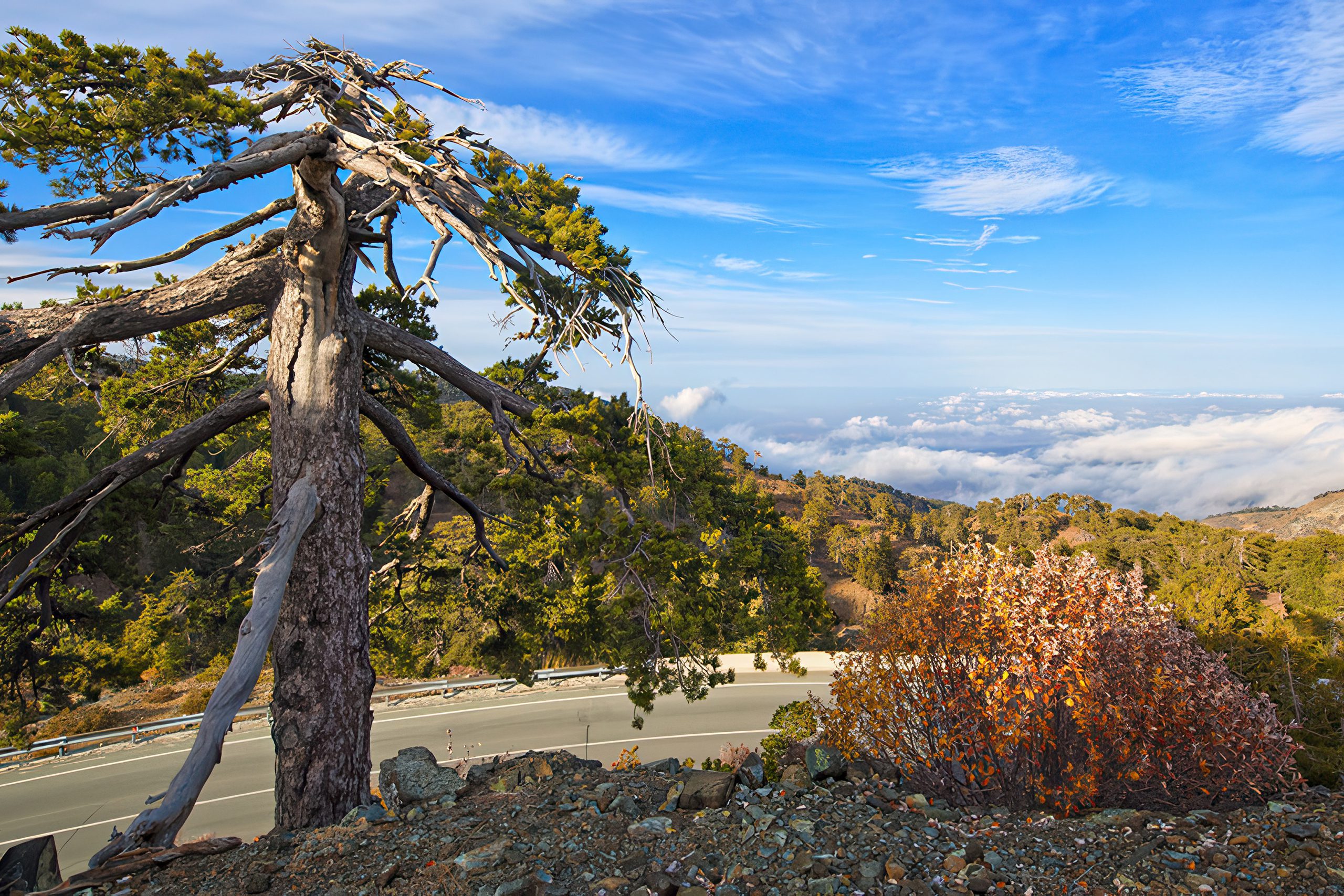
The Teisia tis Madaris, meaning “walls of Madari,” refers to the tall vertical rock formations that line portions of the trail. These geological features rise like natural fortifications. The rock layers tilt at steep angles, evidence of the powerful forces that lifted this oceanic crust above sea level millions of years ago. Climbers sometimes attempt routes on these faces, though most visitors appreciate them from the established trails.
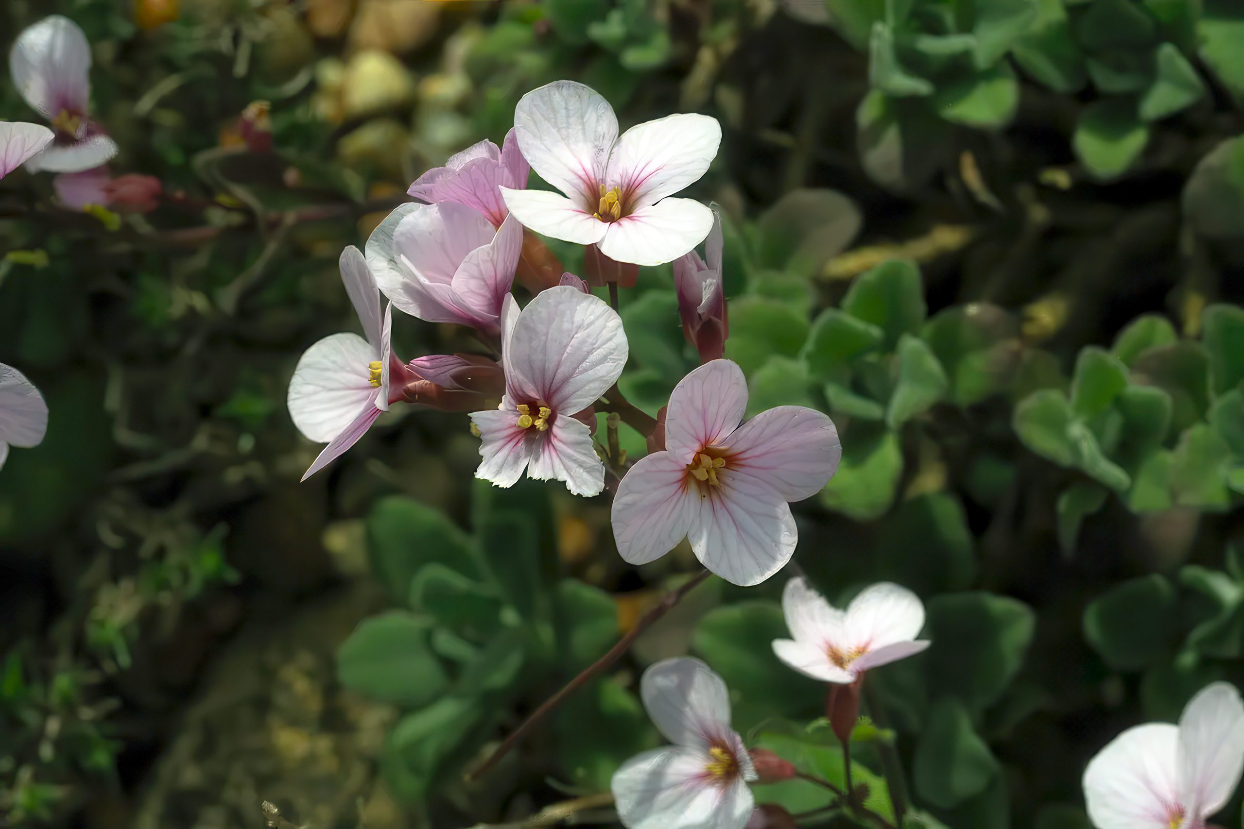
Endemic plant species thrive at Madari’s elevation. The Troodos rose (Rosa chionistrae) grows only in these mountains, producing small pink flowers in summer.
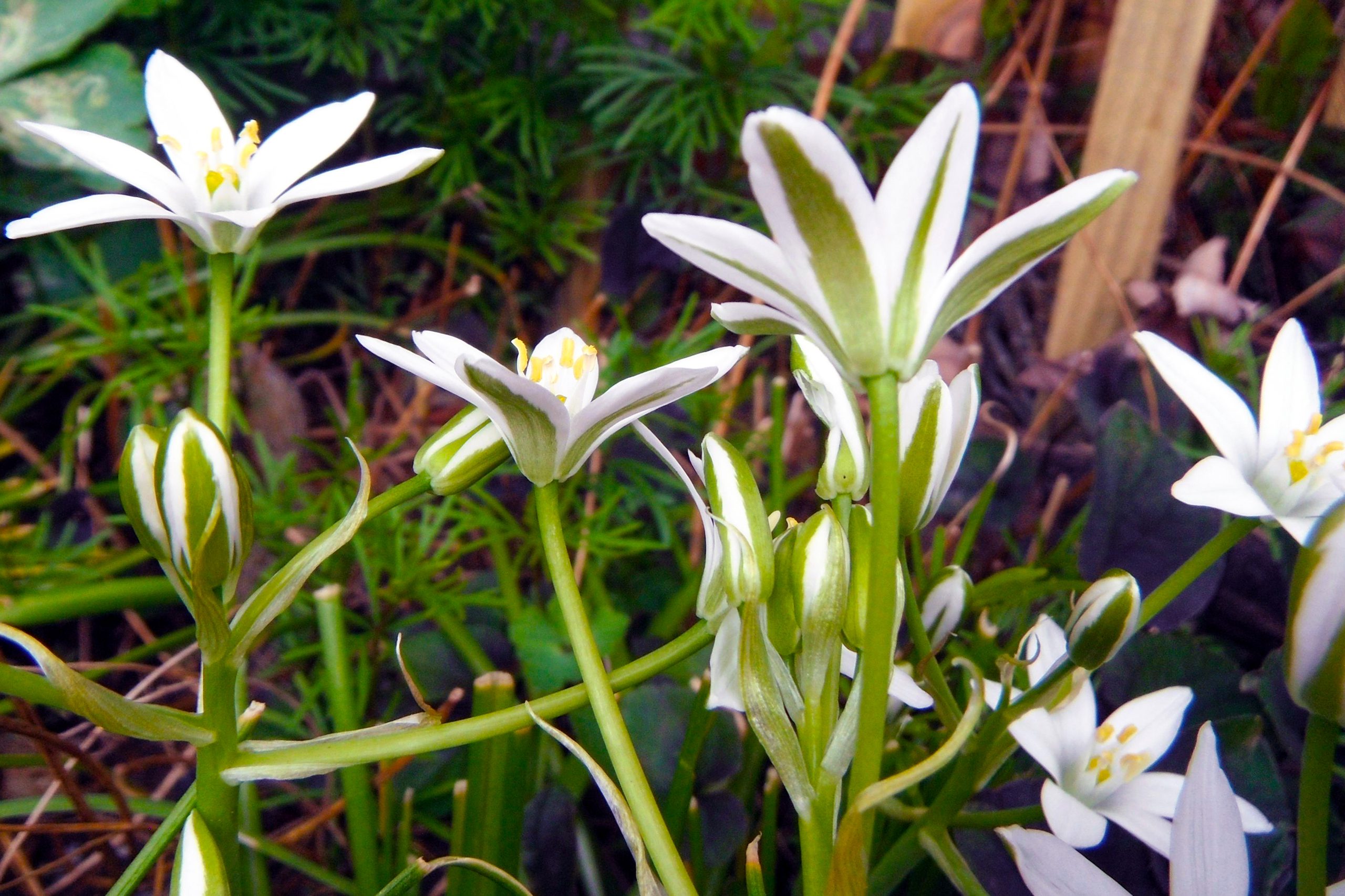
Golden oak (Quercus alnifolia) displays distinctive golden undersides on its leaves, creating a shimmering effect when the wind moves through the canopy. Cyprus catmint (Nepeta troodi), Star of Bethlehem (Ornithogalum chionophilum), and the purple rock cress (Arabis purpurea) add colour to rocky crevices where soil accumulates.
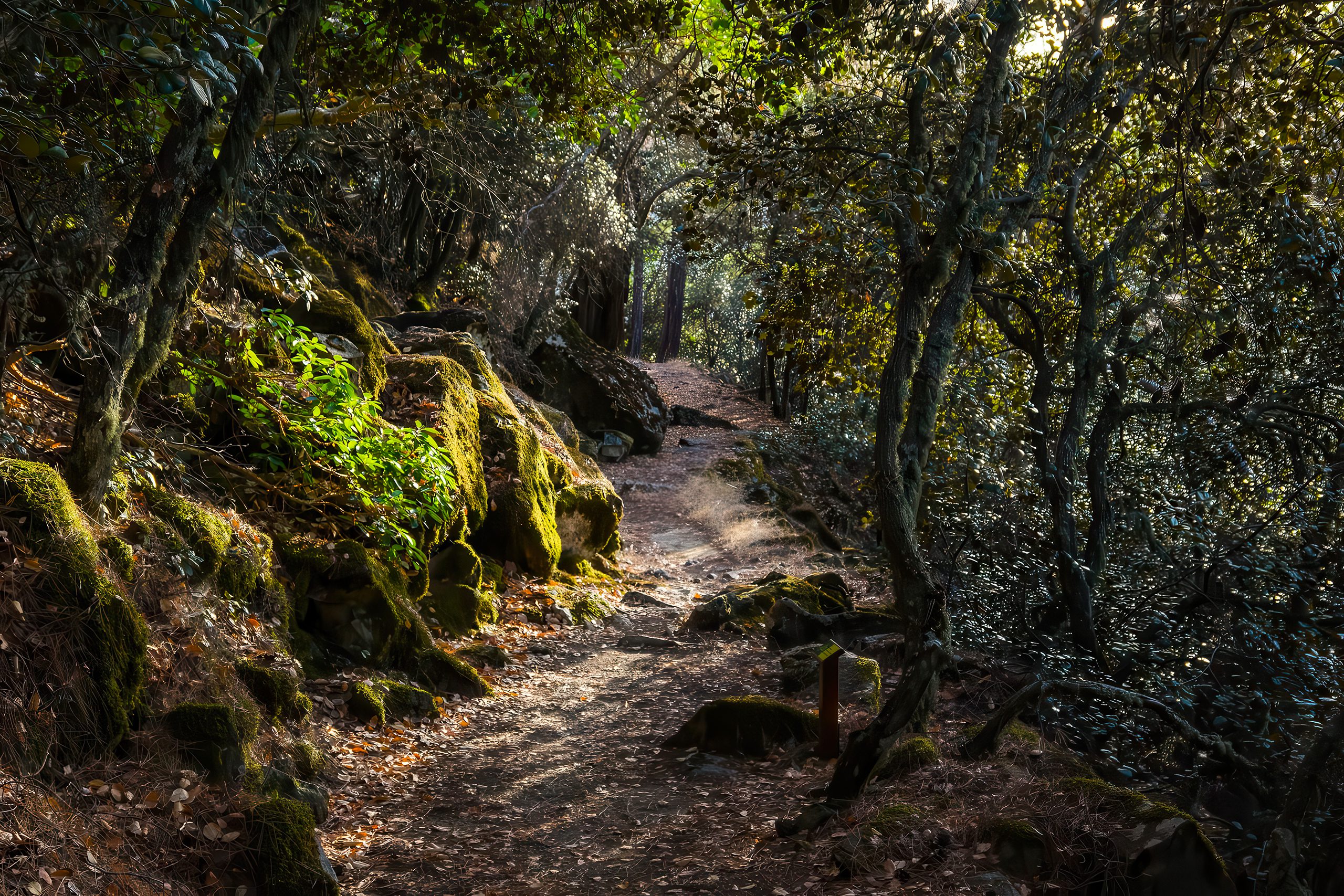
The Adelfoi Forest surrounding Madari contains some of Cyprus’s oldest trees. Black pines, several centuries old, spread their branches over the trails, while juniper specimens with gnarled trunks demonstrate adaptations to high-elevation conditions. Cedar trees, once widespread across the Mediterranean, survive in protected groves where forestry department efforts maintain their populations.
Wildlife includes the Cyprus mouflon, though these shy wild sheep rarely appear near popular trails. The Cyprus warbler and Cyprus wheatear, both endemic species, nest in the forest and rocky areas. Bonelli’s eagle patrols the skies, hunting hares and smaller birds. Reptiles like the Cyprus viper and Cyprus whip snake inhabit rocky areas, though encounters remain uncommon if hikers stay on marked paths
Interesting Facts About the Peak
The trail network around Madari connects multiple starting points and creates various loop options. The most popular circular route measures approximately 13 kilometres with 600 to 650 metres of elevation gain. Hikers typically complete this in four to five hours at a moderate pace. A shorter 3.5-kilometre Teisia tis Madaris circuit focuses specifically on the dramatic cliff sections and takes roughly 90 minutes.
One starting point carries the evocative name “Doxa si o Theos,” which translates as “Praise God” or “Bless God.” Local tradition suggests the name arose because weary hikers reaching this point after the steep climb would thank God for their safe arrival. The location sits approximately 2 kilometres from Kyperounta village on the road toward Spilia.
A memorial along one trail section honours Charalambos Petmeridos, who died in 1958 at age 25 while fighting for EOKA during the independence struggle against British colonial rule. The memorial sits at Selladi Karamanli, a saddle point where several trails intersect. These historical markers remind hikers that these mountains witnessed political conflict alongside their natural evolution.
The fire lookout tower dates from Cyprus’s forest fire prevention program established after devastating blazes destroyed significant forest areas. The 1995 fire in the Kyrenia Mountains demonstrated the catastrophic potential of summer blazes in Mediterranean forests. Lookout stations like Madari’s provide early warning systems that allow rapid response before fires spread uncontrollably.
Stone picnic tables appear at strategic viewpoints along the trails, built by the forestry department to encourage responsible visitor use. These facilities concentrate human activity at designated spots, reducing trail erosion and vegetation damage from people leaving established paths.
Understanding Madari’s Role in Cyprus
The Adelfoi Forest serves crucial ecological functions beyond recreation. The dense tree cover intercepts rainfall and reduces runoff velocity, allowing water to percolate into underground aquifers. These groundwater reserves supply villages and agricultural areas at lower elevations year-round. Without the forest’s water-catching effect, the eastern Troodos would struggle even more with summer drought conditions.
Conservation programs focus on maintaining genetic diversity in endemic plant populations. Some species exist only on a few square kilometres of suitable habitat, making them vulnerable to climate change, fire, or disease. Seed collection and propagation efforts ensure backup populations if wild specimens decline.
The madari trail network underwent significant development in recent years as Cyprus promoted mountain tourism to diversify beyond coastal resorts. The Madari trails connect to the European long-distance E4 hiking route that crosses Cyprus from west to east. International hiking organizations recognize these paths as among the Mediterranean’s best-maintained mountain trails.
Social media attention transformed Madari from a local hiking destination to an internationally known spot. Photographs of hikers perched on cliff edges above cloud layers or framed against sunset skies went viral, attracting visitors who might never have considered Cyprus for mountain activities. This popularity creates management challenges as inexperienced hikers sometimes underestimate the physical demands or weather risks.
Why Madari Matters to Cyprus
Madari demonstrates that Cyprus contains diverse landscapes beyond the beaches that dominate tourism marketing. The dramatic geology, endemic species, and wilderness character provide experiences unavailable on the coast. For locals, the mountain trails offer weekend escapes from summer heat and urban density.
The fire lookout network, including Madari’s station, protects forest resources that took centuries to develop. The 1995 Kyrenia fire and other blazes throughout the Mediterranean show how quickly decades of growth can vanish. Early detection from these strategic viewpoints has prevented numerous potential disasters.
Endemic plant conservation at Madari and throughout the Troodos preserves genetic diversity found nowhere else. As climate change alters temperature and precipitation patterns, these unique adaptations may prove valuable for understanding how species survive environmental stress. Losing them would eliminate evolutionary experiments millions of years in development.
The trail system provides accessible nature experiences that foster environmental awareness. Children hiking with families, students on educational programs, and tourists discovering mountain Cyprus all develop connections to the island’s natural heritage. These experiences often translate into support for conservation policies and sustainable development approaches.
Madari’s growing popularity shows how social media can transform unknown sites into international destinations overnight. This phenomenon creates both opportunities and challenges. Increased visitor numbers generate income for mountain communities but strain infrastructure and ecosystems. Balancing access with protection requires ongoing management attention to ensure the peak remains available for future generations while maintaining the qualities that make it special.