Maa-Palaikastro is a fortified Bronze Age settlement on the west coast of Cyprus, built during a time of major upheaval in the ancient Mediterranean. Strategically positioned and strongly defended, it played an important role in early settlement, copper production, and trade, and is closely linked to the arrival of Greek-speaking populations on the island.
What remains today tells the story of resilience, planning, and cultural change at a crucial moment in Cyprus’s history.
A Rocky Peninsula with a Big Story
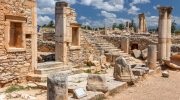
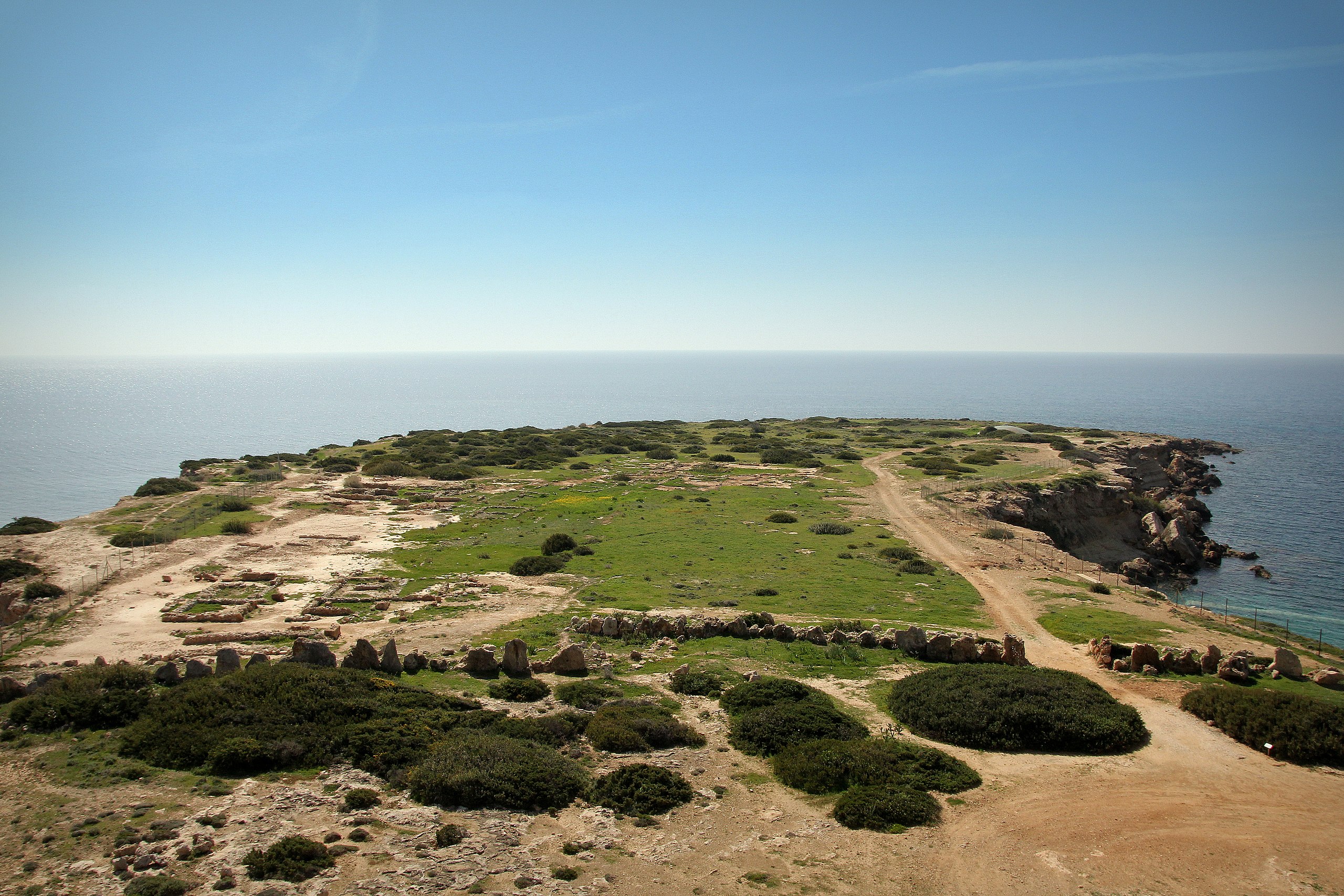
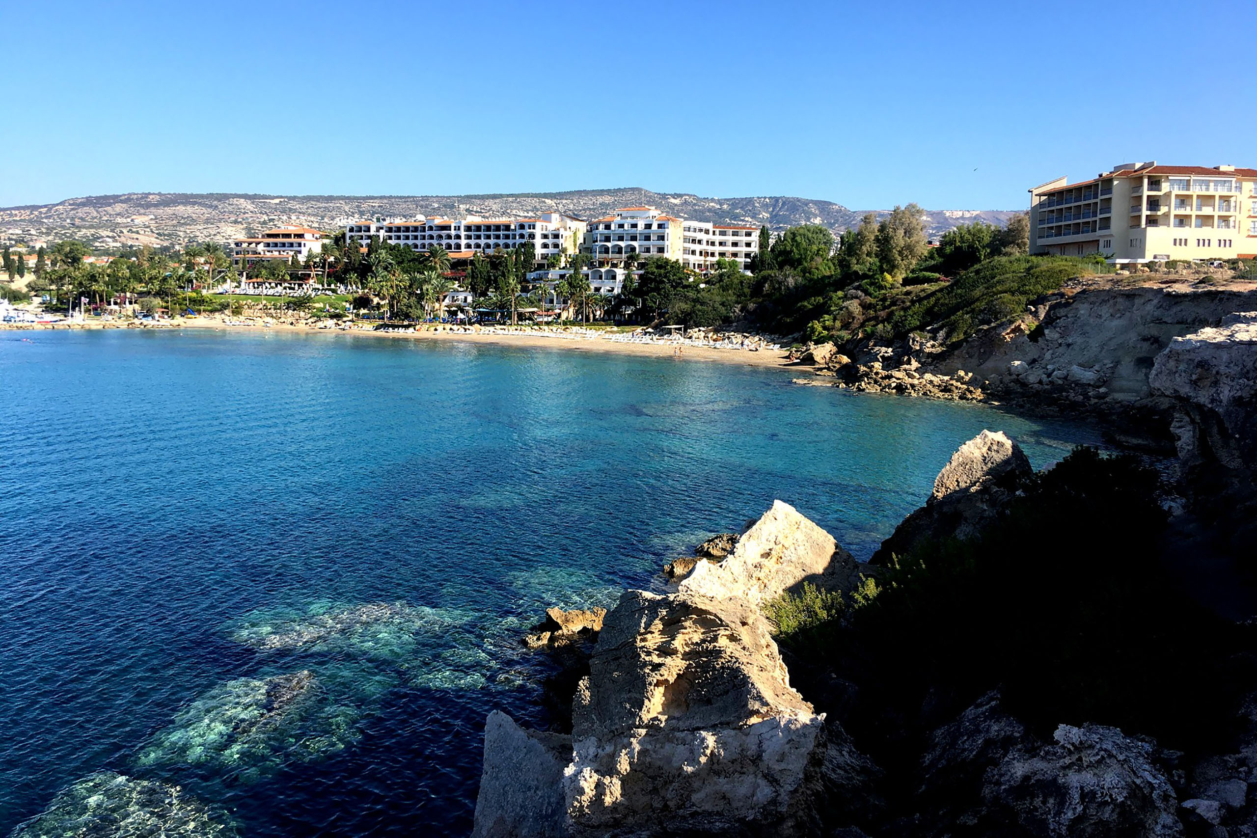
Perched on a narrow rocky peninsula on the Coral Bay coast of western Cyprus, Maa-Palaikastro (often simply called Maa) may look quiet and unassuming today. Yet beneath its surface lies the story of one of the island’s most important early settlements, shaped by movement, survival, and cultural change at a turning point in Mediterranean history.
Archaeological excavations revealed that this small site played a surprisingly large role in the story of Cyprus, linking the island to wider events unfolding across the ancient world.
A New Community in an Uncertain World
Maa-Palaikastro was founded around 1200 BCE, a time when the eastern Mediterranean was in turmoil. Powerful kingdoms were collapsing, trade routes were breaking down, and people were migrating in search of safety and opportunity. Against this backdrop, a group of settlers, likely connected to the Mycenaean Greek world, arrived on Cyprus and established a new community at Maa.
Many archaeologists believe this was one of the earliest Greek settlements on the island. It may have served as a first landing point for newcomers who would later spread across Cyprus, influencing language, culture, and identity for centuries to come. At the same time, traces of earlier activity show that the site had already attracted people long before these arrivals, thanks to its water supply, natural harbours, and defensible terrain.
Built for Protection and Control
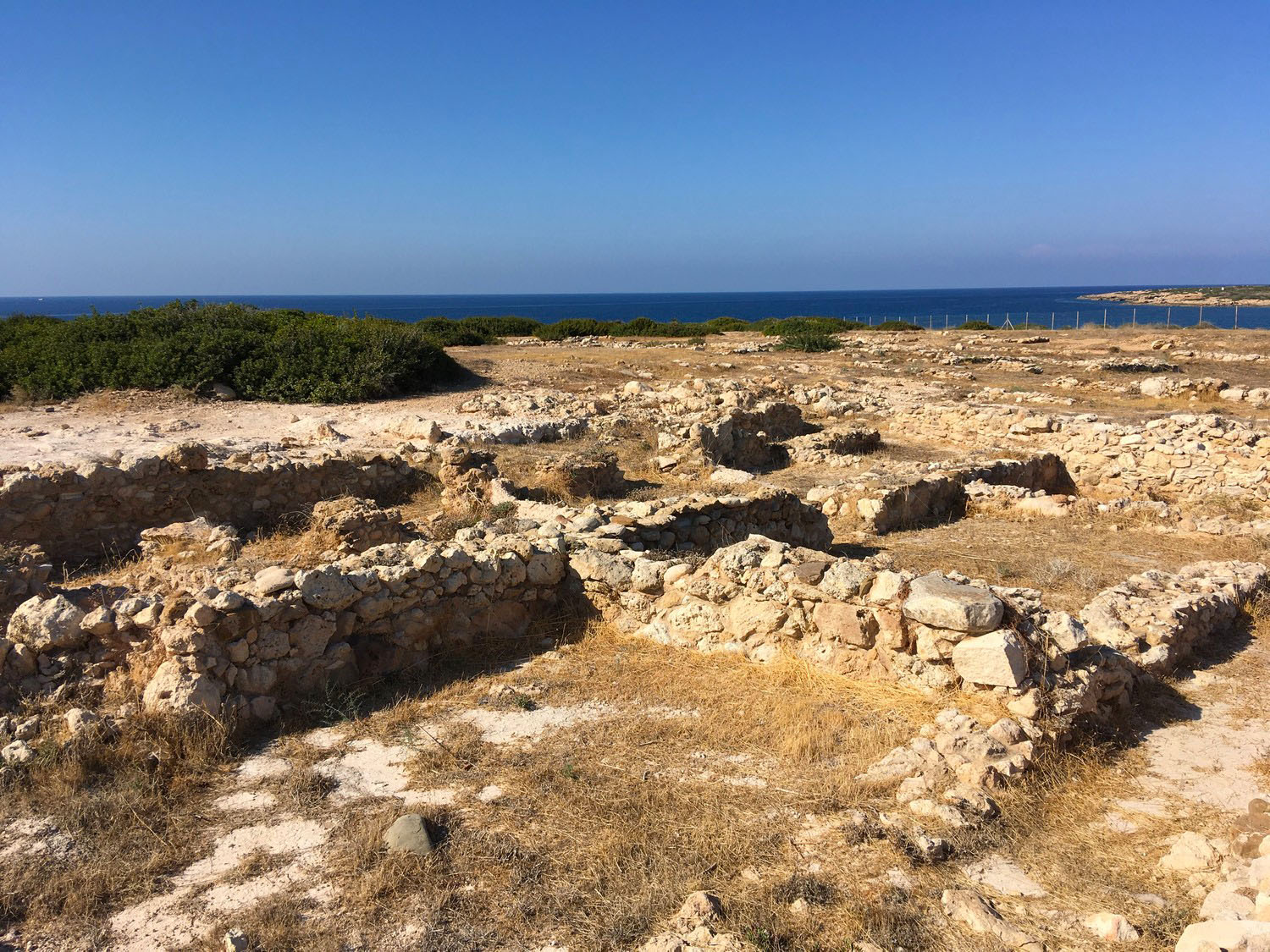
One of the most striking features of Maa-Palaikastro is its fortification. The settlement was carefully positioned and strongly defended, earning it the name “Old Fortress” in later times. Two massive stone walls protected the site, one sealing off the narrow land approach and another guarding the seaward edge above the cliffs.
\n\n\n
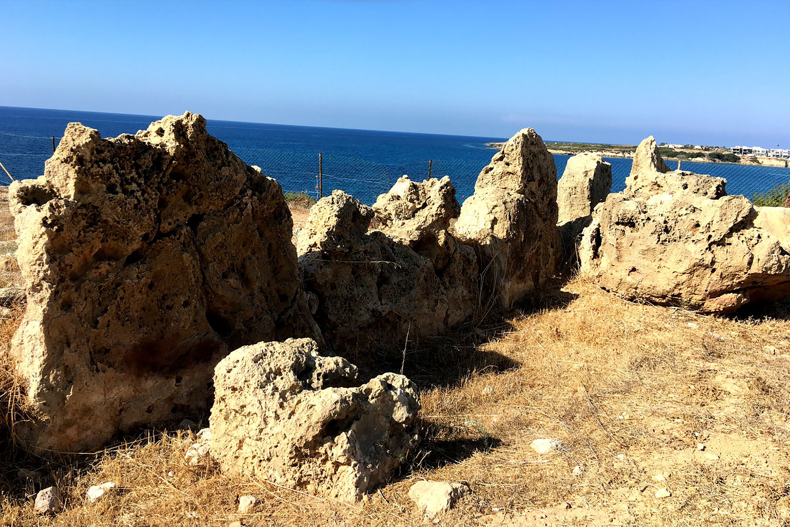
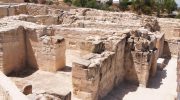
These walls were built using large, rough stones fitted together without mortar, a technique similar to Mycenaean fortifications in mainland Greece. The landward wall included a controlled entrance, showing that access was carefully managed. Inside the walls, the settlement followed a planned layout, with homes and workspaces arranged in an organised manner rather than randomly scattered.
Life Inside the Walls
Maa was not just a defensive outpost, it was a living, working community. Excavations uncovered rooms with central hearths, suggesting spaces where people cooked, gathered, and socialised. Storage jars, tools, and work areas point to a structured daily life with shared resources and careful planning.
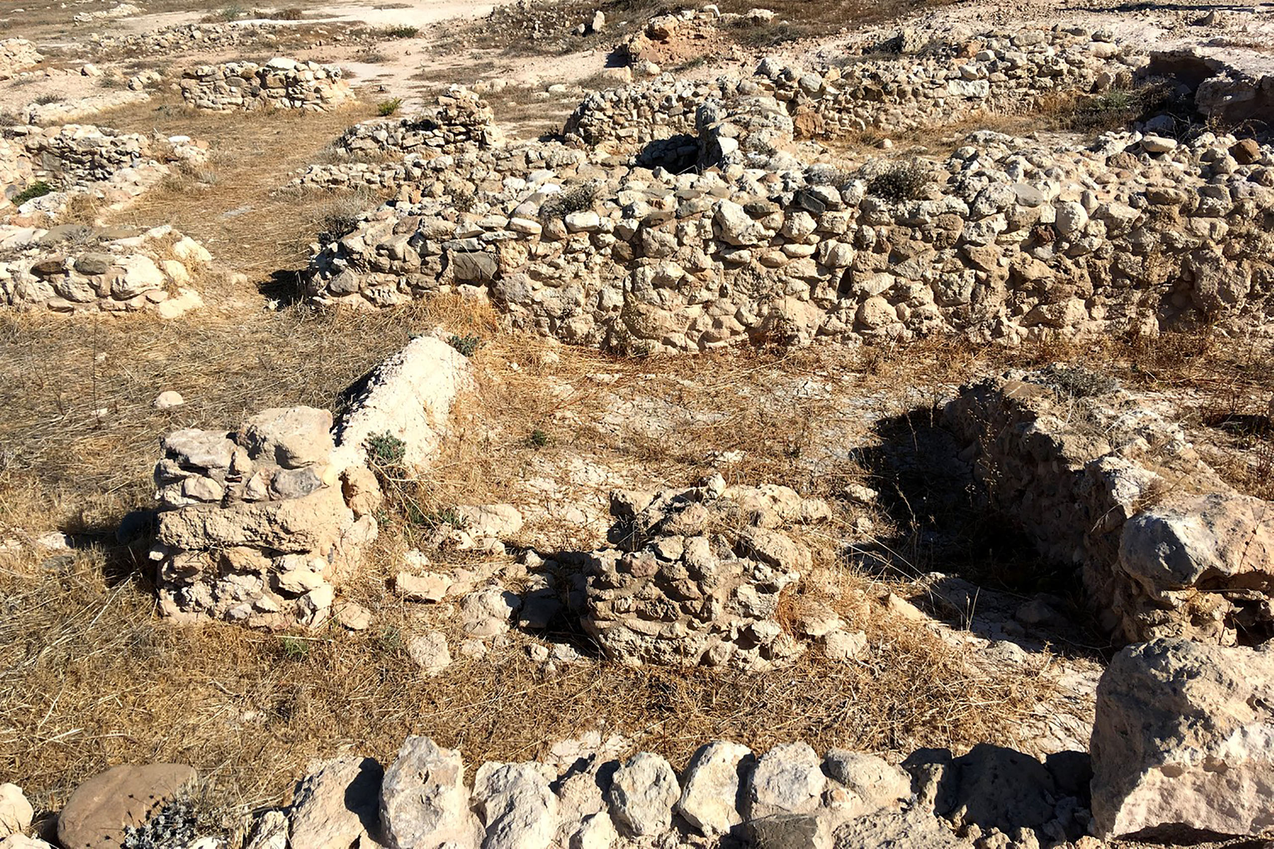
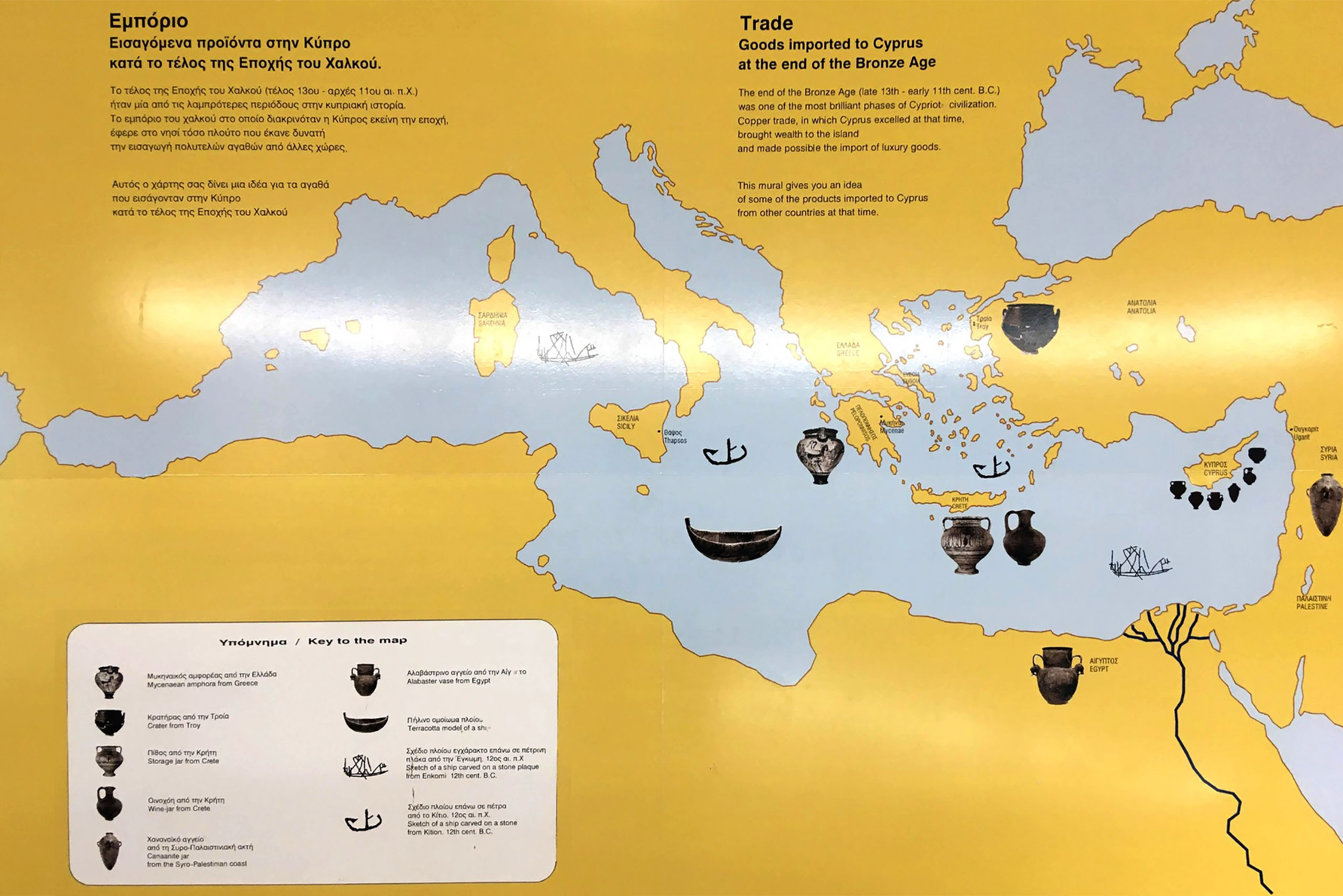
The settlement was also an important centre for production. Evidence of pottery making and metalworking shows that Maa was involved in Cyprus’s copper industry, one of the island’s most valuable resources during the Bronze Age. Pottery styles found at the site reveal strong connections with the Aegean world, suggesting trade links and cultural exchange across the sea.
Destruction, Rebuilding, and Abandonment
Life at Maa-Palaikastro was intense but short. Around 1175 BCE, the settlement was violently destroyed by fire, likely during an attack. Remarkably, the inhabitants rebuilt it almost immediately, repairing walls and continuing daily life, which shows determination and resilience.
However, this revival did not last long. By around 1150 BCE, the settlement was abandoned permanently. The reasons remain uncertain. Changing trade routes, shifting political conditions, or the movement of people elsewhere may all have played a role. Even so, Maa had already left its mark on the cultural development of Cyprus.
A Window into the Past Today
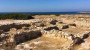
Today, Maa-Palaikastro can be visited as an open archaeological site, accompanied by a small museum built into the landscape. The museum presents the story of the settlement, its people, and the wider world they lived in, using artefacts and reconstructions to bring this distant period to life.
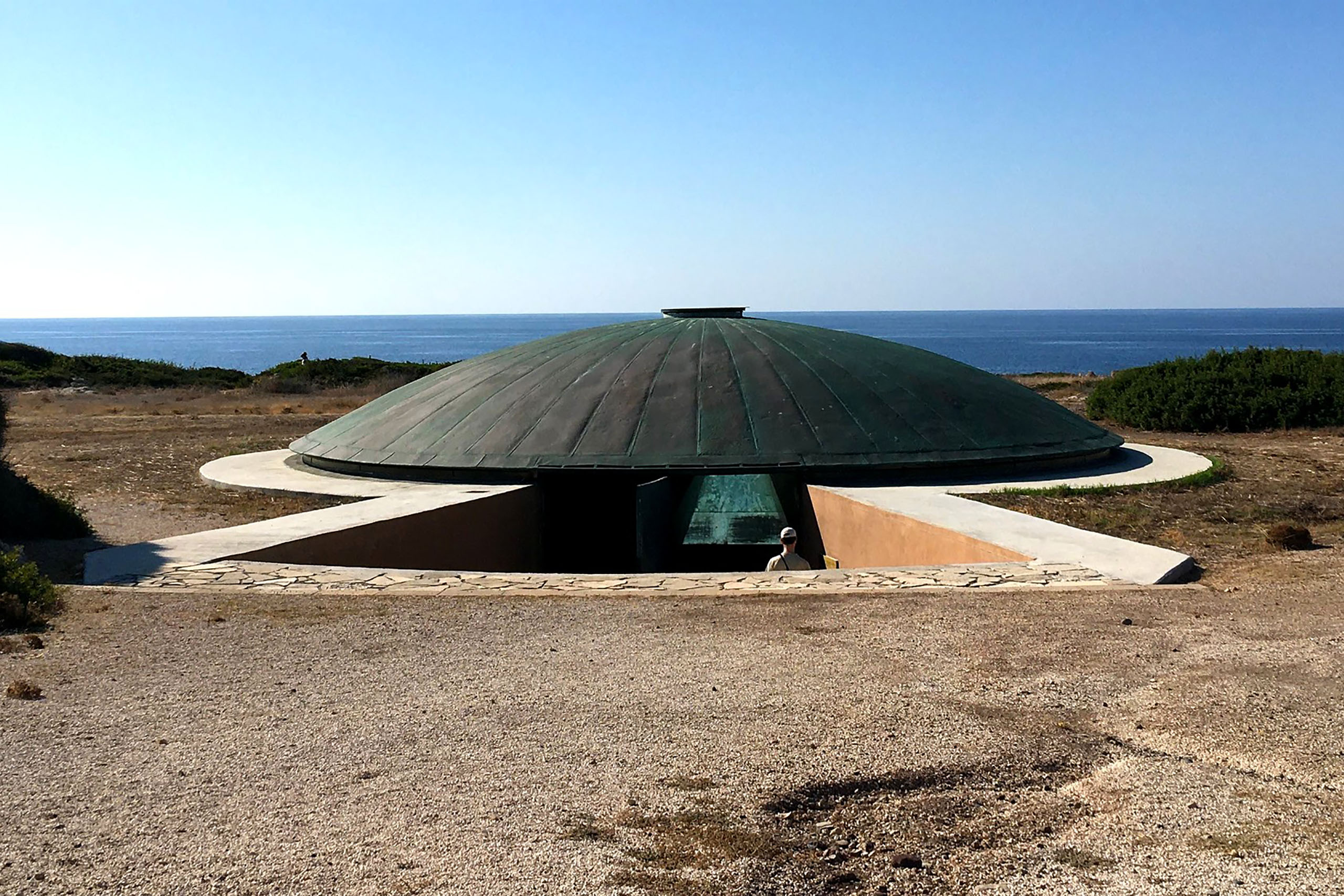
Walking through the remains, visitors can still trace the outlines of walls, buildings, and pathways, with the sea stretching out on either side, much as it did over three thousand years ago.
Why Maa-Palaikastro Still Matters
Maa-Palaikastro may be modest in size, but its importance is immense. It represents a moment of transition, when Cyprus stood at the crossroads of migration, trade, and cultural change. Its fortifications speak of fear and defence, its workshops of skill and industry, and its short lifespan of a world in flux.
More than just ruins, Maa tells the story of how Cyprus became what it is today, a place shaped by movement, resilience, and connection. Understanding Maa-Palaikastro means understanding one of the earliest chapters in the island’s long and complex history.